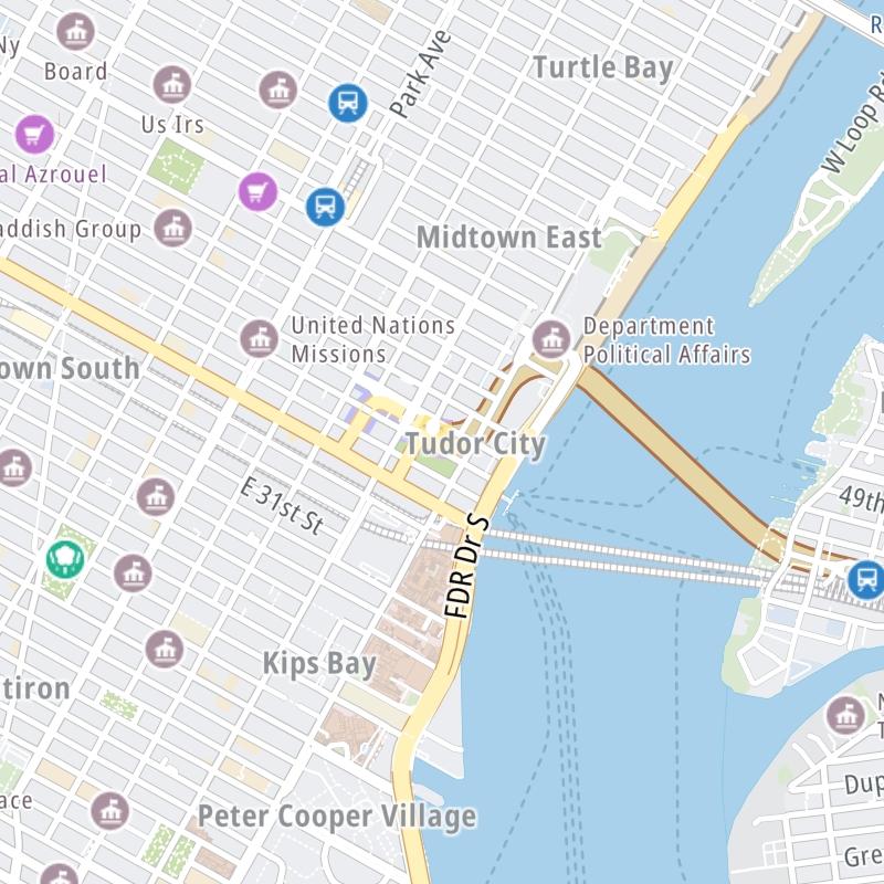
Using The Interactive Toll Map
This tunnel serves Queens, Manhattan, and New York City. The road map of the Queens Midtown Tunnel shows exits and tolling points on the road.
A complete list of exits and other points-of-interest may be found below the map.
You may pan and zoom the interactive map. There are markers you may select for a separate map of that point of interest or location, which includes any nearby dining, gas, EV charging, hotels and other services.


 Bayonne Bridge ▹
 Goethals Bridge ▹
 Holland Tunnel ▹
 Garden State Parkway ▹
 George Washington Bridge ▹
 Lincoln Tunnel ▹
 New Jersey Turnpike ▹
 Outerbridge Crossing ▹
 Bronx Whitestone Bridge ▹
 Hugh L Carey Tunnel ▹
 Cross Westchester Expressway ▹
 Robert F Kennedy Bridge ▹
 Queens Midtown Tunnel ▹
 New England Thruway ▹
 New York State Thruway ▹
 Throgs Neck Bridge ▹
 Henry Hudson Bridge ▹
 Atlantic Beach Bridge ▹
 Marine Parkway Bridge ▹
 Connecticut Turnpike ▹
 Bear Mountain Bridge ▹
 Massachusetts Turnpike ▹
 Thousand Islands Bridge ▹
 Niagara Thruway ▹
 Peace Bridge ▹
 Rainbow Bridge ▹

 Pennsylvania Turnpike ▹
 Milford Montague Toll Bridge ▹
 Delaware Water Gap Toll Bridge ▹
 Portland Columbia Toll Bridge ▹
 Easton Phillipsburg Toll Bridge ▹
 I78 Toll Bridge ▹