Buffalo - Rochester - Niagara Falls Toll Maps

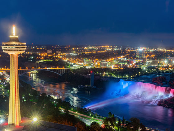
Regional photo of Buffalo - Rochester - Niagara Falls

Using The Interactive Regional Map

The Buffalo - Rochester - Niagara Falls metro area map shows exits and toll points for region-wide toll roads or other toll roads that cross the region.

View Map ▾Road List ▾

The following (6) toll roads are in this area, cross through this area or connect with this region:

The Buffalo - Rochester - Niagara Falls area includes the following cities: Buffalo, Batavia, Rochester, Amherst, Niagara Falls, and Niagara Falls, Ontario.

Markers on the interactive map can be selected to get close-up views of exit points, toll gantries and other locations and points-of-interest. Each POI map shows all nearby dining, gas, EV charging, hotels and other services.

View Map ▾Road List ▾

A complete list of exits and other points-of-interest in the Buffalo - Rochester - Niagara Falls area follows the map. Exit lists are sorted by toll road.

Advertising
Advertising

Regional Map For Buffalo - Rochester - Niagara Falls

Pan and zoom the map as desired, and select or tap the interactive markers to get information about that specific location. Each marker also includes options for viewing a close-up map of the destination point.

A complete list of exits and other points-of-interest is below this map, and other regions are shown further down the page.

Advertising
Advertising

Regional Exits, Listed By Toll Road

A list of all exits and other points-of-interest in this region, sorted by toll road.

Clifton Springs Travel Plaza

Clifton Springs Travel Plaza — Canandaigua

View Map & Info

▾ AVAILABLE GAS AND EV ▾

  • gas

    gas

  • diesel

    diesel

  • ev

    ev

  • truck parking

    truck
    parking

NY Route 21

Exit 43NY Route 21 — Manchester

View Map & Info

▸ GPS 42.978740000 X -77.233430000
NOTES:

The Thruway Authority New York State Thruway Authority manages this segment.

NY Route 332

Exit 44NY Route 332 — Canandaigua

View Map & Info

▸ GPS 42.995700000 X -77.368400000
NOTES:

The Thruway Authority New York State Thruway Authority manages this segment.

Seneca Travel Plaza

Seneca Travel Plaza — Canandaigua

View Map & Info

▾ AVAILABLE GAS AND EV ▾

  • gas

    gas

  • diesel

    diesel

  • truck parking

    truck
    parking

I–490

Exit 45I–490 — Rochester

View Map & Info

▸ GPS 43.009220000 X -77.439910000
NOTES:

The Thruway Authority New York State Thruway Authority manages this segment.

I–390 / Greater Rochester Int'l Airport/ROC

Exit 46I–390 / Greater Rochester Int'l Airport/ROC — Rochester

View Map & Info

▸ GPS 43.047750000 X -77.653870000
NOTES:

The Thruway Authority New York State Thruway Authority manages this segment.

Scottsville Travel Plaza

Scottsville Travel Plaza — Rochester

View Map & Info

▾ AVAILABLE GAS AND EV ▾

  • gas

    gas

  • diesel

    diesel

  • truck parking

    truck
    parking

Ontario Travel Plaza

Ontario Travel Plaza — Rochester

View Map & Info

▾ AVAILABLE GAS AND EV ▾

  • gas

    gas

  • diesel

    diesel

  • ev

    ev

  • truck parking

    truck
    parking

I–490 / NY Route 19

Exit 47I–490 / NY Route 19 — Rochester

View Map & Info

▸ GPS 43.028960000 X -77.966740000
NOTES:

The Thruway Authority New York State Thruway Authority manages this segment.

NY Route 98

Exit 48NY Route 98 — Batavia

View Map & Info

▸ GPS 43.018590000 X -78.188190000
NOTES:

The Thruway Authority New York State Thruway Authority manages this segment.

Pembroke Travel Plaza

Pembroke Travel Plaza — Batavia

View Map & Info

▾ AVAILABLE GAS AND EV ▾

  • gas

    gas

  • diesel

    diesel

  • ev

    ev

  • truck parking

    truck
    parking

NY Route 77

Exit 48ANY Route 77 — Pembroke

View Map & Info

▸ GPS 43.002810000 X -78.413850000
NOTES:

The Thruway Authority New York State Thruway Authority manages this segment.

Clarence Travel Plaza

Clarence Travel Plaza — Depew

View Map & Info

▾ AVAILABLE GAS AND EV ▾

  • gas

    gas

  • diesel

    diesel

  • ev

    ev

  • truck parking

    truck
    parking

NY Route 78 / Transit Road

NY Route 78 / Transit Road — Depew

View Map & Info

▸ GPS 42.950650000 X -78.704930000
NOTES:

The Thruway Authority New York State Thruway Authority manages this segment.

Old Williamsville Barrier

Old Williamsville Barrier — Williamsville

View Map & Info

▸ GPS 42.952030000 X -78.752450000
NOTES: (Barrier removed)

The Thruway Authority New York State Thruway Authority manages this segment.

I–290

Exit 50I–290 — Cleveland Hill

View Map & Info

▸ GPS 42.948920000 X -78.763930000
NOTES:

The Thruway Authority New York State Thruway Authority manages this segment.

Cleveland Drive

Exit 50ACleveland Drive — Cleveland Hill

View Map & Info

▸ GPS 42.944120000 X -78.766370000
NOTES: No WB Exit

The Thruway Authority New York State Thruway Authority manages this segment.

Kensington Expy/NY 33 / Buffalo Niagra Int'l Airport/BUF

Exit 51Kensington Expy/NY 33 / Buffalo Niagra Int'l Airport/BUF — Cheektowaga

View Map & Info

▸ GPS 42.931530000 X -78.766290000
NOTES:

The Thruway Authority New York State Thruway Authority manages this segment.

Walden Avenue

Exit 52Walden Avenue — Cheektowaga

View Map & Info

▸ GPS 42.908100000 X -78.766720000
NOTES:

The Thruway Authority New York State Thruway Authority manages this segment.

William Street

Exit 52AWilliam Street — Buffalo

View Map & Info

▸ GPS 42.883180000 X -78.768630000
NOTES:

The Thruway Authority New York State Thruway Authority manages this segment.

I–190 / Niagara Thruway

Exit 53I–190 / Niagara Thruway — Buffalo

View Map & Info

▸ GPS 42.874220000 X -78.788910000
NOTES:

The Thruway Authority New York State Thruway Authority manages this segment.

NY Route 400/Aurora Expressway

Exit 54NY Route 400/Aurora Expressway — West Seneca

View Map & Info

▸ GPS 42.849100000 X -78.790610000
NOTES:

The Thruway Authority New York State Thruway Authority manages this segment.

US Route 219 / Ridge Road

Exit 55US Route 219 / Ridge Road — West Seneca

View Map & Info

▸ GPS 42.827440000 X -78.790940000
NOTES:

The Thruway Authority New York State Thruway Authority manages this segment.

Old Lackawanna Barrier

Old Lackawanna Barrier — Lackawanna

View Map & Info

▸ GPS 42.813190000 X -78.794850000
NOTES: (Barrier removed)

The Thruway Authority New York State Thruway Authority manages this segment.

Mile Strip Road/NY Route 179

Exit 56Mile Strip Road/NY Route 179 — Blasdell

View Map & Info

▸ GPS 42.792740000 X -78.816610000
NOTES:

The Thruway Authority New York State Thruway Authority manages this segment.

NY Route 75

Exit 57NY Route 75 — Hamburg

View Map & Info

▸ GPS 42.743770000 X -78.840370000
NOTES:

The Thruway Authority New York State Thruway Authority manages this segment.

Eden

Exit 57AEden — Eden

View Map & Info

▸ GPS 42.659080000 X -78.960900000
NOTES: Angola

The Thruway Authority New York State Thruway Authority manages this segment.

Angola Travel Plaza

Angola Travel Plaza — Angola

View Map & Info

▾ AVAILABLE GAS AND EV ▾

  • gas

    gas

  • diesel

    diesel

  • ev

    ev

  • truck parking

    truck
    parking

NY Rte 5 / NY Rte 20 / NY Rte 438

Exit 58NY Rte 5 / NY Rte 20 / NY Rte 438 — Silver Creek

View Map & Info

▸ GPS 42.550920000 X -79.108120000
NOTES:

The Thruway Authority New York State Thruway Authority manages this segment.

I–90/NYS Thruway

I–90/NYS Thruway — Cheektowaga

View Map & Info

▸ GPS 42.874824000 X -78.788074000
NOTES:

The Thruway Authority New York State Thruway Authority manages this segment.

Ogden Street / Dingens Street

Exit 1Ogden Street / Dingens Street — Buffalo

View Map & Info

▸ GPS 42.876352000 X -78.801255000
NOTES:

The Thruway Authority New York State Thruway Authority manages this segment.

Clinton Street / Bailey Avenue

Exit 2Clinton Street / Bailey Avenue — Buffalo

View Map & Info

▸ GPS 42.872023000 X -78.816543000
NOTES:

The Thruway Authority New York State Thruway Authority manages this segment.

Seneca Street

Exit 3Seneca Street — Buffalo

View Map & Info

▸ GPS 42.868039000 X -78.827794000
NOTES:

The Thruway Authority New York State Thruway Authority manages this segment.

Smith Street / Fillmore Avenue

Exit 4Smith Street / Fillmore Avenue — Buffalo

View Map & Info

▸ GPS 42.870856000 X -78.845186000
NOTES:

The Thruway Authority New York State Thruway Authority manages this segment.

Hamburg Street

Exit 5 NBHamburg Street — Buffalo

View Map & Info

▸ GPS 42.873408000 X -78.857519000
NOTES:

The Thruway Authority New York State Thruway Authority manages this segment.

Louisiana Street

Exit 5 SBLouisiana Street — Buffalo

View Map & Info

▸ GPS 42.875545000 X -78.863358000
NOTES:

The Thruway Authority New York State Thruway Authority manages this segment.

Elm Street / Baseball Stadium

Exit 6Elm Street / Baseball Stadium — Buffalo

View Map & Info

▸ GPS 42.877137000 X -78.871423000
NOTES:

The Thruway Authority New York State Thruway Authority manages this segment.

Buffalo Skyway

Exit 7 SBBuffalo Skyway — Buffalo

View Map & Info

▸ GPS 42.879887000 X -78.878832000
NOTES: No NB Off

The Thruway Authority New York State Thruway Authority manages this segment.

Church Street / to Buffalo Skyway

Exit 7 NBChurch Street / to Buffalo Skyway — Buffalo

View Map & Info

▸ GPS 42.884282000 X -78.883734000
NOTES: No SB Off

The Thruway Authority New York State Thruway Authority manages this segment.

Niagara Street

Exit 8Niagara Street — Buffalo

View Map & Info

▸ GPS 42.889860000 X -78.889243000
NOTES:

The Thruway Authority New York State Thruway Authority manages this segment.

Porter Avenue / Peace Bridge

Exit 9Porter Avenue / Peace Bridge — Buffalo

View Map & Info

▸ GPS 42.898376000 X -78.897728000
NOTES: to Fort Erie, Canada

The Thruway Authority New York State Thruway Authority manages this segment.

Scajaquanda Expressway/NY 198

Exit 11Scajaquanda Expressway/NY 198 — Buffalo

View Map & Info

▸ GPS 42.928214000 X -78.898565000
NOTES:

The Thruway Authority New York State Thruway Authority manages this segment.

Amherst Street/Tonowanda Street

Exit 12Amherst Street/Tonowanda Street — Buffalo

View Map & Info

▸ GPS 42.933378000 X -78.902601000
NOTES: SB On/NB Off

The Thruway Authority New York State Thruway Authority manages this segment.

Austin Street

Exit 13Austin Street — Buffalo

View Map & Info

▸ GPS 42.937867000 X -78.905053000
NOTES: SB Off/NB On

The Thruway Authority New York State Thruway Authority manages this segment.

Ontario Street

Exit 14 SBOntario Street — Buffalo

View Map & Info

▸ GPS 42.946319000 X -78.908934000
NOTES: SB Off/NB On

The Thruway Authority New York State Thruway Authority manages this segment.

Vulcan Street

Exit 14 NBVulcan Street — Buffalo

View Map & Info

▸ GPS 42.951625000 X -78.909257000
NOTES: NB Off Only

The Thruway Authority New York State Thruway Authority manages this segment.

Sheridan Drive / Kenmore Avenue

Exit 15Sheridan Drive / Kenmore Avenue — Buffalo

View Map & Info

▸ GPS 42.970257000 X -78.914998000
NOTES: No NB On

The Thruway Authority New York State Thruway Authority manages this segment.

Kenmore Avenue / Sheridan Dr/Grand Isl Blvd

Exit 15Kenmore Avenue / Sheridan Dr/Grand Isl Blvd — Tonawanda

View Map & Info

▸ GPS 42.980530000 X -78.909951000
NOTES: No NB Off

The Thruway Authority New York State Thruway Authority manages this segment.

I–290/Youngmann Memorial Hwy

Exit 16I–290/Youngmann Memorial Hwy — Tonawanda

View Map & Info

▸ GPS 42.986954000 X -78.914623000
NOTES:

The Thruway Authority New York State Thruway Authority manages this segment.

River Road/NY 266

Exit 17River Road/NY 266 — Tonawanda

View Map & Info

▸ GPS 42.996078000 X -78.932222000
NOTES:

The Thruway Authority New York State Thruway Authority manages this segment.

Old South Grand Island Bridge Barrier

Old South Grand Island Bridge Barrier — Tonawanda

View Map & Info

▸ GPS 42.994438000 X -78.929315000
NOTES: (Barrier removed)

The Thruway Authority New York State Thruway Authority manages this segment.

South Grand Island Toll Gantry

South Grand Island Toll Gantry — Tonawanda

View Map & Info

▸ GPS 43.002492000 X -78.943292000
NOTES: Replaced Old South Grand Island Barrier

The Thruway Authority New York State Thruway Authority manages this segment.

Grand Island Boulevard

Exit 18AGrand Island Boulevard — Grand Island

View Map & Info

▸ GPS 43.003817000 X -78.945597000
NOTES: NB On/NB Off

The Thruway Authority New York State Thruway Authority manages this segment.

Beaver Island State Park

Exit 18/18BBeaver Island State Park — Grand Island

View Map & Info

▸ GPS 43.005648000 X -78.949397000
NOTES: No NB On

The Thruway Authority New York State Thruway Authority manages this segment.

Whitehaven Road

Exit 19Whitehaven Road — Grand Island

View Map & Info

▸ GPS 43.021593000 X -78.974339000
NOTES:

The Thruway Authority New York State Thruway Authority manages this segment.

Long Road / Grand Isl Blvd

Exit 20/20BLong Road / Grand Isl Blvd — Grand Island

View Map & Info

▸ GPS 43.048509000 X -78.990369000
NOTES:

The Thruway Authority New York State Thruway Authority manages this segment.

West River Parkway

Exit 20AWest River Parkway — Grand Island

View Map & Info

▸ GPS 43.053699000 X -78.990631000
NOTES: No NB Off

The Thruway Authority New York State Thruway Authority manages this segment.

North Grand Island Bridge Toll Gantry

North Grand Island Bridge Toll Gantry — Grand Island

View Map & Info

▸ GPS 43.058108000 X -78.990611000
NOTES: SB gantry replaced old barrier

The Thruway Authority New York State Thruway Authority manages this segment.

Niagara Scenic Parkway / Buffalo Avenue

Exit 21Niagara Scenic Parkway / Buffalo Avenue — Niagara Falls

View Map & Info

▸ GPS 43.074221000 X -78.990636000
NOTES: Sceneic route to Rainbow Bridge to Canada

The Thruway Authority New York State Thruway Authority manages this segment.

La Salle Expressway

Exit 21ALa Salle Expressway — Niagara Falls

View Map & Info

▸ GPS 43.080710000 X -78.990637000
NOTES:

The Thruway Authority New York State Thruway Authority manages this segment.

Niagara Falls Boulevard

Exit 22Niagara Falls Boulevard — Niagara Falls

View Map & Info

▸ GPS 43.089638000 X -78.990257000
NOTES: To Rainbow Bridge to Canada - left at Packard, then right at Ferry

The Thruway Authority New York State Thruway Authority manages this segment.

Packard Road / NY 182 / Porter Road

Exit 23Packard Road / NY 182 / Porter Road — Niagara Falls

View Map & Info

▸ GPS 43.107049000 X -78.989118000
NOTES:

The Thruway Authority New York State Thruway Authority manages this segment.

NY 31 / Whitmer Road

Exit 24NY 31 / Whitmer Road — Niagara Falls

View Map & Info

▸ GPS 43.130168000 X -79.018426000
NOTES:

The Thruway Authority New York State Thruway Authority manages this segment.

NY 265/Military Road

Exit 25ANY 265/Military Road — Lewiston

View Map & Info

▸ GPS 43.150154000 X -79.027839000
NOTES: NB Off Only

The Thruway Authority New York State Thruway Authority manages this segment.

NY 104 / Upper Mtn Rd / Lewiston Road

Exit 25BNY 104 / Upper Mtn Rd / Lewiston Road — Lewiston

View Map & Info

▸ GPS 43.151523000 X -79.031175000
NOTES: Last US exit before Lewiston-Queenston bridge

The Thruway Authority New York State Thruway Authority manages this segment.

Lewiston

Lewiston — Lewiston

View Map & Info

▸ GPS 43.152928000 X -79.043508000
NOTES: to Canada

The Thruway Authority New York State Thruway Authority manages this segment.

I-190 / Niagara Street / Porter Avenue

Exit 9I-190 / Niagara Street / Porter Avenue — Buffalo

View Map & Info

▸ GPS 42.898999000 X -78.897349000
NOTES: NB exit to Niagara / SB exit to Porter for bridge

The Authority Buffalo and Fort Erie Public Bridge Authority manages this segment.

East Side / US

East Side / US — Buffalo

View Map & Info

▸ GPS 42.905405000 X -78.899782000
NOTES: United States

The Authority Buffalo and Fort Erie Public Bridge Authority manages this segment.

West Side / Canada

West Side / Canada — Fort Erie ON

View Map & Info

▸ GPS 42.907838000 X -78.912485000
NOTES: Canada

The Authority Buffalo and Fort Erie Public Bridge Authority manages this segment.

Peace Bridge Tolls

Peace Bridge Tolls — Fort Erie ON

View Map & Info

▸ GPS 42.908476000 X -78.916652000
NOTES: US to Canada charged only

The Authority Buffalo and Fort Erie Public Bridge Authority manages this segment.

Central Avenue / Niagara Regional Road 124

Central Avenue / Niagara Regional Road 124 — Fort Erie ON

View Map & Info

▸ GPS 42.908357000 X -78.917170000
NOTES:

The Authority Buffalo and Fort Erie Public Bridge Authority manages this segment.

Concession Road / QEW

Concession Road / QEW — Fort Erie ON

View Map & Info

▸ GPS 42.909929000 X -78.928081000
NOTES: Queen Elizabeth Way

The Authority Buffalo and Fort Erie Public Bridge Authority manages this segment.

Niagara Street / Rainbow Boulevard

Niagara Street / Rainbow Boulevard — Niagara Falls

View Map & Info

▸ GPS 43.088134000 X -79.063166000

NFBC Niagara Falls Bridge Commission manages this segment.

Rainbow Bridge Tolls

Rainbow Bridge Tolls — Niagara Falls

View Map & Info

▸ GPS 43.088874000 X -79.064865000
NOTES: US to Canada charged only

NFBC Niagara Falls Bridge Commission manages this segment.

East Side / US

East Side / US — Niagara Falls

View Map & Info

▸ GPS 43.088985000 X -79.066084000
NOTES: United States

NFBC Niagara Falls Bridge Commission manages this segment.

West Side / Canada

West Side / Canada — Niagara Falls ON

View Map & Info

▸ GPS 43.091539000 X -79.069470000
NOTES: Canada

NFBC Niagara Falls Bridge Commission manages this segment.

Ontario Hwy 420 / Bender Street

Ontario Hwy 420 / Bender Street — Niagara Falls ON

View Map & Info

▸ GPS 43.091796000 X -79.071142000
NOTES:

NFBC Niagara Falls Bridge Commission manages this segment.

I-190 / Upper Mountain Road

I-190 / Upper Mountain Road — Niagara Falls

View Map & Info

▸ GPS 43.151726000 X -79.033887000
NOTES: Roadway is called Lewiston-queenston Bridge here.

NFBC Niagara Falls Bridge Commission manages this segment.

East Side / US

East Side / US — Niagara Falls

View Map & Info

▸ GPS 43.152724000 X -79.041881000
NOTES: Roadway is called Lewiston-queenston Bridge here. United States

NFBC Niagara Falls Bridge Commission manages this segment.

West Side / Canada

West Side / Canada — Niagara Falls ON

View Map & Info

▸ GPS 43.153320000 X -79.047268000
NOTES: Roadway is called Lewiston-queenston Bridge here. Canada

NFBC Niagara Falls Bridge Commission manages this segment.

Lewiston-Queenston Tolls

Lewiston-Queenston Tolls — Niagara Falls ON

View Map & Info

▸ GPS 43.156676000 X -79.052457000
NOTES: Roadway is called Lewiston-queenston Bridge here. US to Canada charged only

NFBC Niagara Falls Bridge Commission manages this segment.

Ontario Hwy 405 / Stanley Avenue

Ontario Hwy 405 / Stanley Avenue — Niagara Falls ON

View Map & Info

▸ GPS 43.146788000 X -79.087367000
NOTES: Roadway is called Lewiston-queenston Bridge here. Niagara Regional Road 102

NFBC Niagara Falls Bridge Commission manages this segment.

Whirlpool Street

Whirlpool Street — Niagara Falls

View Map & Info

▸ GPS 43.109774000 X -79.055857000
NOTES: United States

NFBC Niagara Falls Bridge Commission manages this segment.

Whirlpool Rapids Tolls

Whirlpool Rapids Tolls — Niagara Falls

View Map & Info

▸ GPS 43.109594000 X -79.056655000
NOTES: US to Canada charged only

NFBC Niagara Falls Bridge Commission manages this segment.

Niagara River Parkway

Niagara River Parkway — Niagara Falls ON

View Map & Info

▸ GPS 43.108841000 X -79.060094000
NOTES: Canada

NFBC Niagara Falls Bridge Commission manages this segment.

Advertising
Advertising

EXPLORE NEW YORK

Journey to key destinations around and adjacent to New York!

Map Of This Region ▹

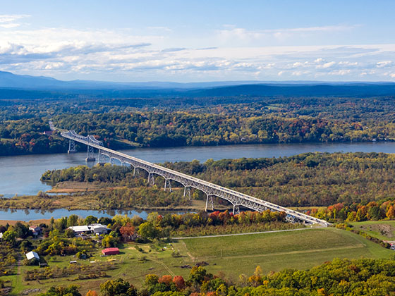
Communities in this metro area include Poughkeepsie, Newburgh, Middletown, Kingston, Hudson, and Catskill.

Individual toll maps for this region are listed below.

Map Of This Region ▹

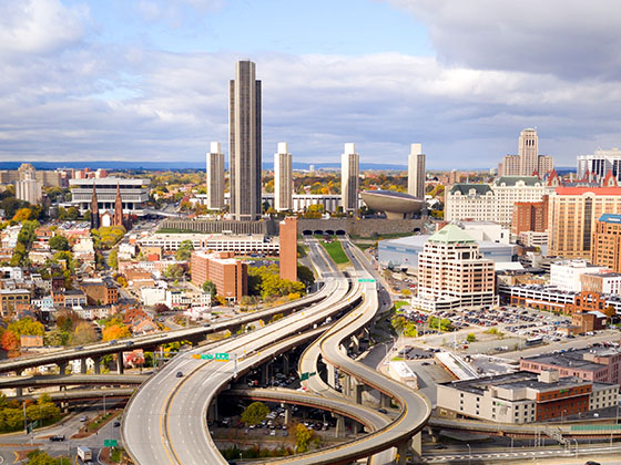
Communities in this metro area include Albany, Schenectady, Rotterdam, Amsterdam, and West Stockbridge, Massachusetts.

Individual toll maps for this region are listed below.

Map Of This Region ▹

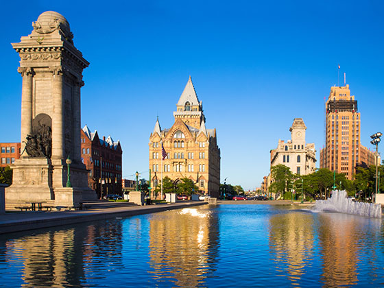
Communities in this metro area include Syracuse, East Syracuse, Oneida, Utica, Rome, Frankfort, and Watertown.

Individual toll maps for this region are listed below.

Map Of This Region ▹

Communities in this metro area include Buffalo, Batavia, Rochester, Amherst, Niagara Falls, and Niagara Falls, Ontario.

Individual toll maps for this region are listed below.

Map Of This Region ▹

Communities in this metro area include New Haven, Bridgeport, Darien, Greenwich, Stamford, and Port Chester, New York.

Individual toll maps for this region are listed below.

Map Of This Region ▹

Communities in this metro area include Scranton, Wilkes Barre, Stroudsburg, Clarks Summit, and Knowlton Township, New Jersey.

Individual toll maps for this region are listed below.