New York City - Northern New Jersey Toll Maps

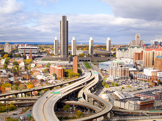
Regional photo of New York City - Northern New Jersey

Using The Interactive Regional Map

The New York City - Northern New Jersey metro area map shows exits and toll points for region-wide toll roads or other toll roads that cross the region.

View Map ▾Road List ▾

The following (22) toll roads are in this area, cross through this area or connect with this region:

The New York City - Northern New Jersey area includes the following cities: Bronx, Brooklyn, Manhattan, New York City, Rockaway, Far Rockaway, Atlantic Beach, Queens, Staten Island, Elizabeth, New Jersey, Fort Lee, New Jersey, Newark, New Jersey, Union City, New Jersey, New Rochelle, and Perth Amboy, New Jersey.

Markers on the interactive map can be selected to get close-up views of exit points, toll gantries and other locations and points-of-interest. Each POI map shows all nearby dining, gas, EV charging, hotels and other services.

View Map ▾Road List ▾

A complete list of exits and other points-of-interest in the New York City - Northern New Jersey area follows the map. Exit lists are sorted by toll road.

Advertising
Advertising

Regional Map For New York City - Northern New Jersey

Pan and zoom the map as desired, and select or tap the interactive markers to get information about that specific location. Each marker also includes options for viewing a close-up map of the destination point.

A complete list of exits and other points-of-interest is below this map, and other regions are shown further down the page.

Advertising
Advertising

Regional Exits, Listed By Toll Road

A list of all exits and other points-of-interest in this region, sorted by toll road.

New Jersey / NJ 440 / Ave A / JFK Blvd

New Jersey / NJ 440 / Ave A / JFK Blvd — Bayonne

View Map & Info

▸ GPS 40.652438000 X -74.136480000
NOTES:

The Port Authority Port Authority of New York & New Jersey manages this segment.

Bayonne Bridge Toll Gantry

Bayonne Bridge Toll Gantry — Staten Island

View Map & Info

▸ GPS 40.633214000 X -74.145601000
NOTES: Toll charged entering NY only

The Port Authority Port Authority of New York & New Jersey manages this segment.

New York / Morningstar Rd / Trantor Pl

Exit 13New York / Morningstar Rd / Trantor Pl — Staten Island

View Map & Info

▸ GPS 40.632287000 X -74.145811000
NOTES:

The Port Authority Port Authority of New York & New Jersey manages this segment.

NJ Turnpike

Exit 13NJ Turnpike — Elizabeth

View Map & Info

▸ GPS 40.640897000 X -74.205619000
NOTES: NJ Turnpike

The Port Authority Port Authority of New York & New Jersey manages this segment.

Toll Plaza

Toll Plaza — Staten Island

View Map & Info

▸ GPS 40.627734000 X -74.182201000
NOTES: Goethals Bridge Tolls

The Port Authority Port Authority of New York & New Jersey manages this segment.
Forest Avenue

Exit 4Forest Avenue — Staten Island

View Map & Info

▸ GPS 40.625824000 X -74.178952000
NOTES: New York

The Port Authority Port Authority of New York & New Jersey manages this segment.

Staten Island Expy / West Shore Expy

Exit 5Staten Island Expy / West Shore Expy — Staten Island

View Map & Info

▸ GPS 40.624325000 X -74.177224000
NOTES:

The Port Authority Port Authority of New York & New Jersey manages this segment.

Holland Tunnel Toll Plaza

Holland Tunnel Toll Plaza — Newport

View Map & Info

▸ GPS 40.729831000 X -74.038631000

The Port Authority Port Authority of New York & New Jersey manages this segment.

Holland Tunnel / New Jersey Bore

Holland Tunnel / New Jersey Bore — Newport

View Map & Info

▸ GPS 40.729704000 X -74.036059000
NOTES:

The Port Authority Port Authority of New York & New Jersey manages this segment.

Holland Tunnel / New York Bore

Holland Tunnel / New York Bore — New York City

View Map & Info

▸ GPS 40.725005000 X -74.006964000
NOTES:

The Port Authority Port Authority of New York & New Jersey manages this segment.

Rtes 9 & 440

Exit 127Rtes 9 & 440 — Keasbey

View Map & Info

▸ GPS 40.519622000 X -74.300903000
NOTES: I

NJTA New Jersey Turnpike Authority manages this segment.

New Jersey Turnpike

Exit 129New Jersey Turnpike — Woodbridge Township

View Map & Info

▸ GPS 40.538616000 X -74.306363000
NOTES: to Rtes 9 & 440

NJTA New Jersey Turnpike Authority manages this segment.

US 1

Exit 130US 1 — Metuchen

View Map & Info

▸ GPS 40.552646000 X -74.317028000
NOTES:

NJTA New Jersey Turnpike Authority manages this segment.

Metro Park Station

Exit 131Metro Park Station — Metuchen

View Map & Info

▸ GPS 40.561993000 X -74.322034000
NOTES:

NJTA New Jersey Turnpike Authority manages this segment.

Gills Lane

Exit 131BGills Lane — Metuchen

View Map & Info

▸ GPS 40.568429000 X -74.326300000
NOTES: Middlesex Essex Tpk

NJTA New Jersey Turnpike Authority manages this segment.

Route 27: Lincoln Highway

Exit 132Route 27: Lincoln Highway — Metuchen

View Map & Info

▸ GPS 40.570161000 X -74.327660000
NOTES:

NJTA New Jersey Turnpike Authority manages this segment.

Colonia South Service Area

Colonia South Service Area — Colonia

View Map & Info

▾ AVAILABLE GAS AND EV ▾

  • gas

    gas

  • diesel

    diesel

Colonia North Service Area

Colonia North Service Area — Colonia

View Map & Info

▾ AVAILABLE GAS AND EV ▾

  • gas

    gas

  • diesel

    diesel

Clark: Brant Ave / Central Ave

Exit 135Clark: Brant Ave / Central Ave — Clark

View Map & Info

▸ GPS 40.626309000 X -74.304982000
NOTES:

NJTA New Jersey Turnpike Authority manages this segment.

Linden: Centennial Ave / N Stiles St

Exit 136Linden: Centennial Ave / N Stiles St — Cranford

View Map & Info

▸ GPS 40.641732000 X -74.288954000
NOTES:

NJTA New Jersey Turnpike Authority manages this segment.

Route 28

Exit 137Route 28 — Cranford

View Map & Info

▸ GPS 40.658135000 X -74.287110000
NOTES: Westfield Ave

NJTA New Jersey Turnpike Authority manages this segment.

Rt 509 Kenilworth: Galloping Hill Rd

Exit 138Rt 509 Kenilworth: Galloping Hill Rd — Cranford

View Map & Info

▸ GPS 40.679795000 X -74.277954000
NOTES:

NJTA New Jersey Turnpike Authority manages this segment.

Chestnut Street

Exit 139AChestnut Street — Cranford

View Map & Info

▸ GPS 40.686098000 X -74.274349000
NOTES:

NJTA New Jersey Turnpike Authority manages this segment.

Route 82: West Union / Chestnut St

Exit 139BRoute 82: West Union / Chestnut St — Cranford

View Map & Info

▸ GPS 40.689431000 X -74.270706000
NOTES:

NJTA New Jersey Turnpike Authority manages this segment.

US 22 / Route 82 East / Morris Ave

Exit 140US 22 / Route 82 East / Morris Ave — Union

View Map & Info

▸ GPS 40.694493000 X -74.261714000
NOTES:

NJTA New Jersey Turnpike Authority manages this segment.

US 22 / Route 82 West

Exit 140AUS 22 / Route 82 West — Union

View Map & Info

▸ GPS 40.697268000 X -74.256947000
NOTES: Route 82 West

NJTA New Jersey Turnpike Authority manages this segment.

Whitney Houston Service Area

Whitney Houston Service Area — Union

View Map & Info

▾ AVAILABLE GAS AND EV ▾

  • gas

    gas

  • diesel

    diesel

  • truck parking

    truck
    parking

Vauxhall Road

Exit 141Vauxhall Road — Union

View Map & Info

▸ GPS 40.699781000 X -74.251923000
NOTES:

NJTA New Jersey Turnpike Authority manages this segment.

I–78 Express Eastbound

Exit 142AI–78 Express Eastbound — Union

View Map & Info

▸ GPS 40.701983000 X -74.247737000
NOTES:

NJTA New Jersey Turnpike Authority manages this segment.

I–78 Express Westbound

Exit 142BI–78 Express Westbound — Union

View Map & Info

▸ GPS 40.705655000 X -74.245487000
NOTES:

NJTA New Jersey Turnpike Authority manages this segment.

Union Avenue / Maplewood

Exit 142CUnion Avenue / Maplewood — Union

View Map & Info

▸ GPS 40.708813000 X -74.244875000
NOTES:

NJTA New Jersey Turnpike Authority manages this segment.

Lyons Avenue

Exit 143BLyons Avenue — Irvington

View Map & Info

▸ GPS 40.718855000 X -74.235304000
NOTES: Hillside

NJTA New Jersey Turnpike Authority manages this segment.

Lyons Avenue

Exit 143ALyons Avenue — Irvington

View Map & Info

▸ GPS 40.718855000 X -74.235304000
NOTES: Maplewood

NJTA New Jersey Turnpike Authority manages this segment.

Lyons Avenue

Exit 143Lyons Avenue — Irvington

View Map & Info

▸ GPS 40.732025000 X -74.221604000
NOTES: Springfield Ave

NJTA New Jersey Turnpike Authority manages this segment.

South Orange Avenue

Exit 144South Orange Avenue — Irvington

View Map & Info

▸ GPS 40.739381000 X -74.216465000
NOTES:

NJTA New Jersey Turnpike Authority manages this segment.

I–280

Exit 145I–280 — Newark

View Map & Info

▸ GPS 40.755230000 X -74.210089000
NOTES:

NJTA New Jersey Turnpike Authority manages this segment.

Springdale Ave / Parkway Dr

Exit 147Springdale Ave / Parkway Dr — East Orange

View Map & Info

▸ GPS 40.776447000 X -74.201853000
NOTES:

NJTA New Jersey Turnpike Authority manages this segment.

Bloomfield Avenue

Exit 148Bloomfield Avenue — Bloomfield

View Map & Info

▸ GPS 40.789431000 X -74.195506000
NOTES:

NJTA New Jersey Turnpike Authority manages this segment.

Belleville Avenue

Exit 149Belleville Avenue — Bloomfield

View Map & Info

▸ GPS 40.799127000 X -74.189154000
NOTES:

NJTA New Jersey Turnpike Authority manages this segment.

Hoover Avenue

Exit 150Hoover Avenue — Bloomfield

View Map & Info

▸ GPS 40.810070000 X -74.180762000
NOTES:

NJTA New Jersey Turnpike Authority manages this segment.

Watchung Avenue

Exit 151Watchung Avenue — Bloomfield

View Map & Info

▸ GPS 40.828763000 X -74.176478000
NOTES:

NJTA New Jersey Turnpike Authority manages this segment.

Connie Chung Service Area

Connie Chung Service Area — Bloomfield

View Map & Info

▾ AVAILABLE GAS AND EV ▾

  • gas

    gas

  • diesel

    diesel

  • truck parking

    truck
    parking

Larry Doby Service Area

Larry Doby Service Area — Bloomfield

View Map & Info

▾ AVAILABLE GAS AND EV ▾

  • gas

    gas

  • diesel

    diesel

  • ev

    ev

Route 3 East

Exit 153ARoute 3 East — Clifton

View Map & Info

▸ GPS 40.847392000 X -74.179199000
NOTES:

NJTA New Jersey Turnpike Authority manages this segment.

Route 3 West / Route 46 West

Exit 153BRoute 3 West / Route 46 West — Clifton

View Map & Info

▸ GPS 40.852465000 X -74.174921000
NOTES:

NJTA New Jersey Turnpike Authority manages this segment.

Route 3

Exit 153Route 3 — Clifton

View Map & Info

▸ GPS 40.853985000 X -74.176022000
NOTES:

NJTA New Jersey Turnpike Authority manages this segment.

US 46

Exit 154US 46 — Clifton

View Map & Info

▸ GPS 40.873808000 X -74.166519000
NOTES: Piaget Avenue

NJTA New Jersey Turnpike Authority manages this segment.

Clifton / Paterson

Exit 155AClifton / Paterson — Clifton

View Map & Info

▸ GPS 40.878231000 X -74.166033000
NOTES:

NJTA New Jersey Turnpike Authority manages this segment.

Hazel Street

Exit 155BHazel Street — Clifton

View Map & Info

▸ GPS 40.883400000 X -74.163235000
NOTES:

NJTA New Jersey Turnpike Authority manages this segment.

Clifton

Exit 156Clifton — Clifton

View Map & Info

▸ GPS 40.889658000 X -74.131264000
NOTES: River Dr

NJTA New Jersey Turnpike Authority manages this segment.

Elmwood Park: US 46 / River Dr

Exit 157Elmwood Park: US 46 / River Dr — Clifton

View Map & Info

▸ GPS 40.893333000 X -74.119928000
NOTES:

NJTA New Jersey Turnpike Authority manages this segment.

I–80

Exit 159I–80 — Elmwood Park

View Map & Info

▸ GPS 40.905221000 X -74.105407000
NOTES:

NJTA New Jersey Turnpike Authority manages this segment.

Passaic St / Route 208 / Paramus Rd

Exit 160Passaic St / Route 208 / Paramus Rd — Elmwood Park

View Map & Info

▸ GPS 40.920126000 X -74.085717000
NOTES:

NJTA New Jersey Turnpike Authority manages this segment.

Route 4

Exit 161Route 4 — Paramus

View Map & Info

▸ GPS 40.922706000 X -74.079955000
NOTES:

NJTA New Jersey Turnpike Authority manages this segment.

Route 17

Exit 163Route 17 — Paramus

View Map & Info

▸ GPS 40.938391000 X -74.071336000
NOTES:

NJTA New Jersey Turnpike Authority manages this segment.

Oradell

Exit 165Oradell — Paramus

View Map & Info

▸ GPS 40.963556000 X -74.065069000
NOTES: Ridgewood

NJTA New Jersey Turnpike Authority manages this segment.

Washington / Highland Ave / Linwood Ave E

Exit 166Washington / Highland Ave / Linwood Ave E — Paramus

View Map & Info

▸ GPS 40.976826000 X -74.070458000
NOTES:

NJTA New Jersey Turnpike Authority manages this segment.

Washington

Exit 168Washington — Washington Township

View Map & Info

▸ GPS 40.998689000 X -74.071050000
NOTES: Westwood

NJTA New Jersey Turnpike Authority manages this segment.

Chestnut Ridge Rd / Glen Rd

Exit 171Chestnut Ridge Rd / Glen Rd — Woodcliff Lake

View Map & Info

▸ GPS 41.036819000 X -74.071636000
NOTES:

NJTA New Jersey Turnpike Authority manages this segment.

James Gandolfini Service Area

James Gandolfini Service Area — Montvale

View Map & Info

▾ AVAILABLE GAS AND EV ▾

  • gas

    gas

  • diesel

    diesel

  • truck parking

    truck
    parking

Grand Avenue

Exit 172Grand Avenue — Woodcliff Lake

View Map & Info

▸ GPS 41.055549000 X -74.065309000
NOTES:

NJTA New Jersey Turnpike Authority manages this segment.

New York State Thruway

New York State Thruway — Nanuet NY

View Map & Info

▸ GPS 41.097440000 X -74.040541000
NOTES:

NJTA New Jersey Turnpike Authority manages this segment.

Hudson Terrace

Exit 73Hudson Terrace — Fort Lee

View Map & Info

▸ GPS 40.853939000 X -73.963774000
NOTES: Westbound

The Port Authority Port Authority of New York & New Jersey manages this segment.

NJ 67

Exit 73 UpperNJ 67 — Fort Lee

View Map & Info

▸ GPS 40.854144000 X -73.965899000
NOTES: Eastbound / Upper Span

The Port Authority Port Authority of New York & New Jersey manages this segment.

Palisades Parkway

Exit 74Palisades Parkway — Fort Lee

View Map & Info

▸ GPS 40.853430000 X -73.961246000
NOTES: WB Off/EB On

The Port Authority Port Authority of New York & New Jersey manages this segment.

NJ 67

Exit 73 LowerNJ 67 — Fort Lee

View Map & Info

▸ GPS 40.854603000 X -73.969891000
NOTES: Eastbound / Lower Span

The Port Authority Port Authority of New York & New Jersey manages this segment.

Toll Plaza

Toll Plaza — Fort Lee

View Map & Info

▸ GPS 40.856464000 X -73.961764000
NOTES: Palisades Parkway Toll Plaza

The Port Authority Port Authority of New York & New Jersey manages this segment.

178th Street

Exit 1178th Street — New York

View Map & Info

▸ GPS 40.849925000 X -73.944048000
NOTES: NYC

The Port Authority Port Authority of New York & New Jersey manages this segment.

Harlem River Drive

Exit 2Harlem River Drive — New York

View Map & Info

▸ GPS 40.847878000 X -73.935622000
NOTES: NYC

The Port Authority Port Authority of New York & New Jersey manages this segment.

I–95

Exit 3I–95 — New York

View Map & Info

▸ GPS 40.845713000 X -73.929646000
NOTES: NYC

The Port Authority Port Authority of New York & New Jersey manages this segment.

Lincoln Tunnel Toll Plaza

Lincoln Tunnel Toll Plaza — Weehawken

View Map & Info

▸ GPS 40.764946000 X -74.023528000
NOTES:

The Port Authority Port Authority of New York & New Jersey manages this segment.

Lincoln Tunnel / New Jersey Bore

Lincoln Tunnel / New Jersey Bore — Weehawken

View Map & Info

▸ GPS 40.766438000 X -74.022708000
NOTES:

The Port Authority Port Authority of New York & New Jersey manages this segment.

Lincoln Tunnel / New York Bore

Lincoln Tunnel / New York Bore — New York City

View Map & Info

▸ GPS 40.758887000 X -73.999253000
NOTES:

The Port Authority Port Authority of New York & New Jersey manages this segment.

I–287 / NJ 440/Outerbridge Crossing

Exit 10I–287 / NJ 440/Outerbridge Crossing — Edison

View Map & Info

▸ GPS 40.525618050 X -74.342281000
NOTES: to Staten Island

NJTA New Jersey Turnpike Authority manages this segment.

Garden State Pkwy.

Exit 11Garden State Pkwy. — Woodbridge

View Map & Info

▸ GPS 40.542024000 X -74.301225830
NOTES: Woodbridge

NJTA New Jersey Turnpike Authority manages this segment.

Thomas Edison Service Area

Thomas Edison Service Area — Woodbridge Township

View Map & Info

▾ AVAILABLE GAS AND EV ▾

  • gas

    gas

  • diesel

    diesel

  • truck parking

    truck
    parking

Grover Cleveland Service Area

Grover Cleveland Service Area — Woodbridge Township

View Map & Info

▾ AVAILABLE GAS AND EV ▾

  • gas

    gas

  • diesel

    diesel

  • truck parking

    truck
    parking

Carteret

Exit 12Carteret — Carteret

View Map & Info

▸ GPS 40.594468300 X -74.234565000
NOTES:

NJTA New Jersey Turnpike Authority manages this segment.

I–278

Exit 13I–278 — Elizabeth

View Map & Info

▸ GPS 40.641500500 X -74.205749720
NOTES: to Goethals Bridge / Staten Island

NJTA New Jersey Turnpike Authority manages this segment.

Newark Liberty Int'l/EWR / Elizabeth Seaport

Exit 13ANewark Liberty Int'l/EWR / Elizabeth Seaport — Newark

View Map & Info

▸ GPS 40.665403050 X -74.181835000
NOTES:

NJTA New Jersey Turnpike Authority manages this segment.

Newark Liberty Int'l/EWR / I–78

Exit 14Newark Liberty Int'l/EWR / I–78 — Newark

View Map & Info

▸ GPS 40.704468300 X -74.152898050
NOTES:

NJTA New Jersey Turnpike Authority manages this segment.

NJ 440 / Bayonne

Exit 14ANJ 440 / Bayonne — Bayonne

View Map & Info

▸ GPS 40.686099000 X -74.096544000
NOTES:

NJTA New Jersey Turnpike Authority manages this segment.

Bayview Avenue / Jersey City

Exit 14BBayview Avenue / Jersey City — Jersey City

View Map & Info

▸ GPS 40.700959000 X -74.068720000
NOTES: Liberty State Park

NJTA New Jersey Turnpike Authority manages this segment.

Liberty Science Center

Liberty Science Center — Jersey City

View Map & Info

▸ GPS 40.707372000 X -74.059958000
NOTES: Park and Ride

NJTA New Jersey Turnpike Authority manages this segment.

Christopher Columbus Drive

Christopher Columbus Drive — Jersey City

View Map & Info

▸ GPS 40.720945000 X -74.055176000
NOTES: Exits to Montgomery St.

NJTA New Jersey Turnpike Authority manages this segment.

Newark / Jersey City

Exit 15ENewark / Jersey City — Jersey City

View Map & Info

▸ GPS 40.728716940 X -74.128660830
NOTES:

NJTA New Jersey Turnpike Authority manages this segment.

Holland Tunnel

Exit 14CHolland Tunnel — Jersey City

View Map & Info

▸ GPS 40.729732000 X -74.036005000
NOTES:

NJTA New Jersey Turnpike Authority manages this segment.

Newark / The Oranges

Exit 15WNewark / The Oranges — East Orange

View Map & Info

▸ GPS 40.755105000 X -74.117802700
NOTES:

NJTA New Jersey Turnpike Authority manages this segment.

Secaucus Transfer Station

Exit 15XSecaucus Transfer Station — Jersey City

View Map & Info

▸ GPS 40.761598000 X -74.077028050
NOTES:

NJTA New Jersey Turnpike Authority manages this segment.

Alexander Hamilton Service Area

Alexander Hamilton Service Area — Secaucus

View Map & Info

▾ AVAILABLE GAS AND EV ▾

  • gas

    gas

  • diesel

    diesel

  • truck parking

    truck
    parking

NJ 3 / NJ 495 / Lincoln Tunnel - SB On/NB Off

Exit 16ENJ 3 / NJ 495 / Lincoln Tunnel - SB On/NB Off — Jersey City

View Map & Info

▸ GPS 40.776613050 X -74.058400830
NOTES:

NJTA New Jersey Turnpike Authority manages this segment.

NJ 3 / Sportsplex

Exit 16WNJ 3 / Sportsplex — Newark

View Map & Info

▸ GPS 40.800735000 X -74.074609000
NOTES: E. Rutherford

NJTA New Jersey Turnpike Authority manages this segment.

NJ 3 / NJ 495 / Lincoln Tunnel - SB Off/NB On

Exit 17NJ 3 / NJ 495 / Lincoln Tunnel - SB Off/NB On — Union City

View Map & Info

▸ GPS 40.789747000 X -74.047827000
NOTES:

NJTA New Jersey Turnpike Authority manages this segment.

Vince Lombardi Service Area

Vince Lombardi Service Area — Ridgefield Borough

View Map & Info

▾ AVAILABLE GAS AND EV ▾

  • gas

    gas

  • diesel

    diesel

  • ev

    ev

  • truck parking

    truck
    parking

I–80 / George Washington Bridge

Exit 18WI–80 / George Washington Bridge — Fort Lee

View Map & Info

▸ GPS 40.861661940 X -74.011871600
NOTES:

NJTA New Jersey Turnpike Authority manages this segment.

Amboy Ave / State St / High St

Amboy Ave / State St / High St — Perth Amboy

View Map & Info

▸ GPS 40.526497000 X -74.270319000
NOTES: NJ 440

The Port Authority Port Authority of New York & New Jersey manages this segment.

Toll Plaza

Toll Plaza — Staten Island

View Map & Info

▸ GPS 40.525286000 X -74.234087000
NOTES: Outerbridge Crossing Tolls

The Port Authority Port Authority of New York & New Jersey manages this segment.

Arthur Kill Road

Exit 1Arthur Kill Road — Staten Island

View Map & Info

▸ GPS 40.525438000 X -74.232997000
NOTES: to Boscombe Ave & Veterans Rd

The Port Authority Port Authority of New York & New Jersey manages this segment.

Cross Island Parkway

Exit 16Cross Island Parkway — Queens

View Map & Info

▸ GPS 40.789562000 X -73.822529000
NOTES: NB 678 To Whitestone Br

MTA MTA Bridges and Tunnels manages this segment.

3rd Ave / 14th Ave

Exit 173rd Ave / 14th Ave — Queens

View Map & Info

▸ GPS 40.793047000 X -73.823962000
NOTES: NB 3rd / SB 14th

MTA MTA Bridges and Tunnels manages this segment.

Bridge Toll Gantry

Bridge Toll Gantry — Bronx

View Map & Info

▸ GPS 40.813404000 X -73.836478000
NOTES:

MTA MTA Bridges and Tunnels manages this segment.

Lafayette Ave

Exit 18Lafayette Ave — Bronx

View Map & Info

▸ GPS 40.817830000 X -73.836249000
NOTES: Ferry Point Park

MTA MTA Bridges and Tunnels manages this segment.

I–95 / I–278 / I–295

Exit 19N/19S/19WI–95 / I–278 / I–295 — Bronx

View Map & Info

▸ GPS 40.828920000 X -73.837053000
NOTES: Bruckner Expy / Cross Bronx Expy

MTA MTA Bridges and Tunnels manages this segment.

Manhattan / Financial District

Manhattan / Financial District — Manhattan

View Map & Info

▸ GPS 40.706126000 X -74.014780000
NOTES:

MTA MTA Bridges and Tunnels manages this segment.

Tunnel Toll Gantry

Tunnel Toll Gantry — Manhattan

View Map & Info

▸ GPS 40.705522000 X -74.015068000
NOTES:

MTA MTA Bridges and Tunnels manages this segment.

Brooklyn

Brooklyn — Brooklyn

View Map & Info

▸ GPS 40.680740000 X -74.004865000
NOTES:

MTA MTA Bridges and Tunnels manages this segment.

Hamilton Avenue

Hamilton Avenue — Brooklyn

View Map & Info

▸ GPS 40.676242000 X -74.001333000
NOTES:

MTA MTA Bridges and Tunnels manages this segment.

New York State Thruway

New York State Thruway — Tarrytown

View Map & Info

▸ GPS 41.057964000 X -73.832264000
NOTES: Start/End of Expy

The Thruway Authority New York State Thruway Authority manages this segment.

NY 119

NY 119 — Tarrytown

View Map & Info

▸ GPS 41.059177000 X -73.828627000
NOTES:

The Thruway Authority New York State Thruway Authority manages this segment.

NY 9A / Saw Mill River Pkwy N

NY 9A / Saw Mill River Pkwy N — Elmsford

View Map & Info

▸ GPS 41.058196000 X -73.816621000
NOTES:

The Thruway Authority New York State Thruway Authority manages this segment.

Sprain Brook Parkway / to Taconic St. Pkwy.

Sprain Brook Parkway / to Taconic St. Pkwy. — Elmsford

View Map & Info

▸ GPS 41.052282000 X -73.808940000
NOTES:

The Thruway Authority New York State Thruway Authority manages this segment.

NY 100A/Knollwood Road

NY 100A/Knollwood Road — Elmsford

View Map & Info

▸ GPS 41.047261000 X -73.803745000
NOTES:

The Thruway Authority New York State Thruway Authority manages this segment.

NY 100 / Hillside Ave. / White Plains Rd.

NY 100 / Hillside Ave. / White Plains Rd. — White Plains

View Map & Info

▸ GPS 41.044629000 X -73.790528000
NOTES:

The Thruway Authority New York State Thruway Authority manages this segment.

N. Broadway/NY 22

N. Broadway/NY 22 — White Plains

View Map & Info

▸ GPS 41.045707000 X -73.769556000
NOTES:

The Thruway Authority New York State Thruway Authority manages this segment.

Central Westchester Pkwy. No. / Taconic St. Pwky.

Central Westchester Pkwy. No. / Taconic St. Pwky. — White Plains

View Map & Info

▸ GPS 41.042516000 X -73.763041000
NOTES:

The Thruway Authority New York State Thruway Authority manages this segment.

NY 127 / Westchester Ave. / Bloomingdale Rd.

NY 127 / Westchester Ave. / Bloomingdale Rd. — White Plains

View Map & Info

▸ GPS 41.031090000 X -73.749766000
NOTES:

The Thruway Authority New York State Thruway Authority manages this segment.

I–684 / Westchester Avenue

I–684 / Westchester Avenue — White Plains

View Map & Info

▸ GPS 41.021826000 X -73.728024000
NOTES:

The Thruway Authority New York State Thruway Authority manages this segment.

Hutchinson River Parkway / Merritt Parkway

Hutchinson River Parkway / Merritt Parkway — White Plains

View Map & Info

▸ GPS 41.014079000 X -73.717154000
NOTES:

The Thruway Authority New York State Thruway Authority manages this segment.

NY 120 / NY 120A / Bowman Ave. / Webb Ave.

NY 120 / NY 120A / Bowman Ave. / Webb Ave. — Harrison

View Map & Info

▸ GPS 41.004673000 X -73.694294000
NOTES:

The Thruway Authority New York State Thruway Authority manages this segment.

US 1 South

US 1 South — Rye

View Map & Info

▸ GPS 40.991845000 X -73.677133000
NOTES: Rye

The Thruway Authority New York State Thruway Authority manages this segment.

I–95/New England Thruway S

I–95/New England Thruway S — Port Chester

View Map & Info

▸ GPS 40.987418000 X -73.679755000
NOTES:

The Thruway Authority New York State Thruway Authority manages this segment.

I–95/New England Thruway N

I–95/New England Thruway N — Port Chester

View Map & Info

▸ GPS 40.988814000 X -73.665558000
NOTES: to Connecticut Turnpike / Start/End of Expy

The Thruway Authority New York State Thruway Authority manages this segment.

Grand Central Pkwy / Brooklyn Queens Expy

Grand Central Pkwy / Brooklyn Queens Expy — Queens

View Map & Info

▸ GPS 40.768453000 X -73.906154000
NOTES: I–278 for Brooklyn Queens Expy

MTA MTA Bridges and Tunnels manages this segment.

31st St / Astoria Blvd / Hoyt Ave

Exit 4531st St / Astoria Blvd / Hoyt Ave — Astoria

View Map & Info

▸ GPS 40.770543000 X -73.917441000
NOTES: Astoria

MTA MTA Bridges and Tunnels manages this segment.

Kennedy Bridge West Toll Gantry

Kennedy Bridge West Toll Gantry — Astoria

View Map & Info

▸ GPS 40.771643000 X -73.918848000
NOTES: Reads eastbound traffic

MTA MTA Bridges and Tunnels manages this segment.

Randalls Island Park

Exit 46ARandalls Island Park — Randalls Island

View Map & Info

▸ GPS 40.789689000 X -73.927025000
NOTES: WB Off only

MTA MTA Bridges and Tunnels manages this segment.

Manhattan / Randalls Island

Exit 46Manhattan / Randalls Island — Randalls Island

View Map & Info

▸ GPS 40.796967000 X -73.920458000
NOTES: to Randalls Island Park

MTA MTA Bridges and Tunnels manages this segment.

I–87 / Maj Deegan Expy

Exit 47I–87 / Maj Deegan Expy — Bronx

View Map & Info

▸ GPS 40.801853000 X -73.916855000
NOTES: Bronx

MTA MTA Bridges and Tunnels manages this segment.

Kennedy Bridge East Toll Gantry

Kennedy Bridge East Toll Gantry — Bronx

View Map & Info

▸ GPS 40.799171000 X -73.925013000
NOTES: Reads westbound traffic

MTA MTA Bridges and Tunnels manages this segment.

Manhattan / 2nd Avenue

Manhattan / 2nd Avenue — Manhattan

View Map & Info

▸ GPS 40.746041000 X -73.974752000
NOTES: Tunnel Approach St to United Nations

MTA MTA Bridges and Tunnels manages this segment.

Tunnel Toll Gantry

Tunnel Toll Gantry — Manhattan

View Map & Info

▸ GPS 40.745665000 X -73.973379000
NOTES:

MTA MTA Bridges and Tunnels manages this segment.

Queens / L.I.E.

Queens / L.I.E. — Queens

View Map & Info

▸ GPS 40.741477000 X -73.953138000
NOTES: Long Island Expy / to LaGuardia Intl Airport

MTA MTA Bridges and Tunnels manages this segment.

Bruckner Expressway

Bruckner Expressway — Bronx

View Map & Info

▸ GPS 40.855617000 X -73.826204000
NOTES: Start/End of New Eng. Thwy.

The Thruway Authority New York State Thruway Authority manages this segment.

City Island

City Island — Bronx

View Map & Info

▸ GPS 40.857152000 X -73.826429000
NOTES: Pelham Parkway

The Thruway Authority New York State Thruway Authority manages this segment.

Hutchinson River Parkway North

Hutchinson River Parkway North — Bronx

View Map & Info

▸ GPS 40.861079000 X -73.828066000
NOTES:

The Thruway Authority New York State Thruway Authority manages this segment.

Gun Hill Road

Gun Hill Road — Bronx

View Map & Info

▸ GPS 40.861571000 X -73.828528000
NOTES:

The Thruway Authority New York State Thruway Authority manages this segment.

Bartow Avenue

Bartow Avenue — Bronx

View Map & Info

▸ GPS 40.868497000 X -73.832588000
NOTES: Co

The Thruway Authority New York State Thruway Authority manages this segment.

Baychester Avenue

Baychester Avenue — Bronx

View Map & Info

▸ GPS 40.870540000 X -73.833571000
NOTES:

The Thruway Authority New York State Thruway Authority manages this segment.

Conner Street

Conner Street — Bronx

View Map & Info

▸ GPS 40.883827000 X -73.825815000
NOTES: Baychester Avenue

The Thruway Authority New York State Thruway Authority manages this segment.

Hutchinson River Parkway South

Hutchinson River Parkway South — Bronx

View Map & Info

▸ GPS 40.886649000 X -73.815305000
NOTES: Whitestone Bridge

The Thruway Authority New York State Thruway Authority manages this segment.

Boston Post Rd / US 1

Boston Post Rd / US 1 — New Rochelle

View Map & Info

▸ GPS 40.900209000 X -73.795637000
NOTES: The Pelhams

The Thruway Authority New York State Thruway Authority manages this segment.

Cedar Street / North Avenue

Cedar Street / North Avenue — New Rochelle

View Map & Info

▸ GPS 40.916359000 X -73.781699000
NOTES:

The Thruway Authority New York State Thruway Authority manages this segment.

New Rochelle Toll Barrier

New Rochelle Toll Barrier — New Rochelle

View Map & Info

▸ GPS 40.926602000 X -73.769523000
NOTES:

The Thruway Authority New York State Thruway Authority manages this segment.

Chatsworth Avenue

Chatsworth Avenue — New Rochelle

View Map & Info

▸ GPS 40.928041000 X -73.768229000
NOTES: Larchmont

The Thruway Authority New York State Thruway Authority manages this segment.

Fenimore Rd. / Mamaroneck Ave. E.

Fenimore Rd. / Mamaroneck Ave. E. — Mamaroneck

View Map & Info

▸ GPS 40.951767000 X -73.745493000
NOTES: NB Exit Only

The Thruway Authority New York State Thruway Authority manages this segment.

Mamaroneck Avenue

Mamaroneck Avenue — Mamaroneck

View Map & Info

▸ GPS 40.962108000 X -73.736256000
NOTES: White Plains

The Thruway Authority New York State Thruway Authority manages this segment.

Playland Parkway

Playland Parkway — Rye

View Map & Info

▸ GPS 40.976778000 X -73.698954000
NOTES: Rye

The Thruway Authority New York State Thruway Authority manages this segment.

US 1 South

US 1 South — Rye

View Map & Info

▸ GPS 40.986493000 X -73.682958000
NOTES: Rye

The Thruway Authority New York State Thruway Authority manages this segment.

Cross Westchester Expressway (I–287)

Cross Westchester Expressway (I–287) — Port Chester

View Map & Info

▸ GPS 40.987418000 X -73.679755000
NOTES:

The Thruway Authority New York State Thruway Authority manages this segment.

Midland Avenue

Midland Avenue — Port Chester

View Map & Info

▸ GPS 40.987418000 X -73.672690000
NOTES: Port Chester

The Thruway Authority New York State Thruway Authority manages this segment.

I–95/Connecticut Turnpike

I–95/Connecticut Turnpike — Port Chester

View Map & Info

▸ GPS 40.994328000 X -73.659458000
NOTES: Connecticut State Line

The Thruway Authority New York State Thruway Authority manages this segment.

Jerome Ave / E 233rd St / Maj. Deegan Expy

Jerome Ave / E 233rd St / Maj. Deegan Expy — Bronx

View Map & Info

▸ GPS 40.899510000 X -73.879290000
NOTES:

The Thruway Authority New York State Thruway Authority manages this segment.

Hall Place / McLean Avenue

Exit 1Hall Place / McLean Avenue — Mount Vernon

View Map & Info

▸ GPS 40.912100000 X -73.875350000
NOTES:

The Thruway Authority New York State Thruway Authority manages this segment.

Yonkers Avenue / Raceway No SB Exit

Exit 2Yonkers Avenue / Raceway No SB Exit — Yonkers

View Map & Info

▸ GPS 40.921490000 X -73.863090000
NOTES:

The Thruway Authority New York State Thruway Authority manages this segment.

Mile Square Road

Exit 3Mile Square Road — Yonkers

View Map & Info

▸ GPS 40.925100000 X -73.858500000
NOTES: No SB Exit

The Thruway Authority New York State Thruway Authority manages this segment.

Cross County Pkwy / Mile Square Rd

Exit 4Cross County Pkwy / Mile Square Rd — Yonkers

View Map & Info

▸ GPS 40.930860000 X -73.856830000
NOTES:

The Thruway Authority New York State Thruway Authority manages this segment.

Central Park Ave/NY Route 100

Exit 5Central Park Ave/NY Route 100 — Yonkers

View Map & Info

▸ GPS 40.938330000 X -73.855640000
NOTES: No SB Exit

The Thruway Authority New York State Thruway Authority manages this segment.

Tuckahoe Road

Exit 6/6E/6WTuckahoe Road — Bronxville

View Map & Info

▸ GPS 40.954960000 X -73.860930000
NOTES: Bronxville

The Thruway Authority New York State Thruway Authority manages this segment.

Stew Leonard Drive

Exit 6AStew Leonard Drive — Bronxville

View Map & Info

▸ GPS 40.966700000 X -73.860800000
NOTES:

The Thruway Authority New York State Thruway Authority manages this segment.

Yonkers Toll Barrier

Yonkers Toll Barrier — Yonkers

View Map & Info

▸ GPS 40.975570000 X -73.858610000
NOTES:

The Thruway Authority New York State Thruway Authority manages this segment.

Ardsley Travel Plaza

Ardsley Travel Plaza — Yonkers

View Map & Info

▾ AVAILABLE GAS AND EV ▾

  • gas

    gas

  • diesel

    diesel

  • ev

    ev

NY Route 9A

Exit 7NY Route 9A — White Plains

View Map & Info

▸ GPS 41.008720000 X -73.850990000
NOTES: No SB Exit

The Thruway Authority New York State Thruway Authority manages this segment.

Saw Mill River Parkway / Taconic State Parkway

Exit 7ASaw Mill River Parkway / Taconic State Parkway — White Plains

View Map & Info

▸ GPS 41.042590000 X -73.836080000
NOTES:

The Thruway Authority New York State Thruway Authority manages this segment.

Cross Westchester Expressway/I–287

Exit 8Cross Westchester Expressway/I–287 — White Plains

View Map & Info

▸ GPS 41.056560000 X -73.835330000
NOTES:

The Thruway Authority New York State Thruway Authority manages this segment.

NY Route 119

Exit 8ANY Route 119 — East Irvington

View Map & Info

▸ GPS 41.057690000 X -73.837320000
NOTES: Saw Mill River Pkwy N

The Thruway Authority New York State Thruway Authority manages this segment.

US Route 9

Exit 9US Route 9 — Tarrytown

View Map & Info

▸ GPS 41.062670000 X -73.861950000
NOTES: Tarrytown

The Thruway Authority New York State Thruway Authority manages this segment.

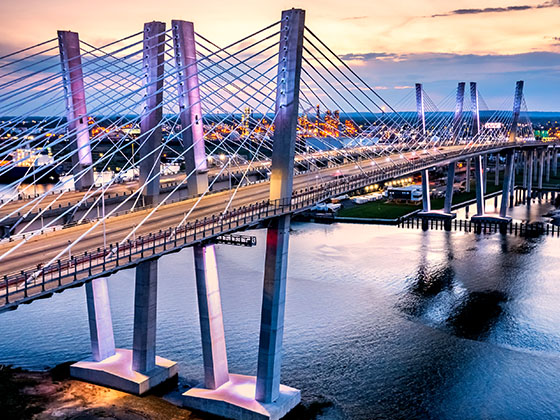
Gov. Mario M. Cuomo Bridge Toll Gantry

Gov. Mario M. Cuomo Bridge Toll Gantry — Tarrytown

View Map & Info

▸ GPS 41.065060000 X -73.864700000
NOTES: Tappan Zee Bridge

The Thruway Authority New York State Thruway Authority manages this segment.

US Route 9W

Exit 10US Route 9W — Nyack

View Map & Info

▸ GPS 41.081990000 X -73.923170000
NOTES: No SB Exit

The Thruway Authority New York State Thruway Authority manages this segment.

US Route 9W

Exit 11US Route 9W — Nyack

View Map & Info

▸ GPS 41.090710000 X -73.928790000
NOTES:

The Thruway Authority New York State Thruway Authority manages this segment.

NY Route 303 / Palisades Center Drive

Exit 12NY Route 303 / Palisades Center Drive — Nyack

View Map & Info

▸ GPS 41.099570000 X -73.950940000
NOTES:

The Thruway Authority New York State Thruway Authority manages this segment.

Palisades Interstate Pkwy

Exit 13Palisades Interstate Pkwy — West Nyack

View Map & Info

▸ GPS 41.101790000 X -73.992450000
NOTES: to NJ / Bear Mtn State Pk

The Thruway Authority New York State Thruway Authority manages this segment.

NY Route 59

Exit 14NY Route 59 — Nanuet

View Map & Info

▸ GPS 41.102720000 X -74.027690000
NOTES: Spring Valley / Nanuet

The Thruway Authority New York State Thruway Authority manages this segment.

Garden State Parkway / New Jersey

Exit 14AGarden State Parkway / New Jersey — Nanuet

View Map & Info

▸ GPS 41.097680000 X -74.039970000
NOTES:

The Thruway Authority New York State Thruway Authority manages this segment.

Spring Valley Toll Barrier

Spring Valley Toll Barrier — Spring Valley

View Map & Info

▸ GPS 41.098300000 X -74.054490000
NOTES:

The Thruway Authority New York State Thruway Authority manages this segment.

Airmont Road

Exit 14BAirmont Road — Suffern

View Map & Info

▸ GPS 41.116290000 X -74.112320000
NOTES:

The Thruway Authority New York State Thruway Authority manages this segment.

I–287 NJ / NJ Route 17

Exit 15I–287 NJ / NJ Route 17 — Suffern

View Map & Info

▸ GPS 41.121330000 X -74.162830000
NOTES: to New Jersey

The Thruway Authority New York State Thruway Authority manages this segment.

Narrows Road

Exit 15WNarrows Road — Staten Island

View Map & Info

▸ GPS 40.604028000 X -74.069134000
NOTES: I–278 as Staten Island Expy

MTA MTA Bridges and Tunnels manages this segment.

Lily Pond Ave

Exit 15N/15SLily Pond Ave — Staten Island

View Map & Info

▸ GPS 40.602747000 X -74.065531000
NOTES: Trucks/Buses use upper deck

MTA MTA Bridges and Tunnels manages this segment.

Bridge Toll Gantries

Bridge Toll Gantries — Staten Island

View Map & Info

▸ GPS 40.602115000 X -74.063121000
NOTES:

MTA MTA Bridges and Tunnels manages this segment.

Belt Pkwy / Shore Pkwy / JFK Intl Airport

Exit 16Belt Pkwy / Shore Pkwy / JFK Intl Airport — Brooklyn

View Map & Info

▸ GPS 40.609708000 X -74.034997000
NOTES: Brooklyn

MTA MTA Bridges and Tunnels manages this segment.

92nd Street

Exit 1792nd Street — Brooklyn

View Map & Info

▸ GPS 40.616296000 X -74.026197000
NOTES: Brooklyn

MTA MTA Bridges and Tunnels manages this segment.

Clearview Expy / Willets Point Blvd

Exit 7Clearview Expy / Willets Point Blvd — Bayside

View Map & Info

▸ GPS 40.786462000 X -73.788191000
NOTES: SB On / NB Off

MTA MTA Bridges and Tunnels manages this segment.

Cross Island Pkwy

Exit 8Cross Island Pkwy — New York City

View Map & Info

▸ GPS 40.790660000 X -73.792739000
NOTES: SB Off / NB On

MTA MTA Bridges and Tunnels manages this segment.

Bridge Toll Gantry

Bridge Toll Gantry — Bronx

View Map & Info

▸ GPS 40.817516000 X -73.801601000
NOTES:

MTA MTA Bridges and Tunnels manages this segment.

Pennyfield Avenue

Exit 9Pennyfield Avenue — Bronx

View Map & Info

▸ GPS 40.818140000 X -73.805918000
NOTES: Fort Schuyler

MTA MTA Bridges and Tunnels manages this segment.

Dyckman Street

Exit 17Dyckman Street — Upper Manhattan

View Map & Info

▸ GPS 40.868715000 X -73.931089000
NOTES: NB for Bridge

MTA MTA Bridges and Tunnels manages this segment.

Hudson Bridge Toll Gantries

Hudson Bridge Toll Gantries — Upper Manhattan

View Map & Info

▸ GPS 40.875728000 X -73.925544000
NOTES:

MTA MTA Bridges and Tunnels manages this segment.

Kappock Street

Exit 18Kappock Street — Bronx

View Map & Info

▸ GPS 40.880480000 X -73.918296000
NOTES: SB Off / NB Off

MTA MTA Bridges and Tunnels manages this segment.

West 232nd Street

Exit 19West 232nd Street — Bronx

View Map & Info

▸ GPS 40.884578000 X -73.914726000
NOTES:

MTA MTA Bridges and Tunnels manages this segment.

Atlantic Blvd / Park St

Atlantic Blvd / Park St — Atlantic Beach

View Map & Info

▸ GPS 40.589596000 X -73.737043000
NOTES:

NCBA Nassau County Bridge Authority manages this segment.

Atlantic Beach Bridge Tolls

Atlantic Beach Bridge Tolls — Lawrence

View Map & Info

▸ GPS 40.596308000 X -73.736940000
NOTES:

NCBA Nassau County Bridge Authority manages this segment.

Seagirt Blvd

Seagirt Blvd — Lawrence

View Map & Info

▸ GPS 40.598621000 X -73.736806000
NOTES: 878 as Nassau Expy

NCBA Nassau County Bridge Authority manages this segment.

Beach Channel Dr / Rockaway Pt Blvd

Beach Channel Dr / Rockaway Pt Blvd — Rockaway Park

View Map & Info

▸ GPS 40.567811000 X -73.881188000
NOTES:

MTA MTA Bridges and Tunnels manages this segment.

Bridge Toll Gantries

Bridge Toll Gantries — Brooklyn

View Map & Info

▸ GPS 40.580026000 X -73.889531000
NOTES:

MTA MTA Bridges and Tunnels manages this segment.

Aviation Road

Aviation Road — Brooklyn

View Map & Info

▸ GPS 40.581740000 X -73.891419000
NOTES: Floyd Bennet Field

MTA MTA Bridges and Tunnels manages this segment.

Belt Pkwy / Shore Pkwy

Belt Pkwy / Shore Pkwy — Brooklyn

View Map & Info

▸ GPS 40.596511000 X -73.907889000
NOTES:

MTA MTA Bridges and Tunnels manages this segment.

Beach Channel Drive

Beach Channel Drive — Far Rockaway

View Map & Info

▸ GPS 40.587946000 X -73.818314000
NOTES:

MTA MTA Bridges and Tunnels manages this segment.

Bridge Toll Gantries

Bridge Toll Gantries — Queens

View Map & Info

▸ GPS 40.597240000 X -73.820932000
NOTES:

MTA MTA Bridges and Tunnels manages this segment.

Van Brunt Rd / W 22nd Rd

Van Brunt Rd / W 22nd Rd — Queens

View Map & Info

▸ GPS 40.598313000 X -73.820785000
NOTES:

MTA MTA Bridges and Tunnels manages this segment.

New England Thruway

New England Thruway — Greenwich

View Map & Info

▸ GPS 40.994192000 X -73.659616000
NOTES: To NYC

ConnDOT Connecticut Department of Transportation manages this segment.

Delavan Avenue

Exit 2Delavan Avenue — Greenwich

View Map & Info

▸ GPS 41.003504000 X -73.650183000
NOTES:

ConnDOT Connecticut Department of Transportation manages this segment.

Arch Street

Exit 3Arch Street — Greenwich

View Map & Info

▸ GPS 41.019591000 X -73.626194000
NOTES:

ConnDOT Connecticut Department of Transportation manages this segment.

Indian Field Road

Exit 4Indian Field Road — Greenwich

View Map & Info

▸ GPS 41.026679000 X -73.605532000
NOTES:

ConnDOT Connecticut Department of Transportation manages this segment.

US 1

Exit 5US 1 — Riverside

View Map & Info

▸ GPS 41.040935000 X -73.578038000
NOTES:

ConnDOT Connecticut Department of Transportation manages this segment.

Harvard Avenue

Exit 6Harvard Avenue — Stamford

View Map & Info

▸ GPS 41.044895000 X -73.563512000
NOTES: NB Off/SB On

ConnDOT Connecticut Department of Transportation manages this segment.

West Avenue

Exit 6West Avenue — Stamford

View Map & Info

▸ GPS 41.044388000 X -73.554327000
NOTES: NB On/SB Off

ConnDOT Connecticut Department of Transportation manages this segment.

Greenwich Avenue

Exit 7Greenwich Avenue — Stamford

View Map & Info

▸ GPS 41.045244000 X -73.549406000
NOTES: to CT 137

ConnDOT Connecticut Department of Transportation manages this segment.

Atlantic Street / Canal Street

Exit 8Atlantic Street / Canal Street — Stamford

View Map & Info

▸ GPS 41.047441000 X -73.542182000
NOTES: NB Off/SB On

ConnDOT Connecticut Department of Transportation manages this segment.

Atlantic Street

Exit 7Atlantic Street — Stamford

View Map & Info

▸ GPS 41.052174000 X -73.531016000
NOTES: to CT 137

ConnDOT Connecticut Department of Transportation manages this segment.

Elm Street

Exit 8Elm Street — Stamford

View Map & Info

▸ GPS 41.055335000 X -73.521147000
NOTES: NB On/SB Off

ConnDOT Connecticut Department of Transportation manages this segment.

US 1 / CT 106

Exit 9US 1 / CT 106 — Stamford

View Map & Info

▸ GPS 41.058393000 X -73.512388000
NOTES:

ConnDOT Connecticut Department of Transportation manages this segment.

Darien Southbound Service Plaza

Darien Southbound Service Plaza — Darien

View Map & Info

▾ AVAILABLE GAS AND EV ▾

  • gas

    gas

  • diesel

    diesel

  • tesla

    tesla

  • truck parking

    truck
    parking

Noroton Avenue

Exit 10Noroton Avenue — Darien

View Map & Info

▸ GPS 41.068108000 X -73.490686000
NOTES:

ConnDOT Connecticut Department of Transportation manages this segment.

US 1 Darien

Exit 11US 1 Darien — Darien

View Map & Info

▸ GPS 41.072341000 X -73.475203000
NOTES:

ConnDOT Connecticut Department of Transportation manages this segment.

Tokeneke Road/CT 136

Exit 12Tokeneke Road/CT 136 — Darien

View Map & Info

▸ GPS 41.072341000 X -73.475203000
NOTES: NB Off/SB On

ConnDOT Connecticut Department of Transportation manages this segment.

Darien Northbound Service Plaza

Darien Northbound Service Plaza — Darien

View Map & Info

▾ AVAILABLE GAS AND EV ▾

  • gas

    gas

  • diesel

    diesel

  • tesla

    tesla

  • truck parking

    truck
    parking

Post Road/US 1

Exit 13Post Road/US 1 — Darien

View Map & Info

▸ GPS 41.088117000 X -73.456704000
NOTES:

ConnDOT Connecticut Department of Transportation manages this segment.

Connecticut Avenue/US 1

Exit 14Connecticut Avenue/US 1 — Norwalk

View Map & Info

▸ GPS 41.103437000 X -73.431517000
NOTES: No NB Off

ConnDOT Connecticut Department of Transportation manages this segment.

South Norwalk

Exit 14South Norwalk — Norwalk

View Map & Info

▸ GPS 41.104503000 X -73.428555000
NOTES: NB Off

ConnDOT Connecticut Department of Transportation manages this segment.

US 7

Exit 15US 7 — Norwalk

View Map & Info

▸ GPS 41.106604000 X -73.420304000
NOTES:

ConnDOT Connecticut Department of Transportation manages this segment.

East Avenue

Exit 16East Avenue — Norwalk

View Map & Info

▸ GPS 41.108447000 X -73.406327000
NOTES:

ConnDOT Connecticut Department of Transportation manages this segment.

Advertising
Advertising

EXPLORE NEW YORK

Journey to key destinations around and adjacent to New York!

Map Of This Region ▹

Communities in this metro area include Poughkeepsie, Newburgh, Middletown, Kingston, Hudson, and Catskill.

Individual toll maps for this region are listed below.

Map Of This Region ▹

Communities in this metro area include Albany, Schenectady, Rotterdam, Amsterdam, and West Stockbridge, Massachusetts.

Individual toll maps for this region are listed below.

Map Of This Region ▹

Communities in this metro area include Syracuse, East Syracuse, Oneida, Utica, Rome, Frankfort, and Watertown.

Individual toll maps for this region are listed below.

Map Of This Region ▹

Communities in this metro area include Buffalo, Batavia, Rochester, Amherst, Niagara Falls, and Niagara Falls, Ontario.

Individual toll maps for this region are listed below.

Map Of This Region ▹

Communities in this metro area include New Haven, Bridgeport, Darien, Greenwich, Stamford, and Port Chester, New York.

Individual toll maps for this region are listed below.

Map Of This Region ▹

Communities in this metro area include Scranton, Wilkes Barre, Stroudsburg, Clarks Summit, and Knowlton Township, New Jersey.

Individual toll maps for this region are listed below.