Gilcrease Expressway West Map

Static map a segment of the Gilcrease Expressway West

Using The Interactive Toll Map

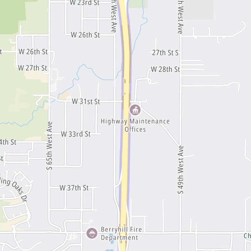
Gilcrease Expressway is another name used for this roadway. This local toll road serves several key cities, including Tulsa, Oakhurst, and Berryhill. The road map of the Gilcrease Expressway West shows exits and tolling points on the road.

A complete list of exits and other points-of-interest may be found below the map.

View Map ▾Exit / POI List ▾

You may pan and zoom the interactive map. There are markers you may select for a separate map of that point of interest or location, which includes any nearby dining, gas, EV charging, hotels and other services.

Advertising
Advertising

The Gilcrease Expressway West Toll Map

This map of the Gilcrease Expressway West displays markers for exits and tolling points, which you can select to get a close-up map of that point of interest or location.

The points-of-interest shown on this map are also listed below, ordered from south to north.

Advertising
Advertising

List Of Exits / Points Of Interest For The Gilcrease Expressway West

Select an exit or other location to get a separate map, including locations of available gas, EV charging, fast-food and other dining options, plus current weather and driving conditions.

I-44 / SH 66

I-44 / SH 66 — Tulsa

View Map & Info

▸ GPS 36.089065000 X -96.037049000
NOTES: I-44 W for Turner Turnpike / to Sapulpa/OKC

OTA Oklahoma Turnpike Authority manages this segment.

W 51st Street S

Exit 1W 51st Street S — Tulsa

View Map & Info

▸ GPS 36.090015000 X -96.051729000
NOTES:

OTA Oklahoma Turnpike Authority manages this segment.

Red Fork Mainline Toll Gantry

Red Fork Mainline Toll Gantry — Tulsa

View Map & Info

▸ GPS 36.097983000 X -96.055259000
NOTES: Just north of W 51st Street

OTA Oklahoma Turnpike Authority manages this segment.

W 41st Street S

Exit 2W 41st Street S — Tulsa

View Map & Info

▸ GPS 36.104570000 X -96.055210000
NOTES:

OTA Oklahoma Turnpike Authority manages this segment.

Berryhill Mainline Toll Gantry

Berryhill Mainline Toll Gantry — Tulsa

View Map & Info

▸ GPS 36.116345000 X -96.054780000
NOTES: Just south of W 31st Street

OTA Oklahoma Turnpike Authority manages this segment.

W 21st Street S

Exit 4W 21st Street S — Tulsa

View Map & Info

▸ GPS 36.133564000 X -96.056216000
NOTES:

OTA Oklahoma Turnpike Authority manages this segment.

West O'Main Mainline Toll Gantry

West O'Main Mainline Toll Gantry — Tulsa

View Map & Info

▸ GPS 36.145119000 X -96.057091000
NOTES: Just south of Charles Page Blvd.

OTA Oklahoma Turnpike Authority manages this segment.

US 412 / Keystone Expressway

Exit 5US 412 / Keystone Expressway — Tulsa

View Map & Info

▸ GPS 36.155945000 X -96.056877000
NOTES: Keystone Expy W for Cimarron Turnpike / OSU

OTA Oklahoma Turnpike Authority manages this segment.

W Edison Street

W Edison Street — Tulsa

View Map & Info

▸ GPS 36.161083000 X -96.056356000
NOTES:

OTA Oklahoma Turnpike Authority manages this segment.

Advertising
Advertising

EXPLORE OKLAHOMA

Journey to key destinations around and adjacent to Oklahoma!

Map Of This Region ▹

Communities in this metro area include Tulsa, Broken Arrow, Muskogee, Stillwater, Sapulpa, Vinita, Joplin, Missouri, Siloam Springs, Arkansas, and San Springs.

Individual toll maps for this region are listed below.

Map Of This Region ▹

Communities in this metro area include Stillwater and Tulsa.

Individual toll maps for this region are listed below.

Map Of This Region ▹

Communities in this metro area include Oklahoma City, Choctaw, Norman, Shawnee, Henryetta, Edmond, and Chickasha.

Individual toll maps for this region are listed below.

Map Of This Region ▹

Communities in this metro area include Lawton, Fort Sill, Geronimo, and Cache.

Individual toll maps for this region are listed below.

Map Of This Region ▹

Communities in this metro area include Dallas, Fort Worth, Plano, Addison, Frisco, Grand Prairie, Arlington, Carrrollton, and Lake Dallas.

Individual toll maps for this region are listed below.

Map Of This Region ▹

Communities in this metro area include Wichita, Bel Aire, Andover, Valley Center, and Maize.

Individual toll maps for this region are listed below.

Advertising
Advertising