Addison Airport Toll Tunnel Map

Static map a segment of the Addison Airport Toll Tunnel

Using The Interactive Toll Map

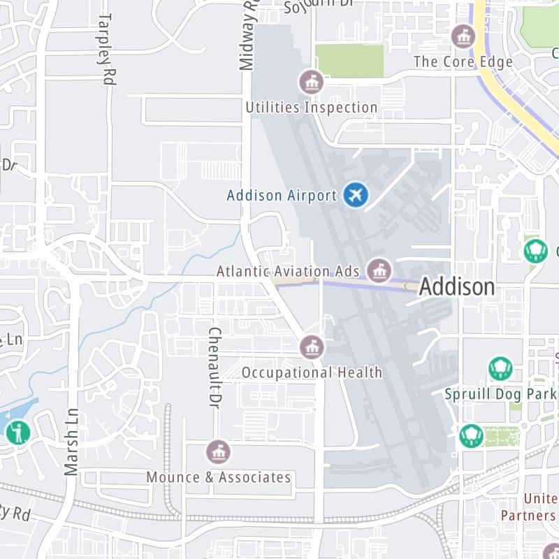
This tunnel serves Addison. The road map of the Addison Airport Toll Tunnel shows exits and tolling points on the road.

A complete list of exits and other points-of-interest may be found below the map.

View Map ▾Exit / POI List ▾

You may pan and zoom the interactive map. There are markers you may select for a separate map of that point of interest or location, which includes any nearby dining, gas, EV charging, hotels and other services.

Advertising
Advertising

The Addison Airport Toll Tunnel Toll Map

This map of the Addison Airport Toll Tunnel displays markers for exits and tolling points, which you can select to get a close-up map of that point of interest or location.

The points-of-interest shown on this map are also listed below, ordered from west to east.

Advertising
Advertising

List Of Exits / Points Of Interest For The Addison Airport Toll Tunnel

Select an exit or other location to get a separate map, including locations of available gas, EV charging, fast-food and other dining options, plus current weather and driving conditions.

Keller Springs Rd at Midway Rd

Keller Springs Rd at Midway Rd — Addison

View Map & Info

▸ GPS 32.968899000 X -96.841518000
NOTES: AATT West

NTTA North Texas Tollway Authority manages this segment.

AATT Toll Plaza

AATT Toll Plaza — Addison

View Map & Info

▸ GPS 32.968895000 X -96.840955000
NOTES:

NTTA North Texas Tollway Authority manages this segment.

Keller Springs Rd at Addison Rd

Keller Springs Rd at Addison Rd — Addison

View Map & Info

▸ GPS 32.968489000 X -96.830175000
NOTES: AATT East

NTTA North Texas Tollway Authority manages this segment.

Advertising
Advertising

EXPLORE TEXAS

Journey to key destinations around and adjacent to Texas!

Map Of This Region ▹

Communities in this metro area include Dallas, Fort Worth, Plano, Addison, Frisco, Grand Prairie, Arlington, Carrrollton, and Lake Dallas.

Individual toll maps for this region are listed below.

Map Of This Region ▹

Communities in this metro area include Houston, Humble, Tomball, Sugar Land, Galveston, Pearland, and Katy.

Individual toll maps for this region are listed below.

Map Of This Region ▹

Communities in this metro area include Austin, Pflugerville, Round Rock, Georgetown, Cedar Park, Mustang Ridge, Manor, Serenada, Sunset Valley, and Hutto.

Individual toll maps for this region are listed below.

Map Of This Region ▹

Communities in this metro area include Tyler, Wood Springs, Noonday, and Whitehouse.

Individual toll maps for this region are listed below.

Map Of This Region ▹

Communities in this metro area include Brownsville, Heroica Matamoros, Tamaulipas, San Benito, Harlingen, and Rancho Viejo.

Individual toll maps for this region are listed below.

Map Of This Region ▹

Communities in this metro area include Lawton, Fort Sill, Geronimo, and Cache.

Individual toll maps for this region are listed below.

Advertising
Advertising