Kansas City - Topeka Toll Maps

Regional photo of Kansas City - Topeka

Using The Interactive Regional Map

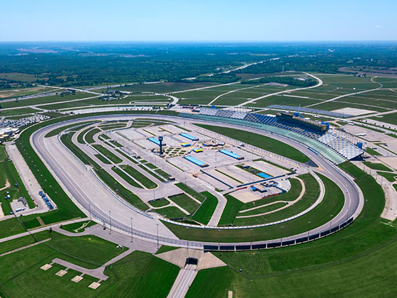
The Kansas City - Topeka metro area map shows exits and toll points for region-wide toll roads or other toll roads that cross the region.

View Map ▾Road List ▾

Only the following toll road is in this area:

The Kansas City - Topeka area includes the following cities: Kansas City, Kansas City, Missouri, Topeka, Lawrence, Overland Park, Edwardsville, and Bonner Springs.

Markers on the interactive map can be selected to get close-up views of exit points, toll gantries and other locations and points-of-interest. Each POI map shows all nearby dining, gas, EV charging, hotels and other services.

View Map ▾Road List ▾

A complete list of exits and other points-of-interest in the Kansas City - Topeka area follows the map. Exit lists are sorted by toll road.

Advertising
Advertising

Regional Map For Kansas City - Topeka

Pan and zoom the map as desired, and select or tap the interactive markers to get information about that specific location. Each marker also includes options for viewing a close-up map of the destination point.

A complete list of exits and other points-of-interest is below this map, and other regions are shown further down the page.

Advertising
Advertising

Regional Exits, Listed By Toll Road

A list of all exits and other points-of-interest in this region, sorted by toll road.

Begin I–335 / I–35 North / US 50

Exit 127Begin I–335 / I–35 North / US 50 — Emporia

View Map & Info

▸ GPS 38.414812000 X -96.237608000

KTA Kansas Turnpike Authority manages this segment.

Emporia Service Area

Emporia Service Area — Emporia

View Map & Info

▸ GPS 38.471513000 X -96.184408000
NOTES:

US 56

Exit 147US 56 — Reading

View Map & Info

▸ GPS 38.648563000 X -96.030516000
NOTES:

KTA Kansas Turnpike Authority manages this segment.

End I–335 / I–470 West

Exit 177End I–335 / I–470 West — Topeka

View Map & Info

▸ GPS 38.991425000 X -95.692500000
NOTES: to US 75

KTA Kansas Turnpike Authority manages this segment.

I–70 West / US 40 / K4

Exit 182I–70 West / US 40 / K4 — Tecumseh

View Map & Info

▸ GPS 39.026442000 X -95.624452000
NOTES: SB On/NB Off

KTA Kansas Turnpike Authority manages this segment.

I–70 West / US 40 / K4

Exit 183I–70 West / US 40 / K4 — Tecumseh

View Map & Info

▸ GPS 39.031703000 X -95.584781000
NOTES: SB Off/NB On

KTA Kansas Turnpike Authority manages this segment.

Topeka Service Area

Topeka Service Area — Tecumseh

View Map & Info

▸ GPS 39.019532000 X -95.508481000
NOTES:

K10

Exit 197K10 — Lawrence

View Map & Info

▸ GPS 38.996528000 X -95.343939000
NOTES:

KTA Kansas Turnpike Authority manages this segment.

US 59 South

Exit 202US 59 South — Lawrence

View Map & Info

▸ GPS 38.989771000 X -95.257438000
NOTES:

KTA Kansas Turnpike Authority manages this segment.

US 40 / US 59 / to US 24

Exit 204US 40 / US 59 / to US 24 — Lawrence

View Map & Info

▸ GPS 38.993489000 X -95.229350000
NOTES:

KTA Kansas Turnpike Authority manages this segment.

Lawrence Service Area

Lawrence Service Area — Reno

View Map & Info

▸ GPS 39.020090000 X -95.134983000
NOTES:

Tonganoxie / Eudora

Exit 212Tonganoxie / Eudora — Tonganoxie

View Map & Info

▸ GPS 39.043755000 X -95.093547000
NOTES:

KTA Kansas Turnpike Authority manages this segment.

Eastern Terminal Toll Plaza

Eastern Terminal Toll Plaza — Tonganoxie

View Map & Info

▸ GPS 39.069901000 X -95.007657000
NOTES:

KTA Kansas Turnpike Authority manages this segment.

K7 S/K7 N

Exit 224/224AK7 S/K7 N — Bonner Springs

View Map & Info

▸ GPS 39.096672000 X -94.881932000
NOTES:

KTA Kansas Turnpike Authority manages this segment.

North 110th Street / Kansas Speedway

Exit 410North 110th Street / Kansas Speedway — Kansas City

View Map & Info

▸ GPS 39.105948000 X -94.835253000
NOTES:

KTA Kansas Turnpike Authority manages this segment.

I–435 S/I–435 N

Exit 411A/411I–435 S/I–435 N — Edwardsville

View Map & Info

▸ GPS 39.106528000 X -94.811299000
NOTES:

KTA Kansas Turnpike Authority manages this segment.

North 78th Street

Exit 414North 78th Street — Kansas City

View Map & Info

▸ GPS 39.105001000 X -94.760508000
NOTES:

KTA Kansas Turnpike Authority manages this segment.

Turner Diagonal / College Parkway

Exit 415/415ATurner Diagonal / College Parkway — Kansas City

View Map & Info

▸ GPS 39.106118000 X -94.739225000
NOTES:

KTA Kansas Turnpike Authority manages this segment.

North 57th Street

Exit 417North 57th Street — Kansas City

View Map & Info

▸ GPS 39.105182000 X -94.709829000
NOTES:

KTA Kansas Turnpike Authority manages this segment.

I–70 EB to I–635 S/I–635 N

Exit 418A/418I–70 EB to I–635 S/I–635 N — Kansas City

View Map & Info

▸ GPS 39.105153000 X -94.686065000
NOTES:

KTA Kansas Turnpike Authority manages this segment.

I–70 WB to I–635 / Park Dr / N 38th St

Exit 419I–70 WB to I–635 / Park Dr / N 38th St — Kansas City

View Map & Info

▸ GPS 39.097962000 X -94.662028000
NOTES:

KTA Kansas Turnpike Authority manages this segment.

US 69 South/S 18th St Expy / N 18th St

Exit 420A / 4US 69 South/S 18th St Expy / N 18th St — Kansas City

View Map & Info

▸ GPS 39.096053000 X -94.649444000
NOTES:

KTA Kansas Turnpike Authority manages this segment.

I–670

Exit 421BI–670 — Kansas City

View Map & Info

▸ GPS 39.091924000 X -94.634209000
NOTES: to Kansas City, Missouri

KTA Kansas Turnpike Authority manages this segment.

Central Avenue

Exit 1ACentral Avenue — Kansas City

View Map & Info

▸ GPS 39.098952000 X -94.614415000
NOTES:

KTA Kansas Turnpike Authority manages this segment.

Missouri State Line

Missouri State Line — Kansas City

View Map & Info

▸ GPS 39.098981000 X -94.607186000
NOTES:

KTA Kansas Turnpike Authority manages this segment.

Advertising
Advertising

EXPLORE KANSAS

Journey to key destinations around and adjacent to Kansas!

Map Of This Region ▹

Communities in this metro area include Kansas City, Kansas City, Missouri, Topeka, Lawrence, Overland Park, Edwardsville, and Bonner Springs.

Individual toll maps for this region are listed below.

Map Of This Region ▹

Communities in this metro area include Wichita, Bel Aire, Andover, Valley Center, and Maize.

Individual toll maps for this region are listed below.

Map Of This Region ▹

Communities in this metro area include Tulsa, Broken Arrow, Muskogee, Stillwater, Sapulpa, Vinita, Joplin, Missouri, Siloam Springs, Arkansas, and San Springs.

Individual toll maps for this region are listed below.

Map Of This Region ▹

Communities in this metro area include Stillwater and Tulsa.

Individual toll maps for this region are listed below.