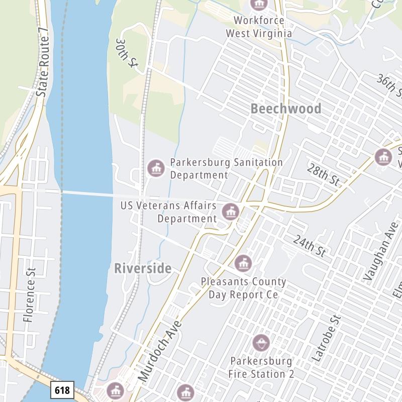
Wv 68 is another name used for this bridge. This bridge serves Parkersburg and Belpre. The road map of the Memorial Bridge shows exits and tolling points on the road.
A complete list of exits and other points-of-interest may be found below the map.
You may pan and zoom the interactive map. There are markers you may select for a separate map of that point of interest or location, which includes any nearby dining, gas, EV charging, hotels and other services.
This map of the Memorial Bridge displays markers for exits and tolling points, which you can select to get a close-up map of that point of interest or location.
The points-of-interest shown on this map are also listed below, ordered from west to east.
Select an exit or other location to get a separate map, including locations of available gas, EV charging, fast-food and other dining options, plus current weather and driving conditions.
Main Street — Belpre
▸ GPS 39.283594000 X -81.568677000
NOTES: to Ohio 7 / OH 32 / OH 618
Toll Plaza — Parkersburg
▸ GPS 39.282824000 X -81.553162000
NOTES: Tolls resume 10/1/23
Ohio Avenue / WV 14 — Parkersburg
▸ GPS 39.282641000 X -81.549624000
NOTES:
Journey to key destinations around and adjacent to West Virginia!
Communities in this metro area include Charleston, Malden, South Ruffner, and Snow Hill.
Individual toll maps for this region are listed below.
Communities in this metro area include Beckley, Beaver, Mac Arthur, Daniels, and Shady Spring.
Individual toll maps for this region are listed below.
Communities in this metro area include Parkersburg, North Hills, Vienna, and Belpre, Ohio.
Individual toll maps for this region are listed below.
Communities in this metro area include Pittsburgh, Cranberry Township, Beaver Valley, New Castle, Washington, Uniontown, Cheat Lake, West Virginia, Boardman, Ohio, and Youngstown, Ohio.
Individual toll maps for this region are listed below.