Seattle - Tacoma Toll Maps

Regional photo of Seattle - Tacoma

Using The Interactive Regional Map

The Seattle - Tacoma metro area map shows exits and toll points for region-wide toll roads or other toll roads that cross the region.

View Map ▾Road List ▾

The following (3) toll roads are in this area, cross through this area or connect with this region:

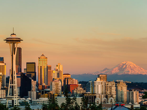
The Seattle - Tacoma area includes the following cities: Seattle, Tacoma, Bellevue, Redmond, Kirkland, Artondale, and University Place.

Markers on the interactive map can be selected to get close-up views of exit points, toll gantries and other locations and points-of-interest. Each POI map shows all nearby dining, gas, EV charging, hotels and other services.

View Map ▾Road List ▾

A complete list of exits and other points-of-interest in the Seattle - Tacoma area follows the map. Exit lists are sorted by toll road.

Advertising
Advertising

Regional Map For Seattle - Tacoma

Pan and zoom the map as desired, and select or tap the interactive markers to get information about that specific location. Each marker also includes options for viewing a close-up map of the destination point.

A complete list of exits and other points-of-interest is below this map, and other regions are shown further down the page.

Advertising
Advertising

Regional Exits, Listed By Toll Road

A list of all exits and other points-of-interest in this region, sorted by toll road.

Orchard Street / S 19th Street East

Exit 2BOrchard Street / S 19th Street East — Tacoma

View Map & Info

▸ GPS 47.241930000 X -122.504081000
NOTES:

WSDOT Washington State Department of Transportation manages this segment.

S 19th Street West

Exit 2AS 19th Street West — Tacoma

View Map & Info

▸ GPS 47.245648000 X -122.507363000
NOTES:

WSDOT Washington State Department of Transportation manages this segment.

Pearl Street / 6th Avenue

Exit 3Pearl Street / 6th Avenue — Tacoma

View Map & Info

▸ GPS 47.255412000 X -122.514262000
NOTES: EB Pearl/WB 6th

WSDOT Washington State Department of Transportation manages this segment.

N Jackson Avenue

Exit 4N Jackson Avenue — Tacoma

View Map & Info

▸ GPS 47.258643000 X -122.537144000
NOTES:

WSDOT Washington State Department of Transportation manages this segment.

24th Street NW

Exit 824th Street NW — Gig Harbor

View Map & Info

▸ GPS 47.279836000 X -122.561096000
NOTES: No WB Off

WSDOT Washington State Department of Transportation manages this segment.

Tacoma Narrows Bridge Toll Plaza

Tacoma Narrows Bridge Toll Plaza — Gig Harbor

View Map & Info

▸ GPS 47.282225000 X -122.561093000
NOTES:

WSDOT Washington State Department of Transportation manages this segment.

36th Street NW/Otto Jahn Rd

Exit 936th Street NW/Otto Jahn Rd — Gig Harbor

View Map & Info

▸ GPS 47.291721000 X -122.564608000
NOTES: EB Off/EB On

WSDOT Washington State Department of Transportation manages this segment.

Olympic Drive NW

Exit 10Olympic Drive NW — Gig Harbor

View Map & Info

▸ GPS 47.305258000 X -122.576591000
NOTES:

WSDOT Washington State Department of Transportation manages this segment.

South Portal / Alaskan Wy / S Royal Brougham Wy

South Portal / Alaskan Wy / S Royal Brougham Wy — Seattle

View Map & Info

▸ GPS 47.594394000 X -122.335384000
NOTES:

WSDOT Washington State Department of Transportation manages this segment.

North Portal / Dexter Ave / 6th Ave N / Mercer St

North Portal / Dexter Ave / 6th Ave N / Mercer St — Seattle

View Map & Info

▸ GPS 47.622255000 X -122.344386000
NOTES:

WSDOT Washington State Department of Transportation manages this segment.

I–5 / SR 520 Begins

I–5 / SR 520 Begins — Seattle

View Map & Info

▸ GPS 47.642883000 X -122.316945000
NOTES: WB Off/EB On

WSDOT Washington State Department of Transportation manages this segment.

Montlake Boulevard E

Montlake Boulevard E — Seattle

View Map & Info

▸ GPS 47.644269000 X -122.304315000
NOTES:

WSDOT Washington State Department of Transportation manages this segment.

Lake Washington Blvd E / West Side of Bridge

Lake Washington Blvd E / West Side of Bridge — Seattle

View Map & Info

▸ GPS 47.644913000 X -122.291095000
NOTES: WB Off/EB On

WSDOT Washington State Department of Transportation manages this segment.

84th Avenue NE / East Side of Bridge

84th Avenue NE / East Side of Bridge — Hunts Point

View Map & Info

▸ GPS 47.635881000 X -122.227442000
NOTES: WB On/EB Off

WSDOT Washington State Department of Transportation manages this segment.

92nd Avenue NE

92nd Avenue NE — Clyde Hill

View Map & Info

▸ GPS 47.640343000 X -122.217278000
NOTES: WB Off/EB On

WSDOT Washington State Department of Transportation manages this segment.

Lake Washington Blvd NE / Bellevue Way E

Lake Washington Blvd NE / Bellevue Way E — Bellevue

View Map & Info

▸ GPS 47.642161000 X -122.201670000
NOTES: WB On/EB Off

WSDOT Washington State Department of Transportation manages this segment.

108th Avenue NE

108th Avenue NE — Bellevue

View Map & Info

▸ GPS 47.639653000 X -122.196381000
NOTES: No EB Off

WSDOT Washington State Department of Transportation manages this segment.

I–405

I–405 — Bellevue

View Map & Info

▸ GPS 47.632203000 X -122.187957000
NOTES:

WSDOT Washington State Department of Transportation manages this segment.

Advertising
Advertising

EXPLORE WASHINGTON

Journey to key destinations around and adjacent to Washington!

Map Of This Region ▹

Communities in this metro area include Seattle, Tacoma, Bellevue, Redmond, Kirkland, Artondale, and University Place.

Individual toll maps for this region are listed below.