William Preston Lane Jr. Memorial (Bay) Bridge Map

Static map a segment of the William Preston Lane Jr. Memorial (Bay) Bridge

Using The Interactive Toll Map

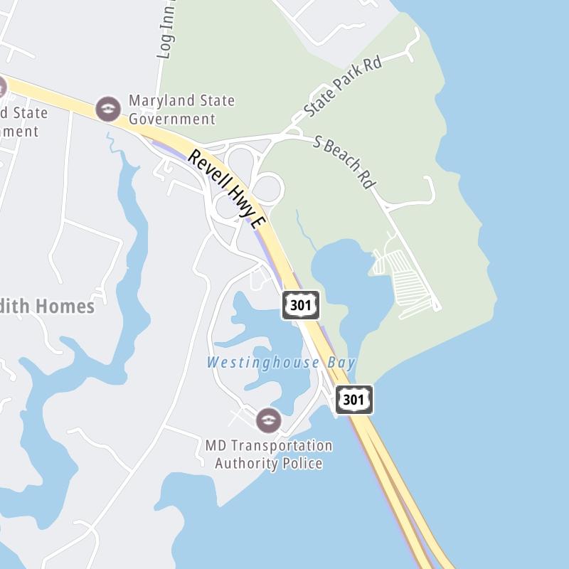
Bay Bridge is another name used for this bridge. This bridge serves Annapolis, Arnold, Cape St Claire, Stevensville, and Chester. The road map of the William Preston Lane Jr. Memorial (Bay) Bridge shows exits and tolling points on the road.

A complete list of exits and other points-of-interest may be found below the map.

View Map ▾Exit / POI List ▾

You may pan and zoom the interactive map. There are markers you may select for a separate map of that point of interest or location, which includes any nearby dining, gas, EV charging, hotels and other services.

Advertising
Advertising

The William Preston Lane Jr. Memorial (Bay) Bridge Toll Map

This map of the William Preston Lane Jr. Memorial (Bay) Bridge displays markers for exits and tolling points, which you can select to get a close-up map of that point of interest or location.

The points-of-interest shown on this map are also listed below, ordered from west to east.

Advertising
Advertising

List Of Exits / Points Of Interest For The William Preston Lane Jr. Memorial (Bay) Bridge

Select an exit or other location to get a separate map, including locations of available gas, EV charging, fast-food and other dining options, plus current weather and driving conditions.

Oceanic Road

Exit 32Oceanic Road — Annapolis

View Map & Info

▸ GPS 39.019778000 X -76.414542000

MDTA Maryland Transportation Authority manages this segment.

Bay Bridge Toll Plaza

Bay Bridge Toll Plaza — Annapolis

View Map & Info

▸ GPS 39.013028000 X -76.407400000
NOTES:

MDTA Maryland Transportation Authority manages this segment.

Romancoke Road

Exit 37Romancoke Road — Stevensville

View Map & Info

▸ GPS 38.980389000 X -76.328114000
NOTES:

MDTA Maryland Transportation Authority manages this segment.

Advertising
Advertising

EXPLORE MARYLAND

Journey to key destinations around and adjacent to Maryland!

Map Of This Region ▹

Communities in this metro area include Washington, Dc, Fairfax County, Virginia, Loundoun County, Virginia, Montgomery County, Maryland, and Prince George's County, Maryland.

Individual toll maps for this region are listed below.

Map Of This Region ▹

Communities in this metro area include Wilmington, Middletown, Newark, and Carneys Point, New Jersey.

Individual toll maps for this region are listed below.

Advertising
Advertising