Miami - South Florida Toll Maps

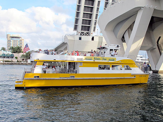
Regional photo of Miami - South Florida

Using The Interactive Regional Map

The Miami - South Florida metro area map shows exits and toll points for region-wide toll roads or other toll roads that cross the region.

View Map ▾Road List ▾

The following (11) toll roads are in this area, cross through this area or connect with this region:

The Miami - South Florida area includes the following cities: Fort Lauderdale, Pompano Beach, Hialeah, Opa Locka, Homestead, Kendall, Key Largo, Miramar, Miami, Hollywood, Sunrise, Boca Raton, Delray Beach, West Palm Beach, Jupiter, Davie, Coral Springs, Lake Worth, and Boynton Beach.

Markers on the interactive map can be selected to get close-up views of exit points, toll gantries and other locations and points-of-interest. Each POI map shows all nearby dining, gas, EV charging, hotels and other services.

View Map ▾Road List ▾

A complete list of exits and other points-of-interest in the Miami - South Florida area follows the map. Exit lists are sorted by toll road.

Advertising
Advertising

Regional Map For Miami - South Florida

Pan and zoom the map as desired, and select or tap the interactive markers to get information about that specific location. Each marker also includes options for viewing a close-up map of the destination point.

A complete list of exits and other points-of-interest is below this map, and other regions are shown further down the page.

Advertising
Advertising

Regional Exits, Listed By Toll Road

A list of all exits and other points-of-interest in this region, sorted by toll road.

Miami Int'l Airport/MIA / NW 21st Street

Miami Int'l Airport/MIA / NW 21st Street — Miami

View Map & Info

▸ GPS 25.795000000 X -80.266190000
NOTES:

MDX Miami-Dade Expressway Authority manages this segment.

Le Jeune Road S/NW 42nd Ave

Le Jeune Road S/NW 42nd Ave — Miami

View Map & Info

▸ GPS 25.807607000 X -80.263210000
NOTES:

MDX Miami-Dade Expressway Authority manages this segment.

NW 36th Street / Le Jeune Road N/NW 42nd Ave

NW 36th Street / Le Jeune Road N/NW 42nd Ave — Miami

View Map & Info

▸ GPS 25.808848000 X -80.260029000
NOTES:

MDX Miami-Dade Expressway Authority manages this segment.

US 27 North/E Okeechobee Road

US 27 North/E Okeechobee Road — Miami

View Map & Info

▸ GPS 25.809594000 X -80.258620000
NOTES:

MDX Miami-Dade Expressway Authority manages this segment.

West AET Toll Gantry

West AET Toll Gantry — Miami

View Map & Info

▸ GPS 25.811700000 X -80.250845000
NOTES:

MDX Miami-Dade Expressway Authority manages this segment.

NW 27th Avenue/SR 9

NW 27th Avenue/SR 9 — Miami

View Map & Info

▸ GPS 25.812255000 X -80.240360000
NOTES:

MDX Miami-Dade Expressway Authority manages this segment.

NW 22nd Avenue / Metro Rail

NW 22nd Avenue / Metro Rail — Miami

View Map & Info

▸ GPS 25.812065000 X -80.232182000
NOTES:

MDX Miami-Dade Expressway Authority manages this segment.

NW 17th Avenue

NW 17th Avenue — Miami

View Map & Info

▸ GPS 25.812525000 X -80.219134000
NOTES:

MDX Miami-Dade Expressway Authority manages this segment.

East AET Toll Gantry

East AET Toll Gantry — Miami

View Map & Info

▸ GPS 25.812358000 X -80.219384000
NOTES:

MDX Miami-Dade Expressway Authority manages this segment.

NW 12th Avenue

NW 12th Avenue — Miami

View Map & Info

▸ GPS 25.812398000 X -80.215839000
NOTES:

MDX Miami-Dade Expressway Authority manages this segment.

I–95 / Julia Tuttle/I–195

I–95 / Julia Tuttle/I–195 — Miami

View Map & Info

▸ GPS 25.812476000 X -80.206346000
NOTES:

MDX Miami-Dade Expressway Authority manages this segment.

Miccosukee Service Plaza

Miccosukee Service Plaza — Miccosukee Reservation

View Map & Info

▸ GPS 26.170882000 X -80.856298000
NOTES:

Broward County Rest Stop

Broward County Rest Stop — Weston

View Map & Info

▸ GPS 26.146204000 X -80.632838000
NOTES:

Alligator Alley Westbound Toll Plaza

Alligator Alley Westbound Toll Plaza — Weston

View Map & Info

▸ GPS 26.146175000 X -80.466927000
NOTES:

FTE Florida's Turnpike Enterprise manages this segment.

US 27

Exit 23US 27 — Weston

View Map & Info

▸ GPS 26.144689000 X -80.441849000
NOTES:

FTE Florida's Turnpike Enterprise manages this segment.

Glades Parkway

Exit 22Glades Parkway — Weston

View Map & Info

▸ GPS 26.140113000 X -80.419399000
NOTES: to Weston and Southwest Ranches

FTE Florida's Turnpike Enterprise manages this segment.

Indian Trace

Exit 21Indian Trace — Weston

View Map & Info

▸ GPS 26.135513000 X -80.400575000
NOTES:

FTE Florida's Turnpike Enterprise manages this segment.

Sawgrass Expressway / I–595 / I–75

Exit 19Sawgrass Expressway / I–595 / I–75 — Weston

View Map & Info

▸ GPS 26.119599000 X -80.345919000
NOTES: to Fort Lauderdale via 595 / to Miami via 75

FTE Florida's Turnpike Enterprise manages this segment.

NW 137th Avenue / West Terminus of 836

NW 137th Avenue / West Terminus of 836 — Tamiami

View Map & Info

▸ GPS 25.776504000 X -80.417300000

MDX Miami-Dade Expressway Authority manages this segment.

Tamiami AET Toll Gantry

Tamiami AET Toll Gantry — Tamiami

View Map & Info

▸ GPS 25.783619000 X -80.411837000
NOTES:

MDX Miami-Dade Expressway Authority manages this segment.

Homestead Extension of Florida's Turnpike

Homestead Extension of Florida's Turnpike — Tamiami

View Map & Info

▸ GPS 25.781881000 X -80.385866000
NOTES:

MDX Miami-Dade Expressway Authority manages this segment.

NW 107th Avenue

NW 107th Avenue — Doral

View Map & Info

▸ GPS 25.780129000 X -80.369014000
NOTES:

MDX Miami-Dade Expressway Authority manages this segment.

Fontainebleau AET Toll Gantry

Fontainebleau AET Toll Gantry — Fontainebleau

View Map & Info

▸ GPS 25.781201000 X -80.355598000
NOTES:

MDX Miami-Dade Expressway Authority manages this segment.

NW 87th Avenue / Galloway Road

NW 87th Avenue / Galloway Road — Fontainebleau

View Map & Info

▸ GPS 25.781236000 X -80.336694000
NOTES:

MDX Miami-Dade Expressway Authority manages this segment.

SR 826 / Palmetto Expressway

SR 826 / Palmetto Expressway — Fontainebleau

View Map & Info

▸ GPS 25.780232000 X -80.321001000
NOTES:

MDX Miami-Dade Expressway Authority manages this segment.

NW 72nd Avenue / Milam Dairy Road

NW 72nd Avenue / Milam Dairy Road — Fontainebleau

View Map & Info

▸ GPS 25.779323000 X -80.314290000
NOTES:

MDX Miami-Dade Expressway Authority manages this segment.

Miami West AET Toll Gantry

Miami West AET Toll Gantry — West Miami

View Map & Info

▸ GPS 25.784559000 X -80.293712000
NOTES:

MDX Miami-Dade Expressway Authority manages this segment.

NW 57th Avenue / Red Road

NW 57th Avenue / Red Road — Ochopee

View Map & Info

▸ GPS 25.784094000 X -80.288527000
NOTES:

MDX Miami-Dade Expressway Authority manages this segment.

NW 45th Avenue

NW 45th Avenue — Ochopee

View Map & Info

▸ GPS 25.783136000 X -80.269678000
NOTES:

MDX Miami-Dade Expressway Authority manages this segment.

NW 42nd Ave / Le Jeune Rd / Miami Int'l Airport/MIA

NW 42nd Ave / Le Jeune Rd / Miami Int'l Airport/MIA — Miami

View Map & Info

▸ GPS 25.785110000 X -80.264083000
NOTES:

MDX Miami-Dade Expressway Authority manages this segment.

NW 37th Avenue / Douglas Road

NW 37th Avenue / Douglas Road — Miami

View Map & Info

▸ GPS 25.785923000 X -80.255847000
NOTES:

MDX Miami-Dade Expressway Authority manages this segment.

NW 27th Avenue

NW 27th Avenue — Miami

View Map & Info

▸ GPS 25.784824000 X -80.239534000
NOTES:

MDX Miami-Dade Expressway Authority manages this segment.

Miami East AET Toll Gantry

Miami East AET Toll Gantry — Miami

View Map & Info

▸ GPS 25.782221000 X -80.228327000
NOTES:

MDX Miami-Dade Expressway Authority manages this segment.

NW 17th Avenue / Marlins Park / Civic Center

NW 17th Avenue / Marlins Park / Civic Center — Miami

View Map & Info

▸ GPS 25.782536000 X -80.222716000
NOTES:

MDX Miami-Dade Expressway Authority manages this segment.

NW 12th Avenue / Marlins Park / Civic Ctr / Jackson Mem Hosp

NW 12th Avenue / Marlins Park / Civic Ctr / Jackson Mem Hosp — Miami

View Map & Info

▸ GPS 25.785378000 X -80.214828000
NOTES:

MDX Miami-Dade Expressway Authority manages this segment.

I–95 / I–395 to Miami Beach

I–95 / I–395 to Miami Beach — Miami

View Map & Info

▸ GPS 25.788705000 X -80.203737000
NOTES: Downtown Miami

MDX Miami-Dade Expressway Authority manages this segment.

Homestead Extension of Florida's Turnpike

Homestead Extension of Florida's Turnpike — Kendall

View Map & Info

▸ GPS 25.644326000 X -80.385491000

MDX Miami-Dade Expressway Authority manages this segment.

Kendall South AET Toll Gantry

Kendall South AET Toll Gantry — Kendall

View Map & Info

▸ GPS 25.661392000 X -80.374390000
NOTES:

MDX Miami-Dade Expressway Authority manages this segment.

Killian Parkway / SW 107th Avenue

Killian Parkway / SW 107th Avenue — Tamiami

View Map & Info

▸ GPS 25.671731000 X -80.365165000
NOTES:

MDX Miami-Dade Expressway Authority manages this segment.

Kendall North AET Toll Gantry

Kendall North AET Toll Gantry — Kendall

View Map & Info

▸ GPS 25.681903000 X -80.355965000
NOTES:

MDX Miami-Dade Expressway Authority manages this segment.

Kendall Drive / SW 88th Street

Kendall Drive / SW 88th Street — Kendall

View Map & Info

▸ GPS 25.687415000 X -80.351003000
NOTES:

MDX Miami-Dade Expressway Authority manages this segment.

SR 878 / Snapper Creek Expressway

SR 878 / Snapper Creek Expressway — Sunset

View Map & Info

▸ GPS 25.693646000 X -80.345502000
NOTES:

MDX Miami-Dade Expressway Authority manages this segment.

Olympia Heights AET Toll Gantry

Olympia Heights AET Toll Gantry — Olympia Heights

View Map & Info

▸ GPS 25.714608000 X -80.326832000
NOTES:

MDX Miami-Dade Expressway Authority manages this segment.

Bird Road / SW 40th Street

Bird Road / SW 40th Street — Olympia Heights

View Map & Info

▸ GPS 25.732686000 X -80.318919000
NOTES:

MDX Miami-Dade Expressway Authority manages this segment.

Palmetto Expressway / SR 826

Palmetto Expressway / SR 826 — Olympia Heights

View Map & Info

▸ GPS 25.728771000 X -80.318268000
NOTES:

MDX Miami-Dade Expressway Authority manages this segment.

US 1 to Florida Keys / HEFT

Exit 1US 1 to Florida Keys / HEFT — Florida City

View Map & Info

▸ GPS 25.453200000 X -80.475100000
NOTES:

FTE Florida's Turnpike Enterprise manages this segment.

SW 312th St / HEFT

Exit 2SW 312th St / HEFT — Homestead

View Map & Info

▸ GPS 25.477400000 X -80.439900000
NOTES:

FTE Florida's Turnpike Enterprise manages this segment.

SW 288th St/Biscayne Dr/Homestead Air Base

Exit 5SW 288th St/Biscayne Dr/Homestead Air Base — Homestead

View Map & Info

▸ GPS 25.499500000 X -80.417500000
NOTES:

FTE Florida's Turnpike Enterprise manages this segment.

SW 137th Ave / HEFT

Exit 6SW 137th Ave / HEFT — Homestead

View Map & Info

▸ GPS 25.510600000 X -80.412500000
NOTES:

FTE Florida's Turnpike Enterprise manages this segment.

SW 112th Ave / HEFT

Exit 9SW 112th Ave / HEFT — Allapattah

View Map & Info

▸ GPS 25.532500000 X -80.372000000
NOTES:

FTE Florida's Turnpike Enterprise manages this segment.

Homestead AET Toll Gantry

Homestead AET Toll Gantry — Homestead

View Map & Info

▸ GPS 25.551263000 X -80.362817000
NOTES:

FTE Florida's Turnpike Enterprise manages this segment.

Cutler Ridge Blvd/SW 216th St / HEFT

Exit 11Cutler Ridge Blvd/SW 216th St / HEFT — Cutler Ridge

View Map & Info

▸ GPS 25.566400000 X -80.362900000
NOTES:

FTE Florida's Turnpike Enterprise manages this segment.

Caribbean Blvd/S Dixie Hwy / HEFT

Exit 12Caribbean Blvd/S Dixie Hwy / HEFT — Cutler Ridge

View Map & Info

▸ GPS 25.577000000 X -80.364600000
NOTES:

FTE Florida's Turnpike Enterprise manages this segment.

Quail Roost Dr/Eureka Drive / HEFT

Exit 13Quail Roost Dr/Eureka Drive / HEFT — Perrine

View Map & Info

▸ GPS 25.595300000 X -80.372100000
NOTES:

FTE Florida's Turnpike Enterprise manages this segment.

Coral Reef Dr/SW 152nd St/117th Ave / HEFT

Exit 16Coral Reef Dr/SW 152nd St/117th Ave / HEFT — Country Walk

View Map & Info

▸ GPS 25.627400000 X -80.379600000
NOTES:

FTE Florida's Turnpike Enterprise manages this segment.

SR 874/Don Shula Expy / HEFT

Exit 17SR 874/Don Shula Expy / HEFT — Kendall

View Map & Info

▸ GPS 25.644100000 X -80.385600000
NOTES:

FTE Florida's Turnpike Enterprise manages this segment.

SW 120th St / HEFT

Exit 19SW 120th St / HEFT — Kendall

View Map & Info

▸ GPS 25.657180000 X -80.386705000
NOTES:

FTE Florida's Turnpike Enterprise manages this segment.

Snapper Creek Service Plaza

Snapper Creek Service Plaza — Kendall

View Map & Info

▸ GPS 25.662200000 X -80.387000000
NOTES: Service plaza located in the Miami Metro area. Southern-most plaza on the turnpike.

Kendall Drive/SW 88th St / HEFT

Exit 20Kendall Drive/SW 88th St / HEFT — Kendall

View Map & Info

▸ GPS 25.686200000 X -80.389100000
NOTES:

FTE Florida's Turnpike Enterprise manages this segment.

Bird Road AET Toll Gantry

Bird Road AET Toll Gantry — Coral Gables

View Map & Info

▸ GPS 25.720134000 X -80.383556000
NOTES:

FTE Florida's Turnpike Enterprise manages this segment.

Bird Road/SW 40th St / HEFT

Exit 23Bird Road/SW 40th St / HEFT — Coral Gables

View Map & Info

▸ GPS 25.732100000 X -80.384200000
NOTES:

FTE Florida's Turnpike Enterprise manages this segment.

Tamiami Trail/SW 8th St / Florida Intl Univ / HEFT

Exit 25Tamiami Trail/SW 8th St / Florida Intl Univ / HEFT — Coral Gables

View Map & Info

▸ GPS 25.761000000 X -80.385300000
NOTES:

FTE Florida's Turnpike Enterprise manages this segment.

SR 836/Dolphin Expy / HEFT

Exit 26SR 836/Dolphin Expy / HEFT — Coral Gables

View Map & Info

▸ GPS 25.776700000 X -80.385900000
NOTES: to Miami Intl Airport

FTE Florida's Turnpike Enterprise manages this segment.

NW 12th Street / HEFT

Exit 27NW 12th Street / HEFT — Doral

View Map & Info

▸ GPS 25.782600000 X -80.385900000
NOTES:

FTE Florida's Turnpike Enterprise manages this segment.

Doral Blvd/NW 41st Street / HEFT

Exit 29Doral Blvd/NW 41st Street / HEFT — Doral

View Map & Info

▸ GPS 25.811700000 X -80.386400000
NOTES:

FTE Florida's Turnpike Enterprise manages this segment.

NW 74th Street / HEFT

Exit 31NW 74th Street / HEFT — Doral

View Map & Info

▸ GPS 25.840245000 X -80.387114000
NOTES:

FTE Florida's Turnpike Enterprise manages this segment.

Okeechobee AET Toll Plaza

Okeechobee AET Toll Plaza — Doral

View Map & Info

▸ GPS 25.848669000 X -80.387405000
NOTES:

FTE Florida's Turnpike Enterprise manages this segment.

NW 106th Street / HEFT

Exit 34NW 106th Street / HEFT — Hialeah

View Map & Info

▸ GPS 25.869887000 X -80.387832000
NOTES:

FTE Florida's Turnpike Enterprise manages this segment.

US 27/Okeechobee Road / HEFT

Exit 35US 27/Okeechobee Road / HEFT — Hialeah

View Map & Info

▸ GPS 25.900800000 X -80.385500000
NOTES:

FTE Florida's Turnpike Enterprise manages this segment.

I–75 / HEFT

Exit 39I–75 / HEFT — Miami Lakes

View Map & Info

▸ GPS 25.948700000 X -80.351400000
NOTES:

FTE Florida's Turnpike Enterprise manages this segment.

Red Road/57th Avenue / HEFT

Exit 43Red Road/57th Avenue / HEFT — Miramar

View Map & Info

▸ GPS 25.970905000 X -80.294920000
NOTES:

FTE Florida's Turnpike Enterprise manages this segment.

Golden Glades Intchg/I–95/Palmetto Expy

Exit 0XGolden Glades Intchg/I–95/Palmetto Expy — Miami Gardens

View Map & Info

▸ GPS 25.936000000 X -80.217000000
NOTES: to I-95, US 441, SR 826 W (Palmetto Expy), SR 826 E (167th St) and the Golden Glades Station for Tri-Rail and Metrorail.

FTE Florida's Turnpike Enterprise manages this segment.

Golden Glades Toll Plaza

Golden Glades Toll Plaza — Miami Gardens

View Map & Info

▸ GPS 25.936000000 X -80.217000000
NOTES: Plaza has been replaced by gantry.

FTE Florida's Turnpike Enterprise manages this segment.

University Dr./27th Ave/SR 817 / HEFT

Exit 47University Dr./27th Ave/SR 817 / HEFT — Miramar

View Map & Info

▸ GPS 25.972400000 X -80.246800000
NOTES:

FTE Florida's Turnpike Enterprise manages this segment.

Hard Rock Stadium/199th Street

Exit 2XHard Rock Stadium/199th Street — Carol City

View Map & Info

▸ GPS 25.960100000 X -80.229300000
NOTES:

FTE Florida's Turnpike Enterprise manages this segment.

Mirimar AET Toll Gantry

Mirimar AET Toll Gantry — Miramar

View Map & Info

▸ GPS 25.972945000 X -80.233536000
NOTES:

FTE Florida's Turnpike Enterprise manages this segment.

Homestead Extension

Exit 4XHomestead Extension — Miramar

View Map & Info

▸ GPS 25.967899000 X -80.229380000
NOTES: to Florida Keys, Homestead, Kendall, Doral, Hialeah, Miramar and Carol City.

FTE Florida's Turnpike Enterprise manages this segment.

NW 215th St/County Line Rd

Exit 4XNW 215th St/County Line Rd — Miramar

View Map & Info

▸ GPS 25.972118000 X -80.229568000
NOTES: NB On Only

FTE Florida's Turnpike Enterprise manages this segment.

Turnpike Spur / to Stadium / SR 836 / I–95

Turnpike Spur / to Stadium / SR 836 / I–95 — Miramar

View Map & Info

▸ GPS 25.977466000 X -80.230046000
NOTES:

FTE Florida's Turnpike Enterprise manages this segment.

Hollywood Blvd/Pines Blvd

Exit 49Hollywood Blvd/Pines Blvd — Hollywood

View Map & Info

▸ GPS 26.008200000 X -80.213700000
NOTES: SB traffic use 49A for Hollywood and 49B for Pines

FTE Florida's Turnpike Enterprise manages this segment.

Griffin Road

Exit 53Griffin Road — Fort Lauderdale

View Map & Info

▸ GPS 26.065400000 X -80.215400000
NOTES:

FTE Florida's Turnpike Enterprise manages this segment.

I–595/Ft Laud/Hwd Intl/FLL

Exit 54I–595/Ft Laud/Hwd Intl/FLL — Fort Lauderdale

View Map & Info

▸ GPS 26.090900000 X -80.216600000
NOTES: Includes ramps for I-595 Express Lanes

FTE Florida's Turnpike Enterprise manages this segment.

Sunrise Blvd

Exit 58Sunrise Blvd — Fort Lauderdale

View Map & Info

▸ GPS 26.138300000 X -80.219200000
NOTES: 58A East/58B West

FTE Florida's Turnpike Enterprise manages this segment.

Commercial Blvd

Exit 62Commercial Blvd — Fort Lauderdale

View Map & Info

▸ GPS 26.191700000 X -80.211100000
NOTES:

FTE Florida's Turnpike Enterprise manages this segment.

Cypress Creek AET Toll Gantry

Cypress Creek AET Toll Gantry — Fort Lauderdale

View Map & Info

▸ GPS 26.208700000 X -80.196800000
NOTES: Twin toll gantries have replaced the old Cypress Creek Toll Plaza.

FTE Florida's Turnpike Enterprise manages this segment.

Pompano Beach Service Plaza

Pompano Beach Service Plaza — Pompano Beach

View Map & Info

▸ GPS 26.226500000 X -80.182700000
NOTES: Service plaza located in the Fort Lauderdale / Hollywood metro area.

Atlantic Blvd

Exit 66Atlantic Blvd — Fort Lauderdale

View Map & Info

▸ GPS 26.231500000 X -80.177700000
NOTES: Do not confuse with Atlantic Ave in Delray Beach. NB Off / SB On ONLY.

FTE Florida's Turnpike Enterprise manages this segment.

Coconut Creek Pkwy/to Atlantic Blvd

Exit 67Coconut Creek Pkwy/to Atlantic Blvd — Pompano Beach

View Map & Info

▸ GPS 26.245221000 X -80.167408000
NOTES: SB must use this exit for Atlantic Blvd.

FTE Florida's Turnpike Enterprise manages this segment.

Sample Road

Exit 69Sample Road — Coral Springs

View Map & Info

▸ GPS 26.274200000 X -80.168800000
NOTES:

FTE Florida's Turnpike Enterprise manages this segment.

Sawgrass Expressway

Exit 71Sawgrass Expressway — Deerfield Beach

View Map & Info

▸ GPS 26.305400000 X -80.169500000
NOTES: to Coral Springs/I–75

FTE Florida's Turnpike Enterprise manages this segment.

Glades Road

Exit 75Glades Road — Boca Raton

View Map & Info

▸ GPS 26.371500000 X -80.170800000
NOTES:

FTE Florida's Turnpike Enterprise manages this segment.

Atlantic Avenue

Exit 81Atlantic Avenue — Delray Beach

View Map & Info

▸ GPS 26.455500000 X -80.174600000
NOTES:

FTE Florida's Turnpike Enterprise manages this segment.

Boynton Beach Blvd

Exit 86Boynton Beach Blvd — Boyton Beach

View Map & Info

▸ GPS 26.528000000 X -80.172600000
NOTES:

FTE Florida's Turnpike Enterprise manages this segment.

Lantana Toll Plaza

Lantana Toll Plaza — Lake Worth

View Map & Info

▸ GPS 26.563047000 X -80.173116000
NOTES: Ticket System South Barrier

FTE Florida's Turnpike Enterprise manages this segment.

Lake Worth Road

Exit 93Lake Worth Road — Lake Worth

View Map & Info

▸ GPS 26.619000000 X -80.173700000
NOTES:

FTE Florida's Turnpike Enterprise manages this segment.

West Palm Beach Service Plaza

West Palm Beach Service Plaza — Lake Worth

View Map & Info

▸ GPS 26.635000000 X -80.174800000
NOTES: Service plaza located in West Palm Beach / Boca Raton metro area.

Southern Blvd

Exit 97Southern Blvd — West Palm Beach

View Map & Info

▸ GPS 26.679300000 X -80.166400000
NOTES:

FTE Florida's Turnpike Enterprise manages this segment.

Jog Road

Exit 98Jog Road — West Palm Beach

View Map & Info

▸ GPS 26.701100000 X -80.147400000
NOTES:

FTE Florida's Turnpike Enterprise manages this segment.

Okeechobee Blvd

Exit 99Okeechobee Blvd — West Palm Beach

View Map & Info

▸ GPS 26.707700000 X -80.141100000
NOTES: to Palm Beach Intl/PBI

FTE Florida's Turnpike Enterprise manages this segment.

SR 710/Beeline Hwy

Exit 107SR 710/Beeline Hwy — Palm Beach Gardens

View Map & Info

▸ GPS 26.803300000 X -80.131400000
NOTES: Access to Northlake Boulevard and MLK Jr. Blvd.

FTE Florida's Turnpike Enterprise manages this segment.

PGA Boulevard

Exit 109PGA Boulevard — Palm Beach Gardens

View Map & Info

▸ GPS 26.839000000 X -80.130000000
NOTES:

FTE Florida's Turnpike Enterprise manages this segment.

I–95 / Indiantown Road

Exit 116I–95 / Indiantown Road — Jupiter

View Map & Info

▸ GPS 26.934800000 X -80.153800000
NOTES: Jupiter exit.

FTE Florida's Turnpike Enterprise manages this segment.

SR 826/Palmetto Expy / I–75

Exit 1A/1BSR 826/Palmetto Expy / I–75 — Hialeah

View Map & Info

▸ GPS 25.900181000 X -80.323742000
NOTES:

MDX Miami-Dade Expressway Authority manages this segment.

Hialeah West AET Toll Gantry

Hialeah West AET Toll Gantry — Hialeah

View Map & Info

▸ GPS 25.897932000 X -80.304472000
NOTES:

MDX Miami-Dade Expressway Authority manages this segment.

NW 57th Avenue/Red Road

NW 57th Avenue/Red Road — Hialeah

View Map & Info

▸ GPS 25.896198000 X -80.291869000
NOTES:

MDX Miami-Dade Expressway Authority manages this segment.

Hialeah East AET Toll Gantry

Hialeah East AET Toll Gantry — Hialeah

View Map & Info

▸ GPS 25.893452000 X -80.279477000
NOTES:

MDX Miami-Dade Expressway Authority manages this segment.

42nd Ave

42nd Ave — Hialeah

View Map & Info

▸ GPS 25.883817000 X -80.263380000
NOTES: 37th Ave Connector / Le Jeune Rd / Douglas Rd.

MDX Miami-Dade Expressway Authority manages this segment.

East Terminus / NW 32nd Ave / NW 119th St

East Terminus / NW 32nd Ave / NW 119th St — Hialeah

View Map & Info

▸ GPS 25.882470000 X -80.251447000
NOTES:

MDX Miami-Dade Expressway Authority manages this segment.

I–595 / I–75

I–595 / I–75 — Sunrise

View Map & Info

▸ GPS 26.120031000 X -80.346707000
NOTES: to Alligator Alley / I–75 to the Florida Turnpike

FTE Florida's Turnpike Enterprise manages this segment.

Sunrise Boulevard / Sawgrass Mills Mall

Exit 1Sunrise Boulevard / Sawgrass Mills Mall — Sunrise

View Map & Info

▸ GPS 26.146727000 X -80.341724000
NOTES:

FTE Florida's Turnpike Enterprise manages this segment.

Sunrise AET Toll Gantry

Sunrise AET Toll Gantry — Sunrise

View Map & Info

▸ GPS 26.156590000 X -80.332255000
NOTES:

FTE Florida's Turnpike Enterprise manages this segment.

Pat Salerno Drive / BB&T Center

Exit 1BPat Salerno Drive / BB&T Center — Sunrise

View Map & Info

▸ GPS 26.161456000 X -80.327022000
NOTES: SB On / NB Off

FTE Florida's Turnpike Enterprise manages this segment.

Oakland Park Blvd / Panther Pkwy / BB&T Center

Exit 3Oakland Park Blvd / Panther Pkwy / BB&T Center — Sunrise

View Map & Info

▸ GPS 26.169991000 X -80.316953000
NOTES:

FTE Florida's Turnpike Enterprise manages this segment.

Commercial Boulevard

Exit 5Commercial Boulevard — Sunrise

View Map & Info

▸ GPS 26.193710000 X -80.294642000
NOTES:

FTE Florida's Turnpike Enterprise manages this segment.

Atlantic Boulevard

Exit 8Atlantic Boulevard — Coral Springs

View Map & Info

▸ GPS 26.233297000 X -80.295961000
NOTES:

FTE Florida's Turnpike Enterprise manages this segment.

Sample Road

Exit 11Sample Road — Coral Springs

View Map & Info

▸ GPS 26.273003000 X -80.296461000
NOTES:

FTE Florida's Turnpike Enterprise manages this segment.

Coral Ridge Drive/Nob Hill Road

Exit 14Coral Ridge Drive/Nob Hill Road — Coral Springs

View Map & Info

▸ GPS 26.302108000 X -80.278789000
NOTES:

FTE Florida's Turnpike Enterprise manages this segment.

University Drive/SR 817

Exit 15University Drive/SR 817 — Coral Springs

View Map & Info

▸ GPS 26.301710000 X -80.250577000
NOTES:

FTE Florida's Turnpike Enterprise manages this segment.

SR 7/US 441

Exit 18A/BSR 7/US 441 — Coconut Creek

View Map & Info

▸ GPS 26.299874000 X -80.202407000
NOTES:

FTE Florida's Turnpike Enterprise manages this segment.

Lyons Road

Exit 19Lyons Road — Coconut Creek

View Map & Info

▸ GPS 26.300982000 X -80.186461000
NOTES:

FTE Florida's Turnpike Enterprise manages this segment.

Deerield Beach AET Toll Gantry

Deerield Beach AET Toll Gantry — Coconut Creek

View Map & Info

▸ GPS 26.305217000 X -80.175908000
NOTES:

FTE Florida's Turnpike Enterprise manages this segment.

Floridas Turnpike

Exit 21A/BFloridas Turnpike — Deerfield Beach

View Map & Info

▸ GPS 26.305320000 X -80.169699000
NOTES:

FTE Florida's Turnpike Enterprise manages this segment.

SW 10th Street / to Powerline Road

SW 10th Street / to Powerline Road — Deerfield Beach

View Map & Info

▸ GPS 26.305459000 X -80.161458000
NOTES:

FTE Florida's Turnpike Enterprise manages this segment.

SW 88th Street/Kendall Drive

SW 88th Street/Kendall Drive — Sunset

View Map & Info

▸ GPS 25.687685000 X -80.351483000
NOTES:

MDX Miami-Dade Expressway Authority manages this segment.

SR 874/Don Shula Expressway

SR 874/Don Shula Expressway — Sunset

View Map & Info

▸ GPS 25.693310000 X -80.345914000

MDX Miami-Dade Expressway Authority manages this segment.

Sunset AET Toll Gantry

Sunset AET Toll Gantry — Sunset

View Map & Info

▸ GPS 25.695245000 X -80.340312000
NOTES:

MDX Miami-Dade Expressway Authority manages this segment.

SW 87th Avenue/Galloway Road

SW 87th Avenue/Galloway Road — Glenvar Heights

View Map & Info

▸ GPS 25.695629000 X -80.333925000
NOTES:

MDX Miami-Dade Expressway Authority manages this segment.

Sunset AET Toll Gantry

Sunset AET Toll Gantry — Glenvar Heights

View Map & Info

▸ GPS 25.695245000 X -80.319632000
NOTES:

MDX Miami-Dade Expressway Authority manages this segment.

SW 72nd Avenue

SW 72nd Avenue — Glenvar Heights

View Map & Info

▸ GPS 25.695729000 X -80.309449000
NOTES:

MDX Miami-Dade Expressway Authority manages this segment.

US 1/South Dixie Highway

US 1/South Dixie Highway — Glenvar Heights

View Map & Info

▸ GPS 25.693357000 X -80.303259000
NOTES:

MDX Miami-Dade Expressway Authority manages this segment.

Key Biscayne / Crandon Park

Key Biscayne / Crandon Park — Key Biscayne

View Map & Info

▸ GPS 25.725630000 X -80.153378000
NOTES: Crandon Park Marina

Miami-Dade Causeways Miami-Dade County Causeways Division manages this segment.

Virginia Beach Drive

Virginia Beach Drive — Key Biscayne

View Map & Info

▸ GPS 25.733610000 X -80.162292000
NOTES: Virginia Key Beach Park

Miami-Dade Causeways Miami-Dade County Causeways Division manages this segment.

Miami Seaquarium

Miami Seaquarium — Key Biscayne

View Map & Info

▸ GPS 25.735166000 X -80.164091000
NOTES:

Miami-Dade Causeways Miami-Dade County Causeways Division manages this segment.

Arthur Lamb Jr. Road

Arthur Lamb Jr. Road — Key Biscayne

View Map & Info

▸ GPS 25.736414000 X -80.165414000
NOTES:

Miami-Dade Causeways Miami-Dade County Causeways Division manages this segment.

Miami Marine Stadium

Miami Marine Stadium — Key Biscayne

View Map & Info

▸ GPS 25.741633000 X -80.171264000
NOTES: Marine Stadium / Mast Academy

Miami-Dade Causeways Miami-Dade County Causeways Division manages this segment.

Rickenbacker Marina

Rickenbacker Marina — Key Biscayne

View Map & Info

▸ GPS 25.744566000 X -80.174553000
NOTES: Also NB to Hobie Island Bch Pk

Miami-Dade Causeways Miami-Dade County Causeways Division manages this segment.

Hobie Island Beach Park

Hobie Island Beach Park — Key Biscayne

View Map & Info

▸ GPS 25.746350000 X -80.177495000
NOTES: SB only / NB use Marina turnout

Miami-Dade Causeways Miami-Dade County Causeways Division manages this segment.

Hobie Island Beach North

Hobie Island Beach North — Miami

View Map & Info

▸ GPS 25.746059000 X -80.193757000
NOTES: SB only

Miami-Dade Causeways Miami-Dade County Causeways Division manages this segment.

Rickenbacker Causeway Toll Gantries

Rickenbacker Causeway Toll Gantries — Miami

View Map & Info

▸ GPS 25.748598000 X -80.202588000
NOTES: SB only charged

Miami-Dade Causeways Miami-Dade County Causeways Division manages this segment.

US 1 / Brickell Avenue

US 1 / Brickell Avenue — Miami

View Map & Info

▸ GPS 25.750429000 X -80.203963000
NOTES: Causeway becomes SE 26th Rd

Miami-Dade Causeways Miami-Dade County Causeways Division manages this segment.

West Avenue

West Avenue — Miami Beach

View Map & Info

▸ GPS 25.792694000 X -80.142519000
NOTES:

Miami-Dade Causeways Miami-Dade County Causeways Division manages this segment.

Sunset Harbor Drive / Maurice Gibb Mem. Park

Sunset Harbor Drive / Maurice Gibb Mem. Park — Miami Beach

View Map & Info

▸ GPS 25.791759000 X -80.144358000
NOTES: Causeway becomes Dade Blvd

Miami-Dade Causeways Miami-Dade County Causeways Division manages this segment.

Island Avenue / Loop

Island Avenue / Loop — Miami

View Map & Info

▸ GPS 25.791391000 X -80.149195000
NOTES: Belle Isle Park

Miami-Dade Causeways Miami-Dade County Causeways Division manages this segment.

Rio Alto Drive / Loop

Rio Alto Drive / Loop — Miami

View Map & Info

▸ GPS 25.791097000 X -80.155540000
NOTES: Rio Alto Island

Miami-Dade Causeways Miami-Dade County Causeways Division manages this segment.

Di Lido Drive / Loop

Di Lido Drive / Loop — Miami

View Map & Info

▸ GPS 25.790906000 X -80.159461000
NOTES: Di Lido Island

Miami-Dade Causeways Miami-Dade County Causeways Division manages this segment.

San Marino Drive / Loop

San Marino Drive / Loop — Miami

View Map & Info

▸ GPS 25.790722000 X -80.163411000
NOTES: San Marino Island

Miami-Dade Causeways Miami-Dade County Causeways Division manages this segment.

San Marco Island East

San Marco Island East — Miami

View Map & Info

▸ GPS 25.790574000 X -80.166466000
NOTES: San Marco Island

Miami-Dade Causeways Miami-Dade County Causeways Division manages this segment.

San Marco Island West

San Marco Island West — Miami

View Map & Info

▸ GPS 25.790383000 X -80.170398000
NOTES: San Marco Island

Miami-Dade Causeways Miami-Dade County Causeways Division manages this segment.

Biscayne Island East

Biscayne Island East — Miami

View Map & Info

▸ GPS 25.790321000 X -80.172244000
NOTES: Biscayne Island

Miami-Dade Causeways Miami-Dade County Causeways Division manages this segment.

Biscayne Island West

Biscayne Island West — Miami

View Map & Info

▸ GPS 25.790130000 X -80.176074000
NOTES: Biscayne Island

Miami-Dade Causeways Miami-Dade County Causeways Division manages this segment.

Venetian Toll Plaza

Venetian Toll Plaza — Miami

View Map & Info

▸ GPS 25.790014000 X -80.178226000
NOTES:

Miami-Dade Causeways Miami-Dade County Causeways Division manages this segment.

Bayshore Drive / Metrorail Omni Station

Bayshore Drive / Metrorail Omni Station — Miami

View Map & Info

▸ GPS 25.789619000 X -80.187173000
NOTES: Causeway becomes NE 15th St

Miami-Dade Causeways Miami-Dade County Causeways Division manages this segment.

US 1 / Biscayne Boulevard

US 1 / Biscayne Boulevard — Miami

View Map & Info

▸ GPS 25.789559000 X -80.189093000
NOTES: Downtown Miami

Miami-Dade Causeways Miami-Dade County Causeways Division manages this segment.

Four Corners

Four Corners — North Key Largo

View Map & Info

▸ GPS 25.286058000 X -80.304322000
NOTES: South end of Card Sound Road at CR 905

Card Sound Toll Authority manages this segment.

Card Sound Bridge South

Card Sound Bridge South — North Key Largo

View Map & Info

▸ GPS 25.285334000 X -80.363541000
NOTES: South side of bridge span

Card Sound Toll Authority manages this segment.

Card Sound Toll Gantry

Card Sound Toll Gantry — North Key Largo

View Map & Info

▸ GPS 25.291065000 X -80.377583000
NOTES: Tolls charged both directions

Card Sound Toll Authority manages this segment.

Card Sound Bridge North

Card Sound Bridge North — North Key Largo

View Map & Info

▸ GPS 25.291401000 X -80.378429000
NOTES: North side of bridge span / Adjacent to restaurant

Card Sound Toll Authority manages this segment.

US 1

US 1 — Florida City

View Map & Info

▸ GPS 25.434253000 X -80.473667000
NOTES: North end of Card Sound Road in Florida City

Card Sound Toll Authority manages this segment.

Advertising
Advertising

EXPLORE FLORIDA

Journey to key destinations around and adjacent to Florida!

Map Of This Region ▹

Communities in this metro area include Destin, Pensacola Beach, Pensacola, Niceville, and Gulf Breeze.

Individual toll maps for this region are listed below.

Map Of This Region ▹

Communities in this metro area include Jacksonville and Middleburg.

Individual toll maps for this region are listed below.

Map Of This Region ▹

Communities in this metro area include Apopka, Cocoa, Kissimmee, Lake Buena Vista, Orlando, Saint Cloud, Sanford, Titusville, Melbourne, Poinciana, and Mount Dora.

Individual toll maps for this region are listed below.

Map Of This Region ▹

Communities in this metro area include Bradenton, Brandon, Saint Petersburg, Spring Hill, and Tampa.

Individual toll maps for this region are listed below.

Map Of This Region ▹

Communities in this metro area include Fort Pierce, Port Saint Lucie, Stuart, and Vero Beach.

Individual toll maps for this region are listed below.

Map Of This Region ▹

Communities in this metro area include Fort Lauderdale, Pompano Beach, Hialeah, Opa Locka, Homestead, Kendall, Key Largo, Miramar, Miami, Hollywood, Sunrise, Boca Raton, Delray Beach, West Palm Beach, Jupiter, Davie, Coral Springs, Lake Worth, and Boynton Beach.

Individual toll maps for this region are listed below.

Map Of This Region ▹

Communities in this metro area include Fort Myers, Naples, and Cape Coral.

Individual toll maps for this region are listed below.