Connecticut Turnpike At CT 32

Static map of Connecticut Turnpike at CT 32

Using The POI Map

A summary of the closest services around the Connecticut Turnpike and CT 32 is shown below. More complete detail follows the overview.

Area Overview ▾View Map ▾

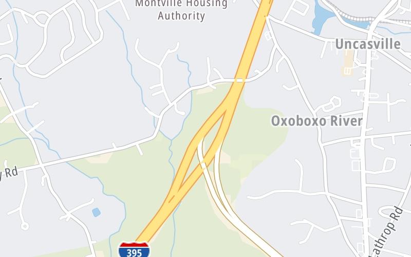
The interactive map and lists on this page include key traveler services within two miles of this destination point, including gas stations, truck stops, EV charging facilities, fast-food or family restaurants, and hotels. These are displayed on the interactive map as markers, which you can select for more information.

Current driving conditions and weather, along with a more complete list of key services, may be found below the map.

View Map ▾Weather ▾

Advertising
Advertising

Interactive Exit Map With Nearby Gas, Food And Lodging

CT 32

At A Glance

This is Exit 5 of the Connecticut Turnpike.

This junction is located in Uncasville. Montville is nearby.

See the adjacent map for detail.▾ Interactive Map Below ▾

This location's approximate GPS Coordinates are 41.43061 x -72.12340.

Which directions can I travel from here?

From this junction, traffic can only enter going northbound. Traffic can only exit going southbound.

The next exit is CT 163, approximately 1.1 miles away ►

◄ The previous exit is CT 85/Hartford Turnpike, approximately 3.2 miles away.

Which direction are tolls charged here?

Tolls are not charged or collected at this junction.

▾ Travel Conditions ▾

Above: Map image © TomTom Intl BV

Area Map & Services Up To Two (2) Miles

Pan and zoom the map as you desire, and select markers for information and other options, including online ordering, where available.

Advertising
Advertising

Food, Gas, EV And Other Services Near CT 32

Fuel, EV and convenience store header

Gas & EV Charging

Closest Gas Stations

CUMBERLAND FARMS

47 Norwich Road • 0.81 miles

Store/Fuel Brand: Cumberland Farms

Mobil

CHUCKYS FOOD STORE

568 Norwich New London Turnpike • 1.16 miles

Store/Fuel Brand: Mobil

View Map ▴

Closest EV Chargers

View Map ▴

No EV charging stations nearby.

Coffee, snacks and dining header

Fast Food & Beverage

Closest Fast Food

Fast food refers ONLY to quick-service and take-out diners. All restaurant types are shown on the map below.

McDonald's

MCDONALD'S

538 Norwich New London Turnpike • 1.12 miles

View Map ▴Full List ▾

Coffee, snacks and dining header

Hotels & Airports

Destination Travel

Hotels closest to CT 32.

Advertising
Advertising

Travel Conditions At CT 32

Current Weather And Visibility

  • 08 6 06
  • Clear

    50°F / 10°C

    Feels Like:

    51°F / 10.4°C

  • Visibility

    18 Mi / 29 Km

    3-Hour Precip:

    0 In / 0.0 Cm

  • North Northwest
    Winds (NNW)

    2.9 MPH / 4.7 KPH

    Gusts:

    5.4 MPH / 8.7 KPH

▸ Get the full forecast for This Location

Available Cameras

I-395 SB N/O EXIT 6 - MONTVILLE SERVICE PLAZA

I-395 SB N/O EXIT 6 - MONTVILLE SERVICE PLAZA

Camera Direction: SOUTH. Source: ConnDOT - Norwich 06382

Cameras Closest To CT 32

Camera Direction: SOUTH. Source: ConnDOT - Norwich 06382

2.94 Mi

Travel Pictures

No photos …

There are no currently-available photos for this location.

Advertising
Advertising

Services Within Two Miles

Lists Include Fuel, EV Charging and Fast Food

Select/Tap Vendors For Info

Vendors within about two miles of CT 32 and the Connecticut Turnpike are listed, sorted by distance, with the closest displayed on top. Select/tap the vendor name to show address, phone numbers and available URLs for gas stations, EV charging stations and fast-food dining. Links will open in a new window. Turnpikes.com is not responsible for third-party website content.

Gas/Diesel/Liquid Fuels

Fuels Within Two (2) Miles

CUMBERLAND FARMS

• 0.81 miles

Mobil

CHUCKYS FOOD STORE

• 1.16 miles

EV Charging/Tesla Superchargers

EV & Tesla Stations Within Two (2) Miles

No EV charging stations nearby.

Fast-Food/Take-Out Dining

Fast-Food Restaurants Within Two (2) Miles

This list only includes quick-service and take-out restaurants. All nearby restaurants are shown on the map above.

McDonald's

MCDONALD'S

• 1.12 miles

EXPLORE CONNECTICUT

Journey to key destinations around and adjacent to Connecticut!

Map Of This Region ▹

Communities in this metro area include New Haven, Bridgeport, Darien, Greenwich, Stamford, and Port Chester, New York.

Individual toll maps for this region are listed below.

Map Of This Region ▹

Communities in this metro area include Springfield, West Springfield, Chicopee, Westfield, and Hartford, Connecticut.

Individual toll maps for this region are listed below.

Advertising
Advertising