A Quick Look At The Grassy Sound Bridge
This bridge serves Middle Township and Stone Harbor.
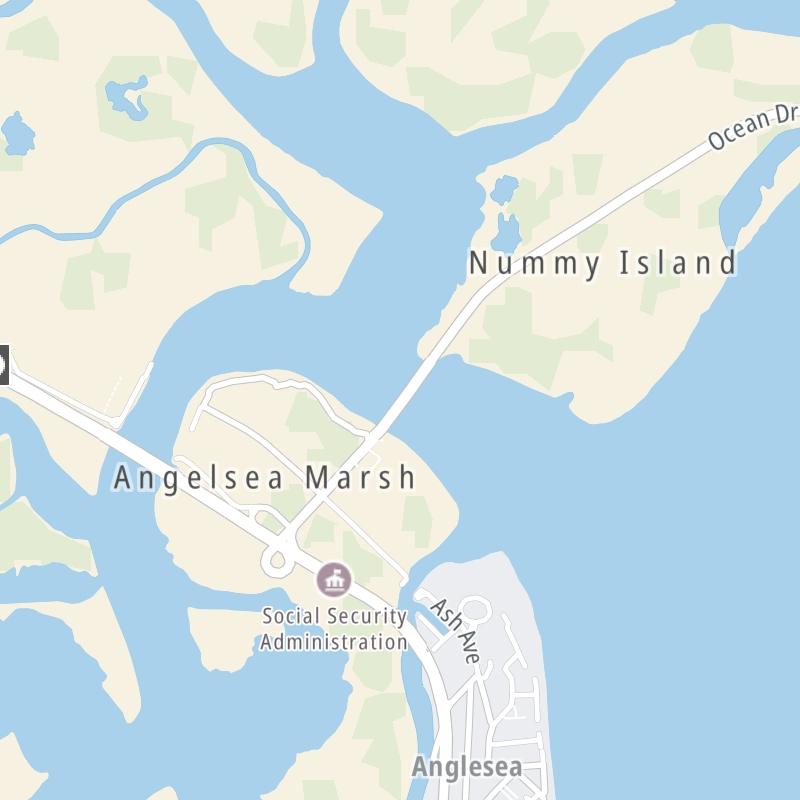
The fixed map seen here presents a quick view of The Grassy Sound Bridge and surrounding area. The fully-interactive map of The Grassy Sound Bridge abvoe includes linked markers. You may resize and reposition the interactive map to orient the road in relation to other landmarks.
There is also a complete list of exits below.
What Does It Cost To Use The Grassy Sound Bridge?
Tolls For Cars, SUVs, Pickups, etc.
▹ Toll as of March 15, 2023.
The total toll for using the Grassy Sound Bridge is $2.50, if you are using a compatible transponder, RFID sticker or other pass.
Transponders You Can Use
For drivers paying with a transponder, the following passes will work on the Grassy Sound Bridge

- e-zpass
- epass xtra
- i-pass
- quick pass
- riverlink
- sunpass pro
- uni


Learn about transponders and accounts in New Jersey.
Without a compatible pass or transponder, the toll will be $2.50.
View MapAll Tolls / Calculator ▸
Our new toll and trip calculator is being constructed. For most roads, you can still use the legacy calculator for current, accurate tolls.

 Cape May County Bridge Commission

 Delaware Memorial Bridge ▹
 Atlantic City Expressway ▹
 Garden State Parkway ▹
 New Jersey Turnpike ▹
 Pennsylvania Turnpike ▹
 Benjamin Franklin Bridge ▹
 Walt Whitman Bridge ▹
 Commodore Barry Bridge ▹
 Betsy Ross Bridge ▹
 Scudder Falls Toll Bridge ▹
 Trenton Morrisville Toll Bridge ▹
 Tacony Palmyra Bridge ▹
 Burlington Bristol Bridge ▹
 Middle Thorofare Bridge ▹
 Grassy Sound Bridge ▹
 Ocean City Longport Bridge ▹
 Milford Montague Toll Bridge ▹
 Delaware Water Gap Toll Bridge ▹
 Portland Columbia Toll Bridge ▹
 Easton Phillipsburg Toll Bridge ▹
 I78 Toll Bridge ▹
 New Hope Lambertville Toll Bridge ▹
 Delaware Turnpike ▹
 State Route 1 ▹
 US 301 ▹
 John F Kennedy Memorial Highway ▹
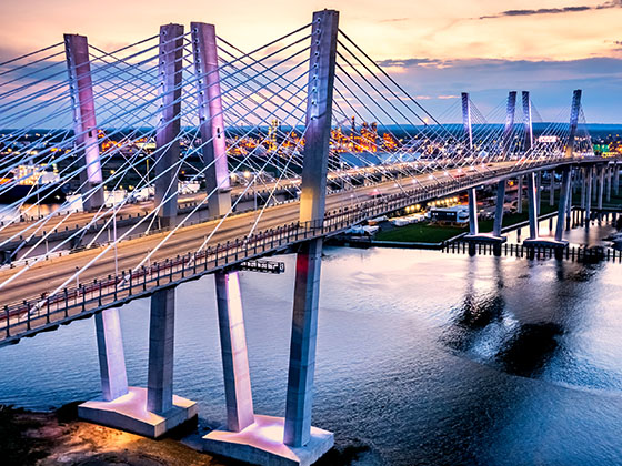
 Bayonne Bridge ▹
 Goethals Bridge ▹
 Holland Tunnel ▹
 George Washington Bridge ▹
 Lincoln Tunnel ▹
 Outerbridge Crossing ▹
 Bronx Whitestone Bridge ▹
 Hugh L Carey Tunnel ▹
 Cross Westchester Expressway ▹
 Robert F Kennedy Bridge ▹
 Queens Midtown Tunnel ▹
 New England Thruway ▹
 New York State Thruway ▹
 Henry Hudson Bridge ▹
 Atlantic Beach Bridge ▹
 Marine Parkway Bridge ▹
 Connecticut Turnpike ▹


