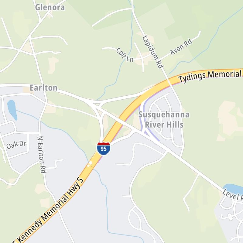
John F Kennedy Memorial Highway Map

Static map a segment of the John F Kennedy Memorial Highway

Using The Interactive Toll Map

This state toll road serves several key cities, including Baltimore, Elkton, North East, Havre De Grace, Aberdeen, and Edgewood. The road map of the John F Kennedy Memorial Highway shows exits and tolling points on the road.

A complete list of exits and other points-of-interest may be found below the map.

View Map ▾Exit / POI List ▾

You may pan and zoom the interactive map. There are markers you may select for a separate map of that point of interest or location, which includes any nearby dining, gas, EV charging, hotels and other services.

Advertising
Advertising

The John F Kennedy Memorial Highway Toll Map

This map of the John F Kennedy Memorial Highway displays markers for exits and tolling points, which you can select to get a close-up map of that point of interest or location.

The points-of-interest shown on this map are also listed below, ordered from south to north.

Advertising
Advertising

List Of Exits / Points Of Interest For The John F Kennedy Memorial Highway

Select an exit or other location to get a separate map, including locations of available gas, EV charging, fast-food and other dining options, plus current weather and driving conditions.

I–695 / Baltimore Beltway

Exit 64/64AI–695 / Baltimore Beltway — Rosedale

View Map & Info

▸ GPS 39.350440000 X -76.495719000
NOTES:

MDTA Maryland Transportation Authority manages this segment.

MD 43 / White Marsh Blvd

Exit 67MD 43 / White Marsh Blvd — Nottingham

View Map & Info

▸ GPS 39.379154000 X -76.448472000
NOTES:

MDTA Maryland Transportation Authority manages this segment.

MD 152 / Mountain Road

Exit 74MD 152 / Mountain Road — Joppatowne

View Map & Info

▸ GPS 39.441906000 X -76.348455000
NOTES: to Gunpowder Falls State Park

MDTA Maryland Transportation Authority manages this segment.

MD 24 / Veterans Mem Hwy

Exit 77A/77BMD 24 / Veterans Mem Hwy — Bel Air

View Map & Info

▸ GPS 39.456785000 X -76.310036000
NOTES: to MD 924

MDTA Maryland Transportation Authority manages this segment.

MD 543 / Riverside Parkway

Exit 80MD 543 / Riverside Parkway — Belcamp

View Map & Info

▸ GPS 39.484197000 X -76.251363000
NOTES: Belcamp / South Bel Air

MDTA Maryland Transportation Authority manages this segment.

Maryland House Travel Plaza

Maryland House Travel Plaza — North East

View Map & Info

▸ GPS 39.496640000 X -76.233187000
NOTES:

MD 22 / Aberdeen Thruway

Exit 85MD 22 / Aberdeen Thruway — Aberdeen

View Map & Info

▸ GPS 39.526406000 X -76.191704000
NOTES:

MDTA Maryland Transportation Authority manages this segment.

MD 155 / Level Road

Exit 89MD 155 / Level Road — Havre De Grace

View Map & Info

▸ GPS 39.571243000 X -76.137589000
NOTES: Havre de Grace

MDTA Maryland Transportation Authority manages this segment.

Tydings Bridge Toll Gantry

Tydings Bridge Toll Gantry — Perryville

View Map & Info

▸ GPS 39.588576000 X -76.072322000
NOTES: Gantry has replaced the old plaza.

MDTA Maryland Transportation Authority manages this segment.
MD 222

Exit 93MD 222 — Perryville

View Map & Info

▸ GPS 39.593091000 X -76.066353000
NOTES: Perryville

MDTA Maryland Transportation Authority manages this segment.

Chesapeake House Travel Plaza

Chesapeake House Travel Plaza — North East

View Map & Info

▸ GPS 39.611788000 X -76.009365000
NOTES:

MD 272 / North East Road

Exit 100MD 272 / North East Road — North East

View Map & Info

▸ GPS 39.631906000 X -75.956700000
NOTES: to Elk Neck State Park

MDTA Maryland Transportation Authority manages this segment.

MD 279 / Elkton Road

Exit 109MD 279 / Elkton Road — Elkton

View Map & Info

▸ GPS 39.640824000 X -75.802145000
NOTES:

MDTA Maryland Transportation Authority manages this segment.

Delaware state line

Delaware state line — Elkton

View Map & Info

▸ GPS 39.638732000 X -75.787768000
NOTES: Delaware Turnpike

MDTA Maryland Transportation Authority manages this segment.

Advertising
Advertising

EXPLORE MARYLAND

Journey to key destinations around and adjacent to Maryland!

Map Of This Region ▹

Communities in this metro area include Washington, Dc, Fairfax County, Virginia, Loundoun County, Virginia, Montgomery County, Maryland, and Prince George's County, Maryland.

Individual toll maps for this region are listed below.

Map Of This Region ▹

Communities in this metro area include Wilmington, Middletown, Newark, and Carneys Point, New Jersey.

Individual toll maps for this region are listed below.

Advertising
Advertising