Current Weather And Visibility
Key Regions Along The Wm Preston Lane Jr Memorial Bridge
Baltimore

Mostly Cloudy
59°F
Feels Like:
61°F

Visibility
10 Mi
Humidity:
79 %
Southwest
Wind0.5 MPH
Gusts:
1.6 MPH
Washington Metro
Mostly Cloudy
59°F
Feels Like:
61°F
Visibility
9 Mi
Humidity:
73 %
South Southeast
Wind0.5 MPH
Gusts:
1.7 MPH
Conditions and forecasts provided in partnership with AccuWeather.

Weather provided in partnership with AccuWeather.
Maryland Radar & Satellite
NOAA composite satellite & weather radar imagery.
Images from GOES-East Northeast Sector. Sequence may take a moment to initialize.
Weather With The Interactive Map
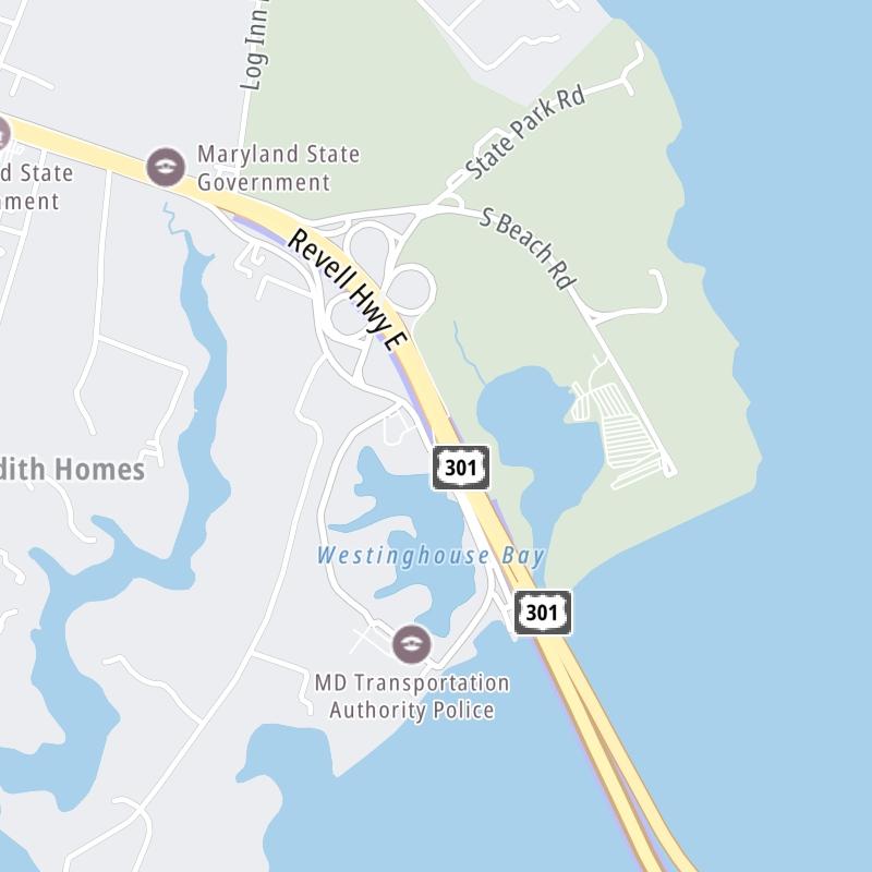
The Wm Preston Lane Jr Memorial Bridge is also known as Bay Bridge. This bridge serves Annapolis, Arnold, Cape St Claire, Stevensville, and Chester. Use the map of the Wm Preston Lane Jr Memorial Bridge to select destination weather.
Pan and zoom the interactive map to your chosen position. Select camera markers to view traffic conditions at that location. Other markers show key travel points for the bridge.


 Wm Preston Lane Jr Memorial Bridge ▹
 Fort McHenry Tunnel ▹
 Francis Scott Key Bridge ▹
 Baltimore Harbor Tunnel ▹
 Intercounty Connector MD 200 ▹
 Thomas J Hatem Memorial Bridge ▹
 Dulles Greenway ▹
 Delaware Memorial Bridge ▹
 Delaware Turnpike ▹
 State Route 1 ▹


