10:29 am Local Time
Heavy Snow
29°F / -1.4°C
Feels Like:
23°F / -4.9°C
Visibility
0 Mi / 0.8 Km
3-Hour Precip:
0.08 In / 0.2 Cm
West
Winds (W)
7.3 MPH / 11.7 KPH
Gusts:
18 MPH / 28.9 KPH
Forecast weather and driving conditions follow the jump. These include an hour-by-hour forecast for the next 12-hours, a three-day forecast and an extended forecast, for extended travel planning.
An area traffic map, with available traffic cameras, shows driving conditions, from current traffic to mother nature's influence on the road. These follow the short-range forecasts below.
There is no currently-available traffic camera feed for this location.
Thursday forecast: Windy and cooler with snow mixing with rain, accumulating 1-3 inches; snow can cause poor visibility and slippery spots, leading to slow travel
Rain And Snow
97% Chance Snow
40° F/4.4° C
WNW Wind
20 to 41 Mi/
32 to 67 Km
Sunrise
6:47 AM
Thursday night: Windy and cooler with snow mixing with rain, accumulating 1-3 inches; snow can cause poor visibility and slippery spots, leading to slow travel
Rain And Snow
45% Chance Snow
37° F/2.8° C
NNW Wind
17 to 45 Mi/
28 to 72 Km
Sunset
4:25 PM
Friday forecast: Mostly cloudy and breezy
Mostly Cloudy
16% Chance Rain
45° F/7.2° C
NW Wind
16 to 25 Mi/
26 to 41 Km
Sunrise
6:48 AM
Friday night: Mostly cloudy and breezy
Cloudy
3% Chance Rain
35° F/1.7° C
WNW Wind
9 to 18 Mi/
15 to 30 Km
Sunset
4:24 PM
Saturday forecast: More clouds than sun
Mostly Cloudy
9% Chance Rain
47° F/8.3° C
W Wind
9 to 13 Mi/
15 to 20 Km
Sunrise
6:49 AM
Saturday night: More clouds than sun
Intermittent Clouds
8% Chance Rain
36° F/2.2° C
SW Wind
6 to 9 Mi/
9 to 15 Km
Sunset
4:23 PM
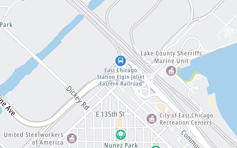
This junction is located in East Chicago, at GPS 41.65355 x -87.44740.
This location is in the Northern Indiana area; it also overlaps with the Chicagoland - Northwestern Indiana area.
The next exit is Inland Steel Overpass, approximately 0.2 miles away ►
◄ The previous exit is Pennsylvania/Michigan Avenues / Block Avenue, approximately 0.1 miles away.
Above: Map image © TomTom Intl BVPan and zoom the map as you desire. Select cameras to see on-road traffic feeds; pick exits and other markers for conditions at those locations.
Journey to key destinations around and adjacent to Indiana!
Communities in this metro area include Gary, South Bend, Elkhart, Portage, and Fremont.
Individual toll maps for this region are listed below.
Communities in this metro area include Chicago, Aurora, Oak Lawn, Des Plaines, Waukegan, Highland Park, Gary, Indiana, Schaumburg, Naperville, Oak Brook, and Joliet.
Individual toll maps for this region are listed below.
Communities in this metro area include Louisville and Jeffersonville, Indiana.
Individual toll maps for this region are listed below.
Communities in this metro area include Toledo, Perrysburg, Maumee, Montpelier, and Wauseon.
Individual toll maps for this region are listed below.
Communities in this metro area include Detroit, Grosse Ile, Ann Arbor, Pontiac, and Lansing.
Individual toll maps for this region are listed below.