A Quick Look At The Detroit Windsor Tunnel
Windsor Detroit Tunnel is another name used for this tunnel. This tunnel toll road serves Detroit and Windsor.
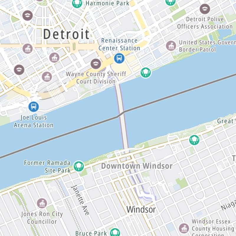
The fixed map seen here presents a quick view of The Detroit Windsor Tunnel and surrounding area. The fully-interactive map of The Detroit Windsor Tunnel abvoe includes linked markers. You may resize and reposition the interactive map to orient the road in relation to other landmarks.
There is also a complete list of exits below.
What Does It Cost To Use The Detroit Windsor Tunnel?
Tolls For Cars, SUVs, Pickups, etc.
▹ Toll as of January 6, 2025.
The total toll for using the Detroit Windsor Tunnel is $6.00, if you are using a compatible transponder, RFID sticker or other pass.
Transponders You Can Use
For drivers paying with a transponder, the following passes will work on the Detroit Windsor Tunnel

- nexpress

Learn about transponders and accounts in Michigan.
Without a compatible pass or transponder, the toll will be $8.25.
View MapAll Tolls / Calculator ▸
Our new toll and trip calculator is being constructed. For most roads, you can still use the legacy calculator for current, accurate tolls.

 Detroit Windsor Tunnel


 Ambassador Bridge ▹
 Detroit Windsor Tunnel ▹
 Mackinac Bridge ▹
 Liberty Bridge ▹
 Independence Bridge ▹
 Ohio Turnpike ▹
 Indiana Toll Road ▹