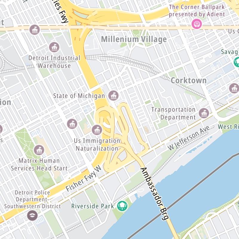
This map of the Ambassador Bridge displays markers for exits and tolling points, which you can select to get a close-up map of that point of interest or location.
The points-of-interest shown on this map are also listed below, ordered from south to north.
See below for more comprehensive information about the Ambassador Bridge
This bridge serves Detroit and Windor.
The fixed map seen here presents a quick view of The Ambassador Bridge and surrounding area. The fully-interactive map of The Ambassador Bridge abvoe includes linked markers. You may resize and reposition the interactive map to orient the road in relation to other landmarks.
There is also a complete list of exits below.
Tolls For Cars, SUVs, Pickups, etc.
▹ Toll as of January 1, 2025.
The total toll for using the Ambassador Bridge is $9.00, if you are using a compatible transponder, RFID sticker or other pass.
For drivers paying with a transponder, the following passes will work on the Ambassador Bridge
Learn about transponders and accounts in Michigan.
Without a compatible pass or transponder, the toll will be $9.00. Canadian Dollars: $12.00.
View MapAll Tolls / Calculator ▸
Our new toll and trip calculator is being constructed. For most roads, you can still use the legacy calculator for current, accurate tolls.
Turnpikes.com has partnered with Tiqets.com to bring you these excusive deals on attractions!
Select an exit or other location to get a separate map, including locations of available gas, EV charging, fast-food and other dining options, plus current weather and driving conditions.
College Avenue / Huron Church Road — Windsor
▸ GPS 42.298552964 X -83.064954303
NOTES: Canadian terminus
Ambassador Bridge manages this segment.
Canada SB Tolls — Windsor
▸ GPS 42.301313998 X -83.066022926
NOTES: Canada Tolls / Border Svc. Checkpoint
Ambassador Bridge manages this segment.
Canada Border Services — Windsor
Border Crossing Checkpoint - ID Required!
▸ GPS 42.300603715 X -83.065060482
NOTES: Canada Border Services Agency checkpoint
Ambassador Bridge manages this segment.
United States / Canada Border
International Border
▸ GPS 42.311807641 X -83.073963301
NOTES: Detroit River
Ambassador Bridge manages this segment.
US Customs — Detroit
Border Crossing Checkpoint - ID Required!
▸ GPS 42.321358304 X -83.080645875
NOTES: Customs and Border Protection
Ambassador Bridge manages this segment.
NB Toll Plaza — Detroit
▸ GPS 42.321645700 X -83.080395513
NOTES: NB US entry / Customs Checkpoint / Trucks use alternate
Ambassador Bridge manages this segment.
Truckers' NB Toll Gantry — Detroit
▸ GPS 42.322152672 X -83.080129092
NOTES: Tolls for NB trucks / Customs checkpoint
Ambassador Bridge manages this segment.
NB I-75 / WB I-96 — Detroit
▸ GPS 42.322824257 X -83.081873565
NOTES: to Northbound / Westbound
Ambassador Bridge manages this segment.
SB I-75 — Detroit
▸ GPS 42.322610857 X -83.083313575
NOTES: to Southbound I-75
Ambassador Bridge manages this segment.
Truckers' Customs — Detroit
Border Crossing Checkpoint - ID Required!
▸ GPS 42.319541523 X -83.077494869
NOTES: Customs and Border Protection for Trucks
Ambassador Bridge manages this segment.
Journey to key destinations around and adjacent to Michigan!
Communities in this metro area include Detroit, Grosse Ile, Ann Arbor, Pontiac, and Lansing.
Individual toll maps for this region are listed below.
Communities in this metro area include St Ignace and Sault Ste Marie.
Individual toll maps for this region are listed below.
Communities in this metro area include Port Huron, Flint, Saginaw, and Bay City.
Individual toll maps for this region are listed below.
Communities in this metro area include Toledo, Perrysburg, Maumee, Montpelier, and Wauseon.
Individual toll maps for this region are listed below.
Communities in this metro area include Sault Ste Marie, Thunder Bay, Fort Frances, and Greater Sudbury.
Individual toll maps for this region are listed below.
Communities in this metro area include Windsor.
Individual toll maps for this region are listed below.