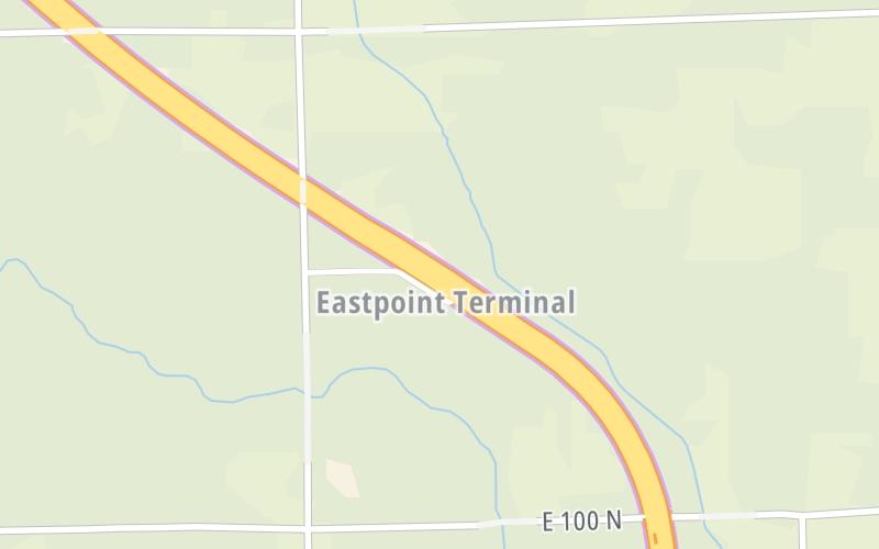
Your selected location relative to roadway
See below for more about this area
See below for more about this area
This toll point is located in . NOTE: Start / End of ticket system..
This location is in the Northern Indiana area; it also overlaps with the Toledo - Western Ohio area.
This location's approximate GPS Coordinates are 41.66611 x -84.85323.
On to Ohio Turnpike, about 4.0 miles away ►
◄ Back to I–69 / US 27 / SR 120 / SR 127, about 9.1 miles away.
Above: Photo by Turnpikes.comThe interactive map will help you orient this location in relationship to other junctions.
Current driving conditions and weather may also be found below the map.

Cloudy
37°F / 2.9°C
Feels Like:
35°F / 1.4°C
Visibility
19 Mi / 30.6 Km
3-Hour Precip:
0 In / 0.0 Cm
Northwest
Winds (NW)
7.8 MPH / 12.5 KPH
Gusts:
12.7 MPH / 20.5 KPH
▸ Get the full forecast for the Northern Indiana area
Conditions and forecasts provided in partnership with AccuWeather.

Weather provided in partnership with AccuWeather.
There is no currently-available traffic camera feed for this location.
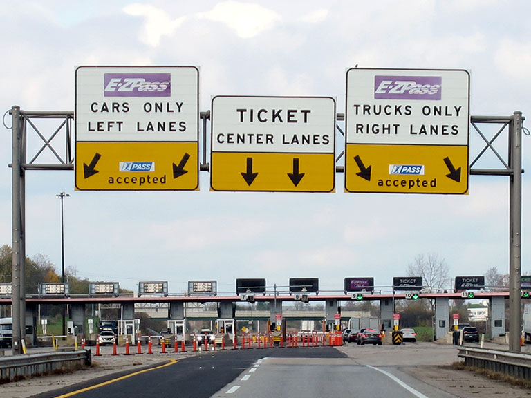
About this photo:
Guide signs frame the view for westbound drivers approaching the Eastpoint Toll Barrier of the Indiana Toll Road. Photo taken November 2, 2019.
Photo taken 11-02-2019
More Pictures Near Eastpoint Toll Barrier


Journey to key destinations around and adjacent to Indiana!
Communities in this metro area include Gary, South Bend, Elkhart, Portage, and Fremont.
Individual toll maps for this region are listed below.
Communities in this metro area include Chicago, Aurora, Oak Lawn, Des Plaines, Waukegan, Highland Park, Gary, Indiana, Schaumburg, Naperville, Oak Brook, and Joliet.
Individual toll maps for this region are listed below.
Communities in this metro area include Louisville and Jeffersonville, Indiana.
Individual toll maps for this region are listed below.
Communities in this metro area include Toledo, Perrysburg, Maumee, Montpelier, and Wauseon.
Individual toll maps for this region are listed below.

Communities in this metro area include Detroit, Grosse Ile, Ann Arbor, Pontiac, and Lansing.
Individual toll maps for this region are listed below.

 Indiana Toll Road ▹
 Chicago Skyway ▹
 Tri State Tollway ▹
 Ohio Turnpike ▹
 Cline Avenue Bridge ▹
 Jane Addams Memorial Tollway ▹
 Ronald Reagan Memorial Tollway ▹
 Veterans Memorial Tollway ▹
 Houbolt Road Extension ▹
 Lewis And Clark Bridge ▹
 Abraham Lincoln Bridge ▹
 Ambassador Bridge ▹
 Detroit Windsor Tunnel ▹


