Dover - Dover Afb Toll Maps

Advertising
Advertising

 U.S. National Weather Service Weather Alert

Special Weather Statement

Area: Kent

View Alert

Toll Road Exit Map For Dover - Dover Afb

Pan and zoom as desired. Tap map markers for information and to view that specific location.

Metro and regional information is below. You will also find a list of exits and other points-of-interest in the Dover - Dover Afb area. Exit lists below are sorted by the name of the toll road.

Advertising
Advertising

A Quick Look At The Dover - Dover Afb Area
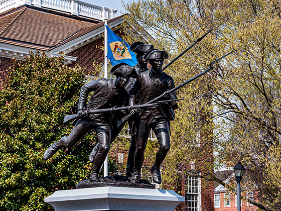
Regional photo of Dover - Dover Afb

The Dover - Dover Afb area includes the following cities: Camden, Dover, Dover Afb, and Smyrna.

View Map Road List

What You Will Find On The Regional Map

The interactive metro/regional map above shows exits and toll points for each toll road that is in, or crosses into, the Dover - Dover Afb area.

Markers can be selected for a map of that specific exit, toll gantry or other point of interest. Exit maps will show you nearby dining, gas, EV charging, hotels and other services.

Only the following toll road is in this area:

Selecting a road will reveal a map of that toll road.

Advertising
Advertising

Discover Delaware Attractions

Turnpikes.com has partnered with Tiqets.com to bring you these excusive deals on attractions!

Advertising
Advertising

Regional Exits, Listed By Toll Road

A list of all exits and other points-of-interest in this region, sorted by toll road.

State Route 9 / Dover AFB Commercial Gate

Exit 91State Route 9 / Dover AFB Commercial Gate — Dover

View Map & Info

▸ GPS 39.106472000 X -75.455113000

DelDOT Delaware Department of Transportation manages this segment.

13th Street / Old Lebanon Road / Dover AFB Main Gate

Exit 9313th Street / Old Lebanon Road / Dover AFB Main Gate — Dover

View Map & Info

▸ GPS 39.121372000 X -75.479486000
NOTES:

DelDOT Delaware Department of Transportation manages this segment.

State Route 10 / Dover AFB North Gate

Exit 95State Route 10 / Dover AFB North Gate — Dover

View Map & Info

▸ GPS 39.130632000 X -75.492180000
NOTES:

DelDOT Delaware Department of Transportation manages this segment.

US 13

Exit 97US 13 — Dover

View Map & Info

▸ GPS 39.154972000 X -75.493437000
NOTES:

DelDOT Delaware Department of Transportation manages this segment.

State Route 8

Exit 98State Route 8 — Dover

View Map & Info

▸ GPS 39.165733000 X -75.492855000
NOTES:

DelDOT Delaware Department of Transportation manages this segment.

Dover Toll Plaza

Dover Toll Plaza — Dover

View Map & Info

▸ GPS 39.185033000 X -75.514476000
NOTES:

DelDOT Delaware Department of Transportation manages this segment.

SR 8 / US 13 / Dover Intl Speedway

Exit 104SR 8 / US 13 / Dover Intl Speedway — Dover

View Map & Info

▸ GPS 39.205231000 X -75.542673000
NOTES: Dover Downs

DelDOT Delaware Department of Transportation manages this segment.

SR 6 / SR 300 / US 13

Exit 114SR 6 / SR 300 / US 13 — Smyrna

View Map & Info

▸ GPS 39.282763000 X -75.589515000
NOTES:

DelDOT Delaware Department of Transportation manages this segment.

Smyrna Rest Area / US 13 / SR 6 / SR 300

Exit 119BSmyrna Rest Area / US 13 / SR 6 / SR 300 — Smyrna

View Map & Info

▸ GPS 39.328205000 X -75.621364000
NOTES:

DelDOT Delaware Department of Transportation manages this segment.

US 13 / SR 6 / SR 300

Exit 119AUS 13 / SR 6 / SR 300 — Smyrna

View Map & Info

▸ GPS 39.334005000 X -75.632505000
NOTES:

DelDOT Delaware Department of Transportation manages this segment.

US 13 / SR 6 / SR 300

Exit 119US 13 / SR 6 / SR 300 — Smyrna

View Map & Info

▸ GPS 39.332431000 X -75.628822000
NOTES:

DelDOT Delaware Department of Transportation manages this segment.

Advertising
Advertising
Regional photo of Dover - Dover Afb

Visiting In The Dover - Dover Afb Area?

We have partnered with Hotels.com to help you get the best deal on hotels.

Find Hotels

Things to do around Dover - Dover Afb

Things To Do While You're Here

We have partnered with Tiqets to bring you deals on dining and attractions.

EXPLORE DELAWARE

Journey to key destinations around and adjacent to Delaware!

Map Of This Region ▹

Communities in this metro area include Wilmington, Middletown, Newark, and Carneys Point, New Jersey.

Individual toll maps for this region are listed below.

Map Of This Region ▹

Communities in this metro area include Camden, Dover, Dover Afb, and Smyrna.

Individual toll maps for this region are listed below.

Map Of This Region ▹

Communities in this metro area include Camden, Burlington, Palmyra, Pennsauken, Cherry Hill, Gloucester City, Trenton, Wilmington, Delaware, Philadelphia, Pennsylvania, Tacony, Pennsylvania, and Bristol, Pennsylvania.

Individual toll maps for this region are listed below.

Map Of This Region ▹

Communities in this metro area include Philadelphia, King Of Prussia, Valley Forge, West Chester, Bristol, Burlington, New Jersey, Morrisville, Trenton, New Jersey, Palmyra, New Jersey, Wilmington, Delaware, and Camden, New Jersey.

Individual toll maps for this region are listed below.

Turnpikes.com is proud to partner with the following: