Southwestern Ontario Toll Maps

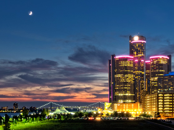
Regional photo of Southwestern Ontario

Using The Interactive Regional Map

The Southwestern Ontario metro area map shows exits and toll points for region-wide toll roads or other toll roads that cross the region.

View Map ▾Road List ▾

The following (3) toll roads are in this area, cross through this area or connect with this region:

The Southwestern Ontario area includes the following cities: Windsor.

Markers on the interactive map can be selected to get close-up views of exit points, toll gantries and other locations and points-of-interest. Each POI map shows all nearby dining, gas, EV charging, hotels and other services.

View Map ▾Road List ▾

A complete list of exits and other points-of-interest in the Southwestern Ontario area follows the map. Exit lists are sorted by toll road.

Advertising
Advertising

Regional Map For Southwestern Ontario

Pan and zoom the map as desired, and select or tap the interactive markers to get information about that specific location. Each marker also includes options for viewing a close-up map of the destination point.

A complete list of exits and other points-of-interest is below this map, and other regions are shown further down the page.

Advertising
Advertising

Regional Exits, Listed By Toll Road

A list of all exits and other points-of-interest in this region, sorted by toll road.

College Avenue / Huron Church Road

College Avenue / Huron Church Road — Windsor

View Map & Info

▸ GPS 42.298552964 X -83.064954303
NOTES: Canadian terminus

Ambassador Bridge manages this segment.

Canada SB Tolls

Canada SB Tolls — Windsor

View Map & Info

▸ GPS 42.301313998 X -83.066022926
NOTES: Canada Tolls / Border Svc. Checkpoint

Ambassador Bridge manages this segment.

Canada Border Services

Canada Border Services — Windsor

Border Crossing Checkpoint - ID Required!

▸ GPS 42.300603715 X -83.065060482
NOTES: Canada Border Services Agency checkpoint

Ambassador Bridge manages this segment.

United States / Canada Border

United States / Canada Border

International Border

▸ GPS 42.311807641 X -83.073963301
NOTES: Detroit River

Ambassador Bridge manages this segment.

US Customs

US Customs — Detroit

Border Crossing Checkpoint - ID Required!

▸ GPS 42.321358304 X -83.080645875
NOTES: Customs and Border Protection

Ambassador Bridge manages this segment.

NB Toll Plaza

NB Toll Plaza — Detroit

View Map & Info

▸ GPS 42.321645700 X -83.080395513
NOTES: NB US entry / Customs Checkpoint / Trucks use alternate

Ambassador Bridge manages this segment.

Truckers' NB Toll Gantry

Truckers' NB Toll Gantry — Detroit

View Map & Info

▸ GPS 42.322152672 X -83.080129092
NOTES: Tolls for NB trucks / Customs checkpoint

Ambassador Bridge manages this segment.

NB I-75 / WB I-96

NB I-75 / WB I-96 — Detroit

View Map & Info

▸ GPS 42.322824257 X -83.081873565
NOTES: to Northbound / Westbound

Ambassador Bridge manages this segment.

SB I-75

SB I-75 — Detroit

View Map & Info

▸ GPS 42.322610857 X -83.083313575
NOTES: to Southbound I-75

Ambassador Bridge manages this segment.

Truckers' Customs

Truckers' Customs — Detroit

Border Crossing Checkpoint - ID Required!

▸ GPS 42.319541523 X -83.077494869
NOTES: Customs and Border Protection for Trucks

Ambassador Bridge manages this segment.

Water Street

Exit 274Water Street — Port Huron Charter Township

View Map & Info

▸ GPS 42.991718656 X -82.451400134
NOTES: Last EB exit before bridge

MDOT Blue Water Bridge manages this segment.

Pine Grove Ave / Hancock St

Pine Grove Ave / Hancock St

View Map & Info

▸ GPS 42.995539739 X -82.443293746
NOTES: No bridge access

MDOT Blue Water Bridge manages this segment.

US Bridge Toll Plaza

US Bridge Toll Plaza — Port Huron Charter Township

View Map & Info

▸ GPS 42.998154459 X -82.435602270
NOTES: EB tolls from US

MDOT Blue Water Bridge manages this segment.

US Customs

US Customs — Port Huron Charter Township

Border Crossing Checkpoint - ID Required!

▸ GPS 42.998800299 X -82.435748783
NOTES: WB US Customs and Border Protection checkpoint

MDOT Blue Water Bridge manages this segment.

United States / Canada Border

United States / Canada Border

International Border

▸ GPS 42.998705925 X -82.423462870
NOTES: St Clair River

MDOT Blue Water Bridge manages this segment.

Canada Border Services

Canada Border Services — Point Edward

Border Crossing Checkpoint - ID Required!

▸ GPS 42.993446011 X -82.411894816
NOTES: Canada Border Services Agency checkpoint

FBCL Blue Water Bridge manages this segment.

Truckers' Customs

Truckers' Customs — Point Edward

Border Crossing Checkpoint - ID Required!

▸ GPS 42.993360152 X -82.413465931
NOTES: Canada Border Services Agency checkpoint for trucks only

FBCL Blue Water Bridge manages this segment.

Canada Bridge Toll Plaza

Canada Bridge Toll Plaza — Point Edward

View Map & Info

▸ GPS 42.993207772 X -82.411102091
NOTES: WB tolls from Canada

FBCL Blue Water Bridge manages this segment.

Front Street N

Exit 1Front Street N — Point Edward

View Map & Info

▸ GPS 42.988258715 X -82.403796444
NOTES: Last exit WB Ont 402 before bridge

FBCL Blue Water Bridge manages this segment.

Wyandotte St E / Goyeau St

Wyandotte St E / Goyeau St — Windsor

View Map & Info

▸ GPS 42.314771857 X -83.035013387
NOTES: Access point to US

DW Tunnel Detroit Windsor Tunnel manages this segment.

Canadian NB Tolls

Canadian NB Tolls — Windsor

View Map & Info

▸ GPS 42.315482372 X -83.036173407
NOTES: Canada toll to US

DW Tunnel Detroit Windsor Tunnel manages this segment.

Canada Border Services

Canada Border Services — Windsor

Border Crossing Checkpoint - ID Required!

▸ GPS 42.315862520 X -83.037116521
NOTES: Canada Border Services Agency checkpoint

DW Tunnel Detroit Windsor Tunnel manages this segment.

United States / Canada Border

United States / Canada Border

International Border

▸ GPS 42.323851581 X -83.040247191
NOTES: Detroit River

DW Tunnel Detroit Windsor Tunnel manages this segment.

US Toll Plaza / Customs

US Toll Plaza / Customs — Detroit

Border Crossing Checkpoint - ID Required!

▸ GPS 42.328558855 X -83.042049384
NOTES: US toll to Canada / Customs and Border Protection checkpoint

DW Tunnel Detroit Windsor Tunnel manages this segment.

Jefferson Avenue

Jefferson Avenue — Detroit

View Map & Info

▸ GPS 42.329773993 X -83.041970914
NOTES: Access point to Canada

DW Tunnel Detroit Windsor Tunnel manages this segment.

Advertising
Advertising

EXPLORE ONTARIO

Journey to key destinations around and adjacent to Ontario!

Map Of This Region ▹

Communities in this metro area include Toronto, Niagara Falls, Hamilton, and Mississauga.

Individual toll maps for this region are listed below.

Map Of This Region ▹

Communities in this metro area include Sault Ste Marie, Thunder Bay, Fort Frances, and Greater Sudbury.

Individual toll maps for this region are listed below.

Map Of This Region ▹

Communities in this metro area include Windsor.

Individual toll maps for this region are listed below.

Map Of This Region ▹

Communities in this metro area include Buffalo, Batavia, Rochester, Amherst, Niagara Falls, and Niagara Falls, Ontario.

Individual toll maps for this region are listed below.

Map Of This Region ▹

Communities in this metro area include Detroit, Grosse Ile, Ann Arbor, Pontiac, and Lansing.

Individual toll maps for this region are listed below.

Map Of This Region ▹

Communities in this metro area include St Ignace and Sault Ste Marie.

Individual toll maps for this region are listed below.

Map Of This Region ▹

Communities in this metro area include Port Huron, Flint, Saginaw, and Bay City.

Individual toll maps for this region are listed below.

Map Of This Region ▹

Communities in this metro area include Duluth and International Falls.

Individual toll maps for this region are listed below.

Turnpikes.com is proud to partner with the following: