Cleveland - Akron - Youngstown Toll Maps

Advertising
Advertising

Toll Road Exit Map For Cleveland - Akron - Youngstown

Pan and zoom as desired. Tap map markers for information and to view that specific location.

Metro and regional information is below. You will also find a list of exits and other points-of-interest in the Cleveland - Akron - Youngstown area. Exit lists below are sorted by the name of the toll road.

Advertising
Advertising

A Quick Look At The Cleveland - Akron - Youngstown Area

For more about this region, read our wiki for the area.
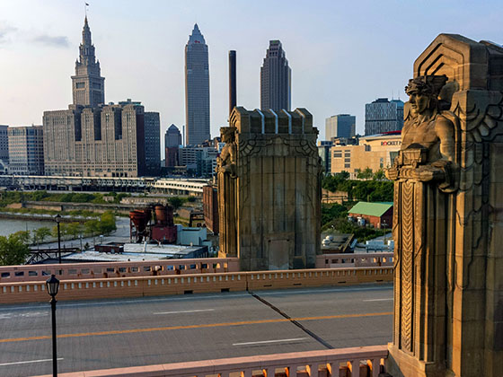
Regional photo of Cleveland - Akron - Youngstown

The Cleveland - Akron - Youngstown area includes the following cities: Cleveland, Akron, Boardman, Lorain, Aurora, Youngstown, New Castle, Pennsylvania, and Beaver Falls, Pennsylvania.

View Map Road List Region Wiki

What You Will Find On The Regional Map

The interactive metro/regional map above shows exits and toll points for each toll road that is in, or crosses into, the Cleveland - Akron - Youngstown area.

Markers can be selected for a map of that specific exit, toll gantry or other point of interest. Exit maps will show you nearby dining, gas, EV charging, hotels and other services.

The following (3) toll roads are in this area, cross through this area or connect with this region:

Selecting a road will reveal a map of that toll road.

Advertising
Advertising

Discover Ohio Attractions

Turnpikes.com has partnered with Tiqets.com to bring you these excusive deals on attractions!

Advertising
Advertising

Regional Exits, Listed By Toll Road

A list of all exits and other points-of-interest in this region, sorted by toll road.

Vermilion / Baumhart Rd.

Exit 135Vermilion / Baumhart Rd. — Vermilion

View Map & Info

▸ GPS 41.360300000 X -82.284200000
NOTES:

Ohio Turnpike Commission Ohio Turnpike and Infrastructure Commission manages this segment.

Middle Ridge Service Plaza

Middle Ridge Service Plaza — Amherst

View Map & Info

▸ GPS 41.379500000 X -82.222600000
NOTES:

Vermilion Valley Service Plaza

Vermilion Valley Service Plaza — Amherst

View Map & Info

▸ GPS 41.377700000 X -82.225000000
NOTES:

Amherst/Oberlin / SR 58

Exit 140Amherst/Oberlin / SR 58 — Amherst

View Map & Info

▸ GPS 41.382200000 X -82.201800000
NOTES:

Ohio Turnpike Commission Ohio Turnpike and Infrastructure Commission manages this segment.

Lorain County West / I–90 / SR 2

Exit 142Lorain County West / I–90 / SR 2 — Lorain Cty

View Map & Info

▸ GPS 41.387000000 X -82.177800000
NOTES:

Ohio Turnpike Commission Ohio Turnpike and Infrastructure Commission manages this segment.

Lorain / Elyria / SR 57

Exit 145Lorain / Elyria / SR 57 — Elyria

View Map & Info

▸ GPS 41.387300000 X -82.110900000
NOTES:

Ohio Turnpike Commission Ohio Turnpike and Infrastructure Commission manages this segment.

N Ridgeville/Cleveland / I–480

Exit 151N Ridgeville/Cleveland / I–480 — Cleveland

View Map & Info

▸ GPS 41.379200000 X -81.996700000
NOTES:

Ohio Turnpike Commission Ohio Turnpike and Infrastructure Commission manages this segment.

N Olmsted/Cleveland / Lorain Rd

Exit 152N Olmsted/Cleveland / Lorain Rd — Cleveland

View Map & Info

▸ GPS 41.378300000 X -81.987800000
NOTES:

Ohio Turnpike Commission Ohio Turnpike and Infrastructure Commission manages this segment.

Strongsville/Cleveland / US 42 / I–71

Exit 161Strongsville/Cleveland / US 42 / I–71 — Cleveland

View Map & Info

▸ GPS 41.332800000 X -81.816800000
NOTES:

Ohio Turnpike Commission Ohio Turnpike and Infrastructure Commission manages this segment.

Great Lakes Service Plaza

Great Lakes Service Plaza — Broadview Heights

View Map & Info

▸ GPS 41.292000000 X -81.671300000
NOTES:

Towpath Service Plaza

Towpath Service Plaza — Broadview Heights

View Map & Info

▸ GPS 41.292000000 X -81.675700000
NOTES:

Cleveland / SR 21 / I–77

Exit 173Cleveland / SR 21 / I–77 — Cleveland

View Map & Info

▸ GPS 41.275600000 X -81.636300000
NOTES: to Rock and Roll Hall of Fame

Ohio Turnpike Commission Ohio Turnpike and Infrastructure Commission manages this segment.

Akron / SR 8

Exit 180Akron / SR 8 — Akron

View Map & Info

▸ GPS 41.258600000 X -81.501200000
NOTES:

Ohio Turnpike Commission Ohio Turnpike and Infrastructure Commission manages this segment.

Streetsboro / SR 14 / I–480

Exit 187Streetsboro / SR 14 / I–480 — Streetsboro

View Map & Info

▸ GPS 41.256200000 X -81.364200000
NOTES:

Ohio Turnpike Commission Ohio Turnpike and Infrastructure Commission manages this segment.

Ravenna / SR 44

Exit 193Ravenna / SR 44 — Ravenna

View Map & Info

▸ GPS 41.245100000 X -81.237000000
NOTES:

Ohio Turnpike Commission Ohio Turnpike and Infrastructure Commission manages this segment.

Portage Service Plaza

Portage Service Plaza — Mantua

View Map & Info

▸ GPS 41.244200000 X -81.175700000
NOTES:

Brady's Leap Service Plaza

Brady's Leap Service Plaza — Mantua

View Map & Info

▸ GPS 41.242800000 X -81.177900000
NOTES:

Warren / SR 5

Exit 209Warren / SR 5 — Warren

View Map & Info

▸ GPS 41.213600000 X -80.950500000
NOTES:

Ohio Turnpike Commission Ohio Turnpike and Infrastructure Commission manages this segment.

Lordstown West / Ellsworth Bailey Rd

Exit 215Lordstown West / Ellsworth Bailey Rd — Lordstown

View Map & Info

▸ GPS 41.153700000 X -80.895900000
NOTES: WB On/EB Off

Ohio Turnpike Commission Ohio Turnpike and Infrastructure Commission manages this segment.

Lordstown East Hallock Young Rd

Exit 216Lordstown East Hallock Young Rd — Lordstown

View Map & Info

▸ GPS 41.135600000 X -80.867300000
NOTES: WB Off/EB On

Ohio Turnpike Commission Ohio Turnpike and Infrastructure Commission manages this segment.

Akron/Youngstown / I–76 W/I–80 E

Exit 218Akron/Youngstown / I–76 W/I–80 E — Youngstown

View Map & Info

▸ GPS 41.109900000 X -80.837800000
NOTES:

Ohio Turnpike Commission Ohio Turnpike and Infrastructure Commission manages this segment.

Youngstown / SR 7

Exit 232Youngstown / SR 7 — Youngstown

View Map & Info

▸ GPS 40.967500000 X -80.656100000
NOTES:

Ohio Turnpike Commission Ohio Turnpike and Infrastructure Commission manages this segment.

Youngstown/Poland / I–680

Exit 234Youngstown/Poland / I–680 — Youngstown

View Map & Info

▸ GPS 40.954100000 X -80.637300000
NOTES: WB Off/EB On

Ohio Turnpike Commission Ohio Turnpike and Infrastructure Commission manages this segment.

Mahoning Valley Service Plaza

Mahoning Valley Service Plaza — New Springfield

View Map & Info

▸ GPS 40.940400000 X -80.586400000
NOTES:

Glacier Hills Service Plaza

Glacier Hills Service Plaza — New Springfield

View Map & Info

▸ GPS 40.938800000 X -80.587200000
NOTES:

Eastgate / North Lima

Eastgate / North Lima — North Lima

View Map & Info

▸ GPS 40.924300000 X -80.556800000
NOTES: to Pennsylvania Turnpike

Ohio Turnpike Commission Ohio Turnpike and Infrastructure Commission manages this segment.

Westgate / Ohio Turnpike

Westgate / Ohio Turnpike — Enon Valley

View Map & Info

▸ GPS 40.903900000 X -80.494600000
NOTES: to Ohio Turnpike

PTC Pennsylvania Turnpike Commission manages this segment.

Toll Gantry T 005

Toll Gantry T 005 — New Beaver

View Map & Info

▸ GPS 40.000000000 X 80.000000000
NOTES: This gantry is not yet active/online

PTC Pennsylvania Turnpike Commission manages this segment.

I–376

Exit 10I–376 — New Castle

View Map & Info

▸ GPS 40.837400000 X -80.378900000
NOTES: to Pittsburgh

PTC Pennsylvania Turnpike Commission manages this segment.

PA 18 / Big Beaver Blvd

Exit 13PA 18 / Big Beaver Blvd — Beaver Falls

View Map & Info

▸ GPS 40.814000000 X -80.325000000
NOTES:

PTC Pennsylvania Turnpike Commission manages this segment.

PA 760 / PA 18 / New Castle Rd

PA 760 / PA 18 / New Castle Rd — Hermitage

View Map & Info

▸ GPS 41.187298000 X -80.455833000
NOTES: West end of Beaver Valley Expy

PTC Pennsylvania Turnpike Commission manages this segment.

I–80

Exit 1A/BI–80 — Hermitage

View Map & Info

▸ GPS 41.184783000 X -80.443626000
NOTES:

PTC Pennsylvania Turnpike Commission manages this segment.

PA 318 / Mercer West Middlesex Rd

Exit 1CPA 318 / Mercer West Middlesex Rd — West Middlesex

View Map & Info

▸ GPS 41.178166000 X -80.439944000

PTC Pennsylvania Turnpike Commission manages this segment.

PA 18 / New Castle Rd

Exit 2PA 18 / New Castle Rd — Shenango Township

View Map & Info

▸ GPS 41.161462000 X -80.433238000
NOTES: to West Middlesex / New Castle

PTC Pennsylvania Turnpike Commission manages this segment.

PA 208

Exit 5PA 208 — Pulaski

View Map & Info

▸ GPS 41.113926000 X -80.426174000
NOTES:

PTC Pennsylvania Turnpike Commission manages this segment.

Mitchell Road

Exit 9Mitchell Road — Neshannock Township

View Map & Info

▸ GPS 41.067300000 X -80.379918000
NOTES: to PA 18

PTC Pennsylvania Turnpike Commission manages this segment.

US 422 Bus / Pulaski Rd

Exit 12AUS 422 Bus / Pulaski Rd — Oakwood

View Map & Info

▸ GPS 41.033664000 X -80.390513000
NOTES: EB Off Only / All others use 12/12B

PTC Pennsylvania Turnpike Commission manages this segment.

US 422 Bus / Sampson St

Exit 12/12BUS 422 Bus / Sampson St — Oakwood

View Map & Info

▸ GPS 41.028956000 X -80.390118000
NOTES: EB exit use Exit 12A

PTC Pennsylvania Turnpike Commission manages this segment.

US 224 / W State Street

Exit 13US 224 / W State Street — Oakwood

View Map & Info

▸ GPS 41.010888000 X -80.391041000
NOTES:

PTC Pennsylvania Turnpike Commission manages this segment.

US 422 / Benjamin Franklin Hwy

Exit 15US 422 / Benjamin Franklin Hwy — New Castle

View Map & Info

▸ GPS 40.992114000 X -80.388971000
NOTES: to New Castle / Westernmost toll

PTC Pennsylvania Turnpike Commission manages this segment.

PA 108 / Mt Jackson Rd

Exit 17PA 108 / Mt Jackson Rd — North Beaver Township

View Map & Info

▸ GPS 40.970220000 X -80.400481000
NOTES: to Mt Jackson / Mahoningtown

PTC Pennsylvania Turnpike Commission manages this segment.

West Mainline Toll Plaza

West Mainline Toll Plaza — New Castle

View Map & Info

▸ GPS 40.945335000 X -80.391589000
NOTES: Western-most mainline plaza

PTC Pennsylvania Turnpike Commission manages this segment.

PA 168 / Galilee Road

Exit 20PA 168 / Galilee Road — North Beaver Township

View Map & Info

▸ GPS 40.918631000 X -80.385114000
NOTES: to PA 18 / Moravia

PTC Pennsylvania Turnpike Commission manages this segment.

PA Turnpike / PA 351

Exit 26PA Turnpike / PA 351 — New Galilee

View Map & Info

▸ GPS 40.838037000 X -80.369336000
NOTES: to Ohio Turnpike

PTC Pennsylvania Turnpike Commission manages this segment.

PA 551 / Wallace Run Road

Exit 29PA 551 / Wallace Run Road — Big Beaver

View Map & Info

▸ GPS 40.794659000 X -80.361157000
NOTES: to PA 18 / Beaver Falls

PTC Pennsylvania Turnpike Commission manages this segment.

East Mainline Toll Plaza

East Mainline Toll Plaza — Beaver Falls

View Map & Info

▸ GPS 40.770982000 X -80.358982000
NOTES: Eastern-most mainline plaza

PTC Pennsylvania Turnpike Commission manages this segment.

PA 51 / Constitution Blvd

Exit 31PA 51 / Constitution Blvd — Beaver Falls

View Map & Info

▸ GPS 40.763931000 X -80.362401000
NOTES: to Chippewa

PTC Pennsylvania Turnpike Commission manages this segment.

Advertising
Advertising
Regional photo of Cleveland - Akron - Youngstown

Visiting In The Cleveland - Akron - Youngstown Area?

We have partnered with Hotels.com to help you get the best deal on hotels.

Find Hotels

Things to do around Cleveland - Akron - Youngstown

Things To Do While You're Here

We have partnered with Tiqets to bring you deals on dining and attractions.

EXPLORE OHIO

Journey to key destinations around and adjacent to Ohio!

Map Of This Region ▹

Communities in this metro area include Cleveland, Akron, Boardman, Lorain, Aurora, Youngstown, New Castle, Pennsylvania, and Beaver Falls, Pennsylvania.

Individual toll maps for this region are listed below.

Map Of This Region ▹

Communities in this metro area include Toledo, Perrysburg, Maumee, Montpelier, and Wauseon.

Individual toll maps for this region are listed below.

Map Of This Region ▹

Communities in this metro area include Castalia, Sandusky, Norwalk, Bellevue, Huron, Milan, and Monroeville.

Individual toll maps for this region are listed below.

Map Of This Region ▹

Communities in this metro area include Gary, South Bend, Elkhart, Portage, and Fremont.

Individual toll maps for this region are listed below.

Map Of This Region ▹

Communities in this metro area include Pittsburgh, Cranberry Township, Beaver Valley, New Castle, Washington, Uniontown, Cheat Lake, West Virginia, Boardman, Ohio, and Youngstown, Ohio.

Individual toll maps for this region are listed below.

Map Of This Region ▹

Communities in this metro area include Parkersburg, North Hills, Vienna, and Belpre, Ohio.

Individual toll maps for this region are listed below.

Map Of This Region ▹

Communities in this metro area include Detroit, Grosse Ile, Ann Arbor, Pontiac, and Lansing.

Individual toll maps for this region are listed below.

Turnpikes.com is proud to partner with the following: