Triangle Expressway Map

Advertising
Advertising

Exits Map For The Triangle Expressway

This map of the Triangle Expressway displays markers for exits and tolling points, which you can select to get a close-up map of that point of interest or location.

The points-of-interest shown on this map are also listed below, ordered from west to east.

See below for more comprehensive information about the Triangle Expressway

Advertising
Advertising
Static map a segment of the Triangle Expressway

A Quick Look At The Triangle Expressway

Nc 540 and Western Wake Freeway are other names for this roadway. This local toll road serves several key cities, including Apex, Morrisville, Cary, Raleigh, and Durham.

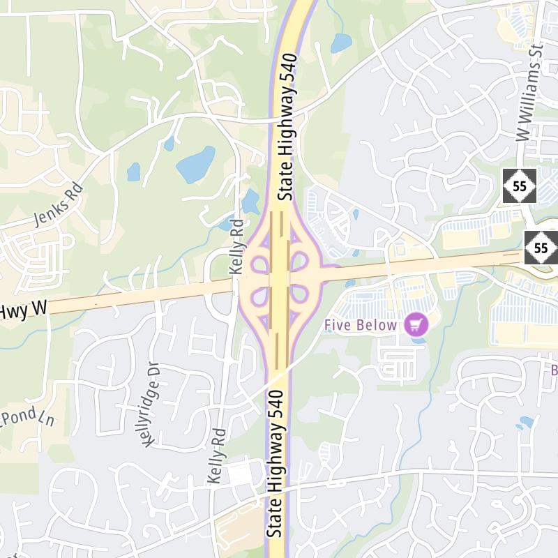
The static map seen here shows a segment of The Triangle Expressway at Green Level West Rd.. The entirety of The Triangle Expressway can be seen in the fully-interactive map above, which includes linked markers. You may resize and reposition the interactive map to orient the road in relation to other landmarks.

There is also a complete list of exits below.

View Map Exit / POI List

Advertising
Advertising

What Does It Cost To Use The Triangle Expressway?

Tolls For Cars, SUVs, Pickups, etc.

▹ Toll as of January 1, 2024.

The total toll for using the Triangle Expressway is $3.94, if you are using a compatible transponder, RFID sticker or other pass.

NOTE: The rates shown are the maximum toll incurred. Your trip may have a lower rate.

Transponders You Can Use

For drivers paying with a transponder, the following passes will work on the Triangle Expressway

  • e-zpass
  • epass xtra
  • i-pass
  • quick pass
  • riverlink
  • sunpass pro
  • uni

Learn about transponders and accounts in North Carolina.

Without a compatible pass or transponder, the toll will be $6.04.

View MapAll Tolls / Calculator ▸

Our new toll and trip calculator is being constructed. For most roads, you can still use the legacy calculator for current, accurate tolls.

Discover North Carolina Attractions

Turnpikes.com has partnered with Tiqets.com to bring you these excusive deals on attractions!

Advertising
Advertising

List Of Exits / Points Of Interest For The Triangle Expressway

Select an exit or other location to get a separate map, including locations of available gas, EV charging, fast-food and other dining options, plus current weather and driving conditions.

Davis Drive

Exit 2Davis Drive — Cary

View Map & Info

▸ GPS 35.870591000 X -78.865599000
NOTES:

manages this segment.

Hopson Road

Exit 3Hopson Road — Cary

View Map & Info

▸ GPS 35.876580000 X -78.866715000
NOTES:

manages this segment.

I-40 / I-885

Exit 5A/5BI-40 / I-885 — Durham

View Map & Info

▸ GPS 35.900704000 X -78.875091000
NOTES: N.C. 885 continues as I-885 / Research Triangle Park

manages this segment.

NC 55 Bypass

Exit 54NC 55 Bypass — Apex

View Map & Info

▸ GPS 35.687862000 X -78.840216000
NOTES: Apex / Beginning/End of expressway

manages this segment.

T33/T34 Mainline Toll Gantry

T33/T34 Mainline Toll Gantry — Apex

View Map & Info

▸ GPS 35.688289000 X -78.849659000
NOTES:

manages this segment.

T35/36 Mainline Toll Gantry

T35/36 Mainline Toll Gantry — Holly Springs

View Map & Info

▸ GPS 35.680852000 X -78.822246000
NOTES:

manages this segment.

Veridea Parkway

Exit 55Veridea Parkway — Apex

View Map & Info

▸ GPS 35.689221000 X -78.861897000
NOTES:

manages this segment.

U.S. Hwy 1

Exit 56A/56BU.S. Hwy 1 — Apex

View Map & Info

▸ GPS 35.697187000 X -78.871673000
NOTES:

manages this segment.

Salem Street / Old US 1

Exit 57Salem Street / Old US 1 — Apex

View Map & Info

▸ GPS 35.708958000 X -78.880124000
NOTES:

manages this segment.

Holly Springs Road

Exit 50Holly Springs Road — Holly Springs

View Map & Info

▸ GPS 35.675353000 X -78.793393000
NOTES:

manages this segment.

T25/T26 Mainline Toll Gantry

T25/T26 Mainline Toll Gantry — Apex

View Map & Info

▸ GPS 35.717338000 X -78.884333000
NOTES:

manages this segment.

T37/38 Mainline Toll Gantry

T37/38 Mainline Toll Gantry — Cary

View Map & Info

▸ GPS 35.676661000 X -78.758999000
NOTES:

manages this segment.

U.S. Hwy 64

Exit 59A/59BU.S. Hwy 64 — Apex

View Map & Info

▸ GPS 35.747009000 X -78.891898000
NOTES:

manages this segment.

Bells Lake Road

Exit 47Bells Lake Road — Oxford Greene

View Map & Info

▸ GPS 35.674949000 X -78.744380000
NOTES:

manages this segment.

T39/40 Mainline Toll Gantry

T39/40 Mainline Toll Gantry — Fuquay-Varina

View Map & Info

▸ GPS 35.665607000 X -78.720528000
NOTES:

manages this segment.

Green Level West Rd.

Exit 62Green Level West Rd. — Cary

View Map & Info

▸ GPS 35.783267000 X -78.886283000
NOTES:

manages this segment.

U.S. Hwy 401

Exit 45U.S. Hwy 401 — Fuquay-Varina

View Map & Info

▸ GPS 35.655361000 X -78.705398000
NOTES:

manages this segment.

T17/T18 Mainline Toll Gantry

T17/T18 Mainline Toll Gantry — Cary

View Map & Info

▸ GPS 35.792196000 X -78.888594000
NOTES:

manages this segment.

T41/42 Mainline Toll Gantry

T41/42 Mainline Toll Gantry — Laneridge

View Map & Info

▸ GPS 35.649956000 X -78.680093000
NOTES:

manages this segment.

Morrisville Parkway

Exit 64Morrisville Parkway — Cary

View Map & Info

▸ GPS 35.809125000 X -78.892293000
NOTES:

manages this segment.

Old Stage Road

Exit 43Old Stage Road — Garner

View Map & Info

▸ GPS 35.646626000 X -78.669281000
NOTES:

manages this segment.

T15/T16 Mainline Toll Gantry

T15/T16 Mainline Toll Gantry — Cary

View Map & Info

▸ GPS 35.830926000 X -78.892529000
NOTES:

manages this segment.

N.C. 55

Exit 66A/66BN.C. 55 — Cary

View Map & Info

▸ GPS 35.840694000 X -78.886509000
NOTES:

manages this segment.

T43/44 Mainilne Toll Gantry

T43/44 Mainilne Toll Gantry — Garner

View Map & Info

▸ GPS 35.626340000 X -78.629686000
NOTES:

manages this segment.

N.C. 885 / to I-885

Exit 67N.C. 885 / to I-885 — Cary

View Map & Info

▸ GPS 35.853031000 X -78.861465000
NOTES:

manages this segment.

T13/T14 Mainline Toll Gantry

T13/T14 Mainline Toll Gantry — Morrisville

View Map & Info

▸ GPS 35.856887000 X -78.857438000
NOTES:

manages this segment.

N.C. 50 / Benson Road

Exit 39N.C. 50 / Benson Road — Garner

View Map & Info

▸ GPS 35.622995000 X -78.606290000
NOTES:

manages this segment.

Chapel Hill Road / N.C. 54

Exit 69Chapel Hill Road / N.C. 54 — Morrisville

View Map & Info

▸ GPS 35.861293000 X -78.845215000
NOTES: N.C. 540 continues as I-540

manages this segment.

T45/46 Mainline Toll TGantry

T45/46 Mainline Toll TGantry — Garner

View Map & Info

▸ GPS 35.627539000 X -78.589963000
NOTES:

manages this segment.

I-40

Exit 36I-40 — Garner

View Map & Info

▸ GPS 35.636306000 X -78.565955000
NOTES: NC 540 continues EB as I-42 / US 70

manages this segment.

Advertising
Advertising

EXPLORE NORTH CAROLINA

Journey to key destinations around and adjacent to North Carolina!

Map Of This Region ▹

Communities in this metro area include Charlotte, Wesley Chapel, Monroe, Unionville, and Fairview.

Individual toll maps for this region are listed below.

Map Of This Region ▹

Communities in this metro area include Raleigh, Durham, Apex, Morrisville, Carpenter, and Chapel Hill.

Individual toll maps for this region are listed below.

Map Of This Region ▹

Communities in this metro area include Norfolk, Chesapeake, Virginia Beach, Newport News, Portsmouth, Suffolk, and Moyock, North Carolina.

Individual toll maps for this region are listed below.

Map Of This Region ▹

Communities in this metro area include Greenville, Spartanburg, Piedmont, Simpsonville, Anderson, and Asheville, North Carolina.

Individual toll maps for this region are listed below.

Advertising
Advertising
Turnpikes.com is proud to partner with the following: