This map of the Monroe Expressway displays markers for exits and tolling points, which you can select to get a close-up map of that point of interest or location.
The points-of-interest shown on this map are also listed below, ordered from west to east.
See below for more comprehensive information about the Monroe Expressway
US 74 BYPASS is another name used for this roadway. This local toll road serves several key cities, including Charlotte, Monroe, Fairview, Unionville, and Wingate.
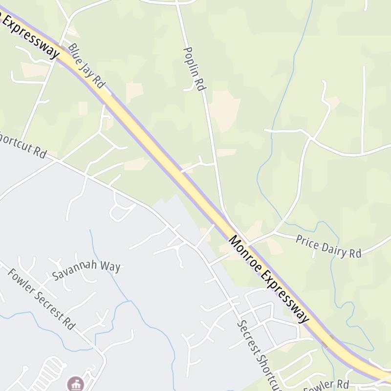
The static map seen here shows a segment of The Monroe Expressway at M07/M08 Mainline Toll Gantry. The entirety of The Monroe Expressway can be seen in the fully-interactive map above, which includes linked markers. You may resize and reposition the interactive map to orient the road in relation to other landmarks.
There is also a complete list of exits below.
Tolls For Cars, SUVs, Pickups, etc.
▹ Toll as of January 1, 2024.
The total toll for using the Monroe Expressway is $2.85, if you are using a compatible transponder, RFID sticker or other pass.
NOTE: The rates shown are the maximum toll incurred. Your trip may have a lower rate.
For drivers paying with a transponder, the following passes will work on the Monroe Expressway
Learn about transponders and accounts in North Carolina.
Without a compatible pass or transponder, the toll will be $4.39.
View MapAll Tolls / Calculator ▸
Our new toll and trip calculator is being constructed. For most roads, you can still use the legacy calculator for current, accurate tolls.
Turnpikes.com has partnered with Tiqets.com to bring you these excusive deals on attractions!
Select an exit or other location to get a separate map, including locations of available gas, EV charging, fast-food and other dining options, plus current weather and driving conditions.
Exit 255U.S. Hwy 74 (West) — Stallings
▸ GPS 35.096848000 X -80.674440000
NOTES: West terminus of U.S. 74 Bypass
M01/M02 Mainline Toll Gantry — Lake Park
▸ GPS 35.092683000 X -80.660149000
NOTES:
Exit 257Indian Trail-Fairview Road — Lake Park
▸ GPS 35.097981000 X -80.639050000
NOTES: to Indian Trail, Hemby Bridge or Fairview / Charlotte National Golf Club
M03/M04 Mainline Toll Gantry — Lake Park
▸ GPS 35.086491000 X -80.619502000
NOTES:
Exit 259Unionville-Indian Trail Road — Unionville
▸ GPS 35.076991000 X -80.610873000
NOTES: to Wesley Chapel
M05/M06 Mainline Toll Gantry — Unionville
▸ GPS 35.069346000 X -80.601660000
NOTES:
Exit 260Rocky River Road — Unionville
▸ GPS 35.063376000 X -80.593035000
NOTES: to Charlotte-Monroe Executive Airport
M07/M08 Mainline Toll Gantry — Unionville
▸ GPS 35.047455000 X -80.570673000
NOTES:
Exit 264U.S. Hwy 601 — Unionville
▸ GPS 35.027907000 X -80.539778000
NOTES: Monroe / Unionville
M09/M10 Mainline Toll Gantry — Unionville
▸ GPS 35.019381000 X -80.528038000
NOTES:
Exit 266Morgan Mill Road — Unionville
▸ GPS 35.011408000 X -80.516126000
NOTES:
M11/M12 Mainline Toll Gantry — Unionville
▸ GPS 35.003297000 X -80.488077000
NOTES:
Exit 270Austin Chaney Road — Wingate
▸ GPS 34.997691000 X -80.448788000
NOTES: Wingate
M13/M14 Mainline Toll Gantry — Wingate
▸ GPS 34.989598000 X -80.413005000
NOTES:
Exit 273U.S. Hwy 74 (East) — Marshville
▸ GPS 34.984446000 X -80.401403000
NOTES: East terminus of U.S. 74 Bypass
Journey to key destinations around and adjacent to North Carolina!
Communities in this metro area include Charlotte, Wesley Chapel, Monroe, Unionville, and Fairview.
Individual toll maps for this region are listed below.
Communities in this metro area include Raleigh, Durham, Apex, Morrisville, Carpenter, and Chapel Hill.
Individual toll maps for this region are listed below.
Communities in this metro area include Norfolk, Chesapeake, Virginia Beach, Newport News, Portsmouth, Suffolk, and Moyock, North Carolina.
Individual toll maps for this region are listed below.
Communities in this metro area include Greenville, Spartanburg, Piedmont, Simpsonville, Anderson, and Asheville, North Carolina.
Individual toll maps for this region are listed below.