Pan and zoom as desired. Tap map markers for information and to view that specific location.
Metro and regional information is below. You will also find a list of exits and other points-of-interest in the East Central Michigan area. Exit lists below are sorted by the name of the toll road.
The East Central Michigan area includes the following cities: Port Huron, Flint, Saginaw, and Bay City.
The interactive metro/regional map above shows exits and toll points for each toll road that is in, or crosses into, the East Central Michigan area.
Markers can be selected for a map of that specific exit, toll gantry or other point of interest. Exit maps will show you nearby dining, gas, EV charging, hotels and other services.
The following (3) toll roads are in this area, cross through this area or connect with this region:
Selecting a road will reveal a map of that toll road.
Turnpikes.com has partnered with Tiqets.com to bring you these excusive deals on attractions!
A list of all exits and other points-of-interest in this region, sorted by toll road.
Exit 274Water Street — Port Huron Charter Township
▸ GPS 42.991718656 X -82.451400134
NOTES: Last EB exit before bridge
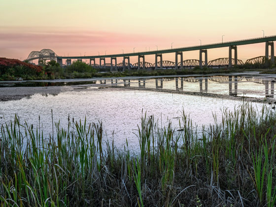
MDOT Blue Water Bridge manages this segment.
Pine Grove Ave / Hancock St
▸ GPS 42.995539739 X -82.443293746
NOTES: No bridge access
MDOT Blue Water Bridge manages this segment.
US Bridge Toll Plaza — Port Huron Charter Township
▸ GPS 42.998154459 X -82.435602270
NOTES: EB tolls from US
MDOT Blue Water Bridge manages this segment.
▸ GPS 42.998800299 X -82.435748783
NOTES: WB US Customs and Border Protection checkpoint
MDOT Blue Water Bridge manages this segment.
▸ GPS 42.998705925 X -82.423462870
NOTES: St Clair River
MDOT Blue Water Bridge manages this segment.
▸ GPS 42.993446011 X -82.411894816
NOTES: Canada Border Services Agency checkpoint
FBCL Blue Water Bridge manages this segment.
▸ GPS 42.993360152 X -82.413465931
NOTES: Canada Border Services Agency checkpoint for trucks only
FBCL Blue Water Bridge manages this segment.
Canada Bridge Toll Plaza — Point Edward
▸ GPS 42.993207772 X -82.411102091
NOTES: WB tolls from Canada
FBCL Blue Water Bridge manages this segment.
Exit 1Front Street N — Point Edward
▸ GPS 42.988258715 X -82.403796444
NOTES: Last exit WB Ont 402 before bridge
FBCL Blue Water Bridge manages this segment.
North Walnut Street — Bay City
▸ GPS 43.602747000 X -83.898174000
NOTES: West side of span / intersection of Vermont & Walnut
Liberty Bridge bascule — Bay City
▸ GPS 43.604680000 X -83.890371000
NOTES: Vermont Street drawbridge
Toll gantry — Bay City
▸ GPS 43.604537000 X -83.888820000
NOTES:
Washington Avenue — Bay City
▸ GPS 43.604325000 X -83.886903000
NOTES: East side of span / intersection of Woodside & Washington Ave
Woodside Avenue — Bay City
▸ GPS 43.605697000 X -83.868242000
NOTES: South side of span / intersection of Harry S Truman Pkwy & Woodwide
Toll gantry — Bay City
▸ GPS 43.610876000 X -83.872253000
NOTES: Expected location of new gantry
Independece Bridge bascule — Bay City
▸ GPS 43.613238000 X -83.872744000
NOTES: Truman Parkway drawbridge
Marquette Avenue — Bay City
▸ GPS 43.616807000 X -83.873240000
NOTES: North side of span / intersection of Truman Parkway and Marquette
We have partnered with Hotels.com to help you get the best deal on hotels.
We have partnered with Tiqets to bring you deals on dining and attractions.
Journey to key destinations around and adjacent to Michigan!
Communities in this metro area include Detroit, Grosse Ile, Ann Arbor, Pontiac, and Lansing.
Individual toll maps for this region are listed below.
Communities in this metro area include St Ignace and Sault Ste Marie.
Individual toll maps for this region are listed below.
Communities in this metro area include Port Huron, Flint, Saginaw, and Bay City.
Individual toll maps for this region are listed below.
Communities in this metro area include Toledo, Perrysburg, Maumee, Montpelier, and Wauseon.
Individual toll maps for this region are listed below.
Communities in this metro area include Sault Ste Marie, Thunder Bay, Fort Frances, and Greater Sudbury.
Individual toll maps for this region are listed below.
Communities in this metro area include Windsor.
Individual toll maps for this region are listed below.