Independence Bridge At Independece Bridge Bascule

Advertising
Advertising

Your selected location relative to roadway

See below for more about this area

Advertising
Advertising

About This Location

Independece Bridge bascule

At A Glance

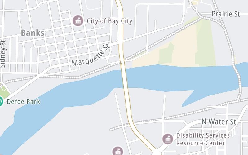
This junction is located in Bay City. NOTE: Truman Parkway drawbridge.

This location is in the East Central Michigan area.

Interactive Map Above

This location's approximate GPS Coordinates are 43.61324 x -83.87274.

Which directions can I travel from here?

From this junction, traffic can enter traveling both southbound and northbound. Traffic can also exit traveling both southbound and northbound.

On to Marquette Avenue, about 0.2 miles away ►

◄ Back to Toll gantry, about 0.2 miles away.

Which direction are tolls charged here?

Tolls are not charged or collected at this junction.

View Map Travel Conditions

Above: Map image © TomTom Intl BV

Using The POI Map

The interactive map will help you orient this location in relationship to other junctions.

Current driving conditions and weather may also be found below the map.

View Map Weather

Static map of Independence Bridge at Independece Bridge bascule
Static map. Interactive map is above.
Advertising
Advertising

Travel Conditions At Independece Bridge bascule

Current Weather And Visibility

  • 19 7 03
  • Mostly Cloudy

    37°F / C

    Feels Like:

    32°F / -0.2°C

  • Visibility

    11 Mi / 17.7 Km

    3-Hour Precip:

    0 In / 0.0 Cm

  • Northwest
    Winds (NW)

    9.7 MPH / 15.6 KPH

    Gusts:

    16.2 MPH / 26.1 KPH

▸ Get the full forecast for the East Central Michigan area

Available Cameras

No camera feed …

There is no currently-available traffic camera feed for this location.

Advertising
Advertising

Travel Pictures

No photos …

There are no currently-available photos for this location.

Advertising
Advertising

EXPLORE MICHIGAN

Journey to key destinations around and adjacent to Michigan!

Map Of This Region ▹

Communities in this metro area include Detroit, Grosse Ile, Ann Arbor, Pontiac, and Lansing.

Individual toll maps for this region are listed below.

Map Of This Region ▹

Communities in this metro area include St Ignace and Sault Ste Marie.

Individual toll maps for this region are listed below.

Map Of This Region ▹

Communities in this metro area include Port Huron, Flint, Saginaw, and Bay City.

Individual toll maps for this region are listed below.

Map Of This Region ▹

Communities in this metro area include Toledo, Perrysburg, Maumee, Montpelier, and Wauseon.

Individual toll maps for this region are listed below.

Map Of This Region ▹

Communities in this metro area include Sault Ste Marie, Thunder Bay, Fort Frances, and Greater Sudbury.

Individual toll maps for this region are listed below.

Map Of This Region ▹

Communities in this metro area include Windsor.

Individual toll maps for this region are listed below.

Advertising
Advertising
Turnpikes.com is proud to partner with the following: