At A Glance
This toll point is located in Port Huron Charter Township. EB tolls from US.
This location is in the East Central Michigan area; it also overlaps with the Southwestern Ontario area.
This location's approximate GPS Coordinates are 42.99815 x -82.43560.
On to US Bridge Toll Plaza, about 0.0 miles away ►
◄ Back to Pine Grove Ave / Hancock St, about 0.5 miles away.
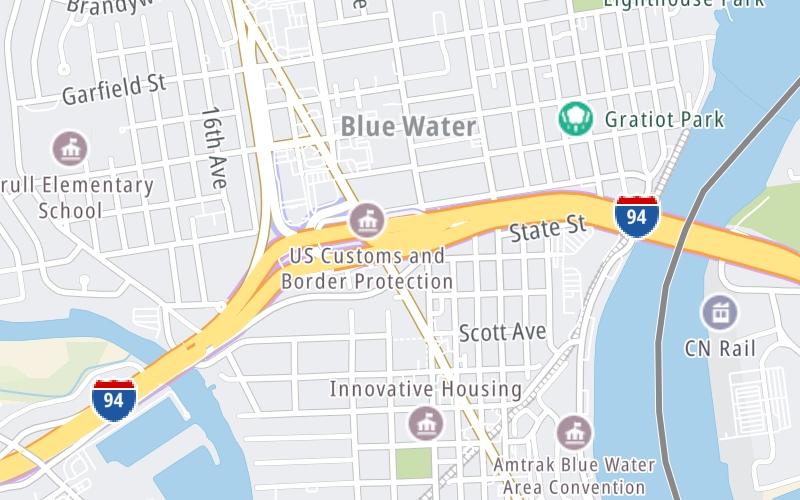
Above: Map image © TomTom Intl BVUsing The POI Map
The interactive map will help you orient this location in relationship to other junctions.
Current driving conditions and weather may also be found below the map.
Because of the nature of this location, no services are displayed. On most exit or junction pages, a summary of the closest services around the junction will be shown, along with detailed lists of services within two miles.


 Ambassador Bridge ▹
 Detroit Windsor Tunnel ▹
 Mackinac Bridge ▹
 Liberty Bridge ▹
 Independence Bridge ▹
 Ohio Turnpike ▹
 Indiana Toll Road ▹