Mackinac Bridge At Bridge Authority Toll Plaza

Advertising
Advertising

Your selected location relative to roadway

See below for more about this area

Advertising
Advertising

About This Location

Bridge Authority Toll Plaza

At A Glance

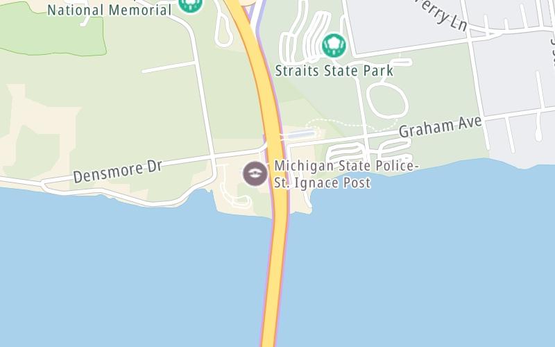
This toll point is located in St Ignace.

This location is in the Eastern Upper Peninsula area; it also overlaps with the Northern Ontario area.

Interactive Map Above

This location's approximate GPS Coordinates are 45.84828 x -84.72369.

On to US Hwy 2 / I-75 Bus. Loop, about 0.6 miles away ►

◄ Back to E Jamet Street, about 4.6 miles away.

View Map Travel Conditions

Above: Map image © TomTom Intl BV

Using The POI Map

The interactive map will help you orient this location in relationship to other junctions.

Current driving conditions and weather may also be found below the map.

View Map Weather

Static map of Mackinac Bridge at Bridge Authority Toll Plaza
Static map. Interactive map is above.
Advertising
Advertising

Travel Conditions At Bridge Authority Toll Plaza

Current Weather And Visibility

  • 19 7 03
  • Cloudy

    32°F / C

    Feels Like:

    30°F / -1.1°C

  • Visibility

    10 Mi / 16.1 Km

    3-Hour Precip:

    0 In / 0.0 Cm

  • Northwest
    Winds (NW)

    6.9 MPH / 11.1 KPH

    Gusts:

    11 MPH / 17.6 KPH

▸ Get the full forecast for the Eastern Upper Peninsula area

Available Cameras

No camera feed …

There is no currently-available traffic camera feed for this location.

Advertising
Advertising

Travel Pictures

No photos …

There are no currently-available photos for this location.

Advertising
Advertising

EXPLORE MICHIGAN

Journey to key destinations around and adjacent to Michigan!

Map Of This Region ▹

Communities in this metro area include Detroit, Grosse Ile, Ann Arbor, Pontiac, and Lansing.

Individual toll maps for this region are listed below.

Map Of This Region ▹

Communities in this metro area include St Ignace and Sault Ste Marie.

Individual toll maps for this region are listed below.

Map Of This Region ▹

Communities in this metro area include Port Huron, Flint, Saginaw, and Bay City.

Individual toll maps for this region are listed below.

Map Of This Region ▹

Communities in this metro area include Toledo, Perrysburg, Maumee, Montpelier, and Wauseon.

Individual toll maps for this region are listed below.

Map Of This Region ▹

Communities in this metro area include Sault Ste Marie, Thunder Bay, Fort Frances, and Greater Sudbury.

Individual toll maps for this region are listed below.

Map Of This Region ▹

Communities in this metro area include Windsor.

Individual toll maps for this region are listed below.

Advertising
Advertising
Turnpikes.com is proud to partner with the following: