Map & services within two (2) miles
Interactive map shows available cameras, plus nearby fuel, food and lodging


See below for more about this area
Interactive map shows available cameras, plus nearby fuel, food and lodging
See below for more about this area
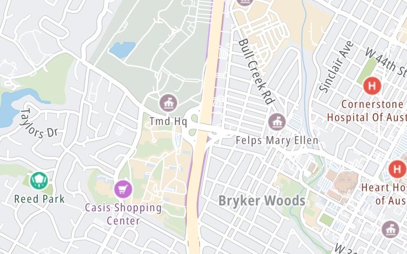
This junction is located in Austin.
This location is in the Austin - Round Rock area.
This location's approximate GPS Coordinates are 30.30901 x -97.75745.
Which directions can I travel from here?
From this junction, traffic can enter traveling both southbound and northbound. Traffic can also exit traveling both southbound and northbound.
On to W 45th Streeet , about 0.9 miles away ►
◄ Back to Northwood Rd / Westover Rd, about 0.6 miles away.
Which direction are tolls charged here?
Tolls are not charged or collected at this junction.
Above: Map image © TomTom Intl BVThe interactive map and lists on this page include key traveler services within two miles of this destination point.
You will find common services, including gas stations, truck stops, EV charging facilities, fast-food or family restaurants, and hotels. These are displayed on the interactive map as markers, which you can select for more information.
Current driving conditions and weather, along with a more complete list of key services, may be found below the map.

Clear
63°F / 17.2°C
Feels Like:
61°F / 16.2°C
Visibility
10 Mi / 16.1 Km
3-Hour Precip:
0 In / 0.0 Cm
Northeast
Winds (NE)
6.9 MPH / 11.1 KPH
Gusts:
6.9 MPH / 11.1 KPH
▸ Get the full forecast for This Location | The Austin - Round Rock area
Conditions and forecasts provided in partnership with AccuWeather.

Weather provided in partnership with AccuWeather.

TX-1 @ BEE CAVE RD
Camera Direction: SOUTH. Source: TXDOT - Austin 78746
Cameras Closest To W 35th Street
3.31 Mi
There are no currently-available photos for this location.
The map above shows all services within about a two (2) mile radius.

Destination Travel

Closest Gas Stations
SHELL
2701 Exposition Boulevard • 0.56 miles
Store/Fuel Brand: Shell
DEVS SHELL
4001 Medical Parkway • 0.90 miles
Store/Fuel Brand: Shell
EXXON
3515 North Lamar Boulevard • 0.90 miles
Store/Fuel Brand: Exxon
SHELL
3201 North Lamar Boulevard • 0.90 miles
Store/Fuel Brand: Shell
Closest EV Chargers
CHARGEPOINT
2200 West 35th St. Camp Mabry 1 mile track near • 0.53 miles
CONNECTOR: IEC62196Type1
POWER: 6 KW @ 240 V
CURRENT: 27 Amp AC1
CHARGEPOINT
2710 Exposition Boulevard • 0.57 miles
CONNECTOR: IEC62196Type1
POWER: 6 KW @ 240 V
CURRENT: 27 Amp AC1
CHARGEPOINT
2710 Exposition Boulevard • 0.57 miles
CONNECTOR: IEC62196Type1
POWER: 6 KW @ 240 V
CURRENT: 27 Amp AC1
CHARGEPOINT
4318 1/2 Bull Creek Road • 0.62 miles
CONNECTOR: IEC62196Type1
POWER: 6 KW @ 240 V
CURRENT: 27 Amp AC1

Closest Fast Food
Fast food refers ONLY to quick-service and take-out diners. All restaurant types are shown on the map above.
BOSTON MARKET
3520 North Lamar Boulevard • 0.86 miles
KOLACHE FACTORY
3706 North Lamar Boulevard • 0.87 miles
P. TERRY'S
3303 North Lamar Boulevard • 0.90 miles
RUDYS 'COUNTRY STORE' & BBQ
3914 North Lamar Boulevard • 0.92 miles
TACO SHACK
4002 North Lamar Boulevard • 0.95 miles
WENDY'S
1615 West 35th Street • 1,928 feet
TACO SHACK
4412 1/2 Medical Parkway • 1.00 miles
STINSON'S BISTRO
4416 Burnet Road • 1.02 miles
Journey to key destinations around and adjacent to Texas!
Communities in this metro area include Dallas, Fort Worth, Plano, Addison, Frisco, Grand Prairie, Arlington, Carrrollton, and Lake Dallas.
Individual toll maps for this region are listed below.
Communities in this metro area include Houston, Humble, Tomball, Sugar Land, Galveston, Pearland, and Katy.
Individual toll maps for this region are listed below.
Communities in this metro area include Austin, Pflugerville, Round Rock, Georgetown, Cedar Park, Mustang Ridge, Manor, Serenada, Sunset Valley, and Hutto.
Individual toll maps for this region are listed below.
Communities in this metro area include Tyler, Wood Springs, Noonday, and Whitehouse.
Individual toll maps for this region are listed below.

Communities in this metro area include Brownsville, Heroica Matamoros, Tamaulipas, San Benito, Harlingen, and Rancho Viejo.
Individual toll maps for this region are listed below.

Communities in this metro area include Lawton, Fort Sill, Geronimo, and Cache.
Individual toll maps for this region are listed below.


 Addison Airport Toll Tunnel ▹
 Chisholm Trail Parkway ▹
 Dallas North Tollway ▹
 Lewisville Lake Toll Bridge ▹
 Mountain Creek Lake Toll Bridge ▹
 President George Bush Turnpike ▹
 Sam Rayburn Tollway ▹
 360 Tollway ▹
 Grand Parkway ▹
 Hardy Toll Road ▹
 Sam Houston Tollway ▹
 Tomball Tollway ▹
 Westpark Tollway ▹
 Loop 1 ▹
 SH 130 ▹
 SH 45 N ▹
 SH 45 SW ▹
 183A Toll Road ▹
 183 Toll Road ▹
 290 Toll Road ▹
 71 Toll Road ▹
 Toll 49 ▹
 SH 550 ▹
 H E Bailey Turnpike ▹


