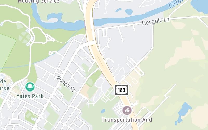
Share

183 Toll Road At Thompson Lane Mainline NB Gantry

Advertising
Advertising

About This Location

Thompson Lane Mainline NB Gantry
Map image © TomTom Intl BV

At A Glance

This toll point is located in Austin.

This location is in the Austin - Round Rock area.

Interactive Map Below

This location's approximate GPS Coordinates are 30.23959 x -97.68820.

On to Montopolis Dr, about 0.2 miles away ►

◄ Back to Thompson Lane Mainline SB Gantry, about 0.3 miles away.

View Map Travel Conditions

Advertising
Advertising

Interactive POI Map

The interactive map will help you orient this location in relationship to other junctions.

Current driving conditions and weather may be found below.

Advertising
Advertising

Travel Conditions At Thompson Lane Mainline NB Gantry

Current Weather And Visibility

  • 20 7 12
  • Cloudy

    43°F / C

    Feels Like:

    41°F / 5.2°C

  • Visibility

    10 Mi / 16.1 Km

    3-Hour Precip:

    0 In / 0.0 Cm

  • North
    Winds (N)

    6 MPH / 9.7 KPH

    Gusts:

    12.1 MPH / 19.5 KPH

▸ Get the full forecast for the Austin - Round Rock area

Available Cameras

SH-71 WB @ E RIVERSIDE DR 7700

Camera direction: NORTH. Austin 78741.
Source: TXDOT.

Camera direction: NORTH. Austin 78741.<br />Source: TXDOT -

1.44 Mi

Camera direction: EAST. Austin 78719.<br />Source: TXDOT -

2.57 Mi

Camera direction: NORTH. Austin 78741.<br />Source: TXDOT -

2.84 Mi

Camera direction: SOUTH. Austin 78704.<br />Source: TXDOT -

2.91 Mi

Camera direction: NORTH. Austin 78741.<br />Source: TXDOT -

3.15 Mi

Advertising
Advertising

Pictures At Thompson Lane Mainline NB Gantry

No photos …

There are no currently-available photos for this location.

Advertising
Advertising

Discover Texas Attractions

Hotels and destinations header

Hotels & Airports

Destination Travel

Advertising
Advertising

EXPLORE TEXAS

Journey to key destinations around and adjacent to Texas!

Map Of This Region ▹

Communities in this metro area include Dallas, Fort Worth, Plano, Addison, Frisco, Grand Prairie, Arlington, Carrrollton, and Lake Dallas.

Individual toll maps for this region are listed below.

Map Of This Region ▹

Communities in this metro area include Houston, Humble, Tomball, Sugar Land, Galveston, Pearland, and Katy.

Individual toll maps for this region are listed below.

Map Of This Region ▹

Communities in this metro area include Austin, Pflugerville, Round Rock, Georgetown, Cedar Park, Mustang Ridge, Manor, Serenada, Sunset Valley, and Hutto.

Individual toll maps for this region are listed below.

Map Of This Region ▹

Communities in this metro area include Tyler, Wood Springs, Noonday, and Whitehouse.

Individual toll maps for this region are listed below.

Map Of This Region ▹

Communities in this metro area include Brownsville, Heroica Matamoros, Tamaulipas, San Benito, Harlingen, and Rancho Viejo.

Individual toll maps for this region are listed below.

Map Of This Region ▹

Communities in this metro area include Lawton, Fort Sill, Geronimo, and Cache.

Individual toll maps for this region are listed below.

Static map of 183 Toll Road at Thompson Lane Mainline NB Gantry

Static map. Interactive map is above.

Advertising
Advertising
Turnpikes.com is proud to partner with the following: