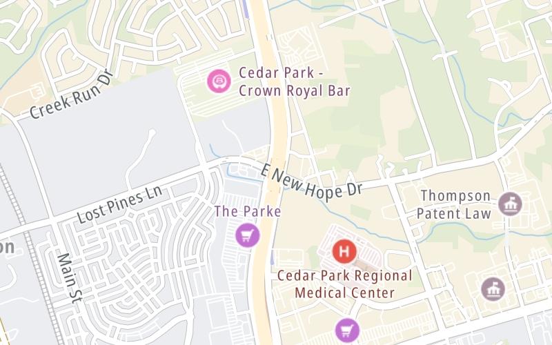
This junction is located in Cedar Park. Austin is nearby.
This location is in the Austin - Round Rock area.
This location's approximate GPS Coordinates are 30.53689 x -97.81625.
Which directions can I travel from here?
From this junction, traffic can enter traveling both southbound and northbound. Traffic can also exit traveling both southbound and northbound.
On to Scottsdale Dr, about 1.0 mile away ►
◄ Back to Whitestone Blvd, about 0.8 miles away.
Which direction are tolls charged here?
Tolls are not charged or collected at this junction.
Use the map below for all services within about a two (2) mile radius.
Closest Gas Stations
MURPHY EXPRESS
1454 East Whitestone Boulevard • 0.81 miles
Store/Fuel Brand: Murphy Express

EXXON
1601 East Whitestone Boulevard • 0.85 miles
Store/Fuel Brand: Exxon

QUIKTRIP
1911 North Bell Boulevard • 1.19 miles
Store/Fuel Brand: QuikTrip

EXXON
1000 North Bell Boulevard • 1.39 miles
Store/Fuel Brand: Exxon
Closest EV Chargers
Closest Fast Food
Fast food refers ONLY to quick-service and take-out diners. All restaurant types are shown on the map below.
GREAT AMERICAN COOKIES
5001 183 A Toll Rd • 0.41 miles
IKE'S LOVE & SANDWICHES
1335 East Whitestone Boulevard • 0.48 miles
MOD PIZZA PARK EAST
4807 183 A Toll Rd • 0.51 miles

PIZZA HUT EXPRESS
1101 C-Bar Ranch Trl • 0.61 miles
COSTCO FOOD COURT
4601 183 A Toll Rd • 0.70 miles
MIGHTY FINE BURGERS CEDAR PARK
1335 East Whitestone Boulevard • 0.71 miles

CHICK-FIL-A
1325 East Whitestone Boulevard • 0.73 miles
EINSTEIN BROTHERS BAGELS
1465 East Whitestone Boulevard • 0.74 miles
The interactive map and lists on this page include key traveler services in a two-mile radius, including gas stations, truck stops, EV charging facilities, fast-food or family restaurants, and hotels.
Current driving conditions and weather, may be found below.

Mostly Cloudy
40°F / 4.5°C
Feels Like:
39°F / 4°C
Visibility
12 Mi / 19.3 Km
3-Hour Precip:
0 In / 0.0 Cm
North
Winds (N)
6.2 MPH / 9.9 KPH
Gusts:
11.6 MPH / 18.7 KPH
▸ Get the full forecast for This Location | The Austin - Round Rock area
No camera feed …
There is no currently-available traffic camera feed for this location.
There are no currently-available photos for this location.
Destination Travel
Journey to key destinations around and adjacent to Texas!
Communities in this metro area include Dallas, Fort Worth, Plano, Addison, Frisco, Grand Prairie, Arlington, Carrrollton, and Lake Dallas.
Individual toll maps for this region are listed below.
Communities in this metro area include Houston, Humble, Tomball, Sugar Land, Galveston, Pearland, and Katy.
Individual toll maps for this region are listed below.
Communities in this metro area include Austin, Pflugerville, Round Rock, Georgetown, Cedar Park, Mustang Ridge, Manor, Serenada, Sunset Valley, and Hutto.
Individual toll maps for this region are listed below.
Communities in this metro area include Tyler, Wood Springs, Noonday, and Whitehouse.
Individual toll maps for this region are listed below.
Communities in this metro area include Brownsville, Heroica Matamoros, Tamaulipas, San Benito, Harlingen, and Rancho Viejo.
Individual toll maps for this region are listed below.
Communities in this metro area include Lawton, Fort Sill, Geronimo, and Cache.
Individual toll maps for this region are listed below.