Map & services within two (2) miles
Interactive map shows available cameras, plus nearby fuel, food and lodging


See below for more about this area
Interactive map shows available cameras, plus nearby fuel, food and lodging
See below for more about this area
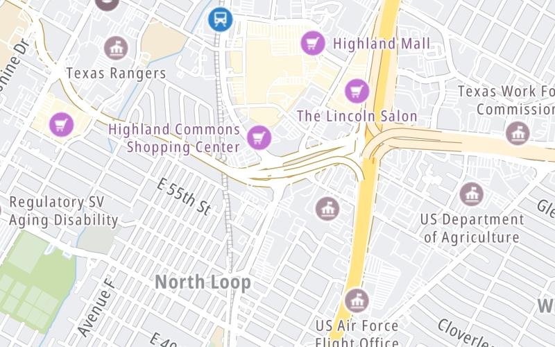
This junction is located in Austin. NOTE: North Loop.
This location is in the Austin - Round Rock area.
This location's approximate GPS Coordinates are 30.32036 x -97.71264.
Which directions can I travel from here?
From this junction, traffic can only enter going eastbound. Traffic can only exit going westbound.
On to I-35, about 0.4 miles away ►
◄ Back to Koenig Ln / 290 Toll west terminus, about 0.2 miles away.
Which direction are tolls charged here?
Tolls are not charged or collected at this junction.
Above: Map image © TomTom Intl BVThe interactive map and lists on this page include key traveler services within two miles of this destination point.
You will find common services, including gas stations, truck stops, EV charging facilities, fast-food or family restaurants, and hotels. These are displayed on the interactive map as markers, which you can select for more information.
Current driving conditions and weather, along with a more complete list of key services, may be found below the map.

Partly Cloudy
61°F / 16.1°C
Feels Like:
63°F / 17.3°C
Visibility
10 Mi / 16.1 Km
3-Hour Precip:
0 In / 0.0 Cm
North
Winds (N)
0 MPH / 0 KPH
Gusts:
3.2 MPH / 5.2 KPH
▸ Get the full forecast for This Location | The Austin - Round Rock area
Conditions and forecasts provided in partnership with AccuWeather.

Weather provided in partnership with AccuWeather.
There is no currently-available traffic camera feed for this location.
There are no currently-available photos for this location.
The map above shows all services within about a two (2) mile radius.

Destination Travel

Closest Gas Stations
CASA MIA FURNITURE
5453 North Interstate 35 • 0.47 miles
Store/Fuel Brand:
CIRCLE K
5407 North Interstate 35 • 0.55 miles
Store/Fuel Brand: Circle K
SNAPPY MART
500 East 51st Street • 0.58 miles
Store/Fuel Brand:
SHELL
6515 Airport Boulevard • 0.69 miles
Store/Fuel Brand: Shell
Closest EV Chargers
WINDSOR PARK TOWERS
6007 North Interstate Highway 35 • 0.40 miles
CONNECTOR: IEC62196Type1
POWER: 7 KW @ 240 V
CURRENT: 30 Amp AC1
6310 WILHELMINA DELCO DRIVE #10
6310 Wilhelmina Delco Drive • 0.41 miles
CONNECTOR: IEC62196Type1
POWER: 6 KW @ 240 V
CURRENT: 27 Amp AC1
CHARGEPOINT
6310 Wilhelmina Delco Drive • 0.43 miles
CONNECTOR: IEC62196Type1
POWER: 6 KW @ 240 V
CURRENT: 27 Amp AC1
CHARGEPOINT
112 Will Davis Drive • 0.51 miles
CONNECTOR: IEC62196Type1
POWER: 6 KW @ 240 V
CURRENT: 27 Amp AC1

Closest Fast Food
Fast food refers ONLY to quick-service and take-out diners. All restaurant types are shown on the map above.
GREAT AMERICAN COOKIES
6001 Airport Boulevard • 0.39 miles
P. TERRY'S
I-35 North • 0.41 miles
JEWBOY BURGERS
5111 Airport Boulevard • 0.55 miles
WINGSTOP
5455 North Interstate 35 • 0.57 miles
MRBEAST BURGER
500 East 51st Street • 0.58 miles
MCDONALD'S
• 0.59 miles
JACK IN THE BOX
6419 Airport Boulevard • 0.63 miles
A&W
5600 Cameron Road • 0.66 miles
Journey to key destinations around and adjacent to Texas!
Communities in this metro area include Dallas, Fort Worth, Plano, Addison, Frisco, Grand Prairie, Arlington, Carrrollton, and Lake Dallas.
Individual toll maps for this region are listed below.
Communities in this metro area include Houston, Humble, Tomball, Sugar Land, Galveston, Pearland, and Katy.
Individual toll maps for this region are listed below.
Communities in this metro area include Austin, Pflugerville, Round Rock, Georgetown, Cedar Park, Mustang Ridge, Manor, Serenada, Sunset Valley, and Hutto.
Individual toll maps for this region are listed below.
Communities in this metro area include Tyler, Wood Springs, Noonday, and Whitehouse.
Individual toll maps for this region are listed below.

Communities in this metro area include Brownsville, Heroica Matamoros, Tamaulipas, San Benito, Harlingen, and Rancho Viejo.
Individual toll maps for this region are listed below.

Communities in this metro area include Lawton, Fort Sill, Geronimo, and Cache.
Individual toll maps for this region are listed below.


 Addison Airport Toll Tunnel ▹
 Chisholm Trail Parkway ▹
 Dallas North Tollway ▹
 Lewisville Lake Toll Bridge ▹
 Mountain Creek Lake Toll Bridge ▹
 President George Bush Turnpike ▹
 Sam Rayburn Tollway ▹
 360 Tollway ▹
 Grand Parkway ▹
 Hardy Toll Road ▹
 Sam Houston Tollway ▹
 Tomball Tollway ▹
 Westpark Tollway ▹
 Loop 1 ▹
 SH 130 ▹
 SH 45 N ▹
 SH 45 SW ▹
 183A Toll Road ▹
 183 Toll Road ▹
 290 Toll Road ▹
 71 Toll Road ▹
 Toll 49 ▹
 SH 550 ▹
 H E Bailey Turnpike ▹


