Map & services within two (2) miles
Interactive map shows available cameras, plus nearby fuel, food and lodging


See below for more about this area
Interactive map shows available cameras, plus nearby fuel, food and lodging
See below for more about this area
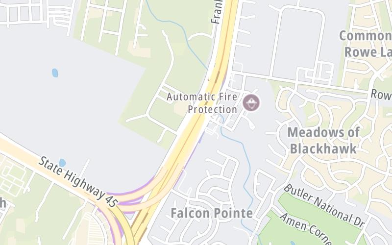
This is Exit 428B SB of SH 130.
This junction is located in Pflugerville. Austin is nearby. NOTE: SB 130 to 45 N WB / 45 N EB to 130 NB.
This location is in the Austin - Round Rock area.
This location's approximate GPS Coordinates are 30.48090 x -97.58707.
Which directions can I travel from here?
From this junction, traffic can only enter going northbound. Traffic can only exit going southbound.
On to SH 45 North WB, about 1.2 miles away ►
◄ Back to Kelly Lane / Wilke Ln, about 0.3 miles away.
▹ SH 130 and Sh 45 N connect here.
Which direction are tolls charged here?
Tolls are not charged or collected at this junction.
Above: Map image © TomTom Intl BVThe interactive map and lists on this page include key traveler services within two miles of this destination point.
You will find common services, including gas stations, truck stops, EV charging facilities, fast-food or family restaurants, and hotels. These are displayed on the interactive map as markers, which you can select for more information.
Current driving conditions and weather, along with a more complete list of key services, may be found below the map.

Partly Cloudy
65°F / 18.4°C
Feels Like:
64°F / 17.7°C
Visibility
9 Mi / 14.5 Km
3-Hour Precip:
0 In / 0.0 Cm
Northeast
Winds (NE)
1.8 MPH / 3 KPH
Gusts:
4.3 MPH / 7 KPH
▸ Get the full forecast for This Location | The Austin - Round Rock area
Conditions and forecasts provided in partnership with AccuWeather.

Weather provided in partnership with AccuWeather.
There is no currently-available traffic camera feed for this location.
There are no currently-available photos for this location.
The map above shows all services within about a two (2) mile radius.

Destination Travel

Closest Gas Stations
TIMEWISE FOOD STORE
1909 Kelly Lane • 0.83 miles
Store/Fuel Brand: Timewise Food Store
COSTCO
1901 Kelly Ln • 0.83 miles
Store/Fuel Brand: Costco
CHEVRON
20205 Farm-to-Market 685 • 1,639 feet
Store/Fuel Brand: Chevron
VALERO
4500 Gattis School Road • 1.25 miles
Store/Fuel Brand: Valero
Closest EV Chargers
[325545] STRR STONE HILL TOWN CENTER
19009 Limestone Commercial Drive • 0.77 miles
CONNECTOR: IEC62196Type1
POWER: 17 KW @ 270 V
CURRENT: 64 Amp AC1
STONE HILL TOWN CENTER
18820 Hilltop Commercial Drive • 1.02 miles
CONNECTOR: IEC62196Type1
POWER: 9 KW @ 240 V
CURRENT: 40 Amp AC1
CHARGEPOINT
19025 North Heatherwilde Boulevard • 1.53 miles
CONNECTOR: IEC62196Type1
POWER: 6 KW @ 240 V
CURRENT: 27 Amp AC1
HUTTO, TX SUPERCHARGER
5000 Gattis School Road • 1.56 miles
CONNECTOR: Tesla
POWER: 250 KW @ 400 V
CURRENT: 625 Amp DC

Closest Fast Food
Fast food refers ONLY to quick-service and take-out diners. All restaurant types are shown on the map above.
TROPICAL SMOOTHIE CAFE
2100 Autumn Slate Drive • 0.91 miles
MOD PIZZA
18817 Limestone Commercial Drive • 0.96 miles
P. TERRY'S BURGER STAND
18801 Farm-to-Market 685 • 0.98 miles
WINGSTOP
18816 Limestone Commercial Drive • 0.98 miles
TORCHY'S TACOS
18817 Limestone Commercial Drive • 0.99 miles
FAST FILLY BURGERS
1908 Fast Filly Avenue • 1.03 miles
SMOOTHIE KING
18701 Limestone Commercial Drive • 1.13 miles
DOMINO'S
18701 Limestone Commercial Drive • 1.14 miles
Journey to key destinations around and adjacent to Texas!
Communities in this metro area include Dallas, Fort Worth, Plano, Addison, Frisco, Grand Prairie, Arlington, Carrrollton, and Lake Dallas.
Individual toll maps for this region are listed below.
Communities in this metro area include Houston, Humble, Tomball, Sugar Land, Galveston, Pearland, and Katy.
Individual toll maps for this region are listed below.
Communities in this metro area include Austin, Pflugerville, Round Rock, Georgetown, Cedar Park, Mustang Ridge, Manor, Serenada, Sunset Valley, and Hutto.
Individual toll maps for this region are listed below.
Communities in this metro area include Tyler, Wood Springs, Noonday, and Whitehouse.
Individual toll maps for this region are listed below.

Communities in this metro area include Brownsville, Heroica Matamoros, Tamaulipas, San Benito, Harlingen, and Rancho Viejo.
Individual toll maps for this region are listed below.

Communities in this metro area include Lawton, Fort Sill, Geronimo, and Cache.
Individual toll maps for this region are listed below.


 Addison Airport Toll Tunnel ▹
 Chisholm Trail Parkway ▹
 Dallas North Tollway ▹
 Lewisville Lake Toll Bridge ▹
 Mountain Creek Lake Toll Bridge ▹
 President George Bush Turnpike ▹
 Sam Rayburn Tollway ▹
 360 Tollway ▹
 Grand Parkway ▹
 Hardy Toll Road ▹
 Sam Houston Tollway ▹
 Tomball Tollway ▹
 Westpark Tollway ▹
 Loop 1 ▹
 SH 130 ▹
 SH 45 N ▹
 SH 45 SW ▹
 183A Toll Road ▹
 183 Toll Road ▹
 290 Toll Road ▹
 71 Toll Road ▹
 Toll 49 ▹
 SH 550 ▹
 H E Bailey Turnpike ▹


