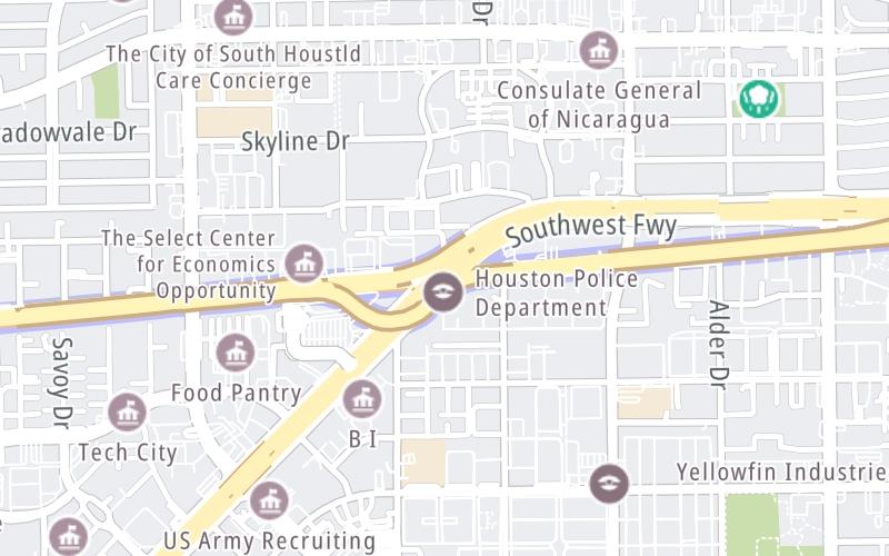
Map & services within two (2) miles
Interactive map shows available cameras, plus nearby fuel, food and lodging


See below for more about this area
Interactive map shows available cameras, plus nearby fuel, food and lodging
See below for more about this area
This junction is located in Houston.
This location is in the Houston - Galveston area.
This location's approximate GPS Coordinates are 29.72353 x -95.49131.
Which directions can I travel from here?
From this junction, traffic can enter traveling both westbound and eastbound. Traffic can also exit traveling both westbound and eastbound.
On to Westpark Dr / S Rice Ave, about 1.4 miles away ►
◄ Back to Fondren Road, about 1.7 miles away.
Which direction are tolls charged here?
Tolls are not charged or collected at this junction.
Above: Map image © TomTom Intl BVThe interactive map and lists on this page include key traveler services within two miles of this destination point.
You will find common services, including gas stations, truck stops, EV charging facilities, fast-food or family restaurants, and hotels. These are displayed on the interactive map as markers, which you can select for more information.
Current driving conditions and weather, along with a more complete list of key services, may be found below the map.

Clear
68°F / 20°C
Feels Like:
69°F / 20.8°C
Visibility
6 Mi / 9.7 Km
3-Hour Precip:
0 In / 0.0 Cm
East Northeast
Winds (ENE)
1.2 MPH / 2 KPH
Gusts:
3.7 MPH / 6 KPH
▸ Get the full forecast for This Location | The Houston - Galveston area
Conditions and forecasts provided in partnership with AccuWeather.

Weather provided in partnership with AccuWeather.
There is no currently-available traffic camera feed for this location.
There are no currently-available photos for this location.
The map above shows all services within about a two (2) mile radius.

Destination Travel

Closest Gas Stations
CHEVRON
6010 Southwest Freeway • 0.44 miles
Store/Fuel Brand: Chevron
HANDI STOP
Rampart Street • 0.49 miles
Store/Fuel Brand:
CHEVRON
6223 Richmond Avenue • 0.53 miles
Store/Fuel Brand: Chevron
BEST STOP FOOD MARKET
5902 Gulfton Street • 0.59 miles
Store/Fuel Brand:
Closest EV Chargers
ATRIUM REGENCY APARTMENTS
5655 Glenmont Drive • 0.74 miles
CONNECTOR: IEC62196Type1
POWER: 8 KW @ 270 V
CURRENT: 32 Amp AC1
CHARGEPOINT
5803 Richmond Avenue • 0.83 miles
CONNECTOR: IEC62196Type1
POWER: 19 KW @ 240 V
CURRENT: 80 Amp AC1
5718 WESTHEINER
5718 Westheimer Road • 1.28 miles
CONNECTOR: IEC62196Type1
POWER: 6 KW @ 208 V
CURRENT: 30 Amp AC1
CHARGEPOINT
6220 Westpark Drive • 615 feet
CONNECTOR: IEC62196Type1
POWER: 6 KW @ 240 V
CURRENT: 27 Amp AC1

Closest Fast Food
Fast food refers ONLY to quick-service and take-out diners. All restaurant types are shown on the map above.
WHATABURGER
6520 Southwest Freeway • 0.55 miles
BOMBAY SWEETS
5827 Hillcroft Avenue • 0.63 miles
FRUTERIA QUEENS
3640 Hillcroft Avenue • 0.63 miles
BUSY BOY SANDWICHES
5722 Hillcroft Avenue • 0.64 miles
WENDY'S
6101 Hillcroft Avenue • 0.67 miles
JACK IN THE BOX
6006 Hillcroft Avenue • 0.70 miles
MCDONALD'S
6000 Richmond Avenue • 0.71 miles
KFC
6050 Hillcroft Avenue • 0.71 miles
Journey to key destinations around and adjacent to Texas!
Communities in this metro area include Dallas, Fort Worth, Plano, Addison, Frisco, Grand Prairie, Arlington, Carrrollton, and Lake Dallas.
Individual toll maps for this region are listed below.
Communities in this metro area include Houston, Humble, Tomball, Sugar Land, Galveston, Pearland, and Katy.
Individual toll maps for this region are listed below.
Communities in this metro area include Austin, Pflugerville, Round Rock, Georgetown, Cedar Park, Mustang Ridge, Manor, Serenada, Sunset Valley, and Hutto.
Individual toll maps for this region are listed below.
Communities in this metro area include Tyler, Wood Springs, Noonday, and Whitehouse.
Individual toll maps for this region are listed below.

Communities in this metro area include Brownsville, Heroica Matamoros, Tamaulipas, San Benito, Harlingen, and Rancho Viejo.
Individual toll maps for this region are listed below.

Communities in this metro area include Lawton, Fort Sill, Geronimo, and Cache.
Individual toll maps for this region are listed below.


 Addison Airport Toll Tunnel ▹
 Chisholm Trail Parkway ▹
 Dallas North Tollway ▹
 Lewisville Lake Toll Bridge ▹
 Mountain Creek Lake Toll Bridge ▹
 President George Bush Turnpike ▹
 Sam Rayburn Tollway ▹
 360 Tollway ▹
 Grand Parkway ▹
 Hardy Toll Road ▹
 Sam Houston Tollway ▹
 Tomball Tollway ▹
 Westpark Tollway ▹
 Loop 1 ▹
 SH 130 ▹
 SH 45 N ▹
 SH 45 SW ▹
 183A Toll Road ▹
 183 Toll Road ▹
 290 Toll Road ▹
 71 Toll Road ▹
 Toll 49 ▹
 SH 550 ▹
 H E Bailey Turnpike ▹


