Map & services within two (2) miles
Interactive map shows available cameras, plus nearby fuel, food and lodging


See below for more about this area
Interactive map shows available cameras, plus nearby fuel, food and lodging
See below for more about this area
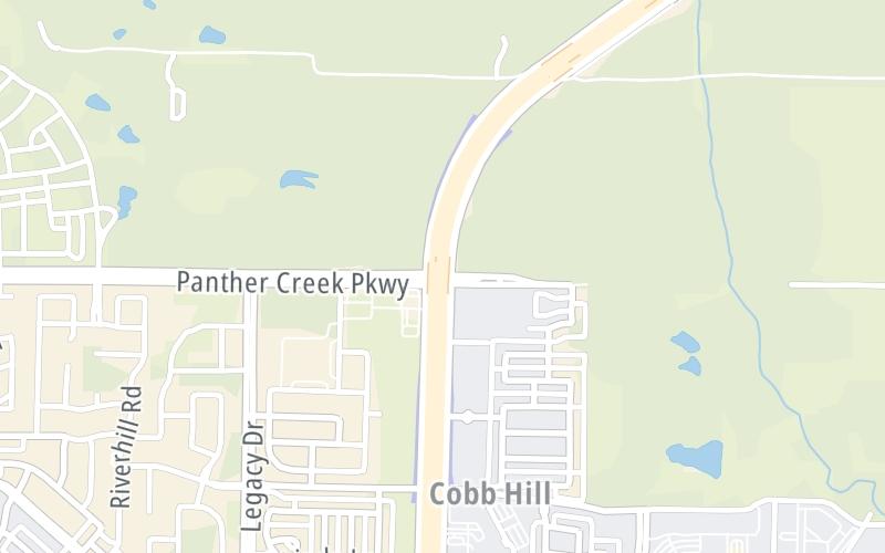
This junction is located in Frisco.
This location is in the Dallas - Fort Worth area.
This location's approximate GPS Coordinates are 33.18980 x -96.83888.
Which directions can I travel from here?
From this junction, traffic can enter traveling both southbound and northbound. Traffic can also exit traveling both southbound and northbound.
On to US 380/University Drive, about 2.5 miles away ►
◄ Back to Eldorado Parkway / Cobb Hill Dr./Longwood Dr., about 1.0 mile away.
Which direction are tolls charged here?
Tolls are not charged or collected at this junction.
Above: Map image © TomTom Intl BVThe interactive map and lists on this page include key traveler services within two miles of this destination point.
You will find common services, including gas stations, truck stops, EV charging facilities, fast-food or family restaurants, and hotels. These are displayed on the interactive map as markers, which you can select for more information.
Current driving conditions and weather, along with a more complete list of key services, may be found below the map.

Cloudy
62°F / 16.6°C
Feels Like:
63°F / 17.2°C
Visibility
14 Mi / 22.5 Km
3-Hour Precip:
0 In / 0.0 Cm
Southeast
Winds (SE)
5.3 MPH / 8.6 KPH
Gusts:
10.4 MPH / 16.7 KPH
▸ Get the full forecast for This Location | The Dallas - Fort Worth area
Conditions and forecasts provided in partnership with AccuWeather.

Weather provided in partnership with AccuWeather.
There is no currently-available traffic camera feed for this location.
There are no currently-available photos for this location.
The map above shows all services within about a two (2) mile radius.

Destination Travel

Closest Gas Stations
QUIKTRIP
5530 Eldorado Parkway • 0.99 miles
Store/Fuel Brand: QuikTrip
UNITED EXPRESS
• 0.99 miles
Store/Fuel Brand: United Express
MARKET STREET UNITED #562
11725 Dallas Parkway • 0.99 miles
Store/Fuel Brand:
COSTCO
11220 Dallas Pkwy • 1.06 miles
Store/Fuel Brand: Costco
Closest EV Chargers
BREA FRISCO
12330 Research Boulevard • 1.05 miles
CONNECTOR: IEC62196Type1
POWER: 8 KW @ 270 V
CURRENT: 32 Amp AC1
VALE FRISCO APARTMENTS
12050 Research Road • 1.17 miles
CONNECTOR: IEC62196Type1
POWER: 8 KW @ 270 V
CURRENT: 32 Amp AC1
SATORI FRISCO APARTMENTS
11900 Research Road • 1.21 miles
CONNECTOR: IEC62196Type1
POWER: 10 KW @ 270 V
CURRENT: 40 Amp AC1
THE LINKS ON PGA PARKWAY APARTMENTS
15950 Paramount Way • 1.44 miles
CONNECTOR: IEC62196Type1
POWER: 7 KW @ 240 V
CURRENT: 30 Amp AC1

Closest Fast Food
Fast food refers ONLY to quick-service and take-out diners. All restaurant types are shown on the map above.
COFFEE 'N CREAM
11660 Legacy Drive • 0.97 miles
JERSEY MIKE'S SUBS
5110 Eldorado Parkway • 0.99 miles
RAISING CANE'S
5220 Eldorado Parkway • 0.99 miles
TACO BELL
5656 Eldorado Parkway • 0.99 miles
TROPICAL SMOOTHIE CAFE
5110 Eldorado Parkway • 1.00 miles
SCOTTY P'S
5110 Eldorado Parkway • 1.01 miles
THE HALAL GUYS
4880 Eldorado Parkway • 1.03 miles
CHIPOTLE
4770 Eldorado Parkway • 1.04 miles
Journey to key destinations around and adjacent to Texas!
Communities in this metro area include Dallas, Fort Worth, Plano, Addison, Frisco, Grand Prairie, Arlington, Carrrollton, and Lake Dallas.
Individual toll maps for this region are listed below.
Communities in this metro area include Houston, Humble, Tomball, Sugar Land, Galveston, Pearland, and Katy.
Individual toll maps for this region are listed below.
Communities in this metro area include Austin, Pflugerville, Round Rock, Georgetown, Cedar Park, Mustang Ridge, Manor, Serenada, Sunset Valley, and Hutto.
Individual toll maps for this region are listed below.
Communities in this metro area include Tyler, Wood Springs, Noonday, and Whitehouse.
Individual toll maps for this region are listed below.

Communities in this metro area include Brownsville, Heroica Matamoros, Tamaulipas, San Benito, Harlingen, and Rancho Viejo.
Individual toll maps for this region are listed below.

Communities in this metro area include Lawton, Fort Sill, Geronimo, and Cache.
Individual toll maps for this region are listed below.


 Addison Airport Toll Tunnel ▹
 Chisholm Trail Parkway ▹
 Dallas North Tollway ▹
 Lewisville Lake Toll Bridge ▹
 Mountain Creek Lake Toll Bridge ▹
 President George Bush Turnpike ▹
 Sam Rayburn Tollway ▹
 360 Tollway ▹
 Grand Parkway ▹
 Hardy Toll Road ▹
 Sam Houston Tollway ▹
 Tomball Tollway ▹
 Westpark Tollway ▹
 Loop 1 ▹
 SH 130 ▹
 SH 45 N ▹
 SH 45 SW ▹
 183A Toll Road ▹
 183 Toll Road ▹
 290 Toll Road ▹
 71 Toll Road ▹
 Toll 49 ▹
 SH 550 ▹
 H E Bailey Turnpike ▹


