Map & services within two (2) miles
Interactive map shows available cameras, plus nearby fuel, food and lodging


See below for more about this area
Interactive map shows available cameras, plus nearby fuel, food and lodging
See below for more about this area
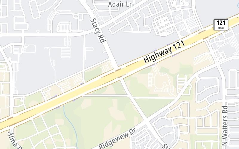
This junction is located in Allen. Dallas is nearby.
This location is in the Dallas - Fort Worth area.
This location's approximate GPS Coordinates are 33.13992 x -96.69131.
Which directions can I travel from here?
From this junction, traffic can enter traveling both southbound and northbound. Traffic can also exit traveling both southbound and northbound.
On to Lake Forest Drive/Walters Road, about 0.8 miles away ►
◄ Back to Alma Drive / Alma Rd, about 1.0 mile away.
Which direction are tolls charged here?
The interactive map and lists on this page include key traveler services within two miles of this destination point.
You will find common services, including gas stations, truck stops, EV charging facilities, fast-food or family restaurants, and hotels. These are displayed on the interactive map as markers, which you can select for more information.
Current driving conditions and weather, along with a more complete list of key services, may be found below the map.

Mostly Cloudy
81°F / 27°C
Feels Like:
83°F / 28.4°C
Visibility
12 Mi / 19.3 Km
3-Hour Precip:
0 In / 0.0 Cm
South Southeast
Winds (SSE)
5.6 MPH / 9 KPH
Gusts:
11.4 MPH / 18.3 KPH
▸ Get the full forecast for This Location | The Dallas - Fort Worth area
Conditions and forecasts provided in partnership with AccuWeather.

Weather provided in partnership with AccuWeather.
There is no currently-available traffic camera feed for this location.
There are no currently-available photos for this location.
The map above shows all services within about a two (2) mile radius.

Destination Travel

Closest Gas Stations
RACETRAC
5588 South Lake Forest Drive • 0.78 miles
Store/Fuel Brand: Racetrac
MURPHY USA
5251 McKinney Ranch Parkway • 1.35 miles
Store/Fuel Brand: Murphy USA
EXXON
3975 South Lake Forest Drive • 1.51 miles
Store/Fuel Brand: Exxon
VALERO
5010 Alma Road • 1.66 miles
Store/Fuel Brand: Valero
Closest EV Chargers
CHILDRENS HEALTH STARCENTER MCKINNEY
6993 Stars Avenue • 0.81 miles
CONNECTOR: IEC62196Type1
POWER: 9 KW @ 240 V
CURRENT: 40 Amp AC1
ALTA AT THE FARM
1287 Blue Tractor Lane • 0.89 miles
CONNECTOR: IEC62196Type1
POWER: 10 KW @ 208 V
CURRENT: 50 Amp AC1
CINEMARK
921 State Highway 121 • 1.01 miles
CONNECTOR: IEC62196Type1
POWER: 7 KW @ 240 V
CURRENT: 30 Amp AC1
CINEMARK
921 State Highway 121 • 1.01 miles
CONNECTOR: IEC62196Type1
POWER: 9 KW @ 240 V
CURRENT: 40 Amp AC1

Closest Fast Food
Fast food refers ONLY to quick-service and take-out diners. All restaurant types are shown on the map above.
AUNTIE ANNE'S
5200 Stacy Road • 0.51 miles
SHIPLEY DO-NUTS
5000 Collin McKinney Parkway • 0.95 miles
NéKTER JUICE BAR
6720 Alma Road • 0.97 miles
JERSEY MIKE'S SUBS
6720 Alma Road • 0.97 miles
I LOVE JUICE BAR
950 West Stacy Road • 1.13 miles
BLACK WALNUT CAFE-ALLEN
955 West Stacy Road • 1.16 miles
DUNKIN'
5001 McKinney Ranch Parkway • 1.24 miles
MARCO'S PIZZA
4100 South Ridge Road • 1.26 miles
Journey to key destinations around and adjacent to Texas!
Communities in this metro area include Dallas, Fort Worth, Plano, Addison, Frisco, Grand Prairie, Arlington, Carrrollton, and Lake Dallas.
Individual toll maps for this region are listed below.
Communities in this metro area include Houston, Humble, Tomball, Sugar Land, Galveston, Pearland, and Katy.
Individual toll maps for this region are listed below.
Communities in this metro area include Austin, Pflugerville, Round Rock, Georgetown, Cedar Park, Mustang Ridge, Manor, Serenada, Sunset Valley, and Hutto.
Individual toll maps for this region are listed below.
Communities in this metro area include Tyler, Wood Springs, Noonday, and Whitehouse.
Individual toll maps for this region are listed below.

Communities in this metro area include Brownsville, Heroica Matamoros, Tamaulipas, San Benito, Harlingen, and Rancho Viejo.
Individual toll maps for this region are listed below.

Communities in this metro area include Lawton, Fort Sill, Geronimo, and Cache.
Individual toll maps for this region are listed below.


 Addison Airport Toll Tunnel ▹
 Chisholm Trail Parkway ▹
 Dallas North Tollway ▹
 Lewisville Lake Toll Bridge ▹
 Mountain Creek Lake Toll Bridge ▹
 President George Bush Turnpike ▹
 Sam Rayburn Tollway ▹
 360 Tollway ▹
 Grand Parkway ▹
 Hardy Toll Road ▹
 Sam Houston Tollway ▹
 Tomball Tollway ▹
 Westpark Tollway ▹
 Loop 1 ▹
 SH 130 ▹
 SH 45 N ▹
 SH 45 SW ▹
 183A Toll Road ▹
 183 Toll Road ▹
 290 Toll Road ▹
 71 Toll Road ▹
 Toll 49 ▹
 SH 550 ▹
 H E Bailey Turnpike ▹


