Map & services within two (2) miles
Interactive map shows available cameras, plus nearby fuel, food and lodging


See below for more about this area
Interactive map shows available cameras, plus nearby fuel, food and lodging
See below for more about this area
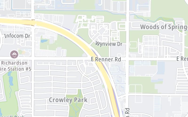
This junction is located in Richardson.
This location is in the Dallas - Fort Worth area.
This location's approximate GPS Coordinates are 32.99710 x -96.67114.
Which directions can I travel from here?
From this junction, traffic can enter traveling both westbound and eastbound. Traffic can also exit traveling both westbound and eastbound.
On to Shiloh Road, about 1.3 miles away ►
◄ Back to Jupiter Road, about 0.8 miles away.
Which direction are tolls charged here?
The interactive map and lists on this page include key traveler services within two miles of this destination point.
You will find common services, including gas stations, truck stops, EV charging facilities, fast-food or family restaurants, and hotels. These are displayed on the interactive map as markers, which you can select for more information.
Current driving conditions and weather, along with a more complete list of key services, may be found below the map.

Sunny
57°F / 14°C
Feels Like:
61°F / 16.1°C
Visibility
12 Mi / 19.3 Km
3-Hour Precip:
0 In / 0.0 Cm
East Southeast
Winds (ESE)
2.5 MPH / 4 KPH
Gusts:
6.4 MPH / 10.3 KPH
▸ Get the full forecast for This Location | The Dallas - Fort Worth area
Conditions and forecasts provided in partnership with AccuWeather.

Weather provided in partnership with AccuWeather.
There is no currently-available traffic camera feed for this location.
There are no currently-available photos for this location.
The map above shows all services within about a two (2) mile radius.

Destination Travel

Closest Gas Stations
7-ELEVEN
3601 North Jupiter Road • 0.74 miles
Store/Fuel Brand: 7-Eleven
CHEVRON
400 Jupiter Road • 0.75 miles
Store/Fuel Brand: Chevron
EXXON
520 Jupiter Road • 0.82 miles
Store/Fuel Brand: Exxon
VALERO
501 Jupiter Road • 0.83 miles
Store/Fuel Brand: Valero
Closest EV Chargers
CHARGEPOINT
2813 East President George Bush Highway • 0.39 miles
CONNECTOR: IEC62196Type1
POWER: 6 KW @ 240 V
CURRENT: 27 Amp AC1
ENCLAVE PLANO GATEWAY
3201 Wynwood Drive • 0.40 miles
CONNECTOR: IEC62196Type1
POWER: 10 KW @ 208 V
CURRENT: 50 Amp AC1
CHARGEPOINT
2601 East President George Bush Highway • 0.64 miles
CONNECTOR: IEC62196Type1
POWER: 6 KW @ 240 V
CURRENT: 27 Amp AC1
CHARGEPOINT
401 Wynhurst Drive • 1,817 feet
CONNECTOR: IEC62196Type1
POWER: 6 KW @ 240 V
CURRENT: 27 Amp AC1

Closest Fast Food
Fast food refers ONLY to quick-service and take-out diners. All restaurant types are shown on the map above.
AU BON PAIN
3304 Essex Drive • 0.63 miles
BURGER KING
2565 East President George Bush Highway • 0.72 miles
MCDONALD'S
400 Jupiter Road • 0.75 miles
RENNER PIZZA & GRILL
3601 North Jupiter Road • 0.77 miles
JERSEY MIKE'S SUBS
2040 East President George Bush Highway • 0.84 miles
NEST BURGERS
2540 East Plano Parkway • 0.85 miles
TACO BUENO
609 Jupiter Road • 0.92 miles
LIBERTY BURGER
3617 Shire Boulevard • 0.97 miles
Journey to key destinations around and adjacent to Texas!
Communities in this metro area include Dallas, Fort Worth, Plano, Addison, Frisco, Grand Prairie, Arlington, Carrrollton, and Lake Dallas.
Individual toll maps for this region are listed below.
Communities in this metro area include Houston, Humble, Tomball, Sugar Land, Galveston, Pearland, and Katy.
Individual toll maps for this region are listed below.
Communities in this metro area include Austin, Pflugerville, Round Rock, Georgetown, Cedar Park, Mustang Ridge, Manor, Serenada, Sunset Valley, and Hutto.
Individual toll maps for this region are listed below.
Communities in this metro area include Tyler, Wood Springs, Noonday, and Whitehouse.
Individual toll maps for this region are listed below.

Communities in this metro area include Brownsville, Heroica Matamoros, Tamaulipas, San Benito, Harlingen, and Rancho Viejo.
Individual toll maps for this region are listed below.

Communities in this metro area include Lawton, Fort Sill, Geronimo, and Cache.
Individual toll maps for this region are listed below.


 Addison Airport Toll Tunnel ▹
 Chisholm Trail Parkway ▹
 Dallas North Tollway ▹
 Lewisville Lake Toll Bridge ▹
 Mountain Creek Lake Toll Bridge ▹
 President George Bush Turnpike ▹
 Sam Rayburn Tollway ▹
 360 Tollway ▹
 Grand Parkway ▹
 Hardy Toll Road ▹
 Sam Houston Tollway ▹
 Tomball Tollway ▹
 Westpark Tollway ▹
 Loop 1 ▹
 SH 130 ▹
 SH 45 N ▹
 SH 45 SW ▹
 183A Toll Road ▹
 183 Toll Road ▹
 290 Toll Road ▹
 71 Toll Road ▹
 Toll 49 ▹
 SH 550 ▹
 H E Bailey Turnpike ▹


