Map & services within two (2) miles
Interactive map shows available cameras, plus nearby fuel, food and lodging


See below for more about this area
Interactive map shows available cameras, plus nearby fuel, food and lodging
See below for more about this area
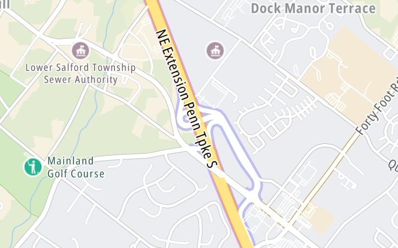
This is Exit 31 of the Pennsylvania Turnpike.
This junction is located in Harleysville. Lansdale is nearby. NOTE: Lansdale - This exit on the Northeast Extension.
This location is in the Philadelphia - Wilmington - South Jersey area; it also overlaps with the Scranton - Wilkes Barre - Allentown area.
This location's approximate GPS Coordinates are 40.25132 x -75.34730.
This junction is located on the Northeast Extension.
Which directions can I travel from here?
From this junction, traffic can enter traveling both southbound and northbound. Traffic can also exit traveling both southbound and northbound.
On to Toll Gantry T 031, about 312.3 miles away ►
◄ Back to Toll Gantry A 027, about 3.0 miles away.
Which direction are tolls charged here?
The interactive map and lists on this page include key traveler services within two miles of this destination point.
You will find common services, including gas stations, truck stops, EV charging facilities, fast-food or family restaurants, and hotels. These are displayed on the interactive map as markers, which you can select for more information.
Current driving conditions and weather, along with a more complete list of key services, may be found below the map.

Sunny
51°F / 10.6°C
Feels Like:
54°F / 12.3°C
Visibility
10 Mi / 16.1 Km
3-Hour Precip:
0 In / 0.0 Cm
Northwest
Winds (NW)
6.6 MPH / 10.7 KPH
Gusts:
12.6 MPH / 20.3 KPH
▸ Get the full forecast for This Location | The Philadelphia - Wilmington - South Jersey area
Conditions and forecasts provided in partnership with AccuWeather.

Weather provided in partnership with AccuWeather.
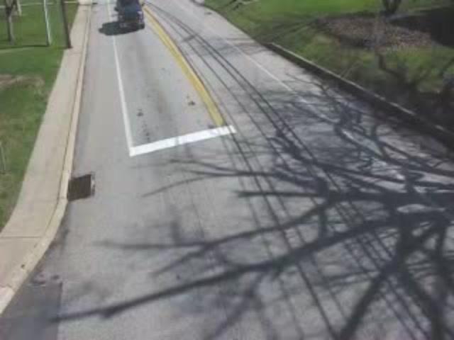
SUMNEYTOWN PIKE @ KULP RD
Camera Direction: NORTH. Source: PennDOT - Allentown 19438
Cameras Closest To PA 63
2.50 Mi
3.22 Mi
There are no currently-available photos for this location.
The map above shows all services within about a two (2) mile radius.

Destination Travel

Closest Gas Stations
ROYAL FARMS
1780 Sumneytown Pike • 0.47 miles
Store/Fuel Brand: Royal Farms
LUKOIL
1685 Sumneytown Pike • 0.64 miles
Store/Fuel Brand: LUKOIL
WAWA FOOD MARKET
1555 Bustard Road • 0.65 miles
Store/Fuel Brand: Wawa Food Market
WAWA FOOD MARKET
140 Forty Foot Road • 0.69 miles
Store/Fuel Brand: Wawa Food Market
Closest EV Chargers
SRE HARLEYSVILLE
2060 Detwiler Road • 0.38 miles
CONNECTOR: IEC62196Type1
POWER: 7 KW @ 240 V
CURRENT: 30 Amp AC1

Closest Fast Food
Fast food refers ONLY to quick-service and take-out diners. All restaurant types are shown on the map above.
WENDY'S
1758 Allentown Road • 1.25 miles
FREDDY'S
220 Forty Foot Road • 1.56 miles
CHICK-FIL-A
210 Forty Foot Road • 1.59 miles
TACO BELL
• 1.60 miles
WAWA
200 Forty Foot Road • 1.63 miles
Journey to key destinations around and adjacent to Pennsylvania!
Communities in this metro area include Pittsburgh, Cranberry Township, Beaver Valley, New Castle, Washington, Uniontown, Cheat Lake, West Virginia, Boardman, Ohio, and Youngstown, Ohio.
Individual toll maps for this region are listed below.
Communities in this metro area include Harrisburg, Mechanicsburg, Carlisle, Hershey, and York.
Individual toll maps for this region are listed below.
Communities in this metro area include Philadelphia, King Of Prussia, Valley Forge, West Chester, Bristol, Burlington, New Jersey, Morrisville, Trenton, New Jersey, Palmyra, New Jersey, Wilmington, Delaware, and Camden, New Jersey.
Individual toll maps for this region are listed below.

Roads Within Region
Communities in this metro area include Scranton, Wilkes Barre, Stroudsburg, Clarks Summit, and Knowlton Township, New Jersey.
Individual toll maps for this region are listed below.
Communities in this metro area include Camden, Burlington, Palmyra, Pennsauken, Cherry Hill, Gloucester City, Trenton, Wilmington, Delaware, Philadelphia, Pennsylvania, Tacony, Pennsylvania, and Bristol, Pennsylvania.
Individual toll maps for this region are listed below.

Roads Within Region
Communities in this metro area include Knowlton Township, Trenton, Phillipsburg, Easton, Pennsylvania, Lambertville, Ewing, Morrisville, Pennsylvania, and Stroudsburg, Pennsylvania.
Individual toll maps for this region are listed below.
Communities in this metro area include Cleveland, Akron, Boardman, Lorain, Aurora, Youngstown, New Castle, Pennsylvania, and Beaver Falls, Pennsylvania.
Individual toll maps for this region are listed below.

 PA Turnpike 66 ▹
 Beaver Valley Expressway ▹
 Mon Fayette Expressway ▹
 Pennsylvania Turnpike ▹
 Ohio Turnpike ▹
 PA Turnpike 576 ▹
 Delaware Memorial Bridge ▹
 Delaware Turnpike ▹
 Atlantic City Expressway ▹
 New Jersey Turnpike ▹
 Benjamin Franklin Bridge ▹
 Walt Whitman Bridge ▹
 Commodore Barry Bridge ▹
 Betsy Ross Bridge ▹
 Scudder Falls Toll Bridge ▹
 Trenton Morrisville Toll Bridge ▹
 Tacony Palmyra Bridge ▹
 Burlington Bristol Bridge ▹
 Milford Montague Toll Bridge ▹
 Delaware Water Gap Toll Bridge ▹
 Portland Columbia Toll Bridge ▹
 Easton Phillipsburg Toll Bridge ▹
 I78 Toll Bridge ▹
 Garden State Parkway ▹
 New Hope Lambertville Toll Bridge ▹