Map & services within two (2) miles
Interactive map shows available cameras, plus nearby fuel, food and lodging


See below for more about this area
Interactive map shows available cameras, plus nearby fuel, food and lodging
See below for more about this area
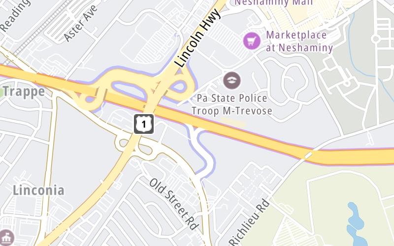
This is Exit 352 of the Pennsylvania Turnpike.
This junction is located in Feasterville. Trevose is nearby. NOTE: EB On/EB Off.
This location is in the Philadelphia - Wilmington - South Jersey area; it also overlaps with the South Jersey - Philadelphia area.
This location's approximate GPS Coordinates are 40.13020 x -74.96330.
Which directions can I travel from here?
From this junction, traffic can only enter going eastbound. Traffic can only exit going eastbound.
On to (Old 358) Delaware Valley / Bristol Pike / US 13, about 6.0 miles away ►
◄ Back to Neshaminy Falls Toll Plaza, about 0.8 miles away.
Which direction are tolls charged here?
The interactive map and lists on this page include key traveler services within two miles of this destination point.
You will find common services, including gas stations, truck stops, EV charging facilities, fast-food or family restaurants, and hotels. These are displayed on the interactive map as markers, which you can select for more information.
Current driving conditions and weather, along with a more complete list of key services, may be found below the map.

Sunny
41°F / 4.8°C
Feels Like:
40°F / 4.6°C
Visibility
10 Mi / 16.1 Km
3-Hour Precip:
0 In / 0.0 Cm
Northwest
Winds (NW)
7.1 MPH / 11.5 KPH
Gusts:
16.5 MPH / 26.5 KPH
▸ Get the full forecast for This Location | The Philadelphia - Wilmington - South Jersey area
Conditions and forecasts provided in partnership with AccuWeather.

Weather provided in partnership with AccuWeather.
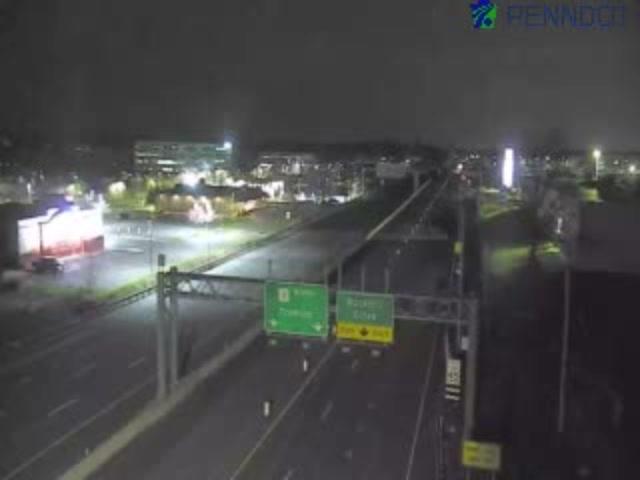
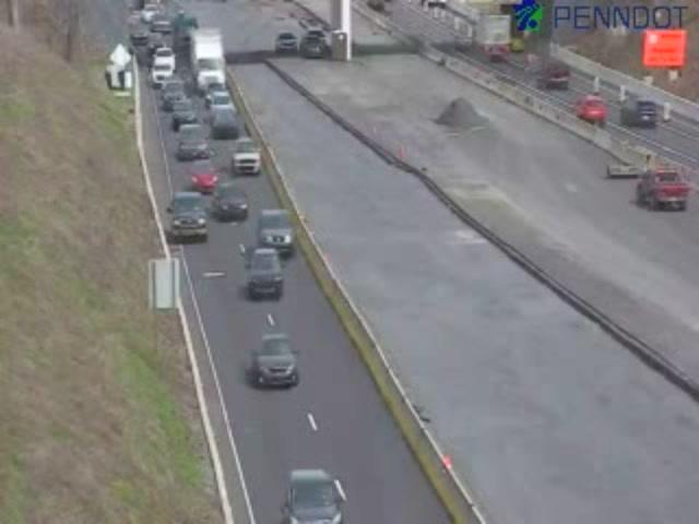
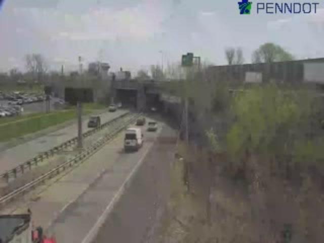
US-1 @ I-276/ PA TURNPIKE
Camera Direction: NORTH. Source: PennDOT - Trenton 19053
Cameras Closest To Street Road / US 1
0.22 Mi

0.48 Mi
0.62 Mi
0.86 Mi
0.94 Mi
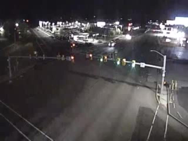
There are no currently-available photos for this location.
The map above shows all services within about a two (2) mile radius.

Destination Travel

Closest Gas Stations
APLUS
2767 Lincoln Highway • 0.51 miles
Store/Fuel Brand: Sunoco
SUNOCO
3419 Street Road • 0.62 miles
Store/Fuel Brand: Sunoco
SUPER PUMPER
2629 Lincoln Highway • 0.72 miles
Store/Fuel Brand:
CLASSIC CAR WASH
2601 Lincoln Highway • 0.74 miles
Store/Fuel Brand:
Closest EV Chargers
NESHAMINY MALL SOUTHWEST MALL ENTRANCE
707 Neshaminy Mall • 0.67 miles
CONNECTOR: IEC62196Type1CCS
POWER: 50 KW @ 400 V
CURRENT: 125 Amp DC
CHARGEPOINT
3331 Street Road • 0.70 miles
CONNECTOR: IEC62196Type1
POWER: 6 KW @ 240 V
CURRENT: 27 Amp AC1
NESHAMINY MALL AMC
707 Neshaminy Mall • 0.80 miles
CONNECTOR: IEC62196Type1
POWER: 9 KW @ 240 V
CURRENT: 40 Amp AC1
CHARGEPOINT
4437 East Street Road • 0.80 miles
CONNECTOR: IEC62196Type1
POWER: 6 KW @ 240 V
CURRENT: 27 Amp AC1

Closest Fast Food
Fast food refers ONLY to quick-service and take-out diners. All restaurant types are shown on the map above.
WENDY'S
3413 Horizon Boulevard • 0.39 miles
MCDONALD'S
3560 Horizon Boulevard • 0.47 miles
PANDA EXPRESS-ROCKHILL & LINCOLN HIGHWAY
3570 Horizon Boulevard • 0.49 miles
CHIPOTLE
3580 Horizon Boulevard • 0.50 miles
MRBEAST BURGER
3617 Horizon Boulevard • 0.51 miles
RAISING CANE'S
3617 Horizon Boulevard • 0.51 miles
CHICK-FIL-A
3621 Horizon Boulevard • 0.56 miles
MRBEAST BURGER
901 Neshaminy Mall • 0.59 miles
Journey to key destinations around and adjacent to Pennsylvania!
Communities in this metro area include Pittsburgh, Cranberry Township, Beaver Valley, New Castle, Washington, Uniontown, Cheat Lake, West Virginia, Boardman, Ohio, and Youngstown, Ohio.
Individual toll maps for this region are listed below.
Communities in this metro area include Harrisburg, Mechanicsburg, Carlisle, Hershey, and York.
Individual toll maps for this region are listed below.
Communities in this metro area include Philadelphia, King Of Prussia, Valley Forge, West Chester, Bristol, Burlington, New Jersey, Morrisville, Trenton, New Jersey, Palmyra, New Jersey, Wilmington, Delaware, and Camden, New Jersey.
Individual toll maps for this region are listed below.

Roads Within Region
Communities in this metro area include Scranton, Wilkes Barre, Stroudsburg, Clarks Summit, and Knowlton Township, New Jersey.
Individual toll maps for this region are listed below.
Communities in this metro area include Camden, Burlington, Palmyra, Pennsauken, Cherry Hill, Gloucester City, Trenton, Wilmington, Delaware, Philadelphia, Pennsylvania, Tacony, Pennsylvania, and Bristol, Pennsylvania.
Individual toll maps for this region are listed below.

Roads Within Region
Communities in this metro area include Knowlton Township, Trenton, Phillipsburg, Easton, Pennsylvania, Lambertville, Ewing, Morrisville, Pennsylvania, and Stroudsburg, Pennsylvania.
Individual toll maps for this region are listed below.
Communities in this metro area include Cleveland, Akron, Boardman, Lorain, Aurora, Youngstown, New Castle, Pennsylvania, and Beaver Falls, Pennsylvania.
Individual toll maps for this region are listed below.

 PA Turnpike 66 ▹
 Beaver Valley Expressway ▹
 Mon Fayette Expressway ▹
 Pennsylvania Turnpike ▹
 Ohio Turnpike ▹
 PA Turnpike 576 ▹
 Delaware Memorial Bridge ▹
 Delaware Turnpike ▹
 Atlantic City Expressway ▹
 New Jersey Turnpike ▹
 Benjamin Franklin Bridge ▹
 Walt Whitman Bridge ▹
 Commodore Barry Bridge ▹
 Betsy Ross Bridge ▹
 Scudder Falls Toll Bridge ▹
 Trenton Morrisville Toll Bridge ▹
 Tacony Palmyra Bridge ▹
 Burlington Bristol Bridge ▹
 Milford Montague Toll Bridge ▹
 Delaware Water Gap Toll Bridge ▹
 Portland Columbia Toll Bridge ▹
 Easton Phillipsburg Toll Bridge ▹
 I78 Toll Bridge ▹
 Garden State Parkway ▹
 New Hope Lambertville Toll Bridge ▹