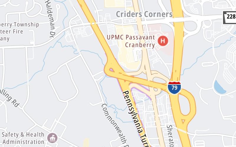
Map & services within two (2) miles
Interactive map shows available cameras, plus nearby fuel, food and lodging


See below for more about this area
Interactive map shows available cameras, plus nearby fuel, food and lodging
See below for more about this area
This is Exit 28 of the Pennsylvania Turnpike.
This junction is located in Cranberry Township. NOTE: to Pittsburgh.
This location is in the Pittsburgh - Western Pennsylvania area.
This location's approximate GPS Coordinates are 40.67930 x -80.10440.
Which directions can I travel from here?
From this junction, traffic can enter traveling both westbound and eastbound. Traffic can also exit traveling both westbound and eastbound.
On to Warrendale Toll Plaza, about 2.6 miles away ►
◄ Back to PA 18 / Big Beaver Blvd, about 15.6 miles away.
Which direction are tolls charged here?
Tolls are not charged or collected at this junction.
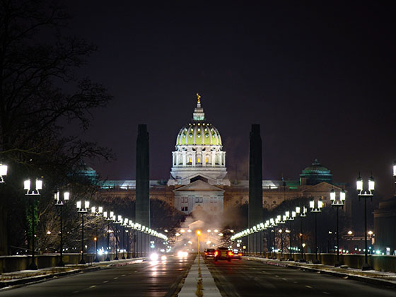
Above: Photo by Turnpikes.comThe interactive map and lists on this page include key traveler services within two miles of this destination point.
You will find common services, including gas stations, truck stops, EV charging facilities, fast-food or family restaurants, and hotels. These are displayed on the interactive map as markers, which you can select for more information.
Current driving conditions and weather, along with a more complete list of key services, may be found below the map.

Mostly Cloudy
34°F / 0.9°C
Feels Like:
31°F / -0.8°C
Visibility
10 Mi / 16.1 Km
3-Hour Precip:
0 In / 0.0 Cm
North Northwest
Winds (NNW)
5.6 MPH / 9 KPH
Gusts:
12.8 MPH / 20.6 KPH
▸ Get the full forecast for This Location | The Pittsburgh - Western Pennsylvania area
Conditions and forecasts provided in partnership with AccuWeather.

Weather provided in partnership with AccuWeather.
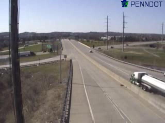
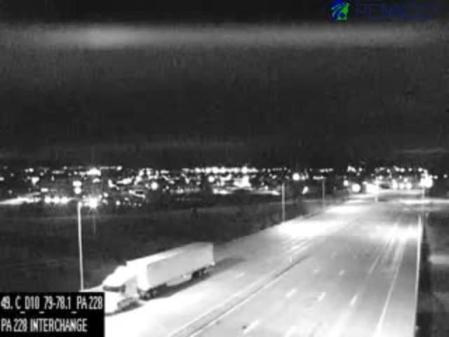
I-79 @ MM 77.7 (TURNPIKE I-76)
Camera Direction: SOUTH. Source: PennDOT - Philadelphia 16066
Cameras Closest To I-79 / US 19 / Perry Hwy
0.39 Mi
0.67 Mi
0.69 Mi
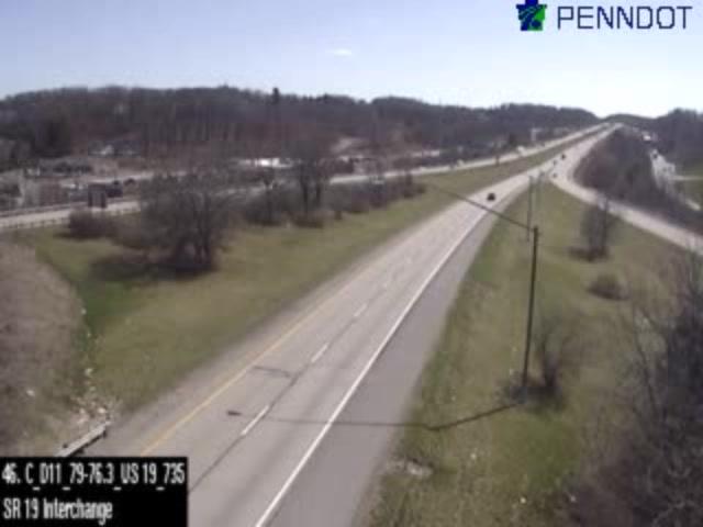
1.33 Mi

2.14 Mi
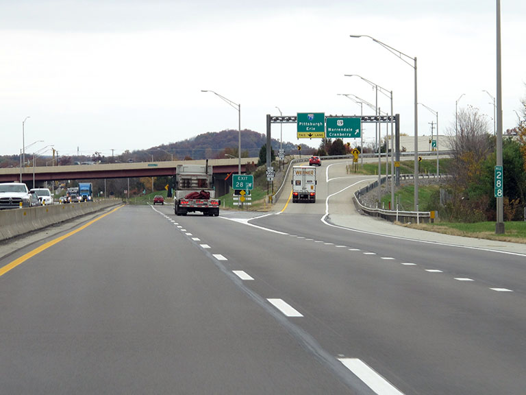
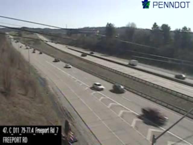
About this photo:
The westbound ramps for Exit 28, from the PA Turnpike, rise ahead on the driver's right, as a pair of ramps comes into view, one leading south to Pittsburgh, and the other north to Warrendale and Cranberry, for which the exit is named.
Photo taken 11-01-2019
More Pictures Near I-79 / US 19 / Perry Hwy


The map above shows all services within about a two (2) mile radius.

Destination Travel

Closest Gas Stations
MARATHON
20133 Route 19 • 0.38 miles
Store/Fuel Brand: Marathon
SHEETZ
1329 Freedom Road • 0.43 miles
Store/Fuel Brand: Sheetz
COSTCO
1050 Cranberry Square Drive • 0.85 miles
Store/Fuel Brand: Costco
WESCO
780 Commonwealth Drive • 1,359 feet
Store/Fuel Brand: Wesco
Closest EV Chargers
CRANBERRY TOWNSHIP, PA SUPERCHARGER
1308 Freedom Road • 0.39 miles
CONNECTOR: Tesla
POWER: 150 KW @ 400 V
CURRENT: 375 Amp DC
SHEETZ - CRANBERRY TOWNSHIP, PA
1329 Freedom Road • 0.47 miles
CONNECTOR: IEC62196Type1CCS
POWER: 350 KW @ 400 V
CURRENT: 875 Amp DC
CRANBERRY TOWNSHIP - US 19, PA SUPERCHARGER
20111 Route 19 • 1,266 feet
CONNECTOR: Tesla
POWER: 250 KW @ 400 V
CURRENT: 625 Amp DC
1737 STATE ROUTE 228
1737 Route 228 • 1.05 miles
CONNECTOR: Chademo
POWER: 150 KW @ 950 V
CURRENT: 158 Amp DC

Closest Fast Food
Fast food refers ONLY to quick-service and take-out diners. All restaurant types are shown on the map above.
CHIPOTLE
20024 Route 19 • 0.40 miles
JIMMY JOHN'S
20018 Route 19 • 0.41 miles
FIVE GUYS
20002 Route 19 • 0.47 miles
BURGER KING
20204 Route 19 • 0.48 miles
ARBY'S
19075 Perry Highway • 0.54 miles
MCDONALD'S
20245 Route 19 • 0.56 miles
KFC
20245 Route 19 • 0.59 miles
MCDONALD'S
Teddy Bear Lane • 0.60 miles
Journey to key destinations around and adjacent to Pennsylvania!
Communities in this metro area include Pittsburgh, Cranberry Township, Beaver Valley, New Castle, Washington, Uniontown, Cheat Lake, West Virginia, Boardman, Ohio, and Youngstown, Ohio.
Individual toll maps for this region are listed below.
Communities in this metro area include Harrisburg, Mechanicsburg, Carlisle, Hershey, and York.
Individual toll maps for this region are listed below.
Communities in this metro area include Philadelphia, King Of Prussia, Valley Forge, West Chester, Bristol, Burlington, New Jersey, Morrisville, Trenton, New Jersey, Palmyra, New Jersey, Wilmington, Delaware, and Camden, New Jersey.
Individual toll maps for this region are listed below.

Roads Within Region
Communities in this metro area include Scranton, Wilkes Barre, Stroudsburg, Clarks Summit, and Knowlton Township, New Jersey.
Individual toll maps for this region are listed below.
Communities in this metro area include Camden, Burlington, Palmyra, Pennsauken, Cherry Hill, Gloucester City, Trenton, Wilmington, Delaware, Philadelphia, Pennsylvania, Tacony, Pennsylvania, and Bristol, Pennsylvania.
Individual toll maps for this region are listed below.

Roads Within Region
Communities in this metro area include Knowlton Township, Trenton, Phillipsburg, Easton, Pennsylvania, Lambertville, Ewing, Morrisville, Pennsylvania, and Stroudsburg, Pennsylvania.
Individual toll maps for this region are listed below.
Communities in this metro area include Cleveland, Akron, Boardman, Lorain, Aurora, Youngstown, New Castle, Pennsylvania, and Beaver Falls, Pennsylvania.
Individual toll maps for this region are listed below.

 PA Turnpike 66 ▹
 Beaver Valley Expressway ▹
 Mon Fayette Expressway ▹
 Pennsylvania Turnpike ▹
 Ohio Turnpike ▹
 PA Turnpike 576 ▹
 Delaware Memorial Bridge ▹
 Delaware Turnpike ▹
 Atlantic City Expressway ▹
 New Jersey Turnpike ▹
 Benjamin Franklin Bridge ▹
 Walt Whitman Bridge ▹
 Commodore Barry Bridge ▹
 Betsy Ross Bridge ▹
 Scudder Falls Toll Bridge ▹
 Trenton Morrisville Toll Bridge ▹
 Tacony Palmyra Bridge ▹
 Burlington Bristol Bridge ▹
 Milford Montague Toll Bridge ▹
 Delaware Water Gap Toll Bridge ▹
 Portland Columbia Toll Bridge ▹
 Easton Phillipsburg Toll Bridge ▹
 I78 Toll Bridge ▹
 Garden State Parkway ▹
 New Hope Lambertville Toll Bridge ▹