Albany - Schenectady Toll Maps

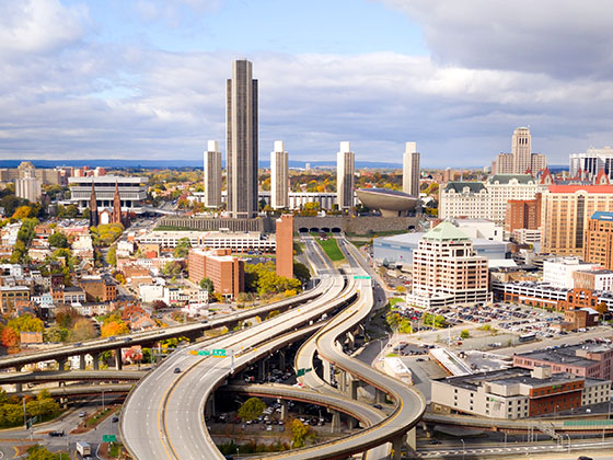
Regional photo of Albany - Schenectady

Using The Interactive Regional Map

The Albany - Schenectady metro area map shows exits and toll points for region-wide toll roads or other toll roads that cross the region.

View Map ▾Road List ▾

The following (2) toll roads are in this area, cross through this area or connect with this region:

The Albany - Schenectady area includes the following cities: Albany, Schenectady, Rotterdam, Amsterdam, and West Stockbridge, Massachusetts.

Markers on the interactive map can be selected to get close-up views of exit points, toll gantries and other locations and points-of-interest. Each POI map shows all nearby dining, gas, EV charging, hotels and other services.

View Map ▾Road List ▾

A complete list of exits and other points-of-interest in the Albany - Schenectady area follows the map. Exit lists are sorted by toll road.

Advertising
Advertising

Regional Map For Albany - Schenectady

Pan and zoom the map as desired, and select or tap the interactive markers to get information about that specific location. Each marker also includes options for viewing a close-up map of the destination point.

A complete list of exits and other points-of-interest is below this map, and other regions are shown further down the page.

Advertising
Advertising

Regional Exits, Listed By Toll Road

A list of all exits and other points-of-interest in this region, sorted by toll road.

I–90 East / Berkshire Connector

Exit 21AI–90 East / Berkshire Connector — East Chatham

View Map & Info

▸ GPS 42.515570000 X -73.789490000
NOTES: to Mass. Turnpike

The Thruway Authority New York State Thruway Authority manages this segment.

NY Route 144 / NY Route 396

Exit 22NY Route 144 / NY Route 396 — Selkirk

View Map & Info

▸ GPS 42.534150000 X -73.784110000
NOTES:

The Thruway Authority New York State Thruway Authority manages this segment.

I–90 / US Route 9

Exit B1I–90 / US Route 9 — Albany

View Map & Info

▸ GPS 42.482190000 X -73.670030000
NOTES:

The Thruway Authority New York State Thruway Authority manages this segment.
Downtown Albany / I–787 / US Route 9W

Exit 23Downtown Albany / I–787 / US Route 9W — Albany

View Map & Info

▸ GPS 42.632890000 X -73.781420000
NOTES:

The Thruway Authority New York State Thruway Authority manages this segment.

I–90 East / I–87 North

Exit 24I–90 East / I–87 North — Albany

View Map & Info

▸ GPS 42.697780000 X -73.845460000
NOTES: to Montreal

The Thruway Authority New York State Thruway Authority manages this segment.

NY Route 295 / Taconic State Parkway

Exit B2NY Route 295 / Taconic State Parkway — East Chatham

View Map & Info

▸ GPS 42.420350000 X -73.548640000
NOTES:

The Thruway Authority New York State Thruway Authority manages this segment.

Canaan Toll Barrier

Canaan Toll Barrier — East Chatham

View Map & Info

▸ GPS 42.398320000 X -73.505100000
NOTES: Berkshire Connector

The Thruway Authority New York State Thruway Authority manages this segment.

Guilderland Travel Plaza

Guilderland Travel Plaza — Albany

View Map & Info

▾ AVAILABLE GAS AND EV ▾

  • gas

    gas

  • diesel

    diesel

  • ev

    ev

  • tesla

    tesla

  • truck parking

    truck
    parking

I–88 / NY Route 7

Exit 25AI–88 / NY Route 7 — Schenectady

View Map & Info

▸ GPS 42.790350000 X -74.015920000
NOTES:

The Thruway Authority New York State Thruway Authority manages this segment.

I–890 / NY Route 7 / NY Route 146

Exit 25I–890 / NY Route 7 / NY Route 146 — Schenectady

View Map & Info

▸ GPS 42.754000000 X -73.933610000
NOTES:

The Thruway Authority New York State Thruway Authority manages this segment.

NY Route 22

Exit B3NY Route 22 — Austerlitz

View Map & Info

▸ GPS 42.357410000 X -73.427010000
NOTES:

The Thruway Authority New York State Thruway Authority manages this segment.

Massachusetts Turnpike

Massachusetts Turnpike — Austerlitz

View Map & Info

▸ GPS 42.348210000 X -73.412590000
NOTES: Massachusetts State Line

The Thruway Authority New York State Thruway Authority manages this segment.

I–890 / NY Route 5 / NY Route 5S

Exit 26I–890 / NY Route 5 / NY Route 5S — Schenectady

View Map & Info

▸ GPS 42.838120000 X -74.012600000
NOTES:

The Thruway Authority New York State Thruway Authority manages this segment.

Pattersonville Travel Plaza

Pattersonville Travel Plaza — Amsterdam

View Map & Info

▾ AVAILABLE GAS AND EV ▾

  • gas

    gas

  • diesel

    diesel

Mohawk Travel Plaza

Mohawk Travel Plaza — Amsterdam

View Map & Info

▾ AVAILABLE GAS AND EV ▾

  • gas

    gas

  • diesel

    diesel

NY Route 30

Exit 27NY Route 30 — Amsterdam

View Map & Info

▸ GPS 42.922950000 X -74.196480000
NOTES:

The Thruway Authority New York State Thruway Authority manages this segment.

NY Route 30A

Exit 28NY Route 30A — Fonda

View Map & Info

▸ GPS 42.944760000 X -74.359760000
NOTES:

The Thruway Authority New York State Thruway Authority manages this segment.

NY Route 10

Exit 29NY Route 10 — Canajoharie

View Map & Info

▸ GPS 42.906970000 X -74.562240000
NOTES:

The Thruway Authority New York State Thruway Authority manages this segment.

Iroquois Travel Plaza

Iroquois Travel Plaza — Canajoharie

View Map & Info

▾ AVAILABLE GAS AND EV ▾

  • gas

    gas

  • diesel

    diesel

  • ev

    ev

  • tesla

    tesla

  • truck parking

    truck
    parking

Berkshire Connector

Berkshire Connector — West Stockbridge

View Map & Info

▸ GPS 42.348155000 X -73.412096000
NOTES: NYS Thruway

MassDOT Massachusetts Department of Transportation manages this segment.

Route 41

Exit 3Route 41 — West Stockbridge

View Map & Info

▸ GPS 42.326494000 X -73.364093000
NOTES: (Old Exit 1) WB Off/EB On West Stockbridge

MassDOT Massachusetts Department of Transportation manages this segment.

Lee Service Plaza Westbound

Lee Service Plaza Westbound — Lee

View Map & Info

▸ GPS 42.298340000 X -73.274499000
NOTES:

Lee Service Plaza Eastbound

Lee Service Plaza Eastbound — Lee

View Map & Info

▸ GPS 42.296942000 X -73.275089000
NOTES:

US 20

Exit 10US 20 — Lee

View Map & Info

▸ GPS 42.298470000 X -73.234934000
NOTES: (Old Exit 2) Lee

MassDOT Massachusetts Department of Transportation manages this segment.

Advertising
Advertising

EXPLORE NEW YORK

Journey to key destinations around and adjacent to New York!

Map Of This Region ▹

Communities in this metro area include Poughkeepsie, Newburgh, Middletown, Kingston, Hudson, and Catskill.

Individual toll maps for this region are listed below.

Map Of This Region ▹

Communities in this metro area include Albany, Schenectady, Rotterdam, Amsterdam, and West Stockbridge, Massachusetts.

Individual toll maps for this region are listed below.

Map Of This Region ▹

Communities in this metro area include Syracuse, East Syracuse, Oneida, Utica, Rome, Frankfort, and Watertown.

Individual toll maps for this region are listed below.

Map Of This Region ▹

Communities in this metro area include Buffalo, Batavia, Rochester, Amherst, Niagara Falls, and Niagara Falls, Ontario.

Individual toll maps for this region are listed below.

Map Of This Region ▹

Communities in this metro area include New Haven, Bridgeport, Darien, Greenwich, Stamford, and Port Chester, New York.

Individual toll maps for this region are listed below.

Map Of This Region ▹

Communities in this metro area include Scranton, Wilkes Barre, Stroudsburg, Clarks Summit, and Knowlton Township, New Jersey.

Individual toll maps for this region are listed below.

Map Of This Region ▹

Communities in this metro area include Toronto, Niagara Falls, Hamilton, and Mississauga.

Individual toll maps for this region are listed below.

Turnpikes.com is proud to partner with the following: