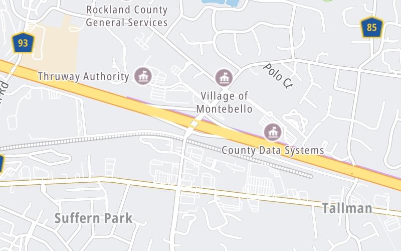
Map & services within two (2) miles
Interactive map shows available cameras, plus nearby fuel, food and lodging


See below for more about this area
Interactive map shows available cameras, plus nearby fuel, food and lodging
See below for more about this area
This is Exit 14B of the New York State Thruway.
This junction is located in Suffern. Airmont is nearby. NOTE: NYSTA Interchange ID: m14b.
This location is in the New York City - Northern New Jersey area; it also overlaps with the Catskills - Hudson Valley area.
This location's approximate GPS Coordinates are 41.11629 x -74.11232.
Which directions can I travel from here?
From this junction, traffic can enter traveling both southbound and northbound. Traffic can also exit traveling both southbound and northbound.
On to I-287 NJ / NJ Route 17, about 2.6 miles away ►
◄ Back to Spring Valley Highway Gantry, about 3.3 miles away.
Which direction are tolls charged here?
Tolls are not charged or collected at this junction.
Above: Map image © TomTom Intl BVThe interactive map and lists on this page include key traveler services within two miles of this destination point.
You will find common services, including gas stations, truck stops, EV charging facilities, fast-food or family restaurants, and hotels. These are displayed on the interactive map as markers, which you can select for more information.
Current driving conditions and weather, along with a more complete list of key services, may be found below the map.

Rain
56°F / 13.5°C
Feels Like:
54°F / 12°C
Visibility
4 Mi / 6.4 Km
3-Hour Precip:
0.71 In / 1.8 Cm
West Northwest
Winds (WNW)
3.6 MPH / 5.8 KPH
Gusts:
21.1 MPH / 33.9 KPH
▸ Get the full forecast for This Location | The New York City - Northern New Jersey area
Conditions and forecasts provided in partnership with AccuWeather.

Weather provided in partnership with AccuWeather.

I-87 @ AIRMONT RD
Camera Direction: SOUTH. Source: NYSTA - New York City 10901
Cameras Closest To Airmont Road / Airmont / Montebello
405 Ft
There are no currently-available photos for this location.
The map above shows all services within about a two (2) mile radius.

Destination Travel

Closest Gas Stations
MANHATTAN BEER
20 Dunnigan Drive • 0.39 miles
Store/Fuel Brand:
TALLMAN SUNOCO
261 Route 59 • 0.45 miles
Store/Fuel Brand: Sunoco
GULF
14 North Airmont Road • 738 feet
Store/Fuel Brand: Gulf
Closest EV Chargers
TOWN OF RAMAPO HIGHWAY DEPARTMENT
16 Pioneer Avenue • 0.67 miles
CONNECTOR: IEC62196Type1
POWER: 7 KW @ 240 V
CURRENT: 32 Amp AC1
INDIAN ROCK SHOPPING CENTER - TESLA DESTINATION
1 Indian Rock • 0.98 miles
CONNECTOR: IEC62196Type1
POWER: 7 KW @ 240 V
CURRENT: 30 Amp AC1
60 NORTH DE BAUN AVENUE
60 North De Baun Avenue • 1,167 feet
CONNECTOR: IEC62196Type1
POWER: 6 KW @ 208 V
CURRENT: 32 Amp AC1
CHARGEPOINT
1 Montebello Road • 1,224 feet
CONNECTOR: IEC62196Type1
POWER: 6 KW @ 240 V
CURRENT: 27 Amp AC1

Closest Fast Food
Fast food refers ONLY to quick-service and take-out diners. All restaurant types are shown on the map above.
BURGER KING
260 Route 59 • 0.50 miles
WENDY'S
320 Route 59 • 0.76 miles
MCDONALD'S
• 0.98 miles
BAGEL BOYS CAFE
9 North Airmont Road • 1,113 feet
JERSEY MIKES SUBS
218 Route 59 • 1,377 feet
PITA LAND
408 Route 59 • 1.23 miles
PANERA BREAD
15 North Airmont Road • 626 feet
Journey to key destinations around and adjacent to New York!
Communities in this metro area include Bronx, Brooklyn, Manhattan, New York City, Rockaway, Far Rockaway, Atlantic Beach, Queens, Staten Island, Elizabeth, New Jersey, Fort Lee, New Jersey, Newark, New Jersey, Union City, New Jersey, New Rochelle, and Perth Amboy, New Jersey.
Individual toll maps for this region are listed below.
Communities in this metro area include Poughkeepsie, Newburgh, Middletown, Kingston, Hudson, and Catskill.
Individual toll maps for this region are listed below.
Communities in this metro area include Albany, Schenectady, Rotterdam, Amsterdam, and West Stockbridge, Massachusetts.
Individual toll maps for this region are listed below.

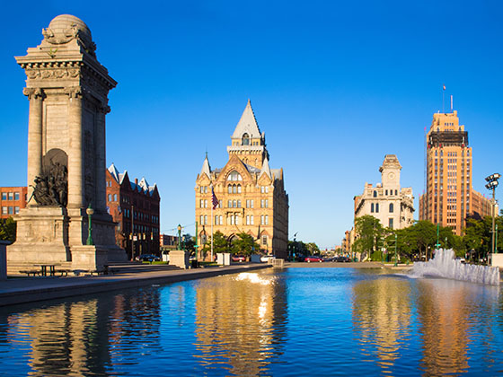
Communities in this metro area include Syracuse, East Syracuse, Oneida, Utica, Rome, Frankfort, and Watertown.
Individual toll maps for this region are listed below.
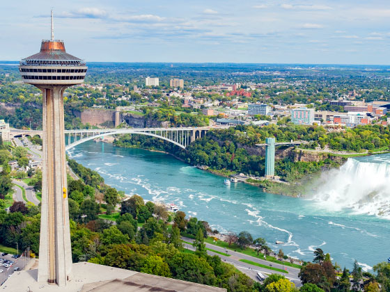
Communities in this metro area include Buffalo, Batavia, Rochester, Amherst, Niagara Falls, and Niagara Falls, Ontario.
Individual toll maps for this region are listed below.
Communities in this metro area include New Haven, Bridgeport, Darien, Greenwich, Stamford, and Port Chester, New York.
Individual toll maps for this region are listed below.
Communities in this metro area include Scranton, Wilkes Barre, Stroudsburg, Clarks Summit, and Knowlton Township, New Jersey.
Individual toll maps for this region are listed below.
Communities in this metro area include Toronto, Niagara Falls, Hamilton, and Mississauga.
Individual toll maps for this region are listed below.
 Bayonne Bridge ▹
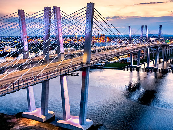
 Goethals Bridge ▹
 Holland Tunnel ▹
 Garden State Parkway ▹
 George Washington Bridge ▹
 Lincoln Tunnel ▹
 New Jersey Turnpike ▹
 Outerbridge Crossing ▹
 Bronx Whitestone Bridge ▹
 Hugh L Carey Tunnel ▹
 Cross Westchester Expressway ▹
 Robert F Kennedy Bridge ▹
 Queens Midtown Tunnel ▹
 New England Thruway ▹
 New York State Thruway ▹
 Throgs Neck Bridge ▹
 Henry Hudson Bridge ▹
 Atlantic Beach Bridge ▹
 Marine Parkway Bridge ▹
 Connecticut Turnpike ▹
 Bear Mountain Bridge ▹
 Massachusetts Turnpike ▹
 Thousand Islands Bridge ▹
 Niagara Thruway ▹
 Peace Bridge ▹
 Rainbow Bridge ▹
 Pennsylvania Turnpike ▹
 Milford Montague Toll Bridge ▹
 Delaware Water Gap Toll Bridge ▹
 Portland Columbia Toll Bridge ▹
 Easton Phillipsburg Toll Bridge ▹
 I78 Toll Bridge ▹