Map & services within two (2) miles
Interactive map shows available cameras, plus nearby fuel, food and lodging


See below for more about this area
Interactive map shows available cameras, plus nearby fuel, food and lodging
See below for more about this area
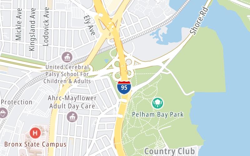
This junction is located in Bronx. Pelham Bay Park is nearby. NOTE: Start/End of New Eng. Thwy..
This location is in the New York City - Northern New Jersey area.
This location's approximate GPS Coordinates are 40.85562 x -73.82620.
Which directions can I travel from here?
From this junction, traffic can enter traveling both southbound and northbound. Traffic can also exit traveling both southbound and northbound.
On to City Island, about 0.2 miles away ►
Which direction are tolls charged here?
Tolls are not charged or collected at this junction.
Above: Map image © TomTom Intl BVThe interactive map and lists on this page include key traveler services within two miles of this destination point.
You will find common services, including gas stations, truck stops, EV charging facilities, fast-food or family restaurants, and hotels. These are displayed on the interactive map as markers, which you can select for more information.
Current driving conditions and weather, along with a more complete list of key services, may be found below the map.

Partly Sunny
50°F / 10.2°C
Feels Like:
53°F / 11.7°C
Visibility
24 Mi / 38.6 Km
3-Hour Precip:
0 In / 0.0 Cm
Northwest
Winds (NW)
9.2 MPH / 14.8 KPH
Gusts:
15.1 MPH / 24.3 KPH
▸ Get the full forecast for This Location | The New York City - Northern New Jersey area
Conditions and forecasts provided in partnership with AccuWeather.

Weather provided in partnership with AccuWeather.
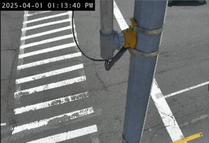
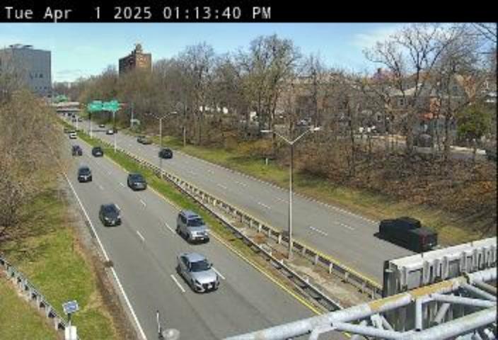
BRUCKNER EXPY @ WILKINSON AVE
Camera Direction: NORTH. Source: NYCTMC - New York City 10465
Cameras Closest To Bruckner Expressway
0.28 Mi
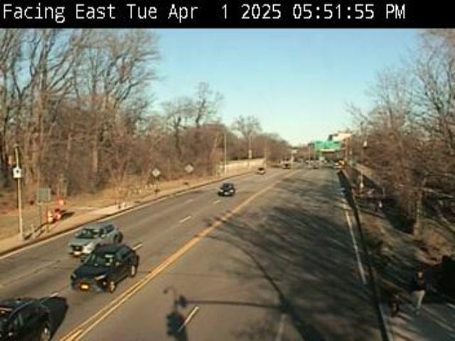
0.55 Mi
0.81 Mi
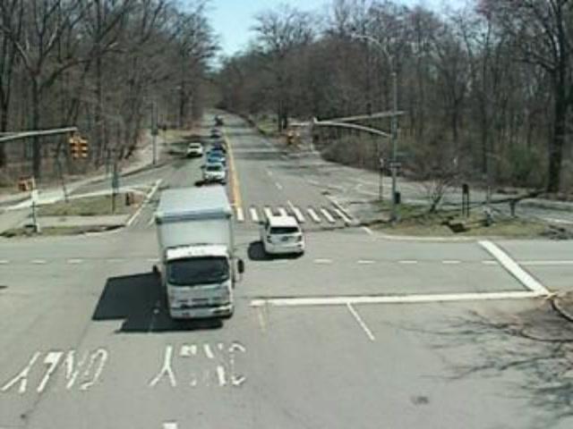
0.90 Mi

0.98 Mi
There are no currently-available photos for this location.
The map above shows all services within about a two (2) mile radius.

Destination Travel

Closest Gas Stations
CARBONIS GAS STATION
3055 Westchester Avenue • 0.54 miles
Store/Fuel Brand: BP
SUNOCO
1738 East Gun Hill Road • 0.80 miles
Store/Fuel Brand: Sunoco
CONOCO
2414 Woodhull Avenue • 0.90 miles
Store/Fuel Brand: Conoco
1930 BARTOW AVE
1930 Bartow Avenue • 0.92 miles
Store/Fuel Brand: Shell
Closest EV Chargers
BRONX - BAY PLAZA, NY SUPERCHARGER
270 Baychester Avenue • 0.58 miles
CONNECTOR: Tesla
POWER: 72 KW @ 400 V
CURRENT: 180 Amp DC
BAYCHESTER RETAIL III LLC
500 Baychester Avenue • 0.98 miles
CONNECTOR: IEC62196Type1
POWER: 7 KW @ 225 V
CURRENT: 32 Amp AC1

Closest Fast Food
Fast food refers ONLY to quick-service and take-out diners. All restaurant types are shown on the map above.
MOE'S SOUTHWEST GRILL
200 Baychester Avenue • 0.56 miles
NATHAN'S
200 Baychester Avenue • 0.58 miles
DAIRY QUEEN
200 Baychester Avenue • 0.59 miles
DQ GRILL & CHILL
• 0.59 miles
CINNABON
200 Baychester Avenue • 0.60 miles
CHARLEYS CHEESESTEAKS
200 Baychester Avenue • 0.60 miles
CHICK-FIL-A
Bartow Avenue • 0.73 miles
LITTLE CAESARS
300 Baychester Avenue • 0.77 miles
Journey to key destinations around and adjacent to New York!
Communities in this metro area include Bronx, Brooklyn, Manhattan, New York City, Rockaway, Far Rockaway, Atlantic Beach, Queens, Staten Island, Elizabeth, New Jersey, Fort Lee, New Jersey, Newark, New Jersey, Union City, New Jersey, New Rochelle, and Perth Amboy, New Jersey.
Individual toll maps for this region are listed below.
Communities in this metro area include Poughkeepsie, Newburgh, Middletown, Kingston, Hudson, and Catskill.
Individual toll maps for this region are listed below.
Communities in this metro area include Albany, Schenectady, Rotterdam, Amsterdam, and West Stockbridge, Massachusetts.
Individual toll maps for this region are listed below.

Communities in this metro area include Syracuse, East Syracuse, Oneida, Utica, Rome, Frankfort, and Watertown.
Individual toll maps for this region are listed below.
Communities in this metro area include Buffalo, Batavia, Rochester, Amherst, Niagara Falls, and Niagara Falls, Ontario.
Individual toll maps for this region are listed below.
Communities in this metro area include New Haven, Bridgeport, Darien, Greenwich, Stamford, and Port Chester, New York.
Individual toll maps for this region are listed below.
Communities in this metro area include Scranton, Wilkes Barre, Stroudsburg, Clarks Summit, and Knowlton Township, New Jersey.
Individual toll maps for this region are listed below.
Communities in this metro area include Toronto, Niagara Falls, Hamilton, and Mississauga.
Individual toll maps for this region are listed below.
 Bayonne Bridge ▹
 Goethals Bridge ▹
 Holland Tunnel ▹
 Garden State Parkway ▹
 George Washington Bridge ▹
 Lincoln Tunnel ▹
 New Jersey Turnpike ▹
 Outerbridge Crossing ▹
 Bronx Whitestone Bridge ▹
 Hugh L Carey Tunnel ▹
 Cross Westchester Expressway ▹
 Robert F Kennedy Bridge ▹
 Queens Midtown Tunnel ▹
 New England Thruway ▹
 New York State Thruway ▹
 Throgs Neck Bridge ▹
 Henry Hudson Bridge ▹
 Atlantic Beach Bridge ▹
 Marine Parkway Bridge ▹
 Connecticut Turnpike ▹
 Bear Mountain Bridge ▹
 Massachusetts Turnpike ▹
 Thousand Islands Bridge ▹
 Niagara Thruway ▹
 Peace Bridge ▹
 Rainbow Bridge ▹
 Pennsylvania Turnpike ▹
 Milford Montague Toll Bridge ▹
 Delaware Water Gap Toll Bridge ▹
 Portland Columbia Toll Bridge ▹
 Easton Phillipsburg Toll Bridge ▹
 I78 Toll Bridge ▹