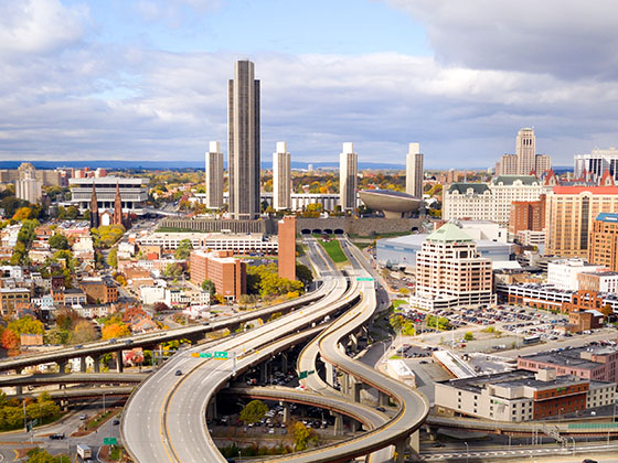
Mass Pike is another name used for this roadway. This state toll road serves several key cities, including Boston, Chicopee, Springfield, and Worcester.
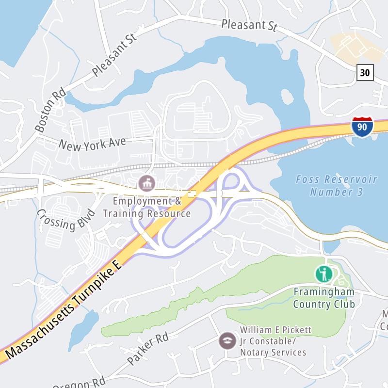
The static map seen here shows a segment of The Massachusetts Turnpike at Route 9. The entirety of The Massachusetts Turnpike can be seen in the fully-interactive map below, which includes linked markers. You may resize and reposition the interactive map to orient the road in relation to other landmarks.
There is also a complete list of exits below the interactive map.
Tolls For Cars, SUVs, Pickups, etc.
▹ Toll as of October 2016.
The total toll for using the Massachusetts Turnpike is $9.35, if you are using a compatible transponder, RFID sticker or other pass.
NOTE: The rates shown are the maximum toll incurred. Your trip may have a lower rate.
For drivers paying with a transponder, the following passes will work on the Massachusetts Turnpike
Learn about transponders and accounts in Massachusetts.
Without a compatible pass or transponder, the toll will be $13.55.
View Map ▾All Tolls / Calculator ▸
Our new toll and trip calculator is being constructed. For most roads, you can still use the legacy calculator for current, accurate tolls.
You may pan and zoom the interactive map. There are markers you may select for a separate map of that point of interest or location, which will show any nearby dining, gas, EV charging, hotels and other services.
A complete list of exits and other points-of-interest may be found below the map. Exits and gantries will display the toll agency responsible for tolls on that portion of the roadway.
This map of the Massachusetts Turnpike displays markers for exits and tolling points, which you can select to get a close-up map of that point of interest or location.
The points-of-interest shown on this map are also listed below, ordered from west to east.
Select an exit or other location to get a separate map, including locations of available gas, EV charging, fast-food and other dining options, plus current weather and driving conditions.
Berkshire Connector — West Stockbridge
▸ GPS 42.348155000 X -73.412096000
NOTES: NYS Thruway
Massachusetts Department of Transportation manages this segment.
Exit 3Route 41 — West Stockbridge
▸ GPS 42.326494000 X -73.364093000
NOTES: (Old Exit 1) WB Off/EB On West Stockbridge
Massachusetts Department of Transportation manages this segment.

Lee Service Plaza Westbound — Lee
▸ GPS 42.298340000 X -73.274499000
NOTES:
Lee Service Plaza Eastbound — Lee
▸ GPS 42.296942000 X -73.275089000
NOTES:
Exit 10US 20 — Lee
▸ GPS 42.298470000 X -73.234934000
NOTES: (Old Exit 2) Lee
Massachusetts Department of Transportation manages this segment.
Blandford Service Plaza Westbound — Blandford
▸ GPS 42.195249000 X -72.932369000
NOTES:
Blandford Service Plaza Eastbound — Blandford
▸ GPS 42.194453000 X -72.934058000
NOTES:
Exit 41US 202 — Westfield
▸ GPS 42.144877000 X -72.735204000
NOTES: (Old Exit 3) Westfield
Massachusetts Department of Transportation manages this segment.
Exit 45I–91 / US 5 — Springfield
▸ GPS 42.153666000 X -72.638588000
NOTES: (Old Exit 4) Springfield
Massachusetts Department of Transportation manages this segment.
Exit 49Route 33 — Chicopee
▸ GPS 42.169547000 X -72.580975000
NOTES: (Old Exit 5) Chicopee
Massachusetts Department of Transportation manages this segment.
Exit 51I–291 — Springfield
▸ GPS 42.161994000 X -72.547348000
NOTES: (Old Exit 6) Springfield / Hartford
Massachusetts Department of Transportation manages this segment.
Exit 54Route 21 — Ludlow
▸ GPS 42.167957000 X -72.471908000
NOTES: (Old Exit 7) Ludlow
Massachusetts Department of Transportation manages this segment.
Ludlow Service Plaza Westbound — Ludlow
▸ GPS 42.171116000 X -72.455350000
NOTES:
Ludlow Service Plaza Eastbound — Ludlow
▸ GPS 42.169256000 X -72.454078000
NOTES:
Exit 63Route 32 — Palmer
▸ GPS 42.172260000 X -72.331878000
NOTES: (Old Exit 8) Palmer / Ware / Amherst
Massachusetts Department of Transportation manages this segment.
Exit 78I–84 — Sturbridge
▸ GPS 42.129467000 X -72.063026000
NOTES: (Old Exit 9) Sturbridge / Hartford / to NYC
Massachusetts Department of Transportation manages this segment.
Charlton Service Plaza Eastbound — Charlton
▸ GPS 42.140004000 X -72.024876000
NOTES:
Charlton Service Plaza Westbound — Charlton
▸ GPS 42.156271000 X -71.964188000
NOTES:
Exit 90I–290 — Auburn
▸ GPS 42.195412231 X -71.845511517
NOTES: (Old Exit 10) Auburn / Worcester
Massachusetts Department of Transportation manages this segment.
Exit 94Route 146 / US 20 — Millbury
▸ GPS 42.210029614 X -71.781294316
NOTES: (Old Exit 10A) Milbury
Massachusetts Department of Transportation manages this segment.
Exit 96Route 122 — Millbury
▸ GPS 42.222506710 X -71.740203388
NOTES: (Old Exit 11) Milbury
Massachusetts Department of Transportation manages this segment.
Westborough Service Plaza Westbound — Westborough
▸ GPS 42.245182000 X -71.592031000
NOTES:
Exit 106I–495 — Hopkinton
▸ GPS 42.266635625 X -71.564360126
NOTES: (Old Exit 11A) Cape Cod / to New Hampshire / Maine
Massachusetts Department of Transportation manages this segment.
Exit 111Route 9 — Framingham
▸ GPS 42.296832251 X -71.478479273
NOTES: (Old Exit 12) Framingham
Massachusetts Department of Transportation manages this segment.
Framingham Service Plaza Westbound — Framingham
▸ GPS 42.312245808 X -71.428876255
NOTES:
Exit 117Route 30 — Natick
▸ GPS 42.312823000 X -71.385111000
NOTES: (Old Exit 13) Natick / Framingham
Massachusetts Department of Transportation manages this segment.
Natick Service Plaza Eastbound — Natick
▸ GPS 42.311590000 X -71.364571000
NOTES:
Exit 123I–95 — Weston
▸ GPS 42.338829000 X -71.276492000
NOTES: (Old Exit 14) WB On/EB Off
Massachusetts Department of Transportation manages this segment.
Weston Toll Barrier — Weston
▸ GPS 42.339051000 X -71.264914000
NOTES:
Massachusetts Department of Transportation manages this segment.
Exit 123A/BI–95 — Weston
▸ GPS 42.339874000 X -71.263159000
NOTES: (Old Exit 15) WB Off/EB On
Massachusetts Department of Transportation manages this segment.
Exit 125Route 16 — West Newton
▸ GPS 42.347359000 X -71.232314000
NOTES: (Old Exit 16) West Newton
Massachusetts Department of Transportation manages this segment.
Exit 127Washington Street / Centre Street — Newton
▸ GPS 42.355337000 X -71.190339000
NOTES: (Old Exit 17)
Massachusetts Department of Transportation manages this segment.
Exit 131ECambridge Street — Boston
▸ GPS 42.356890021 X -71.126681454
NOTES: (Old Exit 18) WB On/EB Off
Massachusetts Department of Transportation manages this segment.
Allston/Brighton Toll Barrier — Boston
▸ GPS 42.357305000 X -71.121629000
NOTES:
Massachusetts Department of Transportation manages this segment.
Exit 131WCambridge Street — Boston
▸ GPS 42.356890021 X -71.126681454
NOTES: (Old Exit 20) WB Off/EB On
Massachusetts Department of Transportation manages this segment.
Route 2A / Mass. Ave. — Boston
▸ GPS 42.347974000 X -71.089853000
NOTES: WB On Only
Massachusetts Department of Transportation manages this segment.
Exit 133WDartmouth St. / Copley Pl. — Boston
▸ GPS 42.347714000 X -71.078372000
NOTES: (Old Exit 22) WB On/EB Off
Massachusetts Department of Transportation manages this segment.
Clarendon Street — Boston
▸ GPS 42.347915000 X -71.076642000
NOTES: WB On Only
Massachusetts Department of Transportation manages this segment.
Arlington Street — Boston
▸ GPS 42.347972000 X -71.072231000
NOTES: WB On Only
Massachusetts Department of Transportation manages this segment.
Exit 134CEB I–90 To SB I–93 — Boston
▸ GPS 42.346358000 X -71.060297000
NOTES: (Old Exit 24C) to Quincy / WB On/EB Off
Massachusetts Department of Transportation manages this segment.
Exit 134BEB I–90 To NB I–93 — Boston
▸ GPS 42.346358000 X -71.060297000
NOTES: (Old Exit 24B) to Concord / WB On/EB Off
Massachusetts Department of Transportation manages this segment.
Exit 134AEB I–90 To South Station — Boston
▸ GPS 42.346358000 X -71.060297000
NOTES: (Old Exit 24A) EB Off Only
Massachusetts Department of Transportation manages this segment.
Exit 134WB I–90 To I–93 NB/SB — Boston
▸ GPS 42.346786000 X -71.039061000
NOTES: (Old Exit 24) WB On/Off Only
Massachusetts Department of Transportation manages this segment.
Exit 135South Boston — Boston
▸ GPS 42.346786000 X -71.039061000
NOTES: (Old Exit 25)
Massachusetts Department of Transportation manages this segment.
Exit 137Logan International Airport/BOS — Boston
▸ GPS 42.346786000 X -71.039061000
NOTES: (Old Exit 27) No WB Exit
Massachusetts Department of Transportation manages this segment.
Route 1A / East Terminus of I–90 — Boston
▸ GPS 42.376331000 X -71.028753000
NOTES: WB On/EB Off
Massachusetts Department of Transportation manages this segment.
Journey to key destinations around and adjacent to Massachusetts!
Communities in this metro area include Boston, Cambridge, Chelsea, Allston, Framingham, Westborough, and Worcester.
Individual toll maps for this region are listed below.
Communities in this metro area include Springfield, West Springfield, Chicopee, Westfield, and Hartford, Connecticut.
Individual toll maps for this region are listed below.
Communities in this metro area include Hooksett, Concord, Manchester, and West Concord.
Individual toll maps for this region are listed below.
Communities in this metro area include Albany, Schenectady, Rotterdam, Amsterdam, and West Stockbridge, Massachusetts.
Individual toll maps for this region are listed below.