Boston Toll Maps

Regional photo of Boston

Using The Interactive Regional Map

The Boston metro area map shows exits and toll points for region-wide toll roads or other toll roads that cross the region.

View Map ▾Road List ▾

The following (6) toll roads are in this area, cross through this area or connect with this region:

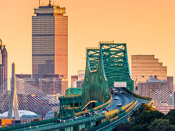
The Boston area includes the following cities: Boston, Cambridge, Chelsea, Allston, Framingham, Westborough, and Worcester.

Markers on the interactive map can be selected to get close-up views of exit points, toll gantries and other locations and points-of-interest. Each POI map shows all nearby dining, gas, EV charging, hotels and other services.

View Map ▾Road List ▾

A complete list of exits and other points-of-interest in the Boston area follows the map. Exit lists are sorted by toll road.

Advertising
Advertising

Regional Map For Boston

Pan and zoom the map as desired, and select or tap the interactive markers to get information about that specific location. Each marker also includes options for viewing a close-up map of the destination point.

A complete list of exits and other points-of-interest is below this map, and other regions are shown further down the page.

Advertising
Advertising

Regional Exits, Listed By Toll Road

A list of all exits and other points-of-interest in this region, sorted by toll road.

I–84

Exit 78I–84 — Sturbridge

View Map & Info

▸ GPS 42.129467000 X -72.063026000
NOTES: (Old Exit 9) Sturbridge / Hartford / to NYC

MassDOT Massachusetts Department of Transportation manages this segment.

Charlton Service Plaza Eastbound

Charlton Service Plaza Eastbound — Charlton

View Map & Info

▸ GPS 42.140004000 X -72.024876000
NOTES:

Charlton Service Plaza Westbound

Charlton Service Plaza Westbound — Charlton

View Map & Info

▸ GPS 42.156271000 X -71.964188000
NOTES:

I–290

Exit 90I–290 — Auburn

View Map & Info

▸ GPS 42.195412231 X -71.845511517
NOTES: (Old Exit 10) Auburn / Worcester

MassDOT Massachusetts Department of Transportation manages this segment.

Route 146 / US 20

Exit 94Route 146 / US 20 — Millbury

View Map & Info

▸ GPS 42.210029614 X -71.781294316
NOTES: (Old Exit 10A) Milbury

MassDOT Massachusetts Department of Transportation manages this segment.

Route 122

Exit 96Route 122 — Millbury

View Map & Info

▸ GPS 42.222506710 X -71.740203388
NOTES: (Old Exit 11) Milbury

MassDOT Massachusetts Department of Transportation manages this segment.

Westborough Service Plaza Westbound

Westborough Service Plaza Westbound — Westborough

View Map & Info

▸ GPS 42.245182000 X -71.592031000
NOTES:

I–495

Exit 106I–495 — Hopkinton

View Map & Info

▸ GPS 42.266635625 X -71.564360126
NOTES: (Old Exit 11A) Cape Cod / to New Hampshire / Maine

MassDOT Massachusetts Department of Transportation manages this segment.

Route 9

Exit 111Route 9 — Framingham

View Map & Info

▸ GPS 42.296832251 X -71.478479273
NOTES: (Old Exit 12) Framingham

MassDOT Massachusetts Department of Transportation manages this segment.

Framingham Service Plaza Westbound

Framingham Service Plaza Westbound — Framingham

View Map & Info

▸ GPS 42.312245808 X -71.428876255
NOTES:

Route 30

Exit 117Route 30 — Natick

View Map & Info

▸ GPS 42.312823000 X -71.385111000
NOTES: (Old Exit 13) Natick / Framingham

MassDOT Massachusetts Department of Transportation manages this segment.

Natick Service Plaza Eastbound

Natick Service Plaza Eastbound — Natick

View Map & Info

▸ GPS 42.311590000 X -71.364571000
NOTES:

I–95

Exit 123I–95 — Weston

View Map & Info

▸ GPS 42.338829000 X -71.276492000
NOTES: (Old Exit 14) WB On/EB Off

MassDOT Massachusetts Department of Transportation manages this segment.

Weston Toll Barrier

Weston Toll Barrier — Weston

View Map & Info

▸ GPS 42.339051000 X -71.264914000
NOTES:

MassDOT Massachusetts Department of Transportation manages this segment.

I–95

Exit 123A/BI–95 — Weston

View Map & Info

▸ GPS 42.339874000 X -71.263159000
NOTES: (Old Exit 15) WB Off/EB On

MassDOT Massachusetts Department of Transportation manages this segment.

Route 16

Exit 125Route 16 — West Newton

View Map & Info

▸ GPS 42.347359000 X -71.232314000
NOTES: (Old Exit 16) West Newton

MassDOT Massachusetts Department of Transportation manages this segment.

Washington Street / Centre Street

Exit 127Washington Street / Centre Street — Newton

View Map & Info

▸ GPS 42.355337000 X -71.190339000
NOTES: (Old Exit 17)

MassDOT Massachusetts Department of Transportation manages this segment.

Cambridge Street

Exit 131ECambridge Street — Boston

View Map & Info

▸ GPS 42.356890021 X -71.126681454
NOTES: (Old Exit 18) WB On/EB Off

MassDOT Massachusetts Department of Transportation manages this segment.

Allston/Brighton Toll Barrier

Allston/Brighton Toll Barrier — Boston

View Map & Info

▸ GPS 42.357305000 X -71.121629000
NOTES:

MassDOT Massachusetts Department of Transportation manages this segment.

Cambridge Street

Exit 131WCambridge Street — Boston

View Map & Info

▸ GPS 42.356890021 X -71.126681454
NOTES: (Old Exit 20) WB Off/EB On

MassDOT Massachusetts Department of Transportation manages this segment.

Route 2A / Mass. Ave.

Route 2A / Mass. Ave. — Boston

View Map & Info

▸ GPS 42.347974000 X -71.089853000
NOTES: WB On Only

MassDOT Massachusetts Department of Transportation manages this segment.

Dartmouth St. / Copley Pl.

Exit 133WDartmouth St. / Copley Pl. — Boston

View Map & Info

▸ GPS 42.347714000 X -71.078372000
NOTES: (Old Exit 22) WB On/EB Off

MassDOT Massachusetts Department of Transportation manages this segment.

Clarendon Street

Clarendon Street — Boston

View Map & Info

▸ GPS 42.347915000 X -71.076642000
NOTES: WB On Only

MassDOT Massachusetts Department of Transportation manages this segment.

Arlington Street

Arlington Street — Boston

View Map & Info

▸ GPS 42.347972000 X -71.072231000
NOTES: WB On Only

MassDOT Massachusetts Department of Transportation manages this segment.

EB I–90 To SB I–93

Exit 134CEB I–90 To SB I–93 — Boston

View Map & Info

▸ GPS 42.346358000 X -71.060297000
NOTES: (Old Exit 24C) to Quincy / WB On/EB Off

MassDOT Massachusetts Department of Transportation manages this segment.

EB I–90 To NB I–93

Exit 134BEB I–90 To NB I–93 — Boston

View Map & Info

▸ GPS 42.346358000 X -71.060297000
NOTES: (Old Exit 24B) to Concord / WB On/EB Off

MassDOT Massachusetts Department of Transportation manages this segment.

EB I–90 To South Station

Exit 134AEB I–90 To South Station — Boston

View Map & Info

▸ GPS 42.346358000 X -71.060297000
NOTES: (Old Exit 24A) EB Off Only

MassDOT Massachusetts Department of Transportation manages this segment.

WB I–90 To I–93 NB/SB

Exit 134WB I–90 To I–93 NB/SB — Boston

View Map & Info

▸ GPS 42.346786000 X -71.039061000
NOTES: (Old Exit 24) WB On/Off Only

MassDOT Massachusetts Department of Transportation manages this segment.

South Boston

Exit 135South Boston — Boston

View Map & Info

▸ GPS 42.346786000 X -71.039061000
NOTES: (Old Exit 25)

MassDOT Massachusetts Department of Transportation manages this segment.

Logan International Airport/BOS

Exit 137Logan International Airport/BOS — Boston

View Map & Info

▸ GPS 42.346786000 X -71.039061000
NOTES: (Old Exit 27) No WB Exit

MassDOT Massachusetts Department of Transportation manages this segment.

Route 1A / East Terminus of I–90

Route 1A / East Terminus of I–90 — Boston

View Map & Info

▸ GPS 42.376331000 X -71.028753000
NOTES: WB On/EB Off

MassDOT Massachusetts Department of Transportation manages this segment.

Sumner Tunnel exit

Sumner Tunnel exit — Boston

View Map & Info

▸ GPS 42.362605000 X -71.055064000
NOTES: 1A SB / Sumner Tunnel exit points

MassDOT Massachusetts Department of Transportation manages this segment.

Callahan Tunnel entrance

Callahan Tunnel entrance — Boston

View Map & Info

▸ GPS 42.362301000 X -71.054342000
NOTES: 1A NB / Callahan Tunnel access points

MassDOT Massachusetts Department of Transportation manages this segment.

Sumner Tunnel toll gantry

Sumner Tunnel toll gantry — Boston

View Map & Info

▸ GPS 42.373289000 X -71.038468000
NOTES: SB toll gantry

MassDOT Massachusetts Department of Transportation manages this segment.

Callahan Tunnel toll gantry

Callahan Tunnel toll gantry — Boston

View Map & Info

▸ GPS 42.373177000 X -71.038296000
NOTES: NB toll gantry

MassDOT Massachusetts Department of Transportation manages this segment.

Sumner Tunnel entrance

Sumner Tunnel entrance — Boston

View Map & Info

▸ GPS 42.373628000 X -71.038015000
NOTES: 1A SB / Sumner Tunnel access points

MassDOT Massachusetts Department of Transportation manages this segment.

Callahan Tunnel exit

Callahan Tunnel exit — Boston

View Map & Info

▸ GPS 42.373371000 X -71.038026000
NOTES: 1A NB / Callahan Tunnel exit points

MassDOT Massachusetts Department of Transportation manages this segment.

Westbound toll gantry

Westbound toll gantry — Boston

View Map & Info

▸ GPS 42.347113000 X -71.040409000
NOTES: Gantry comes after split for Exits 134/135

MassDOT Massachusetts Department of Transportation manages this segment.

Eastbound toll gantry

Eastbound toll gantry — Boston

View Map & Info

▸ GPS 42.346713000 X -71.039850000
NOTES:

MassDOT Massachusetts Department of Transportation manages this segment.

South Boston / Mass Pike

Exit 135South Boston / Mass Pike — Boston

View Map & Info

▸ GPS 42.346728000 X -71.039055000
NOTES: Massachusetts Turnpike / to I-93

MassDOT Massachusetts Department of Transportation manages this segment.

Governors Island / Logan Airport

Exit 137Governors Island / Logan Airport — Boston

View Map & Info

▸ GPS 42.365917000 X -71.024906000
NOTES: Boston Logan International Airport

MassDOT Massachusetts Department of Transportation manages this segment.

Mass 1A

Mass 1A — Boston

View Map & Info

▸ GPS 42.371492000 X -71.027397000
NOTES: Wm. McClellan Freeway / East terminus of I-90

MassDOT Massachusetts Department of Transportation manages this segment.

New Rutherford Avenue

New Rutherford Avenue — Boston

View Map & Info

▸ GPS 42.372302000 X -71.065076000
NOTES: Boston / South side local

MassDOT Massachusetts Department of Transportation manages this segment.

I-93 / US 1

I-93 / US 1 — Boston

View Map & Info

▸ GPS 42.371443000 X -71.066814000
NOTES: Boston / South side

MassDOT Massachusetts Department of Transportation manages this segment.

Tobin Bridge NB toll gantry

Tobin Bridge NB toll gantry — Boston

View Map & Info

▸ GPS 42.370609000 X -71.062685000
NOTES: Bunker Hill

MassDOT Massachusetts Department of Transportation manages this segment.

Tobin Bridge SB toll gantry

Tobin Bridge SB toll gantry — Boston

View Map & Info

▸ GPS 42.370586000 X -71.063907000
NOTES: Bunker Hill

MassDOT Massachusetts Department of Transportation manages this segment.

Chelsea / North side

Chelsea / North side — Chelsea

View Map & Info

▸ GPS 42.386830000 X -71.045808000
NOTES: Loc. Entrances at 5th St or Everett Ave / Loc. Exits to Beacon or 4th St

MassDOT Massachusetts Department of Transportation manages this segment.

Massachusetts / I–95

Massachusetts / I–95 — Seabrook

View Map & Info

▸ GPS 42.880763000 X -70.882859000
NOTES:

Bureau of Turnpikes New Hampshire DOT Bureau of Turnpikes manages this segment.

US 3 / New Hampshire/Mass State Line

US 3 / New Hampshire/Mass State Line — Nashua

View Map & Info

▸ GPS 42.700385000 X -71.449191000
NOTES: Roadway is called Everett Turnpike here.

Bureau of Turnpikes New Hampshire DOT Bureau of Turnpikes manages this segment.

New Hampshire Welcome Center

New Hampshire Welcome Center — Seabrook

View Map & Info

▸ GPS 42.884627000 X -70.880931000
NOTES: Northbound

NH 107

Exit 1NH 107 — Seabrook

View Map & Info

▸ GPS 42.894497000 X -70.879696000
NOTES:

Bureau of Turnpikes New Hampshire DOT Bureau of Turnpikes manages this segment.

New Hampshire Liquor & Wine

New Hampshire Liquor & Wine — Hampton

View Map & Info

▸ GPS 42.933632000 X -70.861417000
NOTES: Northbound

New Hampshire Liquor & Wine

New Hampshire Liquor & Wine — Hampton

View Map & Info

▸ GPS 42.937234000 X -70.862306000
NOTES: Southbound

NH 101/Exeter–Hampton Expressway

Exit 2NH 101/Exeter–Hampton Expressway — Hampton

View Map & Info

▸ GPS 42.959465000 X -70.856691000
NOTES:

Bureau of Turnpikes New Hampshire DOT Bureau of Turnpikes manages this segment.

Spit Brook Road

Exit 1Spit Brook Road — Nashua

View Map & Info

▸ GPS 42.708082000 X -71.450552000
NOTES:

Bureau of Turnpikes New Hampshire DOT Bureau of Turnpikes manages this segment.

Circumferential Highway

Exit 2Circumferential Highway — Nashua

View Map & Info

▸ GPS 42.722161000 X -71.449497000
NOTES:

Bureau of Turnpikes New Hampshire DOT Bureau of Turnpikes manages this segment.

Daniel Webster Highway

Exit 3Daniel Webster Highway — Nashua

View Map & Info

▸ GPS 42.735059000 X -71.458678000
NOTES:

Bureau of Turnpikes New Hampshire DOT Bureau of Turnpikes manages this segment.

Dunstable Road

Exit 4Dunstable Road — Nashua

View Map & Info

▸ GPS 42.733081000 X -71.470376000
NOTES:

Bureau of Turnpikes New Hampshire DOT Bureau of Turnpikes manages this segment.

NH 111 / Hollis St / Main Dunstable Rd

Exit 5/5E/5WNH 111 / Hollis St / Main Dunstable Rd — Nashua

View Map & Info

▸ GPS 42.746853000 X -71.492373000
NOTES:

Bureau of Turnpikes New Hampshire DOT Bureau of Turnpikes manages this segment.

NH 130/Broad Street

Exit 6NH 130/Broad Street — Nashua

View Map & Info

▸ GPS 42.768976000 X -71.493376000
NOTES:

Bureau of Turnpikes New Hampshire DOT Bureau of Turnpikes manages this segment.

NH 101A/Amherst Street

Exit 7E/7WNH 101A/Amherst Street — Nashua

View Map & Info

▸ GPS 42.776746000 X -71.492892000
NOTES:

Bureau of Turnpikes New Hampshire DOT Bureau of Turnpikes manages this segment.

Advertising
Advertising

EXPLORE MASSACHUSETTS

Journey to key destinations around and adjacent to Massachusetts!

Map Of This Region ▹

Communities in this metro area include Boston, Cambridge, Chelsea, Allston, Framingham, Westborough, and Worcester.

Individual toll maps for this region are listed below.

Map Of This Region ▹

Communities in this metro area include Springfield, West Springfield, Chicopee, Westfield, and Hartford, Connecticut.

Individual toll maps for this region are listed below.

Map Of This Region ▹

Communities in this metro area include Hooksett, Concord, Manchester, and West Concord.

Individual toll maps for this region are listed below.

Map Of This Region ▹

Communities in this metro area include Albany, Schenectady, Rotterdam, Amsterdam, and West Stockbridge, Massachusetts.

Individual toll maps for this region are listed below.

Turnpikes.com is proud to partner with the following: