Map & services within two (2) miles
Interactive map shows available cameras, plus nearby fuel, food and lodging


See below for more about this area
Interactive map shows available cameras, plus nearby fuel, food and lodging
See below for more about this area
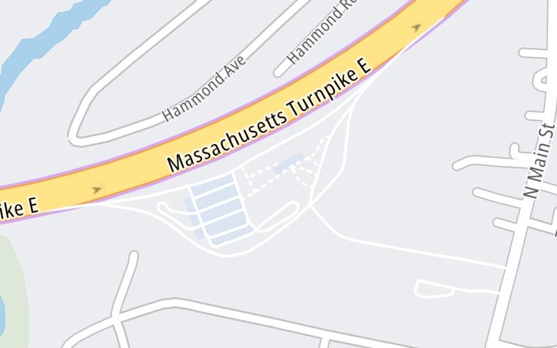
This travel plaza is located in Natick. Framingham is nearby.
This location is in the Boston area.
This location's approximate GPS Coordinates are 42.31159 x -71.36457.
On to I–95, about 5.0 miles away ►
◄ Back to Route 30, about 0.9 miles away.
Above: Map image © TomTom Intl BVThe interactive map and lists on this page include key traveler services within two miles of this destination point.
You will find common services, including gas stations, truck stops, EV charging facilities, fast-food or family restaurants, and hotels. These are displayed on the interactive map as markers, which you can select for more information.
Current driving conditions and weather, along with a more complete list of key services, may be found below the map.

Sunny
49°F / 9.5°C
Feels Like:
56°F / 13.5°C
Visibility
14 Mi / 22.5 Km
3-Hour Precip:
0 In / 0.0 Cm
Northwest
Winds (NW)
6.2 MPH / 10 KPH
Gusts:
15.5 MPH / 24.9 KPH
▸ Get the full forecast for This Location | The Boston area
Conditions and forecasts provided in partnership with AccuWeather.

Weather provided in partnership with AccuWeather.

I-90-EB-MM116.6-NATICK-EX 117 RT 30
Camera Direction: EAST. Source: MassDOT - Boston 01701
Cameras Closest To Natick Service Plaza Eastbound
1.04 Mi
2.69 Mi
There are no currently-available photos for this location.
The map above shows all services within about a two (2) mile radius.

Destination Travel

Closest Gas Stations
NATICK GAS
225 North Main Street • 0.62 miles
Store/Fuel Brand:
HONEY FARMS
114 Main Street • 0.62 miles
Store/Fuel Brand:
WAYLAND MOBIL
315 Commonwealth Road • 0.89 miles
Store/Fuel Brand: Mobil
WAYLAND AUTOMOTIVE
322 Commonwealth Road • 0.96 miles
Store/Fuel Brand:
Closest EV Chargers
CHARGEPOINT
35 Main Street • 0.38 miles
CONNECTOR: IEC62196Type1
POWER: 6 KW @ 240 V
CURRENT: 27 Amp AC1
BERNARDI HONDA - SERIES 7'S
960 Worcester Street • 0.88 miles
CONNECTOR: IEC62196Type1
POWER: 10 KW @ 208 V
CURRENT: 50 Amp AC1
BERNARDI HONDA
960 Worcester Street • 0.88 miles
CONNECTOR: IEC62196Type1
POWER: 8 KW @ 270 V
CURRENT: 32 Amp AC1
WORKBAR FRAMINGHAM
111 Speen Street • 1.09 miles
CONNECTOR: IEC62196Type1
POWER: 11 KW @ 240 V
CURRENT: 48 Amp AC1

Closest Fast Food
Fast food refers ONLY to quick-service and take-out diners. All restaurant types are shown on the map above.
DOMINO'S
25 Main Street • 0.39 miles
LIBERTY PIZZA OF COCHITUATE
116 Main Street • 0.63 miles
CHIPOTLE
219 North Main Street • 0.71 miles
FIVE GUYS
221 North Main Street • 0.77 miles
PANERA BREAD
841 Worcester Street • 0.79 miles
DQ GRILL & CHILL
323 North Main Street • 1,449 feet
DAIRY QUEEN
323 North Main Street • 1,455 feet
EINSTEIN BROTHERS BAGELS
44 Main Street • 1,970 feet
Journey to key destinations around and adjacent to Massachusetts!
Communities in this metro area include Boston, Cambridge, Chelsea, Allston, Framingham, Westborough, and Worcester.
Individual toll maps for this region are listed below.
Communities in this metro area include Springfield, West Springfield, Chicopee, Westfield, and Hartford, Connecticut.
Individual toll maps for this region are listed below.

Communities in this metro area include Hooksett, Concord, Manchester, and West Concord.
Individual toll maps for this region are listed below.

Communities in this metro area include Albany, Schenectady, Rotterdam, Amsterdam, and West Stockbridge, Massachusetts.
Individual toll maps for this region are listed below.


 Massachusetts Turnpike ▹
 Sumner & Callahan Tunnels ▹
 Ted Williams Tunnel ▹
 Tobin Memorial Bridge ▹
 Blue Star Turnpike ▹
 Everett Turnpike ▹
 New York State Thruway ▹


