Interactive map shows available cameras, plus nearby fuel, food and lodging
See below for more about this area
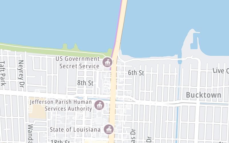
This junction is located in Metairie. New Orleans and Bridge City are nearby. NOTE: South terminus of causeway / N Causeway Blvd at 6th St.
This location is in the New Orleans - Mississippi Gulf area.
This location's approximate GPS Coordinates are 30.01791 x -90.15452.
Which directions can I travel from here?
From this junction, traffic can enter traveling both southbound and northbound. Traffic can also exit traveling both southbound and northbound.
On to Crossover 7000, about 3.7 miles away ►
Which direction are tolls charged here?
Tolls are not charged or collected at this junction.
Above: Map image © TomTom Intl BVThe interactive map and lists on this page include key traveler services within two miles of this destination point.
You will find common services, including gas stations, truck stops, EV charging facilities, fast-food or family restaurants, and hotels. These are displayed on the interactive map as markers, which you can select for more information.
Current driving conditions and weather, along with a more complete list of key services, may be found below the map.
Static map. Interactive map is above.Mostly Cloudy
75°F / 23.9°C
Feels Like:
80°F / 26.6°C
Visibility
10 Mi / 16.1 Km
3-Hour Precip:
0 In / 0.0 Cm
South
Winds (S)
4.3 MPH / 7 KPH
Gusts:
8.4 MPH / 13.6 KPH
▸ Get the full forecast for This Location | The New Orleans - Mississippi Gulf area
There is no currently-available traffic camera feed for this location.
There are no currently-available photos for this location.
The map above shows all services within about a two (2) mile radius.
Destination Travel
Closest Gas Stations
SHELL
3534 Edenborn Avenue • 0.51 miles
Store/Fuel Brand: Shell
DISCOUNT ONE
West Esplanade Avenue South • 0.63 miles
Store/Fuel Brand:
CHEVRON
3605 North Causeway Boulevard • 1,260 feet
Store/Fuel Brand: Chevron
EXXON
3530 North Causeway Boulevard • 1,600 feet
Store/Fuel Brand: Exxon
Closest EV Chargers
SOUTH COAST SOLAR
2605 Ridgelake Drive • 1.25 miles
CONNECTOR: IEC62196Type1
POWER: 7 KW @ 240 V
CURRENT: 30 Amp AC1
HOLIDAY INN METAIRIE NEW ORLEANS AIRPORT - TESLA DESTINATION
2261 North Causeway Boulevard • 1.68 miles
CONNECTOR: Tesla
POWER: 7 KW @ 240 V
CURRENT: 30 Amp AC1
CHARGEPOINT
3701 North Causeway Boulevard • 808 feet
CONNECTOR: IEC62196Type1
POWER: 6 KW @ 240 V
CURRENT: 27 Amp AC1
Closest Fast Food
Fast food refers ONLY to quick-service and take-out diners. All restaurant types are shown on the map above.
CAFFE! CAFFE!
3547 North Hullen Street • 0.38 miles
MCDONALD'S
3532 Severn Avenue • 0.43 miles
WENDY'S
3325 North Causeway Boulevard • 0.54 miles
LA MADELEINE FRENCH BAKERY
3300 Severn Avenue • 0.65 miles
HONEY BAKED HAM
3211 North Causeway Boulevard • 0.68 miles
KRISPY KRUNCHY CHICKEN
3218 Edenborn Avenue • 0.80 miles
FIVE GUYS
3100 Severn Avenue • 0.81 miles
DOMINO'S
3030 Severn Avenue • 0.86 miles
Journey to key destinations around and adjacent to Louisiana!
Communities in this metro area include New Orleans, Slidell, Metairie, Mandeville, and Belle Chasse.
Individual toll maps for this region are listed below.
Communities in this metro area include Houston, Humble, Tomball, Sugar Land, Galveston, Pearland, and Katy.
Individual toll maps for this region are listed below.