Your selected location relative to roadway
See below for more about this area
See below for more about this area
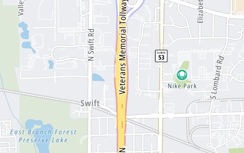
This toll point is located in Addison. Glendale Heights is nearby.
This location is in the Chicagoland - Northwestern Indiana area.
This location's approximate GPS Coordinates are 41.92306 x -88.03776.
On to Army Trail Road, about 0.6 miles away ►
◄ Back to North Avenue/IL 64, about 1.3 miles away.
Above: Map image © TomTom Intl BVThe interactive map will help you orient this location in relationship to other junctions.
Current driving conditions and weather may also be found below the map.

Cloudy
42°F / 5.4°C
Feels Like:
41°F / 5°C
Visibility
10 Mi / 16.1 Km
3-Hour Precip:
0 In / 0.0 Cm
East
Winds (E)
5 MPH / 8.1 KPH
Gusts:
10.2 MPH / 16.4 KPH
▸ Get the full forecast for the Chicagoland - Northwestern Indiana area
Conditions and forecasts provided in partnership with AccuWeather.

Weather provided in partnership with AccuWeather.
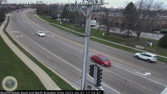
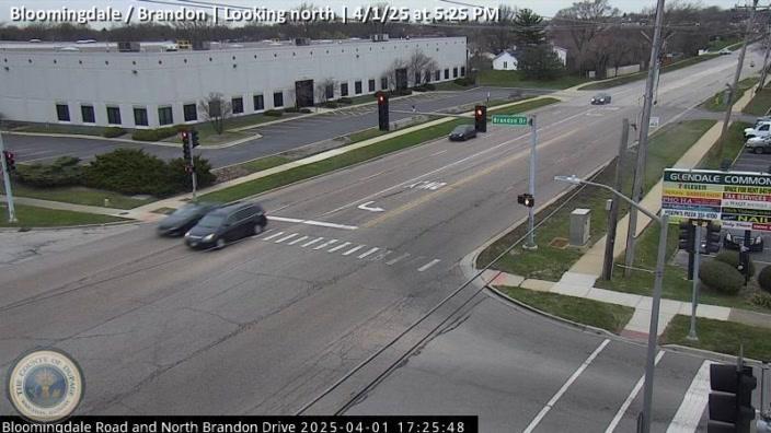
BLOOMINGDALE / BRANDON
Camera Direction: SOUTH. Source: GCM - Chicago 60139
Cameras Closest To Army Trail Road Toll Plaza
2.24 Mi
2.24 Mi
There are no currently-available photos for this location.
Journey to key destinations around and adjacent to Illinois!
Communities in this metro area include Chicago, Aurora, Oak Lawn, Des Plaines, Waukegan, Highland Park, Gary, Indiana, Schaumburg, Naperville, Oak Brook, and Joliet.
Individual toll maps for this region are listed below.
Communities in this metro area include Gary, South Bend, Elkhart, Portage, and Fremont.
Individual toll maps for this region are listed below.

 Chicago Skyway ▹
 Jane Addams Memorial Tollway ▹
 Ronald Reagan Memorial Tollway ▹
 Tri State Tollway ▹
 Veterans Memorial Tollway ▹
 Cline Avenue Bridge ▹
 Houbolt Road Extension ▹
 Indiana Toll Road ▹
 Ohio Turnpike ▹


