Map & services within two (2) miles
Interactive map shows available cameras, plus nearby fuel, food and lodging


See below for more about this area
Interactive map shows available cameras, plus nearby fuel, food and lodging
See below for more about this area
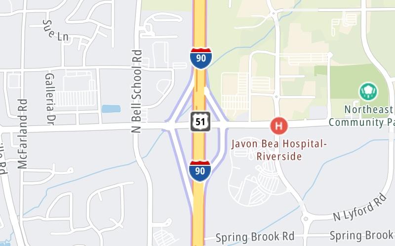
This is Exit 12 of the Jane Addams Memorial Tollway.
This junction is located in Loves Park. Rockford is nearby.
This location is in the Chicagoland - Northwestern Indiana area.
This location's approximate GPS Coordinates are 42.31922 x -88.96465.
Which directions can I travel from here?
From this junction, traffic can enter traveling both westbound and eastbound. Traffic can also exit traveling both westbound and eastbound.
On to Bus U.S. 20, about 3.3 miles away ►
◄ Back to Illinois 173, about 3.5 miles away.
Which direction are tolls charged here?
The interactive map and lists on this page include key traveler services within two miles of this destination point.
You will find common services, including gas stations, truck stops, EV charging facilities, fast-food or family restaurants, and hotels. These are displayed on the interactive map as markers, which you can select for more information.
Current driving conditions and weather, along with a more complete list of key services, may be found below the map.

Cloudy
45°F / 7.4°C
Feels Like:
41°F / 5.2°C
Visibility
24 Mi / 38.6 Km
3-Hour Precip:
0 In / 0.0 Cm
East
Winds (E)
9.3 MPH / 15 KPH
Gusts:
15.8 MPH / 25.4 KPH
▸ Get the full forecast for This Location | The Chicagoland - Northwestern Indiana area
Conditions and forecasts provided in partnership with AccuWeather.

Weather provided in partnership with AccuWeather.
There is no currently-available traffic camera feed for this location.
There are no currently-available photos for this location.
The map above shows all services within about a two (2) mile radius.

Destination Travel

Closest Gas Stations
CASEY'S GENERAL STORE
4001 Interstate Boulevard • 0.39 miles
Store/Fuel Brand: Casey's
BP
6950 East Riverside Boulevard • 0.81 miles
Store/Fuel Brand: BP
CASEY'S GENERAL STORE
6874 Weaver Road • 0.94 miles
Store/Fuel Brand: Casey's
ROAD RANGER
7500 East Riverside Boulevard • 1,286 feet
Store/Fuel Brand: Road Ranger
Closest EV Chargers
SWEDISH AMERICAN REGIONAL CANCER CENTER
3535 North Bell School Road • 0.42 miles
CONNECTOR: IEC62196Type1
POWER: 7 KW @ 240 V
CURRENT: 30 Amp AC1
ROCKFORD - MCFARLAND RD, IL SUPERCHARGER
3155 McFarland Road • 1.09 miles
CONNECTOR: Tesla
POWER: 250 KW @ 400 V
CURRENT: 625 Amp DC

Closest Fast Food
Fast food refers ONLY to quick-service and take-out diners. All restaurant types are shown on the map above.
BUONA
7350 East Riverside Boulevard • 0.48 miles
CHIPOTLE
7190 East Riverside Boulevard • 0.67 miles
TOM & JERRY'S
7170 East Riverside Boulevard • 0.69 miles
DQ GRILL & CHILL
7150 East Riverside Boulevard • 0.72 miles
TACO BELL
4001 McFarland Road • 0.75 miles
MCDONALD'S
6995 East Riverside Boulevard • 0.81 miles
MEG'S DAILY GRIND
3885 North Perryville Road • 0.83 miles
ARBY'S
6802 Rock Valley Parkway • 0.95 miles
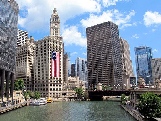
Journey to key destinations around and adjacent to Illinois!
Communities in this metro area include Chicago, Aurora, Oak Lawn, Des Plaines, Waukegan, Highland Park, Gary, Indiana, Schaumburg, Naperville, Oak Brook, and Joliet.
Individual toll maps for this region are listed below.
Communities in this metro area include Gary, South Bend, Elkhart, Portage, and Fremont.
Individual toll maps for this region are listed below.
 Chicago Skyway ▹
 Jane Addams Memorial Tollway ▹
 Ronald Reagan Memorial Tollway ▹
 Tri State Tollway ▹
 Veterans Memorial Tollway ▹
 Cline Avenue Bridge ▹
 Houbolt Road Extension ▹
 Indiana Toll Road ▹
 Ohio Turnpike ▹


