Tampa Bay - West Central Florida Toll Maps

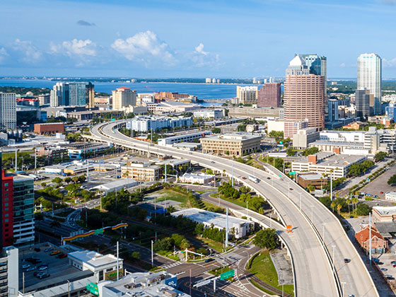
Regional photo of Tampa Bay - West Central Florida

Using The Interactive Regional Map

The Tampa Bay - West Central Florida metro area map shows exits and toll points for region-wide toll roads or other toll roads that cross the region.

View Map ▾Road List ▾

The following (6) toll roads are in this area, cross through this area or connect with this region:

The Tampa Bay - West Central Florida area includes the following cities: Bradenton, Brandon, Saint Petersburg, Spring Hill, and Tampa.

Markers on the interactive map can be selected to get close-up views of exit points, toll gantries and other locations and points-of-interest. Each POI map shows all nearby dining, gas, EV charging, hotels and other services.

View Map ▾Road List ▾

A complete list of exits and other points-of-interest in the Tampa Bay - West Central Florida area follows the map. Exit lists are sorted by toll road.

Advertising
Advertising

Regional Map For Tampa Bay - West Central Florida

Pan and zoom the map as desired, and select or tap the interactive markers to get information about that specific location. Each marker also includes options for viewing a close-up map of the destination point.

A complete list of exits and other points-of-interest is below this map, and other regions are shown further down the page.

Advertising
Advertising

Regional Exits, Listed By Toll Road

A list of all exits and other points-of-interest in this region, sorted by toll road.

I-4 West

I-4 West — Lakeland

View Map & Info

▸ GPS 28.036490000 X -82.040266000
NOTES: to Tampa / Orlando. Exit 27 from Interstate 4.

FTE Florida's Turnpike Enterprise manages this segment.

CR 542/Old Tampa Hwy

Exit 1CR 542/Old Tampa Hwy — Lakeland

View Map & Info

▸ GPS 28.029238000 X -82.040252000
NOTES:

FTE Florida's Turnpike Enterprise manages this segment.

Airport Road

Exit 3Airport Road — Lakeland

View Map & Info

▸ GPS 28.008128000 X -82.016216000
NOTES:

FTE Florida's Turnpike Enterprise manages this segment.

Waring Road

Exit 4Waring Road — Lakeland

View Map & Info

▸ GPS 27.998745000 X -81.998520000
NOTES: to SR 572 / Drane Field Rd.

FTE Florida's Turnpike Enterprise manages this segment.

Harden Boulevard

Exit 5Harden Boulevard — Lakeland

View Map & Info

▸ GPS 27.996262000 X -81.975570000
NOTES: SR 563

FTE Florida's Turnpike Enterprise manages this segment.

South Florida Avenue

Exit 7South Florida Avenue — Lakeland

View Map & Info

▸ GPS 27.995980000 X -81.957133000
NOTES: SR 37

FTE Florida's Turnpike Enterprise manages this segment.

Western Plaza

Western Plaza — Lakeland

View Map & Info

▸ GPS 27.995420000 X -81.934545000
NOTES: Toll gantry

FTE Florida's Turnpike Enterprise manages this segment.

Lakeland Highlands Road

Exit 9Lakeland Highlands Road — Lakeland

View Map & Info

▸ GPS 27.996299000 X -81.924040000
NOTES: CR 37B

FTE Florida's Turnpike Enterprise manages this segment.

US 98/Bartow Road

Exit 10US 98/Bartow Road — Lakeland

View Map & Info

▸ GPS 28.000420000 X -81.901921000
NOTES: Hospital at/near this exit.

FTE Florida's Turnpike Enterprise manages this segment.

Central Plaza

Central Plaza — Lakeland

View Map & Info

▸ GPS 28.010041000 X -81.862896000
NOTES: Toll gantry

FTE Florida's Turnpike Enterprise manages this segment.

Winter Lake Road / SR 540

Exit 14Winter Lake Road / SR 540 — Lakeland

View Map & Info

▸ GPS 28.010284000 X -81.851671000
NOTES:

FTE Florida's Turnpike Enterprise manages this segment.

Winter Lake Plaza

Winter Lake Plaza — Lakeland

View Map & Info

▸ GPS 28.032870000 X -81.832726000
NOTES: Toll gantry

FTE Florida's Turnpike Enterprise manages this segment.

US 92 / Auburndale

Exit 17US 92 / Auburndale — Auburndale

View Map & Info

▸ GPS 28.053885000 X -81.834440000
NOTES:

FTE Florida's Turnpike Enterprise manages this segment.

Old Dixie Highway / CR 546

Exit 18Old Dixie Highway / CR 546 — Auburndale

View Map & Info

▸ GPS 28.073482000 X -81.832497000
NOTES:

FTE Florida's Turnpike Enterprise manages this segment.

Eastern Plaza

Eastern Plaza — Auburndale

View Map & Info

▸ GPS 28.094430000 X -81.830037000
NOTES: Toll gantry

FTE Florida's Turnpike Enterprise manages this segment.

Braddock Road

Exit 20Braddock Road — Auburndale

View Map & Info

▸ GPS 28.103803000 X -81.830712000
NOTES:

FTE Florida's Turnpike Enterprise manages this segment.

Pace Road (Florida Polytechnic Univ.)

Exit 23Pace Road (Florida Polytechnic Univ.) — Lakeland

View Map & Info

▸ GPS 28.135705000 X -81.840120000
NOTES:

FTE Florida's Turnpike Enterprise manages this segment.

I-4 East

Exit 24I-4 East — Lakeland

View Map & Info

▸ GPS 28.154337000 X -81.846480000
NOTES: to Orlando / Tampa. Exit 41 from Interstate 4.

FTE Florida's Turnpike Enterprise manages this segment.

Gandy Blvd Bridge

Gandy Blvd Bridge — Tampa

View Map & Info

▸ GPS 27.892467000 X -82.536482000
NOTES: Causeway

THEA Tampa Hillsborough Expressway Authority manages this segment.

Dale Mabry Hwy / Gandy Blvd / MacDill AFB

Dale Mabry Hwy / Gandy Blvd / MacDill AFB — Tampa

View Map & Info

▸ GPS 27.893599000 X -82.509762000
NOTES: No EB On / EB Exit Via Gandy

THEA Tampa Hillsborough Expressway Authority manages this segment.

Gandy Blvd / MacDill AFB

Exit 1A/1BGandy Blvd / MacDill AFB — Tampa

View Map & Info

▸ GPS 27.898127000 X -82.505172000
NOTES: No WB On

THEA Tampa Hillsborough Expressway Authority manages this segment.

Euclid Avenue

Exit 2Euclid Avenue — Tampa

View Map & Info

▸ GPS 27.908641000 X -82.499848000
NOTES: WB Off/EB On

THEA Tampa Hillsborough Expressway Authority manages this segment.

West Bay to Bay Boulevard

Exit 3West Bay to Bay Boulevard — Tampa

View Map & Info

▸ GPS 27.919592000 X -82.492797000
NOTES: WB Off/EB On

THEA Tampa Hillsborough Expressway Authority manages this segment.
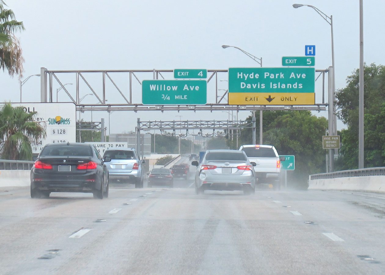
Willow Avenue / Davis Islands

Exit 4Willow Avenue / Davis Islands — Tampa

View Map & Info

▸ GPS 27.942561000 X -82.472726000
NOTES:

THEA Tampa Hillsborough Expressway Authority manages this segment.
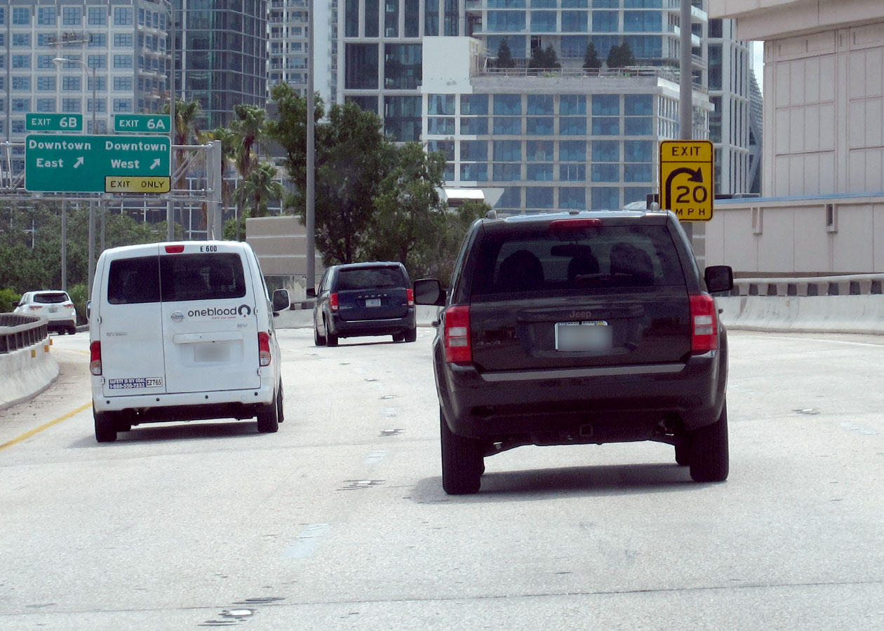
West AET Toll Gantry

West AET Toll Gantry — Tampa

View Map & Info

▸ GPS 27.942827000 X -82.461625000
NOTES:

THEA Tampa Hillsborough Expressway Authority manages this segment.

Hyde Park Avenue / Plant Avenue

Exit 5Hyde Park Avenue / Plant Avenue — Tampa

View Map & Info

▸ GPS 27.942752000 X -82.462762000
NOTES: WB Off/EB On

THEA Tampa Hillsborough Expressway Authority manages this segment.
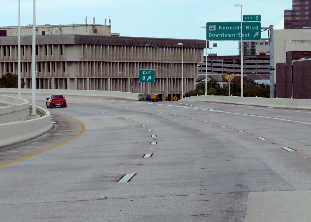
N Tampa St / Downtown

Exit 6N Tampa St / Downtown — Tampa

View Map & Info

▸ GPS 27.943366000 X -82.456957000
NOTES:

THEA Tampa Hillsborough Expressway Authority manages this segment.

Florida Ave / Channelside Dr / Downtown

Exit 6A/6BFlorida Ave / Channelside Dr / Downtown — Tampa

View Map & Info

▸ GPS 27.943544000 X -82.455165000
NOTES: EB Off Only

THEA Tampa Hillsborough Expressway Authority manages this segment.

Morgan St / Downtown

Exit 7Morgan St / Downtown — Tampa

View Map & Info

▸ GPS 27.944404000 X -82.453600000
NOTES: WB On/WB Off Only

THEA Tampa Hillsborough Expressway Authority manages this segment.

Jefferson Street

Jefferson Street — Tampa

View Map & Info

▸ GPS 27.945753000 X -82.452207000
NOTES: EB On Only

THEA Tampa Hillsborough Expressway Authority manages this segment.

Kennedy Blvd / SR 60 / Downtown

Exit 8Kennedy Blvd / SR 60 / Downtown — Tampa

View Map & Info

▸ GPS 27.949951000 X -82.451443000
NOTES: WB Off Only

THEA Tampa Hillsborough Expressway Authority manages this segment.

Nebraska Avenue

Nebraska Avenue — Tampa

View Map & Info

▸ GPS 27.951245000 X -82.450731000
NOTES: EB On Only

THEA Tampa Hillsborough Expressway Authority manages this segment.

Meridian Ave / Port Tampa Bay

Meridian Ave / Port Tampa Bay — Tampa

View Map & Info

▸ GPS 27.952414000 X -82.449013000
NOTES: Exp Lanes West Terminus

THEA Tampa Hillsborough Expressway Authority manages this segment.

22nd Street/Bus. US 41 / Port of Tampa

Exit 922nd Street/Bus. US 41 / Port of Tampa — Tampa

View Map & Info

▸ GPS 27.953179000 X -82.434803000
NOTES:

THEA Tampa Hillsborough Expressway Authority manages this segment.

EB Selmon to I–4 EB/I–4 WB to Selmon WB

Exit 10EB Selmon to I–4 EB/I–4 WB to Selmon WB — Tampa

View Map & Info

▸ GPS 27.951656000 X -82.431618000
NOTES:

THEA Tampa Hillsborough Expressway Authority manages this segment.

WB Selmon to I–4 WB/I–4 EB to Selmon EB

Exit 10WB Selmon to I–4 WB/I–4 EB to Selmon EB — Tampa

View Map & Info

▸ GPS 27.954824000 X -82.418670000
NOTES:

THEA Tampa Hillsborough Expressway Authority manages this segment.

Selmon Connector AET Toll Gantry

Selmon Connector AET Toll Gantry — Tampa

View Map & Info

▸ GPS 27.957721000 X -82.425907000
NOTES:

THEA Tampa Hillsborough Expressway Authority manages this segment.

50th Street/US 41

Exit 1150th Street/US 41 — Tampa

View Map & Info

▸ GPS 27.949757000 X -82.401692000
NOTES:

THEA Tampa Hillsborough Expressway Authority manages this segment.

East AET Toll Gantry

East AET Toll Gantry — Tampa

View Map & Info

▸ GPS 27.950013000 X -82.382113000
NOTES:

THEA Tampa Hillsborough Expressway Authority manages this segment.

78th Street

Exit 1278th Street — Tampa

View Map & Info

▸ GPS 27.949809000 X -82.369040000
NOTES: WB On/EB Off

THEA Tampa Hillsborough Expressway Authority manages this segment.

US 301

Exit 13US 301 — Tampa

View Map & Info

▸ GPS 27.930142000 X -82.351092000
NOTES:

THEA Tampa Hillsborough Expressway Authority manages this segment.

Falkenburg Road

Exit 14Falkenburg Road — Tampa

View Map & Info

▸ GPS 27.928526000 X -82.338063000
NOTES:

THEA Tampa Hillsborough Expressway Authority manages this segment.

I–75

Exit 15I–75 — Brandon

View Map & Info

▸ GPS 27.927735000 X -82.331580000
NOTES:

THEA Tampa Hillsborough Expressway Authority manages this segment.

Town Center Blvd / Brandon Pkwy

Town Center Blvd / Brandon Pkwy — Brandon

View Map & Info

▸ GPS 27.927195000 X -82.319610000
NOTES: Exp Lanes East Terminus

THEA Tampa Hillsborough Expressway Authority manages this segment.

I–275 / SR 60 / Kennedy Blvd

I–275 / SR 60 / Kennedy Blvd — Tampa

View Map & Info

▸ GPS 27.947756000 X -82.531298000
NOTES: Roadway is called Veterans Expressway here.

THEA Tampa Hillsborough Expressway Authority manages this segment.

Spruce Street / Tampa Int'l Airport/TPA

Exit 1Spruce Street / Tampa Int'l Airport/TPA — Tampa

View Map & Info

▸ GPS 27.953889000 X -82.535514000
NOTES: Roadway is called Veterans Expressway here.

THEA Tampa Hillsborough Expressway Authority manages this segment.

George Bean Pkwy / Tampa Int'l Airport/TPA

Exit 1AGeorge Bean Pkwy / Tampa Int'l Airport/TPA — Tampa

View Map & Info

▸ GPS 27.959474000 X -82.544207000
NOTES: Roadway is called Veterans Expressway here.

THEA Tampa Hillsborough Expressway Authority manages this segment.

Spruce Street / Raymond James Stadium

Exit 1BSpruce Street / Raymond James Stadium — Tampa

View Map & Info

▸ GPS 27.961385000 X -82.546164000
NOTES: Roadway is called Veterans Expressway here.

THEA Tampa Hillsborough Expressway Authority manages this segment.

SR 60 / Courtney Campbell Causeway

Exit 2ASR 60 / Courtney Campbell Causeway — Tampa

View Map & Info

▸ GPS 27.962410000 X -82.546298000
NOTES: Roadway is called Veterans Expressway here.

THEA Tampa Hillsborough Expressway Authority manages this segment.

Independence Parkway

Exit 2BIndependence Parkway — Tampa

View Map & Info

▸ GPS 27.971579000 X -82.546500000
NOTES: Roadway is called Veterans Expressway here.

THEA Tampa Hillsborough Expressway Authority manages this segment.

Memorial Highway / Eisenhower Boulevard

Exit 3Memorial Highway / Eisenhower Boulevard — Tampa

View Map & Info

▸ GPS 27.981740000 X -82.546288000
NOTES: Roadway is called Veterans Expressway here. To TPA Air Cargo terminal

THEA Tampa Hillsborough Expressway Authority manages this segment.

Hillsborough Avenue

Exit 4Hillsborough Avenue — Tampa

View Map & Info

▸ GPS 27.996332000 X -82.545816000
NOTES: Roadway is called Veterans Expressway here.

THEA Tampa Hillsborough Expressway Authority manages this segment.

Waters Avenue

Exit 6AWaters Avenue — Tampa

View Map & Info

▸ GPS 28.025664000 X -82.544240000
NOTES: Roadway is called Veterans Expressway here.

THEA Tampa Hillsborough Expressway Authority manages this segment.

Anderson Road

Exit 6BAnderson Road — Tampa

View Map & Info

▸ GPS 28.034321000 X -82.544784000
NOTES: Roadway is called Veterans Expressway here.

THEA Tampa Hillsborough Expressway Authority manages this segment.

Anderson Toll Plaza

Anderson Toll Plaza — Tampa

View Map & Info

▸ GPS 28.037752000 X -82.553243000
NOTES: Roadway is called Veterans Expressway here. Now an overhead toll gantry just south of Linebaugh Avenue

THEA Tampa Hillsborough Expressway Authority manages this segment.

Linebaugh Avenue

Exit 7Linebaugh Avenue — Tampa

View Map & Info

▸ GPS 28.040399000 X -82.558714000
NOTES: Roadway is called Veterans Expressway here.

THEA Tampa Hillsborough Expressway Authority manages this segment.

Wilsky Blvd / to Linebaugh Avenue

Exit 8Wilsky Blvd / to Linebaugh Avenue — Tampa

View Map & Info

▸ GPS 28.046002000 X -82.565709000
NOTES: Roadway is called Veterans Expressway here. Access to Linebaugh, via Wilsky, for SB drivers; Access to NB SR 589, via Wilsky, for drivers on Linebaugh.

THEA Tampa Hillsborough Expressway Authority manages this segment.

Gunn Highway

Exit 9Gunn Highway — Tampa

View Map & Info

▸ GPS 28.065877000 X -82.567310000
NOTES: Roadway is called Veterans Expressway here.

THEA Tampa Hillsborough Expressway Authority manages this segment.

Ehrlich Road

Exit 10Ehrlich Road — Tampa

View Map & Info

▸ GPS 28.078648000 X -82.562175000
NOTES: Roadway is called Veterans Expressway here.

THEA Tampa Hillsborough Expressway Authority manages this segment.

Sugarwood Toll Plaza

Sugarwood Toll Plaza — Tampa

View Map & Info

▸ GPS 28.086007000 X -82.552467000
NOTES: Roadway is called Veterans Expressway here. Plaza is automated toll gantry over highway.

THEA Tampa Hillsborough Expressway Authority manages this segment.

Hutchinson Road

Exit 12Hutchinson Road — Tampa

View Map & Info

▸ GPS 28.097551000 X -82.542661000
NOTES: Roadway is called Veterans Expressway here.

THEA Tampa Hillsborough Expressway Authority manages this segment.

Dale Mabry Highway (Spur)

Exit 13Dale Mabry Highway (Spur) — Tampa

View Map & Info

▸ GPS 28.116704000 X -82.545926000
NOTES: SB On/NB Off

FTE Florida's Turnpike Enterprise manages this segment.

Van Dyke Road

Exit 14Van Dyke Road — Tampa

View Map & Info

▸ GPS 28.128555000 X -82.548296000
NOTES:

FTE Florida's Turnpike Enterprise manages this segment.

Lutz Lake Fern Road

Exit 16Lutz Lake Fern Road — Lutz

View Map & Info

▸ GPS 28.156018000 X -82.537663000
NOTES:

FTE Florida's Turnpike Enterprise manages this segment.

SR 54

Exit 19SR 54 — Lutz

View Map & Info

▸ GPS 28.189595000 X -82.543905000
NOTES:

FTE Florida's Turnpike Enterprise manages this segment.

Anclote Toll Gantry

Anclote Toll Gantry — Land O Lakes

View Map & Info

▸ GPS 28.254217000 X -82.549905000
NOTES: Gantry has replaced plaza.

FTE Florida's Turnpike Enterprise manages this segment.

Ridge Road

Exit 25Ridge Road — River Ridge

View Map & Info

▸ GPS 28.282266000 X -82.550411000
NOTES:

FTE Florida's Turnpike Enterprise manages this segment.

SR 52

Exit 27SR 52 — Dade City

View Map & Info

▸ GPS 28.330706000 X -82.552124000
NOTES: To Werner-Boyce Salt Springs State Park

FTE Florida's Turnpike Enterprise manages this segment.

Spring Hill Toll Gantry

Spring Hill Toll Gantry — Spring Hill

View Map & Info

▸ GPS 28.393920000 X -82.528278000
NOTES: Gantry has replaced plaza.

FTE Florida's Turnpike Enterprise manages this segment.

County Line Road

Exit 37County Line Road — Spring Hill

View Map & Info

▸ GPS 28.433856000 X -82.484929000
NOTES:

FTE Florida's Turnpike Enterprise manages this segment.

Spring Hill Drive

Exit 41Spring Hill Drive — Spring Hill

View Map & Info

▸ GPS 28.481494000 X -82.482167000
NOTES:

FTE Florida's Turnpike Enterprise manages this segment.

SR 50 / Cortez Boulevard

Exit 46SR 50 / Cortez Boulevard — Spring Hill

View Map & Info

▸ GPS 28.533884000 X -82.479252000
NOTES:

FTE Florida's Turnpike Enterprise manages this segment.

Oak Hammock Toll Gantry

Oak Hammock Toll Gantry — Brooksville

View Map & Info

▸ GPS 28.599822000 X -82.489795000
NOTES: Gantry has replaced plaza.

FTE Florida's Turnpike Enterprise manages this segment.

Oak Hammock Toll Plaza (Closed)

Oak Hammock Toll Plaza (Closed) — Spring Hill

View Map & Info

▸ GPS 28.658885000 X -82.493387000
NOTES: Once the northernmost plaza on the parkway, plaza is now closed.

FTE Florida's Turnpike Enterprise manages this segment.

Ponce de Leon Blvd / US 98

Exit 55Ponce de Leon Blvd / US 98 — Brooksville

View Map & Info

▸ GPS 28.687456000 X -82.498137000
NOTES:

FTE Florida's Turnpike Enterprise manages this segment.

Sugarmill Toll Gantry

Sugarmill Toll Gantry — Brooksville

View Map & Info

▸ GPS 28.712559000 X -82.499687000
NOTES:

FTE Florida's Turnpike Enterprise manages this segment.

W Cardinal Street / CR 482

Exit 60W Cardinal Street / CR 482 — Lecanto

View Map & Info

▸ GPS 28.763994000 X -82.498445000
NOTES:

FTE Florida's Turnpike Enterprise manages this segment.

Lecanto Toll Gantry

Lecanto Toll Gantry — Lecanto

View Map & Info

▸ GPS 28.816958000 X -82.516176000
NOTES:

FTE Florida's Turnpike Enterprise manages this segment.

SR 44 / W Gulf to Lake Hwy

SR 44 / W Gulf to Lake Hwy — Lecanto

View Map & Info

▸ GPS 28.864721000 X -82.509224000
NOTES:

FTE Florida's Turnpike Enterprise manages this segment.

US 41

Exit 2US 41 — Palmetto

View Map & Info

▸ GPS 27.585488000 X -82.540275000
NOTES:

FTE Florida's Turnpike Enterprise manages this segment.

US 19

Exit 5US 19 — Terra Ceia

View Map & Info

▸ GPS 27.583824000 X -82.588849000
NOTES:

FTE Florida's Turnpike Enterprise manages this segment.

South Toll Plaza

South Toll Plaza — Terra Ceia

View Map & Info

▸ GPS 27.583593000 X -82.596542000
NOTES: Northbound

FTE Florida's Turnpike Enterprise manages this segment.

Manatee County Rest Area / South Skyway Fishing Pier

Manatee County Rest Area / South Skyway Fishing Pier — Terra Ceia

View Map & Info

▸ GPS 27.583903000 X -82.613292000
NOTES:

Rest Area / North Skyway Fishing Pier / USCG Memorial

Rest Area / North Skyway Fishing Pier / USCG Memorial — St Petersburg

View Map & Info

▸ GPS 27.649909000 X -82.675306000
NOTES:

North Toll Plaza

North Toll Plaza — St Petersburg

View Map & Info

▸ GPS 27.681092000 X -82.678444000
NOTES: Southbound

FTE Florida's Turnpike Enterprise manages this segment.

Pinellas Point Drive

Exit 16Pinellas Point Drive — St Petersburg

View Map & Info

▸ GPS 27.708965000 X -82.679146000
NOTES:

FTE Florida's Turnpike Enterprise manages this segment.

Pinellas Bayway / I–275

Exit 17Pinellas Bayway / I–275 — St Petersburg

View Map & Info

▸ GPS 27.714006000 X -82.679362000
NOTES:

FTE Florida's Turnpike Enterprise manages this segment.

Don CeSar / Long Key / St Pete Beach

Don CeSar / Long Key / St Pete Beach — St Petersburg

View Map & Info

▸ GPS 27.710181000 X -82.737086000
NOTES:

FTE Florida's Turnpike Enterprise manages this segment.

Pinellas Bayway West Plaza

Pinellas Bayway West Plaza — St Petersburg

View Map & Info

▸ GPS 27.709108000 X -82.732418000
NOTES:

FTE Florida's Turnpike Enterprise manages this segment.

SR 679 / to Fort De Soto Park

SR 679 / to Fort De Soto Park — St Petersburg

View Map & Info

▸ GPS 27.712016000 X -82.714959000
NOTES:

FTE Florida's Turnpike Enterprise manages this segment.

Pinellas Bayway East Plaza

Pinellas Bayway East Plaza — St Petersburg

View Map & Info

▸ GPS 27.719178000 X -82.693781000
NOTES:

FTE Florida's Turnpike Enterprise manages this segment.

I–275 / 54th Avenue / Skyway Bridge

I–275 / 54th Avenue / Skyway Bridge — St Petersburg

View Map & Info

▸ GPS 27.719173000 X -82.679335000
NOTES:

FTE Florida's Turnpike Enterprise manages this segment.

I-275

I-275 — Feather Sound

View Map & Info

▸ GPS 27.878909000 X -82.658902000
NOTES: South to Sunshine Skyway Bridge

118th Ave N

118th Ave N — Feather Sound

View Map & Info

▸ GPS 27.879114000 X -82.675511000
NOTES: WB off / EB on only

Gateway Plaza

Gateway Plaza — Pinellas Park

View Map & Info

▸ GPS 27.877824000 X -82.674415000
NOTES: Mainline toll gantry

Ulmerton Rd

Ulmerton Rd — Pinellas Park

View Map & Info

▸ GPS 27.893868000 X -82.692174000
NOTES:

U.S. Hwy 19

U.S. Hwy 19 — Pinellas Park

View Map & Info

▸ GPS 27.884125000 X -82.715648000
NOTES: WB off / EB on only

Roosevelt Blvd

Roosevelt Blvd — Feather Sound

View Map & Info

▸ GPS 27.904101000 X -82.693532000
NOTES: St. Pete-Clearwater International Airport

Bayside Bridge

Bayside Bridge — Feather Sound

View Map & Info

▸ GPS 27.921312000 X -82.698386000
NOTES:

Advertising
Advertising

EXPLORE FLORIDA

Journey to key destinations around and adjacent to Florida!

Map Of This Region ▹

Communities in this metro area include Destin, Pensacola Beach, Pensacola, Niceville, and Gulf Breeze.

Individual toll maps for this region are listed below.

Map Of This Region ▹

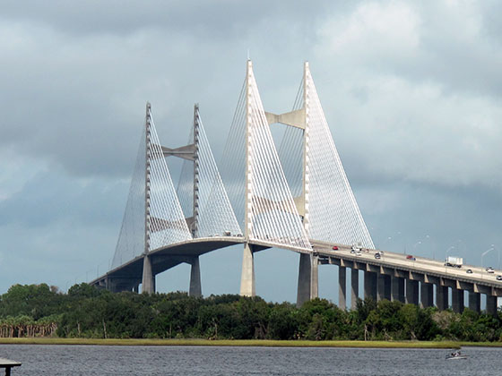
Communities in this metro area include Jacksonville and Middleburg.

Individual toll maps for this region are listed below.

Map Of This Region ▹

Communities in this metro area include Apopka, Cocoa, Kissimmee, Lake Buena Vista, Orlando, Saint Cloud, Sanford, Titusville, Melbourne, Poinciana, and Mount Dora.

Individual toll maps for this region are listed below.

Map Of This Region ▹

Communities in this metro area include Bradenton, Brandon, Saint Petersburg, Spring Hill, and Tampa.

Individual toll maps for this region are listed below.

Map Of This Region ▹

Communities in this metro area include Fort Pierce, Port Saint Lucie, Stuart, and Vero Beach.

Individual toll maps for this region are listed below.

Map Of This Region ▹

Communities in this metro area include Fort Lauderdale, Pompano Beach, Hialeah, Opa Locka, Homestead, Kendall, Key Largo, Miramar, Miami, Hollywood, Sunrise, Boca Raton, Delray Beach, West Palm Beach, Jupiter, Davie, Coral Springs, Lake Worth, and Boynton Beach.

Individual toll maps for this region are listed below.

Map Of This Region ▹

Communities in this metro area include Fort Myers, Naples, and Cape Coral.

Individual toll maps for this region are listed below.

Map Of This Region ▹

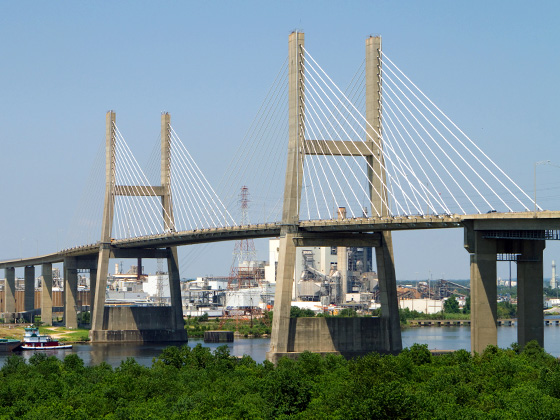
Communities in this metro area include Mobile, Daphne, Dauphin Island, Chickasaw, and Spanish Fort.

Individual toll maps for this region are listed below.

beaches-gulf coast

Roads Within Region

Map Of This Region ▹

Turnpikes.com is proud to partner with the following: