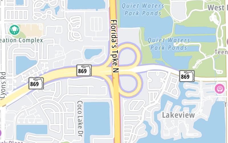
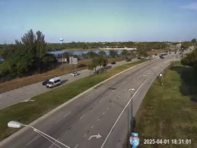
Map & services within two (2) miles
Interactive map shows available cameras, plus nearby fuel, food and lodging


See below for more about this area
Interactive map shows available cameras, plus nearby fuel, food and lodging
See below for more about this area
This is Exit 21A/B of the Sawgrass Expressway.
This junction is located in Deerfield Beach. Coconut Creek is nearby.
This location is in the Miami - South Florida area.
This location's approximate GPS Coordinates are 26.30532 x -80.16970.
Which directions can I travel from here?
From this junction, traffic can enter traveling both southbound and northbound. Traffic can also exit traveling both southbound and northbound.
On to SW 10th Street / to Powerline Road, about 0.8 miles away ►
◄ Back to Lyons Road, about 1.1 miles away.
▹ The Sawgrass Expressway and the Floridas Turnpike connect here.
Which direction are tolls charged here?
Tolls are not charged or collected at this junction.
Above: Photo by Turnpikes.comThe interactive map and lists on this page include key traveler services within two miles of this destination point.
You will find common services, including gas stations, truck stops, EV charging facilities, fast-food or family restaurants, and hotels. These are displayed on the interactive map as markers, which you can select for more information.
Current driving conditions and weather, along with a more complete list of key services, may be found below the map.

Mostly Sunny
71°F / 21.7°C
Feels Like:
80°F / 26.5°C
Visibility
10 Mi / 16.1 Km
3-Hour Precip:
0 In / 0.0 Cm
West Northwest
Winds (WNW)
1.1 MPH / 1.8 KPH
Gusts:
3 MPH / 4.9 KPH
▸ Get the full forecast for This Location | The Miami - South Florida area
Conditions and forecasts provided in partnership with AccuWeather.

Weather provided in partnership with AccuWeather.
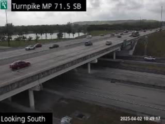
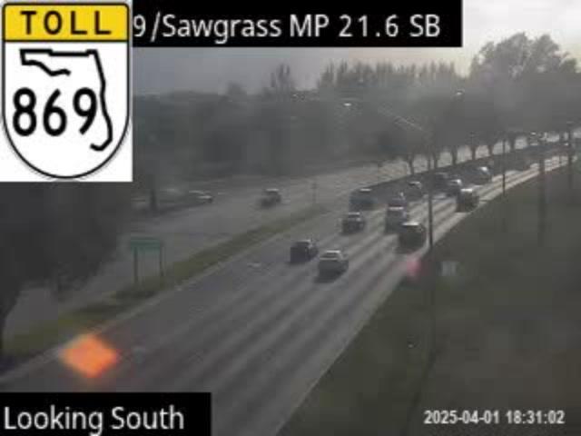
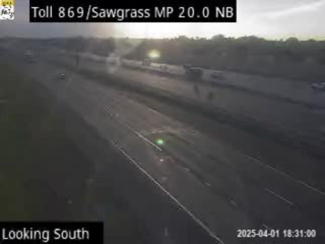
TPKE MM 71.5 AT SAWGRASS EXPWY
Camera Direction: SOUTH. Source: FDOT - undetermined 33073
Cameras Closest To Floridas Turnpike
191 Ft
191 Ft
0.27 Mi
0.71 Mi
0.75 Mi
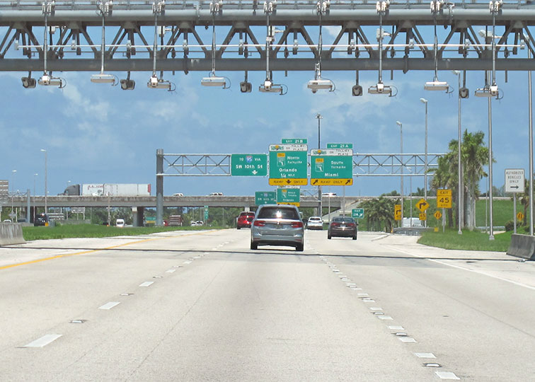
About this photo:
Guide signs for Exits 21A and 21B can be seen easily from just underneath the northbound toll gantry of the Sawgrass Expressway, where SR 869 meets Florida's Turnpike. Photo taken July 15, 2021.
Photo taken 07-15-2021
The map above shows all services within about a two (2) mile radius.

Destination Travel

Closest Gas Stations
SHELL
1011 South Powerline Road • 1.04 miles
Store/Fuel Brand: Shell
SHELL
6135 Lyons Road • 1.07 miles
Store/Fuel Brand: Shell
CHEVRON
4299 West Hillsboro Boulevard • 1.22 miles
Store/Fuel Brand: Chevron
CHEVRON
3355 West Hillsboro Boulevard • 1.42 miles
Store/Fuel Brand: Chevron
Closest EV Chargers
CHARGEPOINT
4455 Sol Press Boulevard • 1.02 miles
CONNECTOR: IEC62196Type1
POWER: 6 KW @ 240 V
CURRENT: 27 Amp AC1
COCONUT CREEK RECREATION COMPLEX
4455 Sol Press Boulevard • 1.02 miles
CONNECTOR: IEC62196Type1
POWER: 6 KW @ 240 V
CURRENT: 27 Amp AC1
CHARGEPOINT
3501 West Drive • 1.15 miles
CONNECTOR: IEC62196Type1
POWER: 6 KW @ 240 V
CURRENT: 27 Amp AC1

Closest Fast Food
Fast food refers ONLY to quick-service and take-out diners. All restaurant types are shown on the map above.
MCDONALD'S
3901 West Hillsboro Boulevard • 1.19 miles
WINGSTOP
3656 West Hillsboro Boulevard • 1.20 miles
TACO BELL
3652 West Hillsboro Boulevard • 1.20 miles
PAPA JOHN'S
3869 West Hillsboro Boulevard • 1.23 miles
DQ GRILL & CHILL
5405 Lyons Road • 1.25 miles
DAIRY QUEEN
5405 Lyons Road • 1.25 miles
PANERA BREAD
3720 West Hillsboro Boulevard • 1.25 miles
CHICK-FIL-A
3648 West Hillsboro Boulevard • 1.26 miles
Journey to key destinations around and adjacent to Florida!
Communities in this metro area include Destin, Pensacola Beach, Pensacola, Niceville, and Gulf Breeze.
Individual toll maps for this region are listed below.

Communities in this metro area include Jacksonville and Middleburg.
Individual toll maps for this region are listed below.

Communities in this metro area include Apopka, Cocoa, Kissimmee, Lake Buena Vista, Orlando, Saint Cloud, Sanford, Titusville, Melbourne, Poinciana, and Mount Dora.
Individual toll maps for this region are listed below.
Communities in this metro area include Bradenton, Brandon, Saint Petersburg, Spring Hill, and Tampa.
Individual toll maps for this region are listed below.
Communities in this metro area include Fort Pierce, Port Saint Lucie, Stuart, and Vero Beach.
Individual toll maps for this region are listed below.

Communities in this metro area include Fort Lauderdale, Pompano Beach, Hialeah, Opa Locka, Homestead, Kendall, Key Largo, Miramar, Miami, Hollywood, Sunrise, Boca Raton, Delray Beach, West Palm Beach, Jupiter, Davie, Coral Springs, Lake Worth, and Boynton Beach.
Individual toll maps for this region are listed below.
Communities in this metro area include Fort Myers, Naples, and Cape Coral.
Individual toll maps for this region are listed below.
Communities in this metro area include Mobile, Daphne, Dauphin Island, Chickasaw, and Spanish Fort.
Individual toll maps for this region are listed below.

Roads Within Region
 Garcon Point Bridge ▹
 Bob Sikes Bridge ▹
 SR 293 ▹
 First Coast Expressway ▹
 Central Florida Greeneway/Seminole Expy ▹
 Florida's Turnpike ▹
 East West Expressway ▹
 Beachline Expressway ▹
 Western Beltway/Wekiva Pkwy ▹
 Apopka Expressway ▹
 Poinciana Parkway ▹
 SR 453 ▹
 Goldenrod Road Extension ▹
 Osceola Parkway ▹
 SR 451 ▹
 Polk Parkway ▹
 Selmon Expressway ▹
 Suncoast Parkway/Veterans Expy ▹
 Sunshine Skyway ▹
 Pinellas Bayway ▹
 Gateway Expressway ▹
 Airport Expressway ▹
 Alligator Alley ▹
 Dolphin Expressway ▹
 Don Shula Expressway ▹
 Gratigny Parkway ▹
 Sawgrass Expressway ▹
 Snapper Creek Expressway ▹
 Rickenbacker Causeway ▹
 Venetian Causeway ▹
 Card Sound Road ▹
 Sanibel Causeway ▹
 Midpoint Memorial Bridge ▹
 Cape Coral Bridge ▹


